

Beinn Dearg Bad Chailleach
Good walks are even better shared.
Overview
Beinn Dearg Bad Chailleach
Beinn Dearg Bad Chailleach is a majestic Munro standing tall at 920 meters in the Scottish Highlands. Known affectionately by locals, it’s not just another hill—it’s a mountain with character!
Geology
The mountain is primarily composed of ancient Lewisian gneiss. This striking geology dates back billions of years, making it one of the oldest rock formations in Europe. If these stones could talk, they would share tales of Earth’s fiery birth!
Routes
A popular route starts from Strathcarron, leading you through heather-covered slopes that look like nature's very own carpet. At approximately 10.5 km, this hike will take about 5 hours and is deemed moderate, making it a delightful choice for a Saturday adventure. Remember, it’s not a race; take your time to enjoy the stunning scenery!
Summit Features
When you finally reach the summit, you’ll be greeted by a modest cairn. This is an ideal spot to catch your breath, take in the views, and perhaps enjoy a wee snack. After all, every hike deserves a hearty celebration!
Terrain Type
Expect a mix of rocky outcrops and grassy patches. While there are sections that can be boggy, these add to the fun—who doesn’t love a bit of mud?
Views
From the top, the views are nothing short of spectacular. On clear days, the distant Isle of Skye will catch your eye, while the famous Torridon hills provide a stunning backdrop. The best seasons for these views are late spring and early autumn, especially when the heather is in full bloom.
Hazards
Keep an eye on the weather—Scotland is known for its mood swings! Sudden changes can turn a pleasant hike into a bit of a scramble, particularly in winter when ice is common. Stay safe and make sure you’re prepared.
Nearby Summits
If you’re feeling energetic, why not explore the nearby peaks? Liathach and Bidein a' Ghlas Thuill are both fabulous companions on this mountain journey.
Access
Parking is available in Strathcarron, but spaces are limited, so arrive early. For those using public transport, the nearest railway station connects to Inverness and offers a scenic start to your adventure!
Facilities
After your hike, Lochcarron offers a lovely café for those well-deserved refreshments. Don't forget to treat yourself!
History
The name Beinn Dearg Bad Chailleach translates to 'the red mountain of the old woman', adding a touch of folklore to your ascent. This Munro is steeped in local culture and is loved by climbers far and wide.
In conclusion, Beinn Dearg Bad Chailleach is a true gem of the Highlands, combining stunning views, interesting geology, and a touch of Scottish charm. Lace up your boots, grab your gear, and head out on an unforgettable adventure!
Explore routes near Beinn Dearg Bad Chailleach
Public walks starting within 80 km of this hill. Nearby does not mean a route reaches the summit; check its map and access before setting out.
Fairy Lochs Liberator Wreckage Circuit
View route
Beinn Eighe Lancaster Wreckage at Coire Mhic Fhearchair
View route
Glen Affric: Coire Loch Woodland Trail
View route
Loch Affric full circuit from River Affric
View route
Route planning notes
These notes describe possible approaches, not verified navigable routes or permission to cross land. Check current paths, local access rules and conditions before setting out.
From Strathcarron
A popular route starting from Strathcarron that winds through heather-covered slopes and rocky terrain before ascending to the summit.
Make a day of it, together
Find someone to share the walk with, or organise a day out along a route you like.
Photo Gallery
View all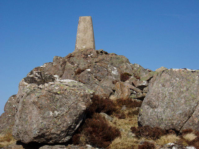 Photo could not load
NG9187 : Summit of Beinn Dearg Bad Chailleach
Roger McLachlan
Hill facts and local notes
Classifications
Elevation
273m
896 ft
Prominence
116m
Coordinates
57.8298, -5.5170
NG912876
OS Map
19
Explorer: 434
At the Summit
The summit is marked by a modest cairn, offering a perfect spot for a well-deserved snack and a selfie.
Terrain & Geology
Beinn Dearg Bad Chailleach is primarily composed of ancient Lewisian gneiss, which forms a rugged and weathered landscape, offering a fascinating glimpse into the geological history of the region.
Views & Scenery
From the summit, you can admire the expansive views of the Torridon mountains, the distant Loch Carron, and on clear days, the Isle of Skye.
History & Heritage
Name Origin
The name translates from Scottish Gaelic as 'the red mountain of the old woman', evoking intriguing local tales.
Historical Significance
As a Munro, Beinn Dearg Bad Chailleach holds a special place in the hearts of local climbers and is a part of the rich cultural fabric of the Highlands.
Getting There & Facilities
Check current local access restrictions, parking rules and transport timetables before travelling. These notes do not confirm public access to the summit.
Parking
There is a small parking area near the start of the trail in Strathcarron, which can accommodate a limited number of cars.
Public Transport
The nearest railway station is in Strathcarron, which connects with services from Inverness and London.
Nearby Facilities
Lochcarron offers basic amenities such as a shop and a café, perfect for a post-hike treat.
Safety Information
Known Hazards
- Be cautious of sudden weather changes, especially in winter; the terrain can become challenging due to snow and ice.
General Safety Tips
- Check weather conditions before setting out
- Carry appropriate clothing and equipment
- Let someone know your planned route
- Take a map, compass, and GPS device
- Carry emergency supplies: food, water, first aid kit, torch
Hills
Some common questions about the hills answered
Are there group walks up Beinn Dearg Bad Chailleach?
Many walkers use Walkmates to join or organise walks with others. You can check for group walks around Beinn Dearg Bad Chailleach through the maps
Are there other walkers around Beinn Dearg Bad Chailleach?
Activity varies by location and time, but Walkmates lets you see whether others have shared walks or shown interest in this area. Find other people through the walking friends search walking friends for Beinn Dearg Bad Chailleach search or of course create your own walk for Beinn Dearg Bad Chailleach
Can I organise a walk to Beinn Dearg Bad Chailleach?
Yes. If there aren’t any walks listed already, you can create a walk and make it available for others to join.
If you're signed up to Walkmates, you can create a walk to Beinn Dearg Bad Chailleach.
How do I find a walk up this hill?
There are often multiple ways to walk this hill, depending on experience and route preference. Walkmates helps you explore walks and routes that others have shared.
Can I suggest a new route up Beinn Dearg Bad Chailleach?
Yes. You can suggest or create routes to share with others. Walkmates focuses on the social side of walking, so routes are used to help people organise walks and explore areas together, rather than as detailed navigation tools or route libraries.
Other uses really appreciate knowledgeable walkers sharing their routes. Share your favourite route to Beinn Dearg Bad Chailleach here
The is an error or something incorrect about this hill. How do I let you know?
We always strive to keep the information on Walkmates as accurate as possible. If you find an error, please let us know through the contact form and we'll aim to correct it as quickly as possible
Community Discussion
Comments
Location
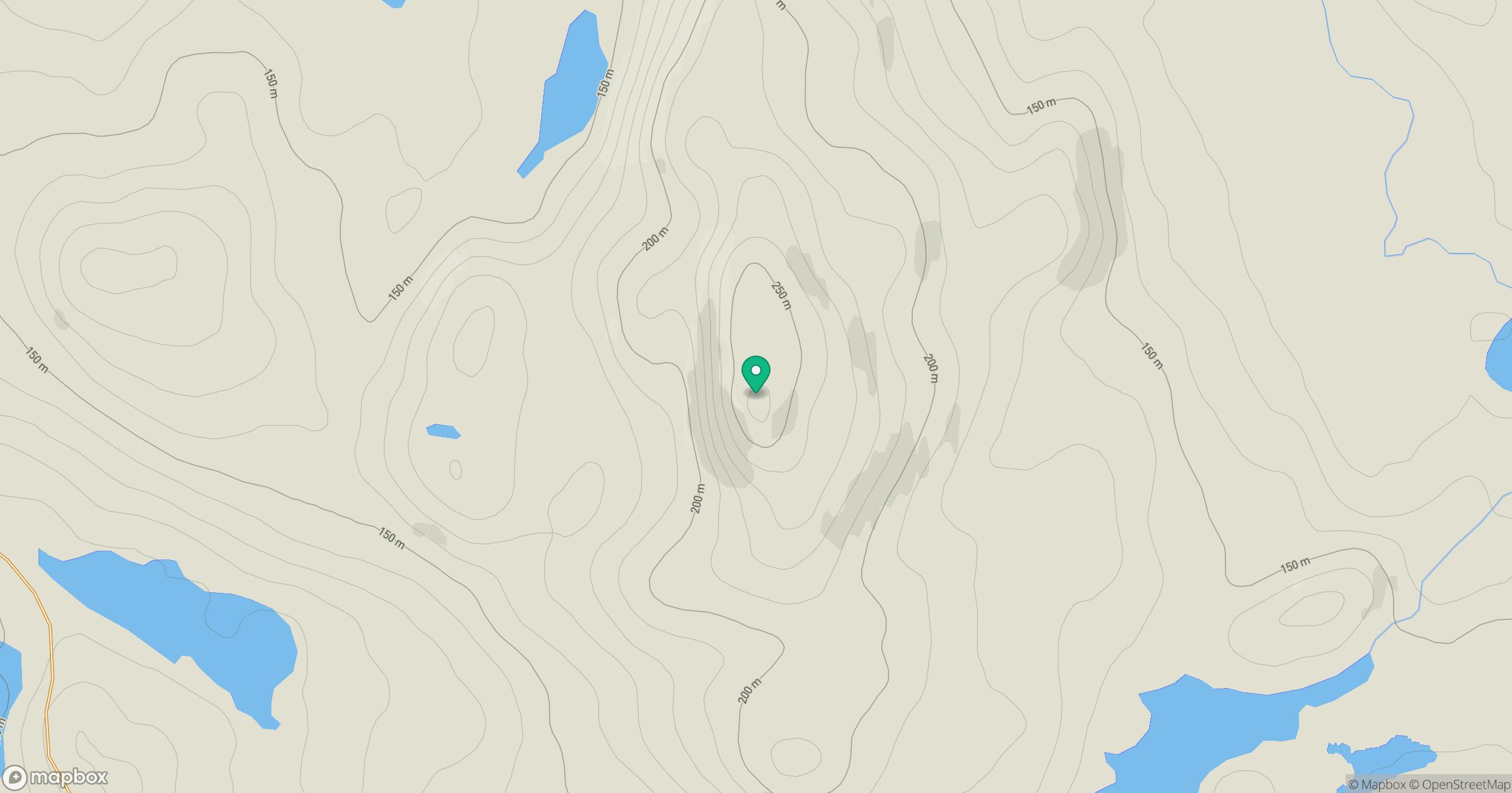
Grid reference: NG912876
View on OpenStreetMapOpens a map in a new tab, centred on the hill.
Hills within 30 km
Straight-line distance, not a walking route or confirmation of access.
No comments yet. Be the first.