

Beinn a' Chroin East Top
Good walks are even better shared.
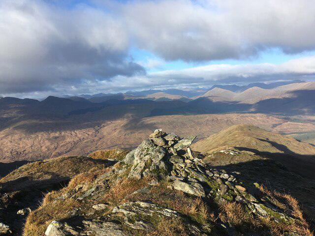
NN3918 : Marshiness between tops of Beinn a' Chroin
Trevor Littlewood Photo source
Overview
Beinn a' Chroin East Top
Overview
Nestled in the heart of the Scottish Highlands, Beinn a' Chroin East Top stands proudly at 933 meters. With its relatively lesser-known status compared to its taller peers, it offers a serene experience for walkers away from the larger crowds.
Geology
Beinn a' Chroin East Top's foundation is primarily rocky, formed of schists and granites that tell the story of glacial activity over millennia. These geological features create an alluring ruggedness, inviting explorers to witness the raw beauty of nature firsthand.
Routes
There are several routes leading to the East Top. The most travelled routes are from Auch Glen, providing a moderately challenging hike perfect for a day out in the hills. For the more adventurous souls, a circuit that combines Beinn a' Chroin East Top with its neighbouring summits can elevate your hiking experience to new heights—literally!
Summit Features
On reaching the summit, expect to find a quaint little cairn that provides an ideal spot for reflection and recharging. The views are nothing short of spectacular—and hey, who doesn’t enjoy munching on a sandwich while bathed in glorious highland vistas?
Terrain
The terrain comprises rocky sections, soft grassy knolls, and the occasional splash of bog—definitely a place to put your boots to the test!
Views
The summit of Beinn a' Chroin East Top rewards the intrepid with sweeping views of the surrounding highlands, with Ben More towering in the distance. Late spring and early autumn are undoubtedly the best seasons to visit, as these times showcase the landscape at its most vibrant.
Hazards
Nature’s beauty comes with its share of challenges. Sudden weather changes are common in the Highlands, making layers essential. Tighten your laces—this mountain can throw a few loose rocks your way, just to keep you on your toes!
Access
Getting there is straightforward. Parking is commonly found at Auch and in nearby laybys off the A82, though it's wise to beat the rush on weekends. For the public transport aficionados, bus services to Crianlarich are a handy option, followed by a scenic walk to the trailhead.
Facilities
Facilities back at Crianlarich include delightful cafes—ideal for fuelling up before your ascent—and public toilets, because sometimes nature calls, and we mean quite literally!
History
The name 'Beinn a' Chroin', translating amusingly to 'Mountain of the Crotch', is a nod to its distinctive shape. This region is steeped in Gaelic heritage, capturing the hearts of local and visiting walkers alike.
In conclusion, Beinn a' Chroin East Top may not be the tallest Munro, but it certainly does not skimp on charm or beauty. Whether you're a seasoned hiker or a curious newcomer, this mountain is definitely worth a visit.
Explore routes near Beinn a' Chroin East Top
Walks starting near this hill. Open a route to check its map, distance and full itinerary.
Loch Katrine: Brenachoile Point Shore Walk from Trossachs Pier
View route
The Cobbler from Succoth Carpark
View route
Beinn Ime from Succoth
View route
Ben Lomond in the trossachs
View route
Route planning notes
These notes describe possible approaches. Check a route's map and access information when planning your walk.
Route from Auch Glen
A popular route starting from Auch Glen, which takes you through beautiful glens and offers excellent views of the adjacent mountains.
Circuit of Beinn a' Chroin
A challenging circular route that connects Beinn a' Chroin East Top with the main summit and Beinn Bhreac, providing a mixture of ridgeline walking and rougher terrain.
Make a day of it, together
Find someone to share the walk with, or organise a day out along a route you like.
Photo Gallery
View all Photo could not load
NN3918 : Marshiness between tops of Beinn a' Chroin
Trevor Littlewood
 Photo could not load
NN3918 : Climbers heading for Beinn a’ Chroin's east top
Russel Wills
 Photo could not load
NN3918 : Heading for the Munro summit (then)
Russel Wills
 Photo could not load
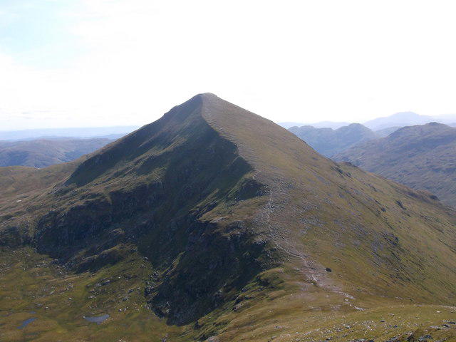
NN3918 : East summit of Beinn a' Chroin
Russel Wills
 Photo could not load
NN3918 : Beinn a' Chroin
Andrew Smith
 Photo could not load
NN3918 : East summit of Beinn a'Chroin
Stephen Sweeney
 Photo could not load
NN3918 : Beinn a' Chroin
Andrew Smith
 Photo could not load
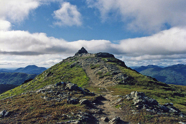
NN3918 : Cairn on the East Top of Beinn a' Chroin
G Laird
Hill facts and local notes
Classifications
Elevation
940m
3,084 ft
Prominence
63m
Coordinates
56.3324, -4.5993
NN393185
OS Map
50 56
Explorer: OL39N 364N
At the Summit
The summit is marked by a small cairn, offering a perfect spot for a quick snack and some breathtaking views. Just make sure to manage to hold your sandwich tight—it can get a tad windy up here!
Terrain & Geology
Primarily composed of schists and granites, this mountain showcases classic geology typical of the Central Highlands, with a history of glacial sculpting evident in its rugged terrain.
Views & Scenery
Stunning panoramic views of the surrounding peaks, including the prominent Ben More, as well as the expansive glens that help encapsulate Scotland's wild beauty.
History & Heritage
Name Origin
The name 'Beinn a' Chroin' translates to 'Mountain of the Crotch', a quirky nod to the mountain's geography rather than any unfortunate bending.
Historical Significance
This region has a rich history tied to the Gaelic culture and is renowned among hillwalkers, making it a popular pilgrimage for outdoor enthusiasts.
Getting There & Facilities
Parking
Parking is available at Auch more or in the laybys along the A82, but be sure to arrive early on weekends to snag a good spot.
Public Transport
Regular bus services operate to nearby Crianlarich, but be prepared for a little extra walking to reach the trailhead.
Nearby Facilities
Facilities in Crianlarich include cafes (perfect for a hearty breakfast before tackling the hills!) and public toilets.
Safety Information
Known Hazards
- Watch out for sudden weather changes; also, some areas can be treacherous if wet, so good boots are your best friends!
- Loose rocks on the ascent can be tricky—think of it as nature's version of a dance-off!
General Safety Tips
- Check weather conditions before setting out
- Carry appropriate clothing and equipment
- Let someone know your planned route
- Take a map, compass, and GPS device
- Carry emergency supplies: food, water, first aid kit, torch
Hills
Some common questions about the hills answered
Are there group walks up Beinn a' Chroin East Top?
Many walkers use Walkmates to join or organise walks with others. You can check for group walks around Beinn a' Chroin East Top through the maps
Are there other walkers around Beinn a' Chroin East Top?
Activity varies by location and time, but Walkmates lets you see whether others have shared walks or shown interest in this area. Find other people through the walking friends search walking friends for Beinn a' Chroin East Top search or of course create your own walk for Beinn a' Chroin East Top
Can I organise a walk to Beinn a' Chroin East Top?
Yes. If there aren’t any walks listed already, you can create a walk and make it available for others to join.
If you're signed up to Walkmates, you can create a walk to Beinn a' Chroin East Top.
How do I find a walk up this hill?
There are often multiple ways to walk this hill, depending on experience and route preference. Walkmates helps you explore walks and routes that others have shared.
Can I suggest a new route up Beinn a' Chroin East Top?
Yes. You can suggest or create routes to share with others. Walkmates focuses on the social side of walking, so routes are used to help people organise walks and explore areas together, rather than as detailed navigation tools or route libraries.
Other uses really appreciate knowledgeable walkers sharing their routes. Share your favourite route to Beinn a' Chroin East Top here
The is an error or something incorrect about this hill. How do I let you know?
We always strive to keep the information on Walkmates as accurate as possible. If you find an error, please let us know through the contact form and we'll aim to correct it as quickly as possible
Community Discussion
Comments
Location
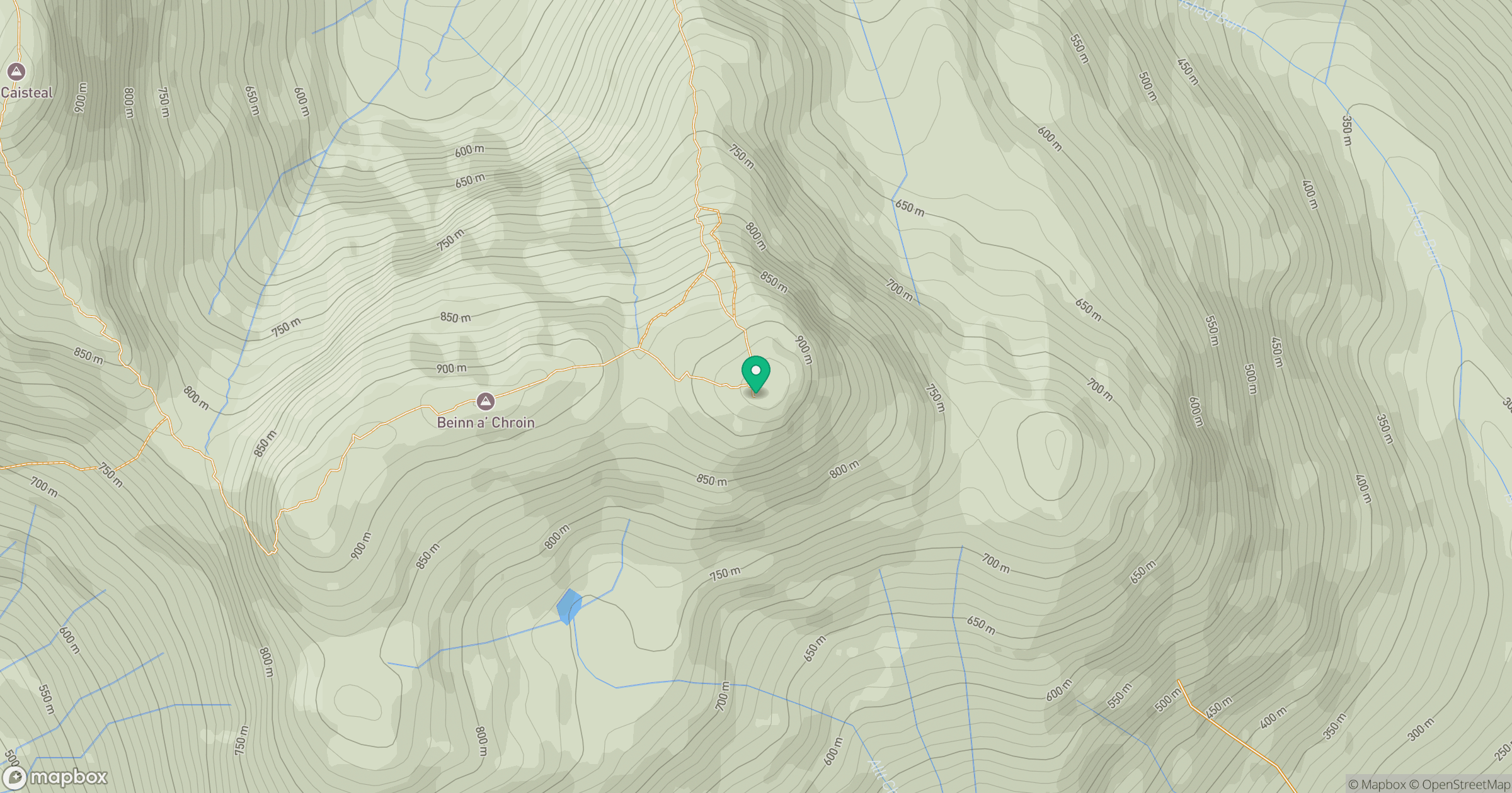
Grid reference: NN393185
View on OpenStreetMapOpens a map in a new tab, centred on the hill.
No comments yet. Be the first.