

Beinn a' Chroin
Good walks are even better shared.
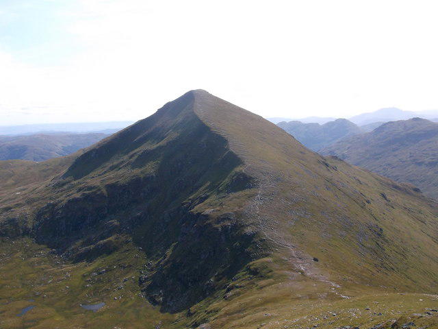
NN3818 : Snow cover, Beinn a' Chroin
Callum Black Photo source
Overview
Beinn a' Chroin
Introduction
Beinn a' Chroin, standing majestically at 942 meters, is a noteworthy Munro in the Scottish Highlands. This mountain draws both seasoned climbers and casual walkers eager to soak in the stunning scenery.
Geology
The geological composition of Beinn a' Chroin includes schist and granite, which are emblematic of this part of the Highlands. With glacial forces having played a significant role in shaping its contours, this mountain's rocks bear witness to millennia of natural history.
Routes
Inverhoon Route
Starting from Inverhoon, this moderate route provides a blend of picturesque views and a manageable gradient, making it a favourite for families.
Cairn at NTS Route
For those seeking a challenge, the Cairn to the summit is steep and rocky. Be prepared for changes in terrain and pack plenty of water.
Summit Features
The summit boasts a robust cairn, perfect for a celebratory photograph or perhaps a triumphant fist pump. Just be careful not to lose your hat to the high winds!
Terrain
Expect a mix of rocky outcrops and grassy patches, with some boggy areas to keep you on your toes. Good footwear is essential, unless you fancy a mud bath!
Views
Once at the top, you will be greeted with sweeping vistas. Notable landmarks include Ben More and the expansive Loch Lomond. The best views are often seen in spring and early summer when skies are clear.
Hazards
Check the weather before heading out! Conditions can change rapidly. The rocky terrain can be slippery, especially if rain has visited recently.
Nearby Summits
Plan a longer trip by including nearby peaks like Ben More and the Crianlarich Hills, both wonderful in their own right.
Access
Nearest Parking: Limited roadside parking in Inverhoon means arriving early is a wise move.
Public Transport: Buses from surrounding towns make reaching Crianlarich easy.
Nearest Town: Crianlarich itself is a welcoming hub for hikers.
Facilities
While the mountain has no facilities, the local town provides various amenities after a long day on the slopes. A refreshing pint might be just what you need!
History
The name, meaning 'Hill of the Crooked', reflects the mountain’s unique shape, and it is steeped in local lore, reminding us that mountains are often more than just a climb.
Conclusion
Whether you're a newbie or a seasoned rambler, Beinn a' Chroin offers an engaging adventure filled with nature, history, and perhaps even a wee bit of humour along the way. A trip here is one for your hiking log, so grab your gear and embark on this Scottish gem!
Explore routes near Beinn a' Chroin
Walks starting near this hill. Open a route to check its map, distance and full itinerary.
Loch Katrine: Brenachoile Point Shore Walk from Trossachs Pier
View route
The Cobbler from Succoth Carpark
View route
Beinn Ime from Succoth
View route
Ben Lomond in the trossachs
View route
Route planning notes
These notes describe possible approaches. Check a route's map and access information when planning your walk.
Inverhoon Route
A popular route starting from the small village of Inverhoon, offering gradual ascent and breathtaking views.
Cairn at NTS Route
Starting at the Cairn, this route provides a steep ascent to the summit with diverse terrain.
Make a day of it, together
Find someone to share the walk with, or organise a day out along a route you like.
Photo Gallery
View all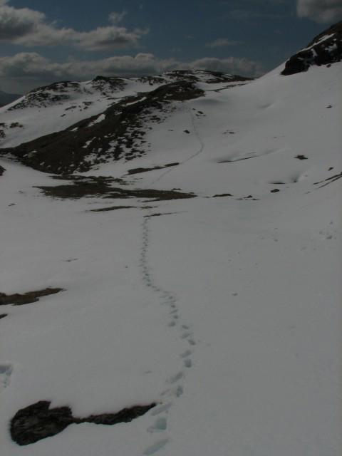 Photo could not load
NN3818 : Snow cover, Beinn a' Chroin
Callum Black
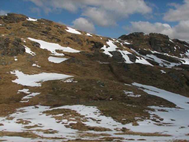 Photo could not load
NN3818 : Beinn a' Chroin
Callum Black
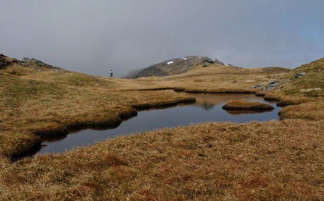 Photo could not load
NN3818 : Summit of Beinn a' Chroin
Alan Reid
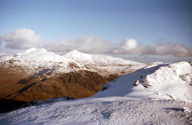 Photo could not load
NN3818 : West top of Beinn a' Chroin
Russel Wills
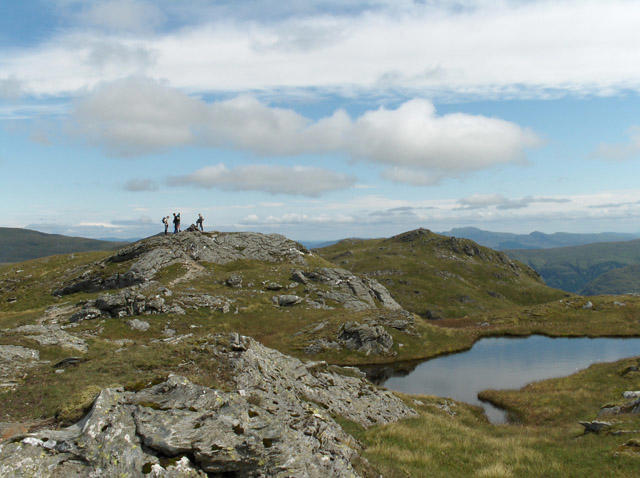 Photo could not load
NN3818 : Beinn a' Chroin
Andrew Smith
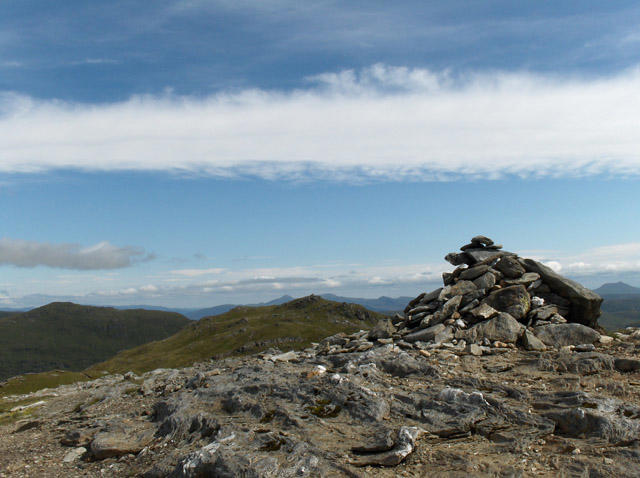 Photo could not load
NN3818 : Beinn a' Chroin
Andrew Smith
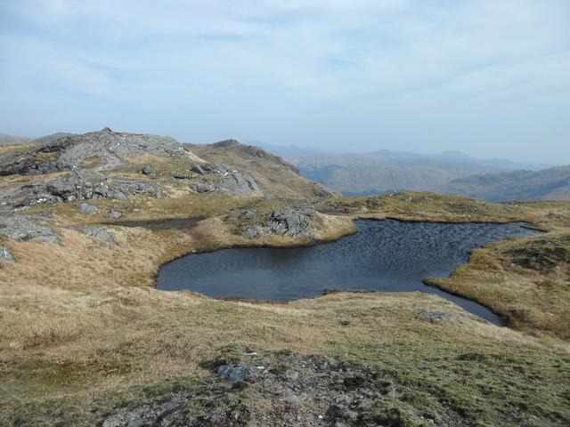 Photo could not load
NN3818 : Small lochan at the Beinn a'Chroin summit
Stephen Sweeney
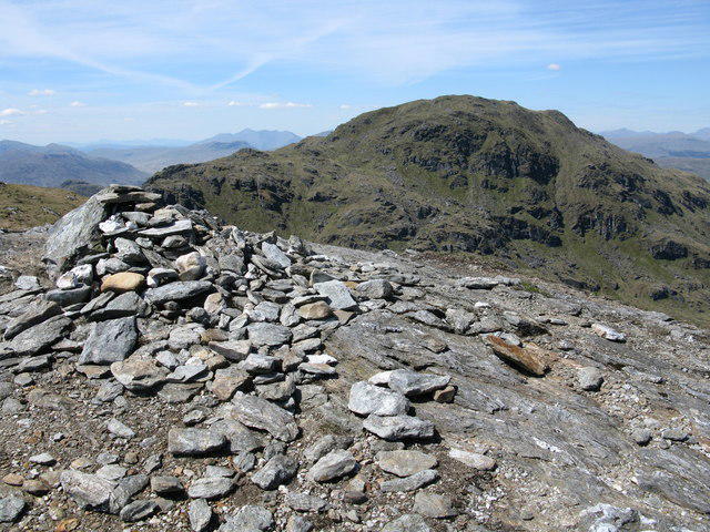 Photo could not load
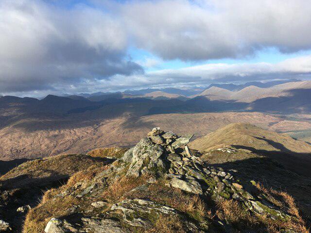
NN3818 : Beinn a'Chroin Summit Cairn
G Laird
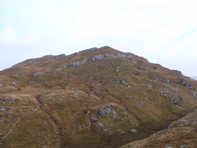 Photo could not load
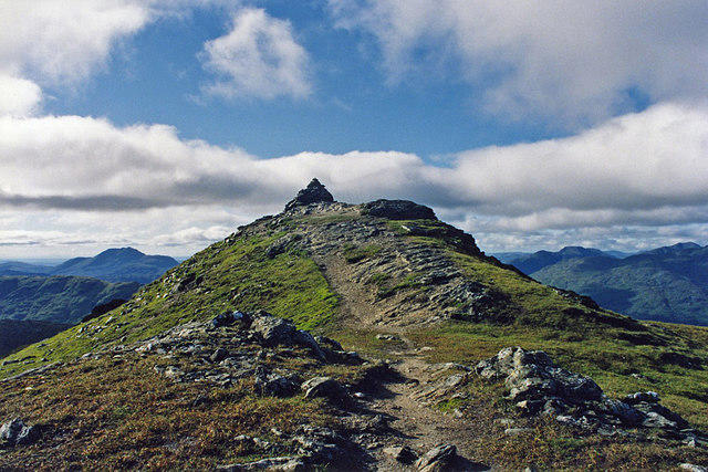
NN3818 : Towards the summit of Beinn a'Chroin
Iain Russell
Hill facts and local notes
Classifications
Elevation
941m
3,089 ft
Prominence
137m
Coordinates
56.3320, -4.6096
NN387185
OS Map
50 56
Explorer: OL39N 364N
At the Summit
The summit is marked by a rugged rocky outcrop with a prominent cairn that offers a perfect photo opportunity to prove you made it to the top!
Terrain & Geology
Beinn a' Chroin features primarily schist and granite, typical of the Scottish Highlands. The rocks here tell a tale of ancient geological forces shaping the landscape, with remnants of glacial activity visible in the surrounding valleys.
Views & Scenery
From the summit, you can gaze over stunning views of the surrounding peaks, including the mighty Ben More and the sprawling landscape of Loch Lomond.
History & Heritage
Name Origin
The name 'Beinn a' Chroin' translates to 'Hill of the Crooked', possibly referring to its distinctive shape.
Historical Significance
This mountain is part of a range that holds cultural and historical significance, often being referenced in local folklore and stories.
Getting There & Facilities
Parking
Parking is available at the roadside in Inverhoon, with limited spaces. Arrive early to ensure a spot.
Public Transport
Regular bus services run from nearby towns, with the nearest station being Crianlarich, approximately 12 km away.
Nearby Facilities
There are no facilities directly on the mountain, but Crianlarich offers a few pubs and shops, and a toilet can be found at the train station.
Safety Information
Known Hazards
- Be aware of changing weather conditions which can turn from sunny to stormy in a flash. The terrain can be slippery, especially after rain, so sturdy footwear is advised.
General Safety Tips
- Check weather conditions before setting out
- Carry appropriate clothing and equipment
- Let someone know your planned route
- Take a map, compass, and GPS device
- Carry emergency supplies: food, water, first aid kit, torch
Hills
Some common questions about the hills answered
Are there group walks up Beinn a' Chroin?
Many walkers use Walkmates to join or organise walks with others. You can check for group walks around Beinn a' Chroin through the maps
Are there other walkers around Beinn a' Chroin?
Activity varies by location and time, but Walkmates lets you see whether others have shared walks or shown interest in this area. Find other people through the walking friends search walking friends for Beinn a' Chroin search or of course create your own walk for Beinn a' Chroin
Can I organise a walk to Beinn a' Chroin?
Yes. If there aren’t any walks listed already, you can create a walk and make it available for others to join.
If you're signed up to Walkmates, you can create a walk to Beinn a' Chroin.
How do I find a walk up this hill?
There are often multiple ways to walk this hill, depending on experience and route preference. Walkmates helps you explore walks and routes that others have shared.
Can I suggest a new route up Beinn a' Chroin?
Yes. You can suggest or create routes to share with others. Walkmates focuses on the social side of walking, so routes are used to help people organise walks and explore areas together, rather than as detailed navigation tools or route libraries.
Other uses really appreciate knowledgeable walkers sharing their routes. Share your favourite route to Beinn a' Chroin here
The is an error or something incorrect about this hill. How do I let you know?
We always strive to keep the information on Walkmates as accurate as possible. If you find an error, please let us know through the contact form and we'll aim to correct it as quickly as possible
Community Discussion
Comments
Location
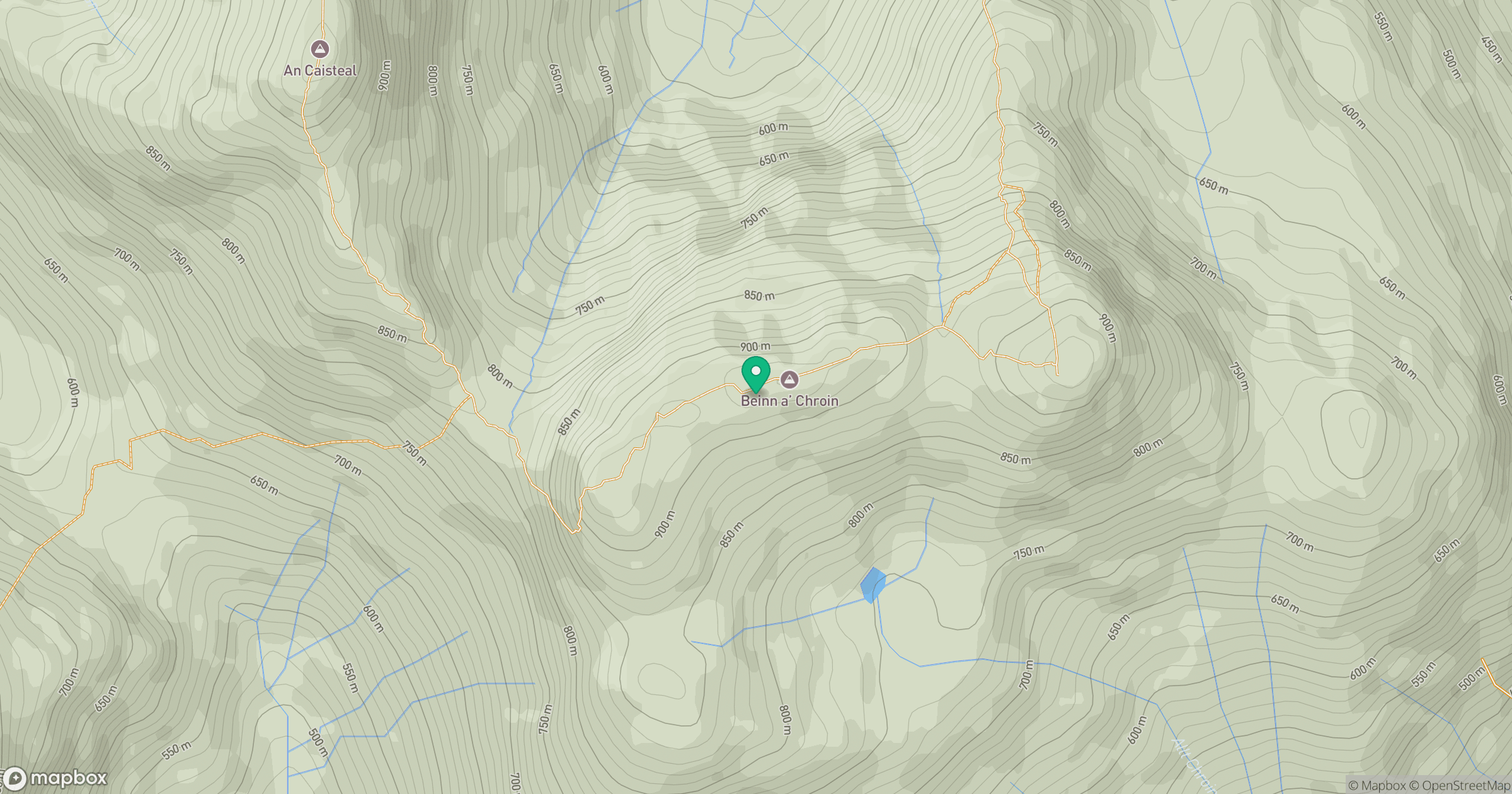
Grid reference: NN387185
View on OpenStreetMapOpens a map in a new tab, centred on the hill.
No comments yet. Be the first.