
An Socach
Good walks are even better shared.
Overview
An Socach: The Rough One
An Socach stands proudly at 945 meters, a classic Munro among the majestic Scottish Highlands. Known for its stunning vistas and challenging terrain, this mountain attracts adventurers eager to explore its rugged beauty.
Geology
Composed of ancient volcanic rock, An Socach features glacial deposits that have shaped its landscape over millennia. The varying geology results in lush grassy slopes, interspersed with rocky outcrops towards the summit.
Routes
The most popular route begins west from the A86. It's a 12.5 km journey that typically takes around four hours to complete, depending on your pace and how much you stop to admire the views. The path is well-defined, leading you steadily upward, while the panorama grows increasingly captivating.
Summit Features
Upon reaching the summit, you’ll be greeted by a sizeable cairn that serves as a testament to the many hikers who’ve trodden the rocky path before you. It’s an ideal spot to catch your breath, sip some water, and indulge in a well-earned snack.
Terrain Type
The terrain varies from soft, grassy ground to rocky sections that could be mistaken for staircases—if staircases were designed by Mother Nature to keep things interesting!
Views
The summit showcases dizzying views of notable landmarks. To the south, you’ll see the towering presence of Ben Nevis, while the Cairngorms loom impressively to the east. For those photo buffs, spring and summer offer the best conditions, but autumn's array of colours is equally enchanting.
Hazards
As always in the Highlands, be cautious of changing weather conditions. The summit can become snow-covered in winter, transforming the ascent into an unexpected winter wonderland.
Access
Access to An Socach is fairly straightforward, with parking available along the A86. If you're relying on public transport, you might need to get creative, as the nearest bus stop is in Laggan, about 8 km away.
Facilities
While you won’t find any toilets or shops on the mountain, the village of Laggan provides essential facilities to prepare for your adventure. A cuppa and some cake post-hike would certainly hit the spot!
History
Etymologically, An Socach means 'the rough one' in Gaelic, aptly reflecting its character. Culturally, it holds a special significance for many climbers, being a prominent peak in the Munro collection, embracing both challenge and beauty.
So lace up your boots, grab your sense of adventure, and make memories on An Socach! And remember, every steep climb is just nature’s way of making sure you truly appreciate the view at the top!
Explore routes near An Socach
Walks starting near this hill. Open a route to check its map, distance and full itinerary.
Glen Affric: Coire Loch Woodland Trail
View route
Beinn Eighe Lancaster Wreckage at Coire Mhic Fhearchair
View route
Fort Augustus to Kytra Lock: Caledonian Canal Towpath
View route
Fairy Lochs Liberator Wreckage Circuit
View route
Route planning notes
These notes describe possible approaches. Check a route's map and access information when planning your walk.
West from the A86
A relatively straightforward ascent starting from the A86, featuring well-defined paths and stunning views as you climb.
Make a day of it, together
Find someone to share the walk with, or organise a day out along a route you like.
Hill facts and local notes
Classifications
Elevation
1,069m
3,507 ft
Prominence
207m
Coordinates
57.3502, -5.1586
NH100332
OS Map
25
Explorer: 429 430
At the Summit
The summit boasts a sizable cairn, providing a perfect spot for a well-deserved snack and photo opportunity—don't forget to take one before dragging yourself back down!
Terrain & Geology
An Socach is primarily composed of ancient volcanic rock with glacial deposits, giving rise to its rugged beauty. The mountain's slopes are covered in heather and grass, with occasional rocky outcrops.
Views & Scenery
From the summit, you can catch a glimpse of the majestic Ben Nevis to the south and the sprawling peaks of the Cairngorms to the east.
History & Heritage
Name Origin
An Socach translates to 'the rough one' in Gaelic, a fitting name considering its rocky terrain and unyielding weather conditions.
Historical Significance
An Socach is renowned among mountain enthusiasts for its scenic beauty and as part of the revered Munro list, drawing climbers from all over.
Getting There & Facilities
Parking
Parking is available at the car park near the start of the route on the A86. It's a rough and ready spot but worth it for the adventure that awaits.
Public Transport
Limited public transport options are available, but the nearest bus stop is in the village of Laggan, approximately 8 km from the trailhead.
Nearby Facilities
There are no facilities directly on the mountain, but cafes and toilets can be found in Laggan, which is a short drive away.
Safety Information
Known Hazards
- Beware of sudden weather changes typical of the Highlands. The summit can accumulate snow in winter, making conditions potentially treacherous.
General Safety Tips
- Check weather conditions before setting out
- Carry appropriate clothing and equipment
- Let someone know your planned route
- Take a map, compass, and GPS device
- Carry emergency supplies: food, water, first aid kit, torch
Hills
Some common questions about the hills answered
Are there group walks up An Socach?
Many walkers use Walkmates to join or organise walks with others. You can check for group walks around An Socach through the maps
Are there other walkers around An Socach?
Activity varies by location and time, but Walkmates lets you see whether others have shared walks or shown interest in this area. Find other people through the walking friends search walking friends for An Socach search or of course create your own walk for An Socach
Can I organise a walk to An Socach?
Yes. If there aren’t any walks listed already, you can create a walk and make it available for others to join.
If you're signed up to Walkmates, you can create a walk to An Socach.
How do I find a walk up this hill?
There are often multiple ways to walk this hill, depending on experience and route preference. Walkmates helps you explore walks and routes that others have shared.
Can I suggest a new route up An Socach?
Yes. You can suggest or create routes to share with others. Walkmates focuses on the social side of walking, so routes are used to help people organise walks and explore areas together, rather than as detailed navigation tools or route libraries.
Other uses really appreciate knowledgeable walkers sharing their routes. Share your favourite route to An Socach here
The is an error or something incorrect about this hill. How do I let you know?
We always strive to keep the information on Walkmates as accurate as possible. If you find an error, please let us know through the contact form and we'll aim to correct it as quickly as possible
Community Discussion
Comments
Location
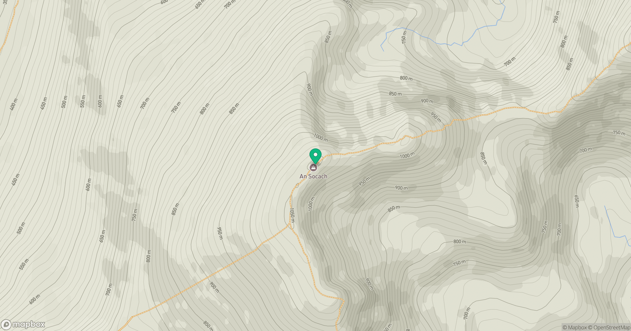
Grid reference: NH100332
View on OpenStreetMapOpens a map in a new tab, centred on the hill.
No comments yet. Be the first.