

Cefncarnau
Good walks are even better shared.
ST1684 : Gateway on track, Cefncarnau
M J Roscoe Photo source
Overview
Exploring Cefncarnau
Cefncarnau is a delightful hill situated in the verdant hills of South Wales. Standing proud at 222 meters, it's a Marilyn classified mountain, offering charming views and a great day out.
Geology
Cefncarnau boasts an interesting geological makeup, primarily formed from sandstone and shale. The layers of these stones not only provide stunning views but also evidence of the earth's history. Look closely, and you might spot unique fissures and intriguing rock formations that tell tales of time.
Routes
The Cefncarnau Circular Walk is a popular choice among hikers. Spanning 5.5 km, this moderate route is beautifully enveloped in forest and leads hikers to gradual ascents with rewarding panoramas. Budget about 2.5 hours to get to the top and back, including time to soak in those views! Perfect for families or anyone looking to stretch their legs.
Summit Features
At the summit, you'll find a respectable cairn, a monument to those who have trekked here before you. It's a classic spot for a breather or a quick snack break – just watch out for that sneaky midges!
Terrain Type
Expect a mix of grassy slopes and rocky outcrops, with a few sections of thick woodland. This blend is not just pleasing to the eye but creates a variety of habitats for local wildlife.
Views
One of the highlights from the summit includes breathtaking vistas towards the Bristol Channel, where you can often spot ships cruising along. Weather permitting, the rolling hills of the Brecon Beacons can be marvellous, especially during the golden hour.
Hazards
Cefncarnau is relatively safe, but as always, watch your step. Muddy areas can be a bit treacherous, especially when the heavens have opened up. Trust me, no one needs to add 'slip and slide champion' to their resume.
Nearby Summits
If you’re up for more after conquering Cefncarnau, consider visiting nearby summits such as Mynydd Maen (460 meters) or Twmbarlwm (410 meters). Both offer their unique charms and views, making them worth the extra effort!
Access
Getting to Cefncarnau is a doddle. The nearest parking can be found at the Cwmcarn Forest Drive car park, which provides easy access to the trail. For those venturing by bus, services from Newport deliver you right to the doorstep. Closed the the quaint town of Risca, it’s easy to refuel your energy before or after the hike.
Facilities
Right at the Cwmcarn car park, you'll also find a lovely café where you can grab a warming beverage or a slice of cake. It’s the perfect way to celebrate your achievement after completing the climb.
History
The name Cefncarnau derives from Welsh, meaning 'Head of the Grave'. This hint at the area's historical past is complemented by traces of ancient pathways and settlements. It seems our ancestors knew a brilliant view when they saw one!
In summary, Cefncarnau offers a combination of stunning landscape, rich history, and accessibility, making it an ideal destination for a day of outdoor adventure.
Happy hiking!
Explore routes near Cefncarnau
Walks starting near this hill. Open a route to check its map, distance and full itinerary.
Cardiff: Hailey Park to Blackweir Bridge on the Taff Trail
View route
Newport Fourteen Locks to Risca: Monmouthshire Canal Return
View route
Aberdare Walk with Men Walking & Talking
View route
Merthyr Tydfil with Men Walking & Talking
View route
Route planning notes
These notes describe possible approaches. Check a route's map and access information when planning your walk.
Cefncarnau Circular Walk
A delightful circular route starting from the village of Cwmcarn. The trail weaves through lush forests and opens up to stunning vistas.
Make a day of it, together
Find someone to share the walk with, or organise a day out along a route you like.
Photo Gallery
View all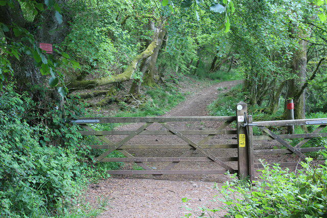 Photo could not load
ST1684 : Gateway on track, Cefncarnau
M J Roscoe
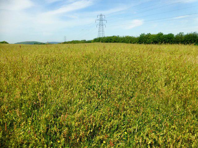 Photo could not load
ST1684 : Cefncarnau Summit
Rude Health
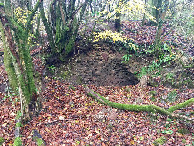 Photo could not load
ST1684 : Lime kiln
Alan Hughes
Hill facts and local notes
Classifications
Elevation
272m
892 ft
Prominence
108m
Coordinates
51.5551, -3.2056
ST165847
OS Map
171
Explorer: 151E
At the Summit
The summit features a modest cairn and a panoramic view over the surrounding valleys, providing a perfect backdrop for a group selfie.
Terrain & Geology
Cefncarnau is primarily composed of sedimentary rocks, mainly sandstone and shale, which create interesting formations and contribute to the rich ecosystems on the mountain.
Views & Scenery
On a clear day, the views extend to the Bristol Channel and the nearby hills of the Brecon Beacons.
History & Heritage
Name Origin
Cefncarnau translates to 'Head of the Grave' in Welsh, hinting at ancient burial sites or folklore related to the area.
Historical Significance
The area has historical significance, with ancient pathways and remnants of early settlement reflecting the rich human history.
Getting There & Facilities
Parking
Cwmcarn Forest Drive car park is the nearest, offering ample spaces and views right from the start.
Public Transport
Regular bus services run to Cwmcarn from Newport, making it accessible for those relying on public transportation.
Nearby Facilities
There is a café at the Cwmcarn Forest Drive car park where you can grab a cuppa and perhaps a piece of cake before your hike.
Safety Information
Known Hazards
- Watch out for muddy patches, especially after rain. Slips can happen faster than you can say 'slippery slope!'
General Safety Tips
- Check weather conditions before setting out
- Carry appropriate clothing and equipment
- Let someone know your planned route
- Take a map, compass, and GPS device
- Carry emergency supplies: food, water, first aid kit, torch
Hills
Some common questions about the hills answered
Are there group walks up Cefncarnau?
Many walkers use Walkmates to join or organise walks with others. You can check for group walks around Cefncarnau through the maps
Are there other walkers around Cefncarnau?
Activity varies by location and time, but Walkmates lets you see whether others have shared walks or shown interest in this area. Find other people through the walking friends search walking friends for Cefncarnau search or of course create your own walk for Cefncarnau
Can I organise a walk to Cefncarnau?
Yes. If there aren’t any walks listed already, you can create a walk and make it available for others to join.
If you're signed up to Walkmates, you can create a walk to Cefncarnau.
How do I find a walk up this hill?
There are often multiple ways to walk this hill, depending on experience and route preference. Walkmates helps you explore walks and routes that others have shared.
Can I suggest a new route up Cefncarnau?
Yes. You can suggest or create routes to share with others. Walkmates focuses on the social side of walking, so routes are used to help people organise walks and explore areas together, rather than as detailed navigation tools or route libraries.
Other uses really appreciate knowledgeable walkers sharing their routes. Share your favourite route to Cefncarnau here
The is an error or something incorrect about this hill. How do I let you know?
We always strive to keep the information on Walkmates as accurate as possible. If you find an error, please let us know through the contact form and we'll aim to correct it as quickly as possible
Community Discussion
Comments
Location
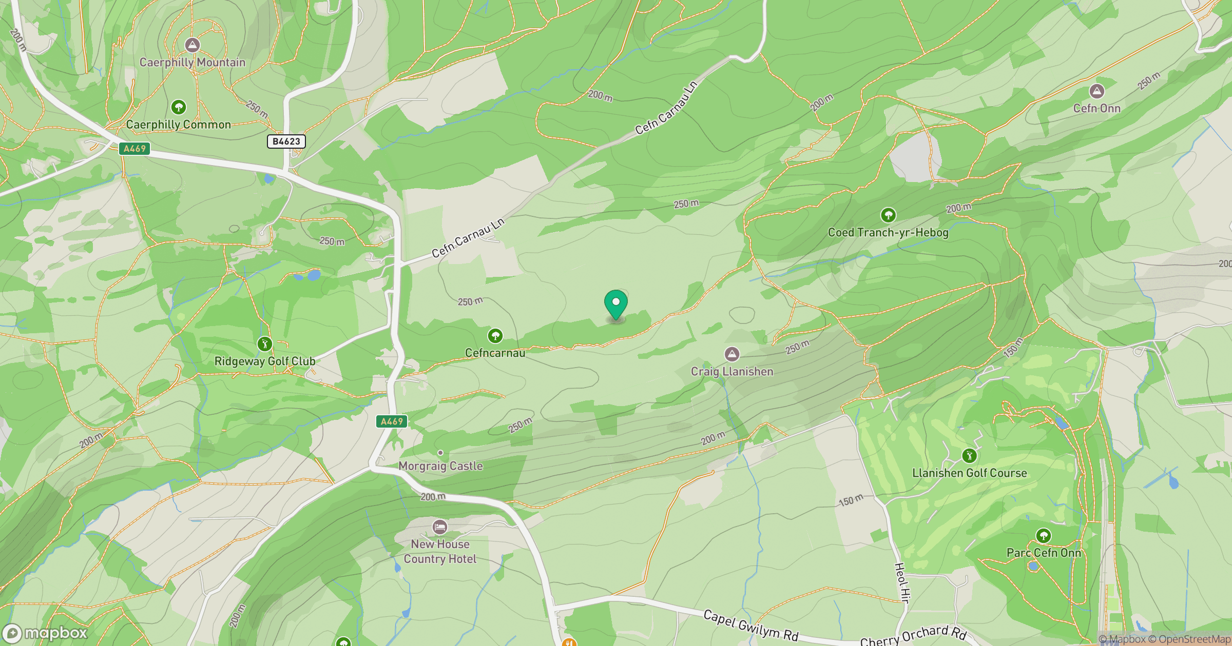
Grid reference: ST165847
View on OpenStreetMapOpens a map in a new tab, centred on the hill.



No comments yet. Be the first.