

Whit Fell
Good walks are even better shared.
SE0894 : Whit Fell
Trevor Littlewood Photo source
Overview
Whit Fell: A Hidden Gem of the Lake District
Nestled in the glorious Lake District, Whit Fell is a delightful Marilyn that invites hikers to explore its grassy slopes and rocky outcrops. Standing tall at 672 meters, it may not be the tallest buddy in the crew, but it certainly holds its own, providing stunning views of its more famous neighbours like Skiddaw and Blencathra.
Geology
Whit Fell boasts a formation primarily made up of andesite, a volcanic rock that contributes to the hill's sturdy structure. The terrain is dotted with glacial features, showcasing the dramatic history of its formation, akin to a sculptor shaping a masterpiece over millennia.
Route Details
The most popular route involves starting from the south-east where a small lane leads you to the base. This 3.2 km trek is best taken at a moderate pace—too fast and you might miss the enchanting landscape unfolding around you!
Route Highlights
- Distance: 3.2 km round trip
- Time: Approximately 1.5 hours
- Difficulty: Moderate
Summit Features
Reaching the summit, you’ll be greeted with a small cairn and an informal trig point nearby. Perfect spot for a victory photo! The views from the top are worth every step, stretching across the Lake District, feeling like you're on top of the world (or at least a massive hill!).
Terrain
The terrain is primarily grassy with a few rocky outcrops. Ideal for those who prefer a good old-fashioned stroll without the wrestling match often found on more rugged mountains.
Views
The summit vistas are breathtaking—you'll find yourself looking across to Blencathra and Skiddaw with a sense of awe. Best viewed during late spring or early autumn when the skies are usually clearer and the weather a bit kinder.
Hazards
A word of caution: the Lake District is famed for its ever-changing weather. Always check the forecast and carry essentials like a map and compass. There's no shame in getting lost, but it's much better to stay found!
Nearby Summits
If you’re feeling adventurous, why not take a swing by some of the nearby peaks?
- Blencathra (868 m)
- Skiddaw (931 m)
Access
Finding your way to Whit Fell is part of the fun! The nearest parking is a cozy little roadside spot near SE096940— arrive early to nab a space.
If you fancy leaving the car behind, regular buses can whisk you from Penrith to the surrounding villages.
Facilities
Bear in mind there are no facilities directly on the mountain itself. But fear not! The delightful town of Threlkeld is only a short drive away and hosts a couple of pubs and shops where you can refuel after your adventures.
History
The mountain’s name, ‘Whit Fell’, likely comes from the Old Norse word for white, possibly alluding to the light-coloured rocks or snow in winter. Historically, it's been a local favourite, cherished for its accessibility and awe-inspiring views.
So pack your rucksack, lace up your boots, and set forth on your adventure to Whit Fell. It's an experience that's as refreshing as a crisp mountain breeze!
Explore routes near Whit Fell
Walks starting near this hill. Open a route to check its map, distance and full itinerary.
Richmond Yorkshire
View route
Barnard Castle: Flatts Wood and Cleveland Walk
View route
Buckden Pike Wellington Wreckage and Memorial
View route
Fountains Abbey and Studley Royal Circular
View route
Route planning notes
These notes describe possible approaches. Check a route's map and access information when planning your walk.
The Path from the South East
A pleasant ascent beginning from the small lane south-east of the hill, this route offers a steady climb with manageable gradients.
Make a day of it, together
Find someone to share the walk with, or organise a day out along a route you like.
Photo Gallery
View all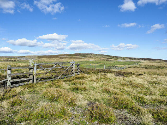 Photo could not load
SE0894 : Whit Fell
Trevor Littlewood
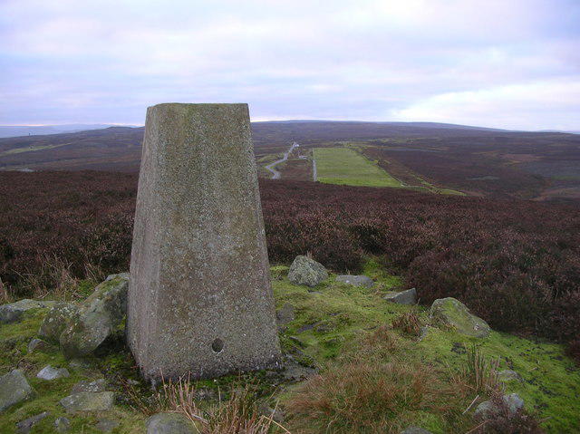 Photo could not load
SE0894 : Trigpoint on Whit Fell, Yorkshire
Jeremy Kemp
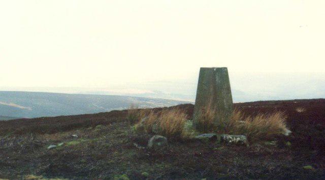 Photo could not load
SE0894 : Trig Point on Whit Fell, Stainton Moor
Roger Templeman
Hill facts and local notes
Classifications
Elevation
411m
1,348 ft
Prominence
38m
Coordinates
54.3468, -1.8690
SE086945
OS Map
99
Explorer: OL30N
At the Summit
The summit features a small cairn and offers a more informal, yet undeniably charming, trig point nearby—perfect for your next Instagram moment.
Terrain & Geology
Whit Fell is primarily composed of volcanic rock, specifically andesite, which gives the hill its sturdy structure. The surrounding landscape features glacial landforms, typical of the Lake District's dramatic topography.
Views & Scenery
The summit provides stunning vistas of nearby peaks such as Blencathra and Skiddaw, as well as sweeping views of the northern lakes.
History & Heritage
Name Origin
The name 'Whit Fell' likely derives from the Old Norse 'Vita' meaning white, possibly referring to the light-coloured rock or snow-capped peaks in winter.
Historical Significance
Whit Fell has been a local favourite for generations, known for its accessibility and panoramic views, making it a beloved secluded getaway.
Getting There & Facilities
Parking
Small parking area available by the roadside near SE096940, but spots are limited. Arrive early!
Public Transport
Regular buses operate from Penrith to the surrounding villages, but check the latest schedules.
Nearby Facilities
There are no toilets or cafes directly on the mountain; however, facilities can be found in Threlkeld and Keswick.
Safety Information
Known Hazards
- Variable weather conditions can lead to sudden changes in visibility; always be prepared with a map and compass.
General Safety Tips
- Check weather conditions before setting out
- Carry appropriate clothing and equipment
- Let someone know your planned route
- Take a map, compass, and GPS device
- Carry emergency supplies: food, water, first aid kit, torch
Hills
Some common questions about the hills answered
Are there group walks up Whit Fell?
Many walkers use Walkmates to join or organise walks with others. You can check for group walks around Whit Fell through the maps
Are there other walkers around Whit Fell?
Activity varies by location and time, but Walkmates lets you see whether others have shared walks or shown interest in this area. Find other people through the walking friends search walking friends for Whit Fell search or of course create your own walk for Whit Fell
Can I organise a walk to Whit Fell?
Yes. If there aren’t any walks listed already, you can create a walk and make it available for others to join.
If you're signed up to Walkmates, you can create a walk to Whit Fell.
How do I find a walk up this hill?
There are often multiple ways to walk this hill, depending on experience and route preference. Walkmates helps you explore walks and routes that others have shared.
Can I suggest a new route up Whit Fell?
Yes. You can suggest or create routes to share with others. Walkmates focuses on the social side of walking, so routes are used to help people organise walks and explore areas together, rather than as detailed navigation tools or route libraries.
Other uses really appreciate knowledgeable walkers sharing their routes. Share your favourite route to Whit Fell here
The is an error or something incorrect about this hill. How do I let you know?
We always strive to keep the information on Walkmates as accurate as possible. If you find an error, please let us know through the contact form and we'll aim to correct it as quickly as possible
Community Discussion
Comments
Location
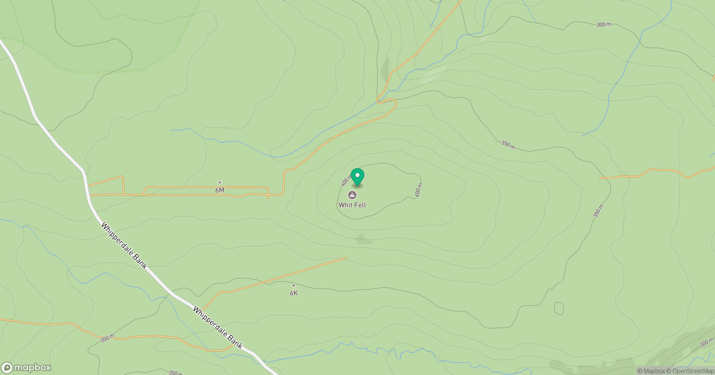
Grid reference: SE086945
View on OpenStreetMapOpens a map in a new tab, centred on the hill.
Nearby Hills
Buckden Pike
702m
Nine Standards Rigg
662m

Pen-y-ghent
694m
Rombalds Moor [Ilkley Moor]
402m

Whernside
737m
No comments yet. Be the first.