

Hoove
Good walks are even better shared.
NZ0006 : Blocked grip on Hoove
Trevor Littlewood Photo source
Overview
Hoove Mountain: A Hidden Gem of the North Pennines
Nestled in the picturesque North Pennines, Hoove Mountain is a treasure waiting to be discovered by enthusiasts of the great outdoors. Standing at an elevation of 600 meters, this Marilyn offers a delightful escape for hikers looking to soak in stunning views and enjoy a hearty dose of fresh air.
Geology
Hoove is predominantly made of Carboniferous limestone, leading to a landscape adorned with striking rock formations and impressive crags. Geologists and curious onlookers will appreciate the complexity of its geological features, which tell stories of the Earth's distant past. Don't forget your rock hammer (but only if you're not leaving it behind to face the sheep).
Routes
The Hoove Hill Circular route is particularly popular, providing a scenic 8 km trek that will take you approximately 3 hours to complete. Starting from Alston, this moderately challenging path takes you through diverse terrain, offering a delightful mix of grassy moorland with some rocky spots. Keep an eye out for local wildlife, as you might catch a glimpse of a hare or even a rare bird!
Summit Features
At the summit of Hoove, you'll find a small yet charming stone cairn that adds to the mountain's allure. The stunning panoramic views from this vantage point are unbeatable, promising to take your breath away (in the best way possible).
Terrain Type
Expect a rocky and grassy terrain, alongside a few boggy patches, particularly during or after wet weather. Proper hiking boots are highly recommended to navigate through the uneven landscape.
Views
From the summit, majestic landscapes unfold before you. On a clear day, the vistas encompass the North Pennines Area of Outstanding Natural Beauty and reach the distant peaks of the Lake District. The best times to visit for breathtaking views are in the spring, when wildflowers bloom, or in autumn, when leaves put on a colourful show.
Hazards
As with any journey into the hills, be aware of sudden weather changes. Although Hoove is a friendly giant, slippery surfaces can crop up, especially after rainfall. Also, the local sheep have the right of way, so mind your manners!
Nearby Summits
For those keen on exploring more, nearby summits include Cross Fell, which towers at 893 meters, and Little Fell at 703 meters. A thrilling day of hiking awaits!
Access
Getting to Hoove is as easy as pie. The nearest parking is just off the A686 at Alston, where you can park safely before your adventure begins. Should you prefer public transport, regular buses operate from nearby towns such as Penrith.
Facilities
In the quaint town of Alston, you will find everything you need from charming cafes serving delightful beverages to local shops stocked with snacks for your trek. Public toilets are also available to ensure your visit is as comfortable as can be.
History
The name Hoove has a rich etymology, stemming from the Old English 'hoh', meaning 'heel or projection'. This features the unique characteristics of the hill itself. Historical significance lies within its legend-laden past, a staple of local folklore that binds the community to its beloved hills.
With so much to offer, Hoove Mountain is a wonderful destination for outdoor enthusiasts and nature lovers alike. So lace up those boots, grab a friend (or the family dog), and hit the trail—adventure awaits!
Explore routes near Hoove
Walks starting near this hill. Open a route to check its map, distance and full itinerary.
Barnard Castle: Flatts Wood and Cleveland Walk
View route
Richmond Yorkshire
View route
Hamsterley Forest, Bedburn Beck and Crossfield Plantation
View route
Buckden Pike Wellington Wreckage and Memorial
View route
Route planning notes
These notes describe possible approaches. Check a route's map and access information when planning your walk.
Hoove Hill Circular
A scenic circular route starting from the village of Alston. This path takes you through stunning moorland, rolling hills, and offers occasional glimpses of local wildlife.
Make a day of it, together
Find someone to share the walk with, or organise a day out along a route you like.
Photo Gallery
View all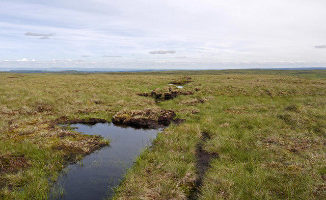 Photo could not load
NZ0006 : Blocked grip on Hoove
Trevor Littlewood
Hill facts and local notes
Classifications
Elevation
555m
1,820 ft
Prominence
177m
Coordinates
54.4576, -1.9987
NZ001069
OS Map
92
Explorer: OL30N
At the Summit
The summit features a small stone cairn and breathtaking panoramic views that can make even the most seasoned hiker's heart skip a beat (in a good way!).
Terrain & Geology
Hoove is primarily composed of Carboniferous limestone, which gives rise to its characteristic rugged terrain. The rock formations often feature impressive craggy outcrops, making it a favourite among geology enthusiasts.
Views & Scenery
From the summit, adventurers can enjoy views of the North Pennines Area of Outstanding Natural Beauty, including the distant peaks of the Lake District. On a clear day, you might even spot as far as the North Sea!
History & Heritage
Name Origin
The name Hoove is believed to derive from the Old English term 'hoh', meaning 'heel or projection', referring to the hill's shape.
Historical Significance
Hoove has been a part of local folklore, and its rugged terrain has been a silent witness to the lives of the region's farmers and shepherds for centuries.
Getting There & Facilities
Parking
Parking is available just off the A686 at the Alston trailhead. Be sure to use designated parking spots to avoid any bad blood with the locals.
Public Transport
Regular bus services run from nearby towns such as Penrith, though be prepared for a bit of a trek to the starting point.
Nearby Facilities
Alston offers a range of facilities including cafes for a warm cuppa, local shops for snacks, and public toilets.
Safety Information
Known Hazards
- Be cautious of sudden weather changes typical of the region. Some areas can be slippery, especially when wet, so sturdy footwear is recommended. Additionally, watch out for the local sheep—they're the real bosses of the hills!
General Safety Tips
- Check weather conditions before setting out
- Carry appropriate clothing and equipment
- Let someone know your planned route
- Take a map, compass, and GPS device
- Carry emergency supplies: food, water, first aid kit, torch
Hills
Some common questions about the hills answered
Are there group walks up Hoove?
Many walkers use Walkmates to join or organise walks with others. You can check for group walks around Hoove through the maps
Are there other walkers around Hoove?
Activity varies by location and time, but Walkmates lets you see whether others have shared walks or shown interest in this area. Find other people through the walking friends search walking friends for Hoove search or of course create your own walk for Hoove
Can I organise a walk to Hoove?
Yes. If there aren’t any walks listed already, you can create a walk and make it available for others to join.
If you're signed up to Walkmates, you can create a walk to Hoove.
How do I find a walk up this hill?
There are often multiple ways to walk this hill, depending on experience and route preference. Walkmates helps you explore walks and routes that others have shared.
Can I suggest a new route up Hoove?
Yes. You can suggest or create routes to share with others. Walkmates focuses on the social side of walking, so routes are used to help people organise walks and explore areas together, rather than as detailed navigation tools or route libraries.
Other uses really appreciate knowledgeable walkers sharing their routes. Share your favourite route to Hoove here
The is an error or something incorrect about this hill. How do I let you know?
We always strive to keep the information on Walkmates as accurate as possible. If you find an error, please let us know through the contact form and we'll aim to correct it as quickly as possible
Community Discussion
Comments
Location
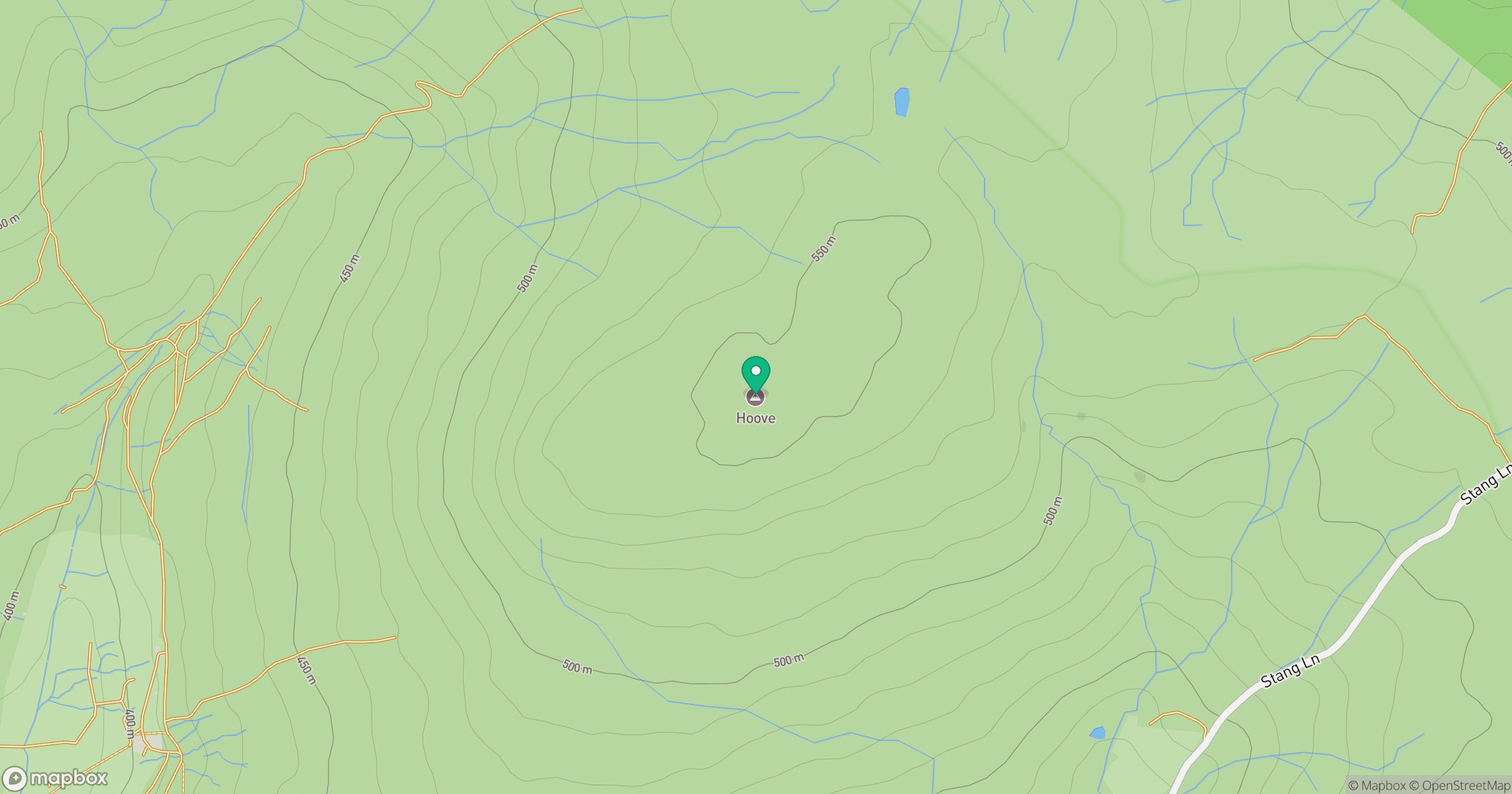
Grid reference: NZ001069
View on OpenStreetMapOpens a map in a new tab, centred on the hill.



No comments yet. Be the first.