

Birks Fell
Good walks are even better shared.
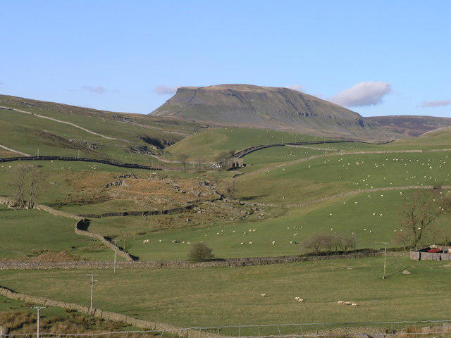
SD9176 : Walls on Birks Fell
David Brown Photo source
Overview
Birks Fell: A Hidden Gem in the Yorkshire Dales
Nestled in the scenic beauty of the Yorkshire Dales, Birks Fell is a delightful hike that delivers stunning views and exhilarating fresh air without the need to summit the highest peaks.
Geology
Birks Fell is primarily formed from carboniferous limestone, which is evident in its rugged terrain and unique rock formations. As you ascend, keep an eye out for distinctive textures and colours that change with the light, making it an artist’s dream!
Route Information
The Birks Fell Circular Walk kicks off in the delightful village of Muker. This route is approximately 9.5 km long and takes about 3.5 hours to complete. It’s rated as moderate, making it suitable for hikers with a bit of experience under their boots. The circular path weaves through lush valleys and rocky outcrops, hugging the contours of the fell, giving plenty of opportunities to stop and catch your breath (and take pictures).
Summit Features
At the summit, expect to find a humble cairn and a rocky outcrop that offers expansive views of Swaledale. It’s a perfect place to catch your breath and perhaps have a snack if you’ve remembered to pack one!
Terrain Type
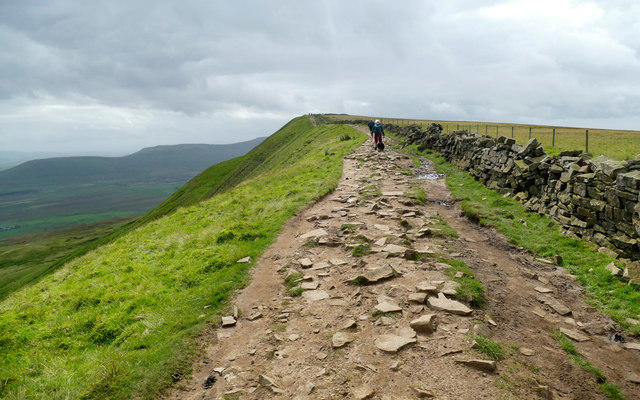
Birks Fell's terrain is varied, ranging from gentle grassy slopes to rocky sections that keep things interesting. You might find a few boggy patches to navigate, so good footwear is essential. Don’t worry though, it’s all part of the fun!
Views
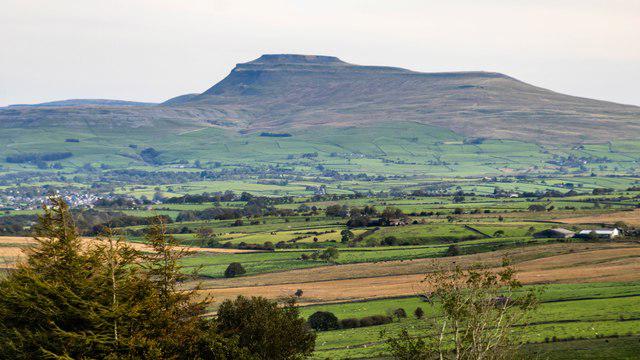
From the summit, you’ll be treated to beautiful vistas stretching across the Dales. The best times to enjoy these views are during late spring and early autumn when the skies are often at their clearest.
Hazards
Keep in mind that the weather can change faster than a politician's promises, so be prepared for all seasons in one day. Wet rocks can be slippery, so tread carefully, especially after a rainstorm.
Nearby Summits
For those looking to extend their adventure, consider the nearby summits like Great Shunner Fell and The Calf which offer additional trails and stunning views.
Access
Birks Fell is accessible by car, with parking available near Muker. If you prefer public transport, be aware that bus services are infrequent, so check the timetable before heading out. Muker is the closest town, providing the perfect setting for a little refreshment post-hike.
Facilities
In terms of facilities, Muker has a quaint tea room perfect for indulging in homemade cakes or perhaps a cup of Yorkshire tea. Public toilets are open during the summer months, providing necessary amenities for weary walkers.
History
The name 'Birks' hails from the Old Norse term for birch, giving a nod to the historical significance of the area. Historically, this land has been shaped by farming and sheep herding, with traditional paths crisscrossing the fell. The rich cultural history adds depth to your hike, connecting you with the generations who have walked these hills before.
In summary, Birks Fell offers a perfect escape into nature, with manageable routes, stunning scenery, and a dash of history. Bring your boots, grab your friends, and don’t forget the cake!
Explore routes near Birks Fell
Walks starting near this hill. Open a route to check its map, distance and full itinerary.
Buckden Pike Wellington Wreckage and Memorial
View route
Pen-y-ghent from Horton in Ribblesdale
View route
Yorkshire Three Peaks Challenge – Gentle Pace
View route
Yorkshire Three Peaks Challenge – Sub-12 Hour
View route
Route planning notes
These notes describe possible approaches. Check a route's map and access information when planning your walk.
Birks Fell Circular Walk
A delightful loop that can be tackled from the village of Muker, offering a great mix of scenic views and manageable terrain.
Make a day of it, together
Find someone to share the walk with, or organise a day out along a route you like.
Photo Gallery
View all Photo could not load
SD9176 : Walls on Birks Fell
David Brown
 Photo could not load
SD9176 : Summit area of Birks Fell
Trevor Littlewood
 Photo could not load
SD9176 : Gate in the dry stone wall on Birks Fell
Graham Robson
 Photo could not load
SD9176 : Cairn on Birks Fell
Graham Robson
 Photo could not load
SD9176 : The summit of Birks Fell
David Brown
 Photo could not load
SD9176 : Birks Fell
Rude Health
 Photo could not load
SD9176 : Birks Fell Summit
Des Taylor
Hill facts and local notes
Classifications
Elevation
610m
2,003 ft
Prominence
158m
Coordinates
54.1830, -2.1259
SD918763
OS Map
98
Explorer: OL30S
At the Summit
The summit of Birks Fell is marked by a small rocky outcrop and a cairn. It provides a perfect resting spot after the hike, complete with stunning panoramic views.
Terrain & Geology
Birks Fell is predominantly composed of carboniferous limestone, which has created some fascinating features such as scree slopes and weathered rock formations. The exposure to the elements has led to some striking scenery, perfect for that Instagram shot.
Views & Scenery
Summit vistas include the stunning expanse of Swaledale, and on a clear day, you might even spot the iconic Three Peaks in the distance.
History & Heritage
Name Origin
The name 'Birks' is derived from the Old Norse word 'birki', meaning birch trees, which were once prevalent in the area.
Historical Significance
Historically, Birks Fell has been a point of interest for local farmers and sheep herders, with traditional rights of way going back hundreds of years.
Getting There & Facilities
Parking
There is a small layby just off the B6270 near Muker. Ensure your vehicle is parked off the road to avoid any fines.
Public Transport
Buses run infrequently to Muker from nearby towns; however, driving is generally more reliable.
Nearby Facilities
The nearby village of Muker has a tea room perfect for a slice of cake after your trek. Public toilets are available during the summer months.
Safety Information
Known Hazards
- Beware of sudden weather changes typical of the region, and watch out for slippery rocks, especially after rain.
General Safety Tips
- Check weather conditions before setting out
- Carry appropriate clothing and equipment
- Let someone know your planned route
- Take a map, compass, and GPS device
- Carry emergency supplies: food, water, first aid kit, torch
Hills
Some common questions about the hills answered
Are there group walks up Birks Fell?
Many walkers use Walkmates to join or organise walks with others. You can check for group walks around Birks Fell through the maps
Are there other walkers around Birks Fell?
Activity varies by location and time, but Walkmates lets you see whether others have shared walks or shown interest in this area. Find other people through the walking friends search walking friends for Birks Fell search or of course create your own walk for Birks Fell
Can I organise a walk to Birks Fell?
Yes. If there aren’t any walks listed already, you can create a walk and make it available for others to join.
If you're signed up to Walkmates, you can create a walk to Birks Fell.
How do I find a walk up this hill?
There are often multiple ways to walk this hill, depending on experience and route preference. Walkmates helps you explore walks and routes that others have shared.
Can I suggest a new route up Birks Fell?
Yes. You can suggest or create routes to share with others. Walkmates focuses on the social side of walking, so routes are used to help people organise walks and explore areas together, rather than as detailed navigation tools or route libraries.
Other uses really appreciate knowledgeable walkers sharing their routes. Share your favourite route to Birks Fell here
The is an error or something incorrect about this hill. How do I let you know?
We always strive to keep the information on Walkmates as accurate as possible. If you find an error, please let us know through the contact form and we'll aim to correct it as quickly as possible
Community Discussion
Comments
Location
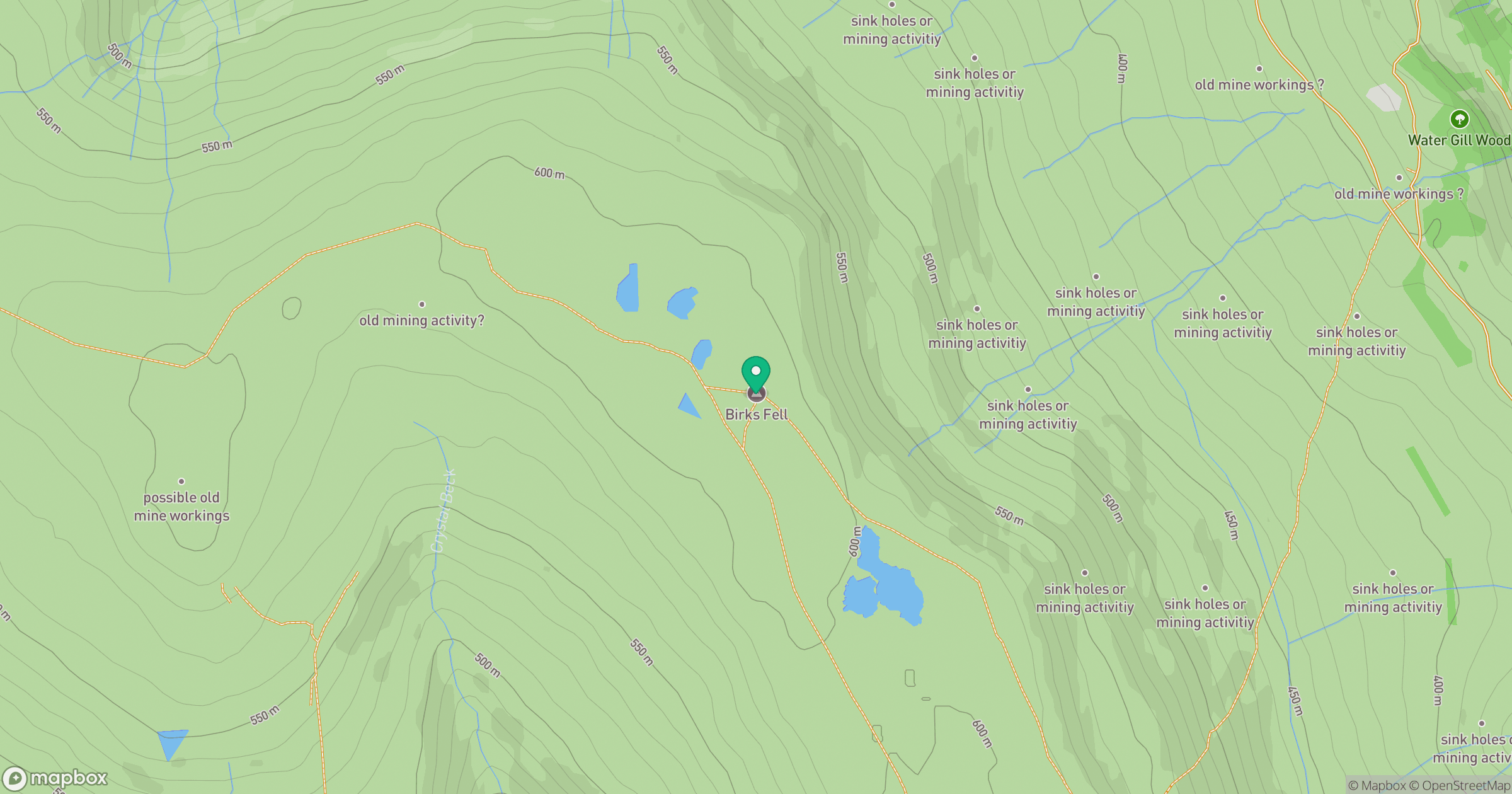
Grid reference: SD918763
View on OpenStreetMapOpens a map in a new tab, centred on the hill.
No comments yet. Be the first.