

Uldale Head
Good walks are even better shared.
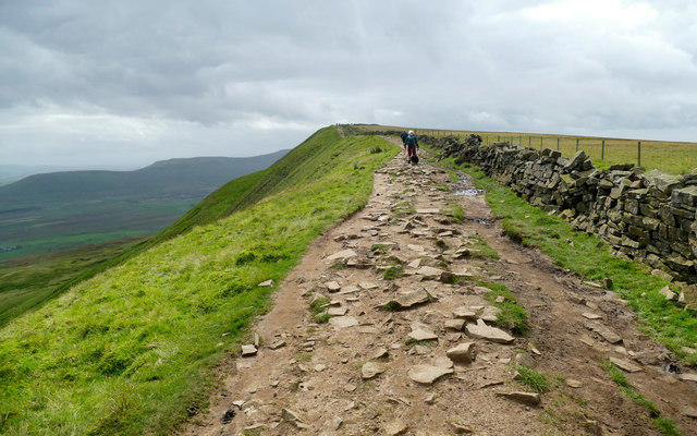
NY6300 : Path up to Uldale Head
Raymond Knapman Photo source
Overview
Uldale Head: A Hidden Gem in the Lake District
Nestled in the heart of the Lake District, Uldale Head offers a delightful escape for hikers seeking both tranquillity and stunning vistas. With an elevation of 580 meters, this Marilyn might not be the highest peak, but it holds its own charm and beauty.
Geology
Uldale Head is primarily composed of slate and volcanic rock, evidence of the dramatic geological history that has shaped much of the Lake District. The rugged terrain serves as a reminder of ancient volcanic activity, offering a glimpse into the earth's past.
Route Description
The most popular route begins in Uldale village, a quaint locale characterised by its charming cottages and friendly locals. The Uldale Walk is approximately 4.5 km long and takes around 2 hours to complete, making it perfect for a leisurely stroll. The path meanders through lush pastures before ascending towards the summit, with rocky sections punctuating the grassy slopes.
Summit Features
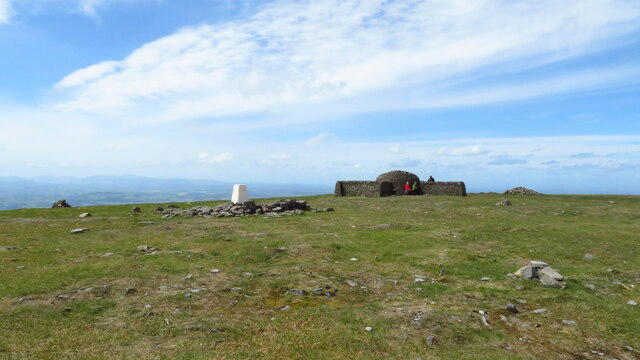
Upon reaching the summit, you'll be greeted by a small rocky outcrop adorned with a traditional cairn. It’s a perfect pit stop for a breather and a few photos—don’t forget to capture the views!
Terrain and Views
The terrain can be a bit boggy, so it's wise to wear waterproof footwear. However, nothing beats the reward awaiting you at the top: panoramic views of the stunning Skiddaw range, Blencathra, and even the Solway Firth, especially on clear days. The best seasons to visit are spring and early summer, when the landscape bursts into colour and visibility is at its peak.
Hazards
Keep in mind that some sections may be boggy, especially after rain. Always check the weather conditions and plan accordingly to ensure a safe and enjoyable hike.
Nearby Summits
For those looking to extend their adventure, nearby summits include Skiddaw (931 meters) and Blencathra (868 meters), both offering a range of hiking challenges and breathtaking views.
Access
Getting to Uldale Head is relatively easy. The nearest parking is available in Uldale village, and for those reliant on public transport, there are services connecting to Keswick. This makes it accessible for day-trippers from nearby towns.
Facilities
While Uldale village boasts a small café, larger options can be found in the bustling town of Keswick, where you can refuel after your hike.
Conclusion
Uldale Head may not have the fame of some of its towering neighbours, but it possesses a charm and serenity that is sure to captivate hikers. So lace up your boots and head to this hidden gem—the views are worth every step!
Happy hiking, and watch out for those bogs!
Explore routes near Uldale Head
Walks starting near this hill. Open a route to check its map, distance and full itinerary.
Sizergh: Park End Moss and Brigsteer Park Wood Circuit
View route
Ingleton Waterfalls Walk
View route
Striding Edge, Helvellyn and Catstye Cam
View route
Helvellyn via Striding Edge
View route
Route planning notes
These notes describe possible approaches. Check a route's map and access information when planning your walk.
Uldale Walk from Uldale Village
A scenic walk starting from the picturesque village of Uldale, meandering through lush pastures and gentle slopes towards the summit.
Make a day of it, together
Find someone to share the walk with, or organise a day out along a route you like.
Photo Gallery
View all Photo could not load
NY6300 : Path up to Uldale Head
Raymond Knapman
 Photo could not load
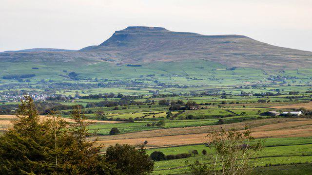
SD6499 : View N from Fell Head towards Uldale Head, Howgill Fells
Colin Park
 Photo could not load
NY6400 : Uldale Head
Rude Health
 Photo could not load
NY6400 : Cairn, Uldale Head
Michael Graham
 Photo could not load
NY6400 : Uldale Head cairn
Raymond Knapman
Hill facts and local notes
Classifications
Elevation
532m
1,745 ft
Prominence
132m
Coordinates
54.3943, -2.5554
NY640000
OS Map
91
Explorer: OL19S
At the Summit
The summit features a small rocky outcrop with a humble but charming cairn, providing a perfect spot for a well-deserved break.
Terrain & Geology
Primarily composed of slate and volcanic rock, Uldale Head showcases the geological beauty of the Lake District, with its rugged terrain resulting from ancient volcanic activities.
Views & Scenery
Panoramic views of the Skiddaw range, Blencathra, and the northern fells, along with a delightful glimpse of the Solway Firth in the distance.
History & Heritage
Name Origin
The name 'Uldale' originates from Old Norse, meaning 'valley of the old', reflecting its ancient heritage.
Historical Significance
Uldale Head offers a serene escape for hikers and is part of the rich cultural tapestry of the Lake District, which has inspired countless poets and painters.
Getting There & Facilities
Parking
There is a small car park in Uldale village, which serves as a good starting point for the walk.
Public Transport
The nearest bus service operates from Keswick to Uldale, making it accessible for those relying on public transport.
Nearby Facilities
The village of Uldale has a small café and village shop, although larger facilities can be found in Keswick.
Safety Information
Known Hazards
- Boggy patches can be present, especially after rainfall, so waterproof footwear is recommended. As always, check the weather before heading out.
General Safety Tips
- Check weather conditions before setting out
- Carry appropriate clothing and equipment
- Let someone know your planned route
- Take a map, compass, and GPS device
- Carry emergency supplies: food, water, first aid kit, torch
Hills
Some common questions about the hills answered
Are there group walks up Uldale Head?
Many walkers use Walkmates to join or organise walks with others. You can check for group walks around Uldale Head through the maps
Are there other walkers around Uldale Head?
Activity varies by location and time, but Walkmates lets you see whether others have shared walks or shown interest in this area. Find other people through the walking friends search walking friends for Uldale Head search or of course create your own walk for Uldale Head
Can I organise a walk to Uldale Head?
Yes. If there aren’t any walks listed already, you can create a walk and make it available for others to join.
If you're signed up to Walkmates, you can create a walk to Uldale Head.
How do I find a walk up this hill?
There are often multiple ways to walk this hill, depending on experience and route preference. Walkmates helps you explore walks and routes that others have shared.
Can I suggest a new route up Uldale Head?
Yes. You can suggest or create routes to share with others. Walkmates focuses on the social side of walking, so routes are used to help people organise walks and explore areas together, rather than as detailed navigation tools or route libraries.
Other uses really appreciate knowledgeable walkers sharing their routes. Share your favourite route to Uldale Head here
The is an error or something incorrect about this hill. How do I let you know?
We always strive to keep the information on Walkmates as accurate as possible. If you find an error, please let us know through the contact form and we'll aim to correct it as quickly as possible
Community Discussion
Comments
Location
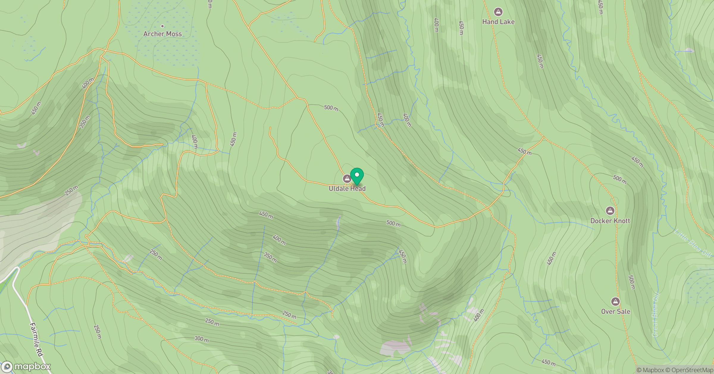
Grid reference: NY640000
View on OpenStreetMapOpens a map in a new tab, centred on the hill.
No comments yet. Be the first.