

The Storr South Top
Good walks are even better shared.
NG4953 : Southwards from The Storr, Skye
Jim Barton Photo source
Overview
The Storr South Top
The Storr South Top, perched at 719 meters, forms part of the breathtaking Trotternish Ridge on the Isle of Skye, known for its stunning landscapes and iconic rock formations. This Marilyn is often overshadowed by the nearby Old Man of Storr, but make no mistake, South Top has its own character and charm.
Geology
This rugged peak is composed mainly of Old Red Sandstone, revealing a rich tapestry of geological history. The formations here tell tales of ancient rivers and magnificent landscapes shaped over millions of years. Just try to picture it: a bustling prehistoric river valley that eventually gave way to the towering cliffs you see today. Time travel isn't feasible, but hiking these hills can feel like a journey back in time.
Routes
The most commonly travelled route is the The Storr Path, which begins at the car park. It stretches approximately 5.0 km round-trip and typically takes about 2.5 hours. You’ll find yourself meandering through grassy slopes, rocky outcrops, and honestly, the occasional bog—perfect terrain to test your waterproof boots!
Summit Features
At the summit, you will find a modest yet charming cairn. The rocks could almost pass for an ancient monument trying to communicate with the sky, wistful yet proud.
Terrain Type
Expect a mixed bag of rocky scrambles and lush grassy areas punctuated with suspiciously wet patches—handle with care, unless mud wrestling is on your to-do list!
Views
Once you reach the top, you are rewarded with unbeatable views. Witness the Old Man of Storr towering nearby, and gaze across the waters of the Sound of Raasay towards mainland Scotland. The sunsets from this viewpoint can induce a fair bit of jealousy from the sun itself—truly a sight to behold!
Hazards
As with any mountain, caution is the name of the game. Slippery rocks and steep cliffs can pose risks, especially if the weather turns choppy. Always keep an eye out for the fickle Scottish weather.
Nearby Summits
Don't forget to check out the Old Man of Storr while you’re in the neighbourhood! This characteristically tall spire of rock is just around the corner.
Access
The nearest car park is a boon for hikers, conveniently located at NG487532. Public transport options from Portree make it accessible, especially when your legs are tired and you fancy a pint instead.
Facilities
While the Storr South Top itself is quite rustic, Portree is your go-to spot for cafes and refreshment options, complete with the necessary toilet facilities to refresh before or after your hike.
History
The name 'Storr' harkens back to the island's Norse heritage, embodying the grandeur of this majestic landscape. Local legends whisper stories that make this place all the more enchanting, bringing a blend of history and natural wonder together.
In summary, whether it’s for the stunning scenery, the rich geology, or just a good old bit of nature, The Storr South Top is well worth visiting. Just remember to pack your sense of adventure (and a sandwich or two) and get ready for an unforgettable experience!
Explore routes near The Storr South Top
Walks starting near this hill. Open a route to check its map, distance and full itinerary.
Fairy Lochs Liberator Wreckage Circuit
View route
Beinn Eighe Lancaster Wreckage at Coire Mhic Fhearchair
View route
Berneray Community Hall to the beautiful beach
View route
Beautiful private beach walk Isle of Harris
View route
Route planning notes
These notes describe possible approaches. Check a route's map and access information when planning your walk.
The Storr Path
A well-trodden and scenic path that begins at the main car park and winds its way up to the summit, offering stunning views along the way.
Make a day of it, together
Find someone to share the walk with, or organise a day out along a route you like.
Photo Gallery
View all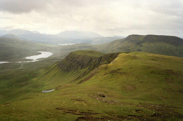 Photo could not load
NG4953 : Southwards from The Storr, Skye
Jim Barton
Hill facts and local notes
Classifications
Elevation
491m
1,611 ft
Prominence
36m
Coordinates
57.4967, -6.1906
NG490529
OS Map
23
Explorer: 408 409
At the Summit
At the summit, you will find a small cairn and the remains of ancient rock formations, which seem to be pointing towards the sky in an effort to catch a cloud or two.
Terrain & Geology
The Storr South Top is primarily composed of Old Red Sandstone, formed over 400 million years ago. The rugged cliffs and distinctive rock formations offer a dramatic insight into the geological history of the area.
Views & Scenery
From the summit, you can enjoy panoramic vistas of the Old Man of Storr, the Trotternish Ridge, and across the waters to the mainland, including the distant hills of the Great Glen.
History & Heritage
Name Origin
The name 'Storr' is believed to derive from the Norse word 'storr' meaning 'great' or 'big', reflecting both its prominent stature and the imposing landscape.
Historical Significance
The Storr area is steeped in local folklore and has been an important site for both ancient and modern culture, celebrated in local art and storytelling.
Getting There & Facilities
Parking
There is a large car park at NG487532, which serves as the starting point for most routes to The Storr.
Public Transport
Regular bus services run from Portree to the Storr, providing convenient access during the peak tourist season.
Nearby Facilities
There are no facilities directly at the site, but Portree offers a variety of cafes, shops, and toilets for all your hiking needs.
Safety Information
Known Hazards
- Be wary of slippery rocks, especially after rain, and watch out for steep cliffs on the northern side.
General Safety Tips
- Check weather conditions before setting out
- Carry appropriate clothing and equipment
- Let someone know your planned route
- Take a map, compass, and GPS device
- Carry emergency supplies: food, water, first aid kit, torch
Hills
Some common questions about the hills answered
Are there group walks up The Storr South Top?
Many walkers use Walkmates to join or organise walks with others. You can check for group walks around The Storr South Top through the maps
Are there other walkers around The Storr South Top?
Activity varies by location and time, but Walkmates lets you see whether others have shared walks or shown interest in this area. Find other people through the walking friends search walking friends for The Storr South Top search or of course create your own walk for The Storr South Top
Can I organise a walk to The Storr South Top?
Yes. If there aren’t any walks listed already, you can create a walk and make it available for others to join.
If you're signed up to Walkmates, you can create a walk to The Storr South Top.
How do I find a walk up this hill?
There are often multiple ways to walk this hill, depending on experience and route preference. Walkmates helps you explore walks and routes that others have shared.
Can I suggest a new route up The Storr South Top?
Yes. You can suggest or create routes to share with others. Walkmates focuses on the social side of walking, so routes are used to help people organise walks and explore areas together, rather than as detailed navigation tools or route libraries.
Other uses really appreciate knowledgeable walkers sharing their routes. Share your favourite route to The Storr South Top here
The is an error or something incorrect about this hill. How do I let you know?
We always strive to keep the information on Walkmates as accurate as possible. If you find an error, please let us know through the contact form and we'll aim to correct it as quickly as possible
Community Discussion
Comments
Location
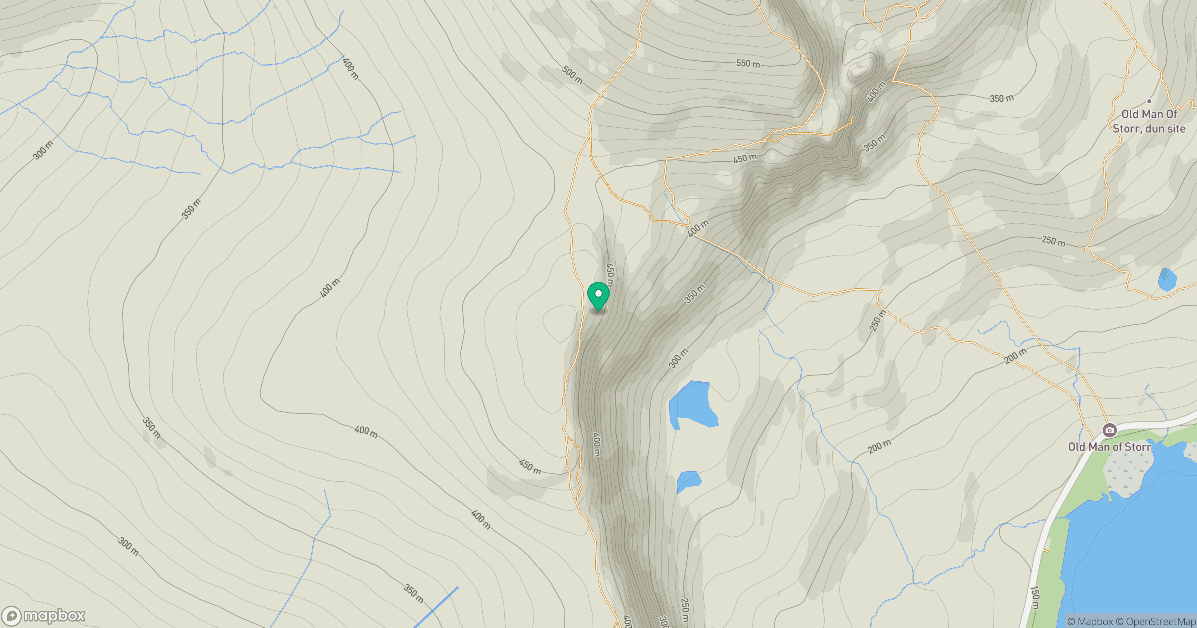
Grid reference: NG490529
View on OpenStreetMapOpens a map in a new tab, centred on the hill.
No comments yet. Be the first.