

Creag a' Lain
Good walks are even better shared.
NG4658 : Frozen pool on top of Creag a' Lain
John Allan Photo source
Overview
Creag a' Lain: A Hidden Gem in the Scottish Highlands
Nestled in the breathtaking Scottish Highlands, Creag a' Lain stands as a testament to nature's artistry, offering both seasoned hikers and curious wanderers a splendid escape.
Geology
Creag a' Lain is a marvel of gneiss rock, shaped by the relentless forces of time and weather. This metamorphic rock has created a rugged yet enticing landscape—perfect for adventure seekers, and perhaps even a friendly mountain goat or two!
Routes
The most popular route is the Benmore Lodge Route, starting in a lovely wood where the scents of pine and earth mingle. As you ascend, keep an eye out for wildlife; you might spot a deer or maybe a multi-talented squirrel attempting parkour!
Route Details
- Distance: 8.0 km
- Time: Approximately 3 hours
- Difficulty: Moderate
Summit Features
Upon reaching the summit, you'll find a small but proud cairn, standing like a sentinel over the surrounding landscape. It's the perfect spot to catch your breath, have a sip of water, and maybe share a moment with the local wildlife—those crows are notorious for scavenging snacks!
Terrain
The terrain is notably rocky with grassy stretches in between. Some areas might resemble a bog when the rains have been generous, so sturdy footwear is recommended—unless you're aiming for a free pedicure!
Views
The views from Creag a' Lain are nothing short of spectacular. On a clear day, you might catch a glimpse of Ben Nevis in the distance, a majestic backdrop to your conquest. The shimmering Loch Awe further enhances the beauty, particularly in the afternoon sun when the water dances like it's had one too many whiskies!
Best Seasons for Views
The late spring to early autumn months are optimal for hiking, especially when the heather blooms in vibrant purple, creating a picturesque scene that photographs can barely capture.
Hazards
Be wary of the unpredictable Scottish weather! Conditions can change faster than you can say 'Scottish summer,' so prepare yourself for the elements. Loose rocks can also surprise the unsuspecting hiker, so watch your footing.
Nearby Summits
If you're up for a bit more adventure, consider tackling nearby summits such as Beinn a' Chroin and Ben Vorlich, both offering their unique challenges and stunning vistas.
Access
- Nearest Parking: Benmore Lodge Car Park.
- Public Transport: Accessible via local buses; a taxi may be needed to reach the trailhead.
- Nearest Town: Dunoon, where you can refuel with fine cafe delicacies!
Facilities
Dunoon has several lovely cafes and pubs—a great place to reminisce about the day's ventures. To avoid any grassy predicaments, make sure to take advantage of public toilets within the town before heading out.
History
The name Creag a' Lain hints at its geological wonders, with its Gaelic roots providing a rich tapestry of local folklore. Tales of battles and fairies fill the air, making the hike not just a physical journey but a walk through history.
In summary, Creag a' Lain offers a delightful mix of adventure, natural beauty, and a dash of history — perfect for those looking to escape the mundane and embrace the wild. Don't forget your camera, a snack, and perhaps a sprinkle of fairy dust!
Explore routes near Creag a' Lain
Walks starting near this hill. Open a route to check its map, distance and full itinerary.
Fairy Lochs Liberator Wreckage Circuit
View route
Beinn Eighe Lancaster Wreckage at Coire Mhic Fhearchair
View route
Berneray Community Hall to the beautiful beach
View route
Beautiful private beach walk Isle of Harris
View route
Route planning notes
These notes describe possible approaches. Check a route's map and access information when planning your walk.
Benmore Lodge Route
This route starts from the car park near Benmore Lodge and takes you through beautiful native woodlands before ascending to the summit.
Make a day of it, together
Find someone to share the walk with, or organise a day out along a route you like.
Photo Gallery
View all Photo could not load
NG4658 : Frozen pool on top of Creag a' Lain
John Allan
 Photo could not load
NG4658 : East face of Creag a' Lain
John Allan
 Photo could not load
NG4658 : Top of Creag a' Lain
John Allan
Hill facts and local notes
Classifications
Elevation
609m
1,997 ft
Prominence
114m
Coordinates
57.5462, -6.2398
NG464586
OS Map
23
Explorer: 408
At the Summit
The summit features a small cairn with panoramic views of the surrounding hills and lochs, a perfect spot for a snack—just watch for the cheeky crows!
Terrain & Geology
Creag a' Lain is primarily formed from gneiss, a metamorphic rock that has been shaped by the forces of nature over millennia. The glacial activity in the area has left its mark, creating stunning ridges and valleys.
Views & Scenery
From the summit, you can see the iconic peak of Ben Nevis to the north, the shimmering waters of Loch Awe to the south, and the rugged beauty of the surrounding mountains.
History & Heritage
Name Origin
The name 'Creag a' Lain' translates to 'rocky place of the river,' reflecting its location near the River Ruel.
Historical Significance
The area is rich in Gaelic history, and local folklore often speaks of fairies and ancient battles fought in the hills.
Getting There & Facilities
Parking
Benmore Lodge Car Park, which is free and has space for about 10 cars. Please do not block access roads.
Public Transport
Regular buses from Inveraray to Dunoon; however, a short taxi ride may be necessary to reach the trailhead.
Nearby Facilities
Dunoon offers several cafes and pubs for refreshments. Public toilets are available in the town, but none are at the trailhead.
Safety Information
Known Hazards
- Sudden weather changes can occur; be prepared with appropriate gear. Some areas may have loose rocks.
General Safety Tips
- Check weather conditions before setting out
- Carry appropriate clothing and equipment
- Let someone know your planned route
- Take a map, compass, and GPS device
- Carry emergency supplies: food, water, first aid kit, torch
Hills
Some common questions about the hills answered
Are there group walks up Creag a' Lain?
Many walkers use Walkmates to join or organise walks with others. You can check for group walks around Creag a' Lain through the maps
Are there other walkers around Creag a' Lain?
Activity varies by location and time, but Walkmates lets you see whether others have shared walks or shown interest in this area. Find other people through the walking friends search walking friends for Creag a' Lain search or of course create your own walk for Creag a' Lain
Can I organise a walk to Creag a' Lain?
Yes. If there aren’t any walks listed already, you can create a walk and make it available for others to join.
If you're signed up to Walkmates, you can create a walk to Creag a' Lain.
How do I find a walk up this hill?
There are often multiple ways to walk this hill, depending on experience and route preference. Walkmates helps you explore walks and routes that others have shared.
Can I suggest a new route up Creag a' Lain?
Yes. You can suggest or create routes to share with others. Walkmates focuses on the social side of walking, so routes are used to help people organise walks and explore areas together, rather than as detailed navigation tools or route libraries.
Other uses really appreciate knowledgeable walkers sharing their routes. Share your favourite route to Creag a' Lain here
The is an error or something incorrect about this hill. How do I let you know?
We always strive to keep the information on Walkmates as accurate as possible. If you find an error, please let us know through the contact form and we'll aim to correct it as quickly as possible
Community Discussion
Comments
Location
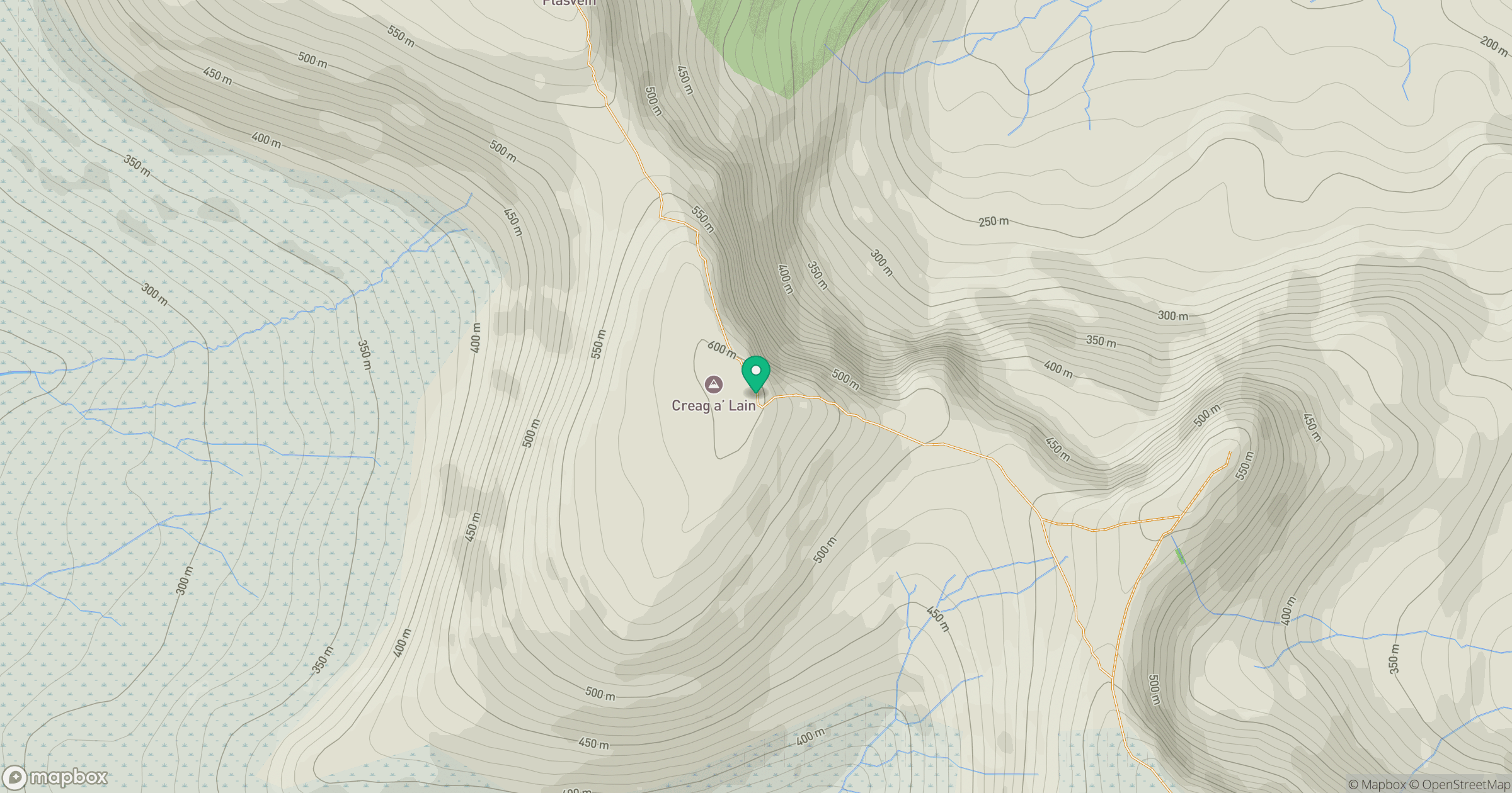
Grid reference: NG464586
View on OpenStreetMapOpens a map in a new tab, centred on the hill.
No comments yet. Be the first.