
Taobh na Coille West Top
Good walks are even better shared.
Overview
Taobh na Coille West Top
Nestled in the heart of the Scottish Highlands, Taobh na Coille West Top stands at an elevation of 640 meters, offering an allure for hikers and those with a keen sense of adventure. Known as a Marilyn, it boasts a prominence of 112 meters, making it a worthy ascent for both novice and seasoned walkers.
Geology
The mountain is predominantly fashioned from old red sandstone mixed with quartzite. These rock formations not only tell a tale of the earth’s geological history but also provide a rugged charm that appeals to rock enthusiasts.
Routes
The most popular route to the summit is the Loch Awe Trail, stretching approximately 10.5 km. Expect a moderate challenge as you navigate through scenic glens and open moorland before tackling the final ascent to the summit. It's a perfect length for a half-day adventure!
Summit Features
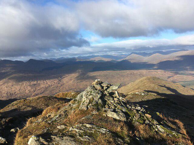
At the summit, hikers are greeted by a sturdy cairn, which serves as both a guidepost and a resting spot. Take a moment here to reflect on your journey and catch your breath.
Terrain
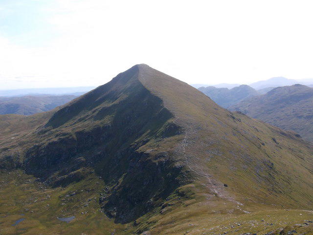
The terrain varies significantly, featuring rocky outcrops alongside lush, grassy slopes. Patches of vibrant heather bloom during the summer months, adding bursts of colour and fragrance, making it a delightful trek.
Views
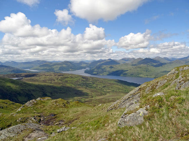
The views from Taobh na Coille West Top are nothing short of breathtaking. On a clear day, you're treated to stunning panoramas of Loch Awe below and the majestic Ben Cruachan range in the distance. Late spring and early autumn are particularly wonderful times to visit for the best visibility.
Hazards
Be mindful of loose rocks on steeper sections; they can be a tad slippery. Staying on the well-marked paths will help mitigate potential falls, ensuring a safe and enjoyable hike.
Nearby Summits
After conquering Taobh na Coille West Top, why not extend your adventure to nearby peaks such as Ben Cruachan, the king of this area at 1126 meters?
Access
Access to the trail is straightforward. The nearest parking area is conveniently located at NN455154, suitable for a few cars. If you're relying on public transport, Taynuilt is the closest town, around 10 km south, with bus services flowing in from Oban.
Facilities
In Taynuilt, you'll find cafes to replenish your energy and facilities for a quick pit-stop, ensuring you're well-prepared for your journey up the mountain.
History
The name 'Taobh na Coille,' meaning 'Side of the Wood' in Gaelic, encompasses the surrounding area's natural beauty and its historical ties to local communities and ancient paths.
In summary, a hike up Taobh na Coille West Top promises not only physical exercise but also a delightful immersion into Scotland's natural landscape. Remember to pack a snack and maybe some oatcakes—because who doesn't love a good treat after a climb?
Happy hiking!
Explore routes near Taobh na Coille West Top
Walks starting near this hill. Open a route to check its map, distance and full itinerary.
Loch Katrine: Brenachoile Point Shore Walk from Trossachs Pier
View route
Loch Lubnaig: West Shore Railway Path from Ben Ledi Car Park
View route
Loch Ard Forest: Sculpture Trail and Little Loch Ard
View route
Aberfoyle woodland wellbeing walk
View route
Route planning notes
These notes describe possible approaches. Check a route's map and access information when planning your walk.
Loch Awe Trail
A scenic route beginning from the shores of Loch Awe, meandering through lush glens and open moorland before the final ascent to the summit.
Make a day of it, together
Find someone to share the walk with, or organise a day out along a route you like.
Hill facts and local notes
Classifications
Elevation
697m
2,287 ft
Prominence
20m
Coordinates
56.3034, -4.4859
NN462151
OS Map
57
Explorer: OL46N 365N
At the Summit
A well-constructed cairn sits atop the summit, offering a perfect spot to catch your breath and enjoy the views.
Terrain & Geology
Predominantly composed of old red sandstone intermixed with quartzite, offering a glimpse into the geological history of the region and the forces that shaped it.
Views & Scenery
Stunning vistas of Loch Awe, the distant peaks of the Ben Cruachan range, and the impressionable landscape of the Scottish Highlands.
History & Heritage
Name Origin
The name 'Taobh na Coille' translates to 'Side of the Wood' in Gaelic, hinting at the lush surroundings.
Historical Significance
This area has long been a part of ancient paths and routes used by local communities, with a rich history tied to both nature and heritage.
Getting There & Facilities
Parking
There is a small parking area near the start of the Loch Awe Trail at NN455154, suitable for several cars.
Public Transport
Regular bus services operate from Oban to nearby villages; check local schedules as services may vary.
Nearby Facilities
There are basic facilities available in Taynuilt, including cafes and public toilets.
Safety Information
Known Hazards
- Loose rocky sections may pose a risk to ankle-twisters. Make sure to stick to well-trodden paths.
General Safety Tips
- Check weather conditions before setting out
- Carry appropriate clothing and equipment
- Let someone know your planned route
- Take a map, compass, and GPS device
- Carry emergency supplies: food, water, first aid kit, torch
Hills
Some common questions about the hills answered
Are there group walks up Taobh na Coille West Top?
Many walkers use Walkmates to join or organise walks with others. You can check for group walks around Taobh na Coille West Top through the maps
Are there other walkers around Taobh na Coille West Top?
Activity varies by location and time, but Walkmates lets you see whether others have shared walks or shown interest in this area. Find other people through the walking friends search walking friends for Taobh na Coille West Top search or of course create your own walk for Taobh na Coille West Top
Can I organise a walk to Taobh na Coille West Top?
Yes. If there aren’t any walks listed already, you can create a walk and make it available for others to join.
If you're signed up to Walkmates, you can create a walk to Taobh na Coille West Top.
How do I find a walk up this hill?
There are often multiple ways to walk this hill, depending on experience and route preference. Walkmates helps you explore walks and routes that others have shared.
Can I suggest a new route up Taobh na Coille West Top?
Yes. You can suggest or create routes to share with others. Walkmates focuses on the social side of walking, so routes are used to help people organise walks and explore areas together, rather than as detailed navigation tools or route libraries.
Other uses really appreciate knowledgeable walkers sharing their routes. Share your favourite route to Taobh na Coille West Top here
The is an error or something incorrect about this hill. How do I let you know?
We always strive to keep the information on Walkmates as accurate as possible. If you find an error, please let us know through the contact form and we'll aim to correct it as quickly as possible
Community Discussion
Comments
Location
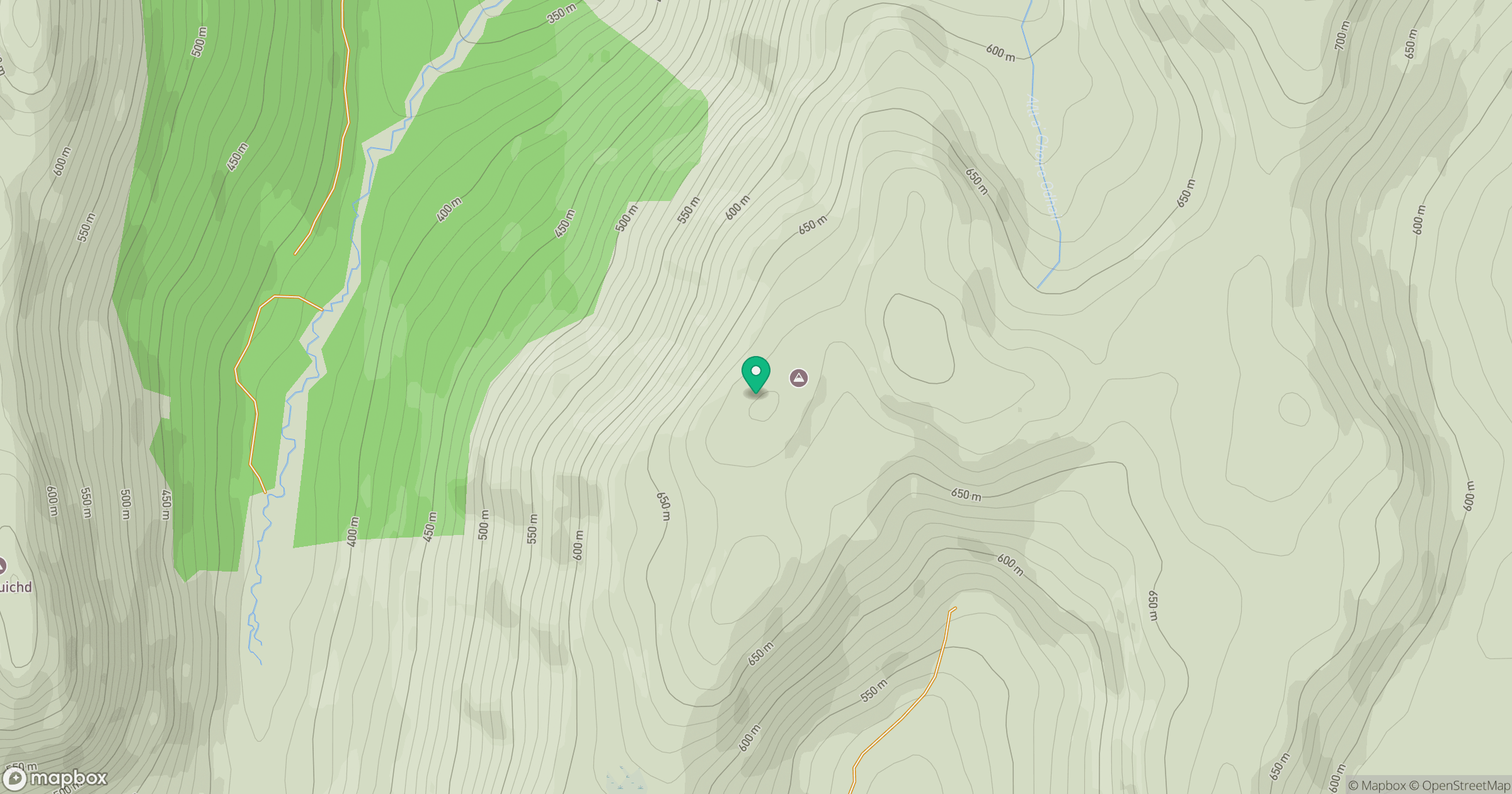
Grid reference: NN462151
View on OpenStreetMapOpens a map in a new tab, centred on the hill.
No comments yet. Be the first.