
Slieveboy
Good walks are even better shared.
Overview
Slieveboy: A Hidden Gem in the Mourne Mountains
Nestled in the stunning Southern Mourne Mountains, Slieveboy stands at an elevation of 509 meters, offering hikers a rewarding experience with breathtaking views and a serene atmosphere.
1. Geology
The mountain is primarily composed of granite and slate, true to the geological characteristics of the Mournes. This granite, with its rugged visage, adds a delightful challenge to hikers. Be sure to take a moment at the summit to appreciate how ancient forces shaped this land.
2. Route Information
The Mourne Wall Route is a favourite among walkers, stretching for approximately 5.5 km and taking around 2.5 hours, making it a moderately challenging trek. As you follow this path, the famed Mourne Wall—a marvel of 19th-century engineering—lines your route, giving you something to ponder other than your aching legs!
3. Summit Features
Upon reaching the summit of Slieveboy, you'll find a modest cairn, perfect for a quick photo op. Gaze upon the breathtaking views of Slieve Bearnagh and Slieve Donard, as they peek over the landscape like jealous siblings.
4. Terrain
Expect a mix of rocky and grassy terrain, with occasional boggy patches. Proper footwear is essential; no one wants soggy socks on a sunny day, let alone after a slip in the mire!
5. Views
As you stand on the summit, the vista is nothing short of spectacular. You'll have a front-row seat to the Irish Sea, the stunning Mourne Mountains, and even, on a rare occasion, the distant Wicklow hills. The best seasons for visiting are spring and autumn, as the light tends to be more forgiving, and the views clearer.
6. Hazards
While the walk is rewarding, be cautious of several hazards. The weather can change in a heartbeat, so be prepared for unexpected rain. Keep an eye on your footing, especially around the slippery rocks and boggy patches—no one wants an unexpected dunk!
7. Access
Getting to Slieveboy is quite straightforward. The nearest parking is at Carrick Little car park (grid reference: J364204), where you can leave your car. Public transport options are available from Newcastle or Belfast, though be prepared for a bit of a trek to reach the trailhead.
8. Nearby Summits
Don't miss the opportunity to tackle nearby peaks like Slieve Bearnagh and Slieve Donard. They are like the popular kids in the schoolyard of mountains—always worth checking out!
9. Facilities
After your adventure, head back to Newcastle for a well-deserved snack. You’ll find plenty of cafés, restaurants, and public toilets to ensure a comfortable visit.
10. History
The name 'Slieveboy' comes from 'Sliabh Bui', translating to 'yellow mountain' in Irish. This adds a layer of intrigue and historical richness to your visit, being part of a legendary landscape that has inspired poets and adventurers alike.
So lace up those boots, pack a sandwich, and get ready to conquer Slieveboy! Happy hiking!
Explore routes near Slieveboy
Public walks starting within 80 km of this hill. Nearby does not mean a route reaches the summit; check its map and access before setting out.
Banagher Glen and Forest: complete higher-return circuit
View route
Derry~Londonderry City Walls Circuit
View route
Portballintrae to Giant's Causeway: railway path and Blue Trail return
View route
Peatlands Park Red Trail: Annagarriff Wood and Derryadd Lough
View route
Route planning notes
These notes describe possible approaches, not verified navigable routes or permission to cross land. Check current paths, local access rules and conditions before setting out.
Mourne Wall Route
Starting from the Carrick Little car park, this route takes you past the famous Mourne Wall, allowing you to admire its engineering while gradually ascending Slieveboy.
Make a day of it, together
Find someone to share the walk with, or organise a day out along a route you like.
Hill facts and local notes
Classifications
Elevation
259m
850 ft
Prominence
105m
Coordinates
54.8734, -7.1300
C559032
OS Map
07
At the Summit
The summit is marked by a small cairn and offers a panoramic view of the surrounding peaks, particularly Slieve Bearnagh and Slieve Donard, which eagerly compete for your attention.
Terrain & Geology
Dominated by granite and slate, Slieveboy showcases the classic geological formations found throughout the Mourne range. The weathering processes have crafted a rugged terrain that offers splendid views and an exciting hiking experience.
Views & Scenery
From the summit, you can enjoy sweeping views of the Irish Sea, the rest of the Mourne Mountains, and on a clear day, the distant hills of Wicklow.
History & Heritage
Name Origin
The name 'Slieveboy' is derived from the Irish 'Sliabh Bui', which translates to 'yellow mountain', possibly in reference to the gorse that blooms in profusion.
Historical Significance
Slieveboy plays a vital role in the landscape’s cultural heritage, being part of the legendary Mourne Mountains that inspired the poet Percy French and countless hikers.
Getting There & Facilities
Check current local access restrictions, parking rules and transport timetables before travelling. These notes do not confirm public access to the summit.
Parking
Carrick Little car park (grid reference: J364204) offers ample space for vehicles and serves as the gateway to several scenic routes in the Mourne Mountains.
Public Transport
Local buses from Newcastle or Belfast can be taken to the nearest drop-off point at the foot of the mountains, with further hiking required to reach the car park.
Nearby Facilities
In Newcastle, you'll find cafés, restaurants, and public toilets. Don't forget to refuel with a hearty meal before tackling the peaks!
Safety Information
Known Hazards
- Potential for rapid weather changes, slippery rocks, and boggy areas. Make sure to check the forecast and prepare accordingly to avoid damp socks!
General Safety Tips
- Check weather conditions before setting out
- Carry appropriate clothing and equipment
- Let someone know your planned route
- Take a map, compass, and GPS device
- Carry emergency supplies: food, water, first aid kit, torch
Hills
Some common questions about the hills answered
Are there group walks up Slieveboy?
Many walkers use Walkmates to join or organise walks with others. You can check for group walks around Slieveboy through the maps
Are there other walkers around Slieveboy?
Activity varies by location and time, but Walkmates lets you see whether others have shared walks or shown interest in this area. Find other people through the walking friends search walking friends for Slieveboy search or of course create your own walk for Slieveboy
Can I organise a walk to Slieveboy?
Yes. If there aren’t any walks listed already, you can create a walk and make it available for others to join.
If you're signed up to Walkmates, you can create a walk to Slieveboy.
How do I find a walk up this hill?
There are often multiple ways to walk this hill, depending on experience and route preference. Walkmates helps you explore walks and routes that others have shared.
Can I suggest a new route up Slieveboy?
Yes. You can suggest or create routes to share with others. Walkmates focuses on the social side of walking, so routes are used to help people organise walks and explore areas together, rather than as detailed navigation tools or route libraries.
Other uses really appreciate knowledgeable walkers sharing their routes. Share your favourite route to Slieveboy here
The is an error or something incorrect about this hill. How do I let you know?
We always strive to keep the information on Walkmates as accurate as possible. If you find an error, please let us know through the contact form and we'll aim to correct it as quickly as possible
Community Discussion
Comments
Location
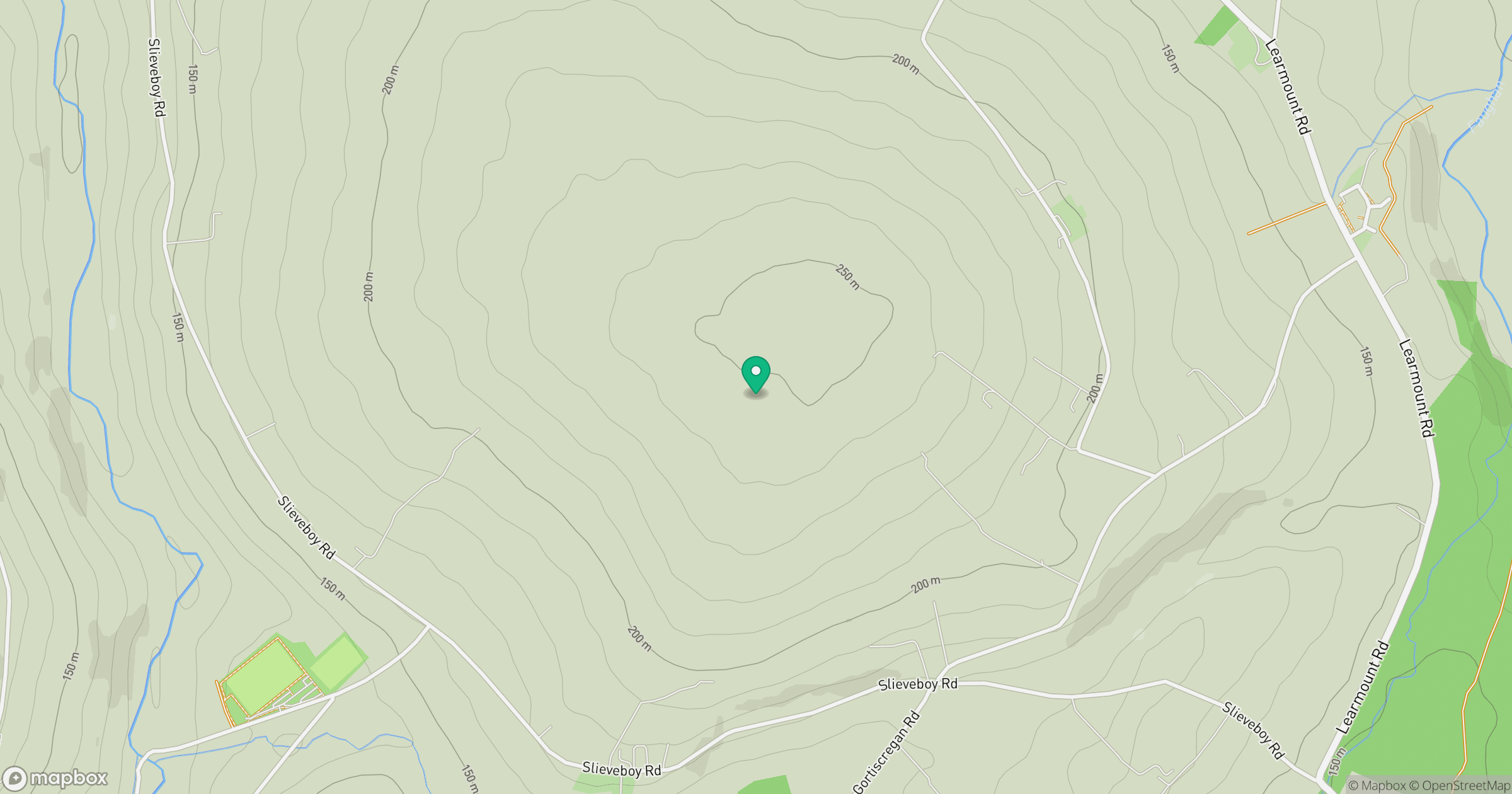
Grid reference: C559032
View on OpenStreetMapOpens a map in a new tab, centred on the hill.
Hills within 30 km
Straight-line distance, not a walking route or confirmation of access.
No comments yet. Be the first.