

Slieve Meelmore
Good walks are even better shared.
J3028 : Path ascending the southern face of Slieve Meelmore
Eric Jones Photo source
Overview
Slieve Meelmore is a 687 m mountain in the Mourne Mountains, County Down, Northern Ireland. The Mourne Wall crosses its high ground, with a stone shelter tower separate from the summit cairn. It is often combined with neighbouring Slieve Meelbeg; the Ott circular walk also crosses Slieve Loughshannagh.
Slieve Meelmore
Slieve Meelmore rises to 687 m in the Mourne Mountains of County Down, Northern Ireland. Its summit cairn and the nearby Mourne Wall shelter tower are separate landmarks. Slieve Meelbeg is its southwestern neighbour, while Spellack is the rocky spur to the northeast.
Walking from Ott
The circular route starts and finishes at Ott car park, J279279. Visit Mourne lists the complete walk as 5.5 miles, approximately 8.9 km. Follow Ott Track to the wall, then traverse Loughshannagh, Meelbeg and Meelmore. Return by the wall junction and valley, then the Ulster Way past Fofanny Dam, finishing with 800 m along Slievenaman Road. This itinerary uses the valley return rather than the steep Spellack descent.
Ground and navigation
Expect rocky paths, grassy slopes and wet sections. A wall does not remove the need to navigate: low cloud can obscure the correct ridge or descent. Spellack has steep cliffs, and heavy rain can make a Trassey return river crossing impassable. Snow, ice and strong winds can make the higher ground more demanding.
Landscape and heritage
Granite meets older metasedimentary rocks on Meelmore’s slopes. The Mourne Wall was constructed in 1904–1922 to protect the water catchment. Clear-weather views from the high ridge include neighbouring Mourne peaks and the County Down landscape.
Access
Ott has parking and picnic facilities, but no toilets. Keep to existing paths and keep dogs on leads to protect livestock and ground-nesting birds.
Explore routes near Slieve Meelmore
Walks starting near this hill. Open a route to check its map, distance and full itinerary.
Tollymore Forest Park: Mountain and Drinns Trail
View route
Tollymore Forest Park: River Trail near Newcastle
View route
Silent Valley to Ben Crom Dam: Reservoir Road Walk, County Down
View route
Newcastle, Co. Down (NI) with Men Walking & Talking
View route
Route planning notes
These notes describe possible approaches. Check a route's map and access information when planning your walk.
Meelmore and Meelbeg from Ott (circular)
Ott car park (J279279) circular: 5.5 miles (about 8.9 km), as listed by Visit Mourne. Take Ott Track to the Loughshannagh–Carn col, then follow the Mourne Wall over Loughshannagh, Meelbeg and Meelmore. Backtrack to the wall junction and descend beside the right-hand wall to the valley river. Follow it downhill, then take the Ulster Way southwest past Fofanny Dam to Slievenaman Road. Turn left for the final 800 m to Ott. This return avoids Spellack.
Make a day of it, together
Find someone to share the walk with, or organise a day out along a route you like.
Photo Gallery
View all Photo could not load
J3028 : Path ascending the southern face of Slieve Meelmore
Eric Jones
 Photo could not load
J3028 : The summit of Slieve Meelmore from the Slievenaman Road
Eric Jones
 Photo could not load
J3028 : View NNE along the Mourne Wall from the summit of Slieve Meelmore
Eric Jones
 Photo could not load
J3028 : Summit cairn, Slieve Meelmore
Rossographer
 Photo could not load
J3028 : The cairn on the summit of Slieve Meelmore
Eric Jones
 Photo could not load
J3028 : Below the summit cairn of Slieve Meelmore
Eric Jones
 Photo could not load
J3028 : View SSW along the Mourne Wall towards the summit of Slieve Meelmore
Eric Jones
 Photo could not load
J3028 : The Mourne Wall, Slieve Meelmore
Rossographer
 Photo could not load
J3028 : The north-eastern ridge of Slieve Meelmore
Eric Jones

J3028 : View out of the watch tower on the summit of Slieve Meelmore
Eric Jones
Hill facts and local notes
Classifications
Elevation
687m
2,254 ft
Prominence
97m
Coordinates
54.1907, -5.9999
J306287
OS Map
29
At the Summit
A cairn marks the summit near the Mourne Wall. The stone shelter tower lies farther northeast at a corner in the wall and is a separate landmark from the summit cairn.
Terrain & Geology
The southern slopes expose Mourne granite, while older Silurian metasedimentary rocks occur on the northern slopes. Their contact is visible from Meelmore Lodge. Nearby Happy Valley is glacially carved, and the Trassey and Shimna valley landscape includes moraines.
Views & Scenery
The summit ridge and wall tower offer views across the High Mournes, including Slieve Bearnagh, Commedagh and Donard. In clear conditions, the wider outlook includes the County Down countryside, Dromara Hills and Dundrum Bay.
History & Heritage
Name Origin
Paul Tempan’s place-name compilation gives the Irish Sliabh Míol Mór, interpreted as “big mountain of the ants”, citing Place-Names of Northern Ireland.
Historical Significance
The Mourne Wall was built by the Belfast Water Commissioners between 1904 and 1922 to protect the reservoir catchment. Slieve Meelmore has one of its stone shelter towers; the wall is now owned by Northern Ireland Water.
Getting There & Facilities
Parking
Ott car park on Slievenaman Road, Irish grid J279279, is the start and finish of the circular route described here. Northern approaches also use Meelmore Lodge or Trassey car park.
Nearby Facilities
Ott car park has picnic facilities but no toilets.
Safety Information
Known Hazards
- Mist can make it easy to leave the summit on the wrong ridge; carry a map and compass and know how to use them.
- The northeast ridge leads towards Spellack cliffs. Its steep, rocky descents require careful route-finding and are outside the listed Ott valley-return route.
- A river crossing on the Trassey Track return can become impassable after heavy rain; do not force a crossing.
- Mountain paths include wet grass, mud and slippery rock. The Ott circular walk also includes 800 m on Slievenaman Road.
Seasonal Hazards
Snow and ice can affect the uplands in colder weather, while strong winds and low cloud can make the exposed ridges difficult in any season. Keep dogs on leads around grazing livestock and ground-nesting birds.
General Safety Tips
- Check weather conditions before setting out
- Carry appropriate clothing and equipment
- Let someone know your planned route
- Take a map, compass, and GPS device
- Carry emergency supplies: food, water, first aid kit, torch
Hills
Some common questions about the hills answered
Are there group walks up Slieve Meelmore?
Many walkers use Walkmates to join or organise walks with others. You can check for group walks around Slieve Meelmore through the maps
Are there other walkers around Slieve Meelmore?
Activity varies by location and time, but Walkmates lets you see whether others have shared walks or shown interest in this area. Find other people through the walking friends search walking friends for Slieve Meelmore search or of course create your own walk for Slieve Meelmore
Can I organise a walk to Slieve Meelmore?
Yes. If there aren’t any walks listed already, you can create a walk and make it available for others to join.
If you're signed up to Walkmates, you can create a walk to Slieve Meelmore.
How do I find a walk up this hill?
There are often multiple ways to walk this hill, depending on experience and route preference. Walkmates helps you explore walks and routes that others have shared.
Can I suggest a new route up Slieve Meelmore?
Yes. You can suggest or create routes to share with others. Walkmates focuses on the social side of walking, so routes are used to help people organise walks and explore areas together, rather than as detailed navigation tools or route libraries.
Other uses really appreciate knowledgeable walkers sharing their routes. Share your favourite route to Slieve Meelmore here
The is an error or something incorrect about this hill. How do I let you know?
We always strive to keep the information on Walkmates as accurate as possible. If you find an error, please let us know through the contact form and we'll aim to correct it as quickly as possible
Community Discussion
Comments
Location
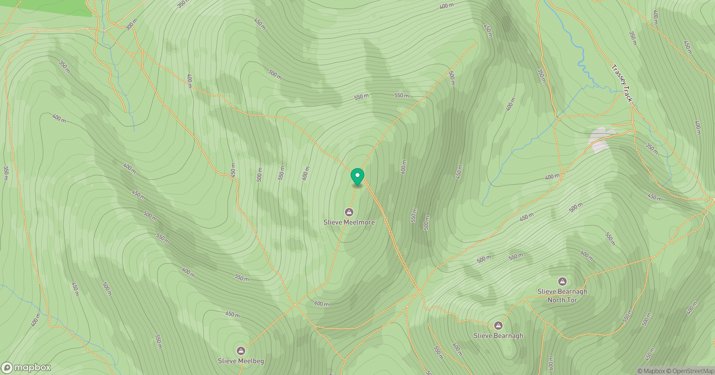
Grid reference: J306287
View on OpenStreetMapOpens a map in a new tab, centred on the hill.
Nearby Hills
Slieve Bearnagh
739m
Slievelamagan
702m
Slieve Binnian
746m
Slieve Commedagh
767m
Slieve Donard
850m
No comments yet. Be the first.