
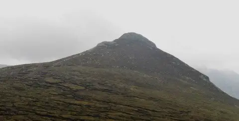
Doan
Good walks are even better shared.
Overview
Doan in the Mourne Mountains
Doan stands in the central Mournes in County Down, Northern Ireland. DoBIH records 592.6 m, 115 m prominence and a high point at J 30229 26217. Its classifications are Hump, Dodd and Arderin. The commonly quoted 593 m is a rounded height. The imported survey record gives no specific summit feature, so no cairn is certified as the exact highest point.
Walk from Ott
Start and finish at Ott car park on Slievenaman Road. Cross the road onto the Ott Track, approach the saddle between Carn Mountain and Slieve Loughshannagh and cross the Mourne Wall by its stile. Follow the worn paths through peat towards Doan, above Lough Shannagh. Pass the false top and pick a careful line around the final rocks, using the easier southern approach. Return along the same route.
The Irish Road Trip guide, updated in December 2023, gives approximately 8 km return and 4–5 hours. Total ascent is not provided. The rocky finish and boggy approach require more care than the hill’s modest height suggests. Extra summits, a Lough Shannagh circuit or a finish at Meelmore Lodge change the itinerary and are not included in those figures.
Landscape and heritage
The summit is granite. The Mourne granite complex formed beneath the surface around 56 million years ago, rather than as a modern-looking volcanic cone. The panorama takes in Lough Shannagh, Silent Valley and the surrounding Mourne peaks.
Dún Maol Chobha means “Maol Chobha’s fort”. Paul Tempan records no actual fort, suggesting that the rocky outline inspired the name. The route crosses the Mourne Wall, constructed between 1904 and 1922 for the reservoir catchment, but the wall does not pass over Doan.
Getting there and taking care
Ott parking is small: keep the carriageway, entrances and gates clear. Do not rely on toilets or refreshments at the start. Newcastle is a regional visitor base, rather than the trailhead.
A council tourism article dated 28 April 2026 describes a pre-bookable shuttle from Meelmore Lodge to Ott and a linear Doan walk back to the lodge. Confirm current operation and arrange the route and return separately. No direct scheduled bus to Ott was verified.
Prepare for mist, wind and wet or icy rock. Use a map and compass, keep dogs on leads, stay on existing paths and respect farmland and current notices. Nearby Slieve Loughshannagh, Carn Mountain, Ben Crom and Ott Mountain are separate summits and are not included in this out-and-back.
Explore routes near Doan
Public walks starting within 80 km of this hill. Nearby does not mean a route reaches the summit; check its map and access before setting out.
Silent Valley to Ben Crom Dam: Reservoir Road Walk, County Down
View route
Tollymore Forest Park: Mountain and Drinns Trail
View route
Tollymore Forest Park: River Trail near Newcastle
View route
Newcastle, Co. Down (NI) with Men Walking & Talking
View route
Route planning notes
These notes describe possible approaches, not verified navigable routes or permission to cross land. Check current paths, local access rules and conditions before setting out.
Doan from Ott car park, out and back
Start and finish at Ott car park on Slievenaman Road. Cross the road and follow the Ott Track towards the saddle between Carn Mountain and Slieve Loughshannagh. Cross the Mourne Wall at the stile, then take the worn paths over peaty ground towards Doan, keeping above Lough Shannagh. Pass the false top and negotiate the final rocks carefully; the southern side offers the easier approach to the summit. Retrace the same route to Ott. The Irish Road Trip guide gives approximately 8 km return and 4–5 hours; ascent is not published. These figures exclude extra summits, a lake circuit, and a shuttle-assisted finish at Meelmore Lodge. DoBIH locates the high point at J 30229 26217 but records no specific summit marker.
Make a day of it, together
Find someone to share the walk with, or organise a day out along a route you like.
Photo Gallery
View all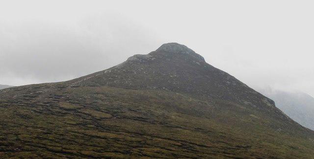 Photo could not load
J3026 : Path to the summit of Doan
Eric Jones
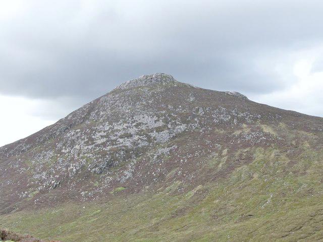 Photo could not load
J3026 : The eastern slopes of Doan from the Ben Crom River valley
Eric Jones
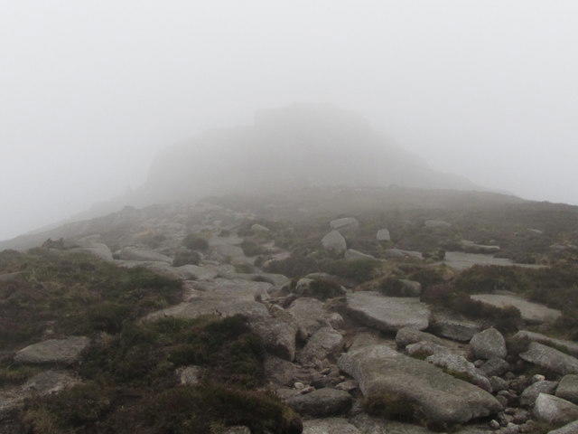 Photo could not load
J3026 : The mist shrouded peak of Doan
Eric Jones
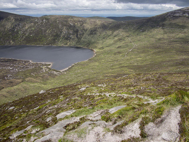 Photo could not load
J3026 : Lough Shannagh from Doan
Rossographer
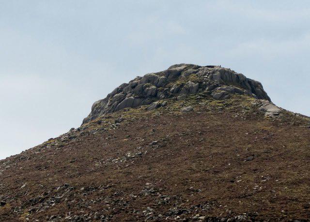 Photo could not load
J3026 : The summit tor of Doan viewed from the Ben Crom valley
Eric Jones
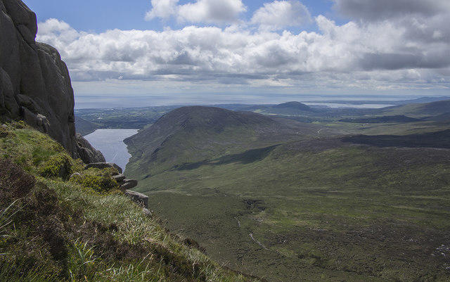 Photo could not load
J3026 : View from Doan
Rossographer
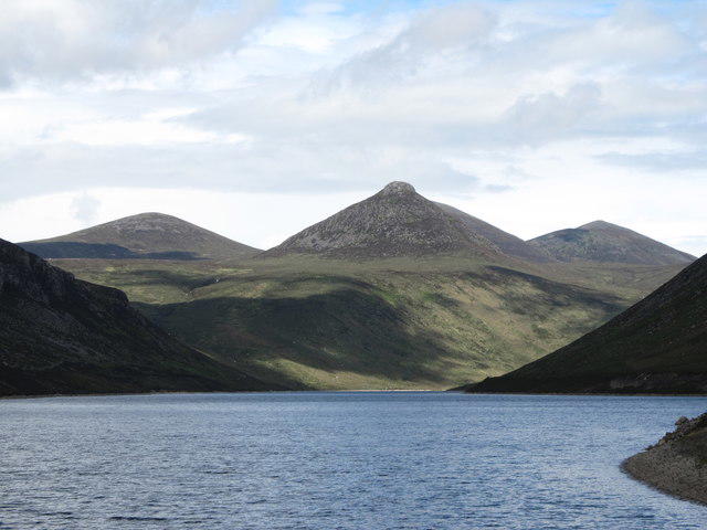 Photo could not load
J3026 : Doan from the Silent Valley Reservoir dam
Eric Jones
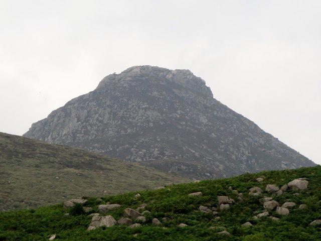 Photo could not load
J3026 : Doan from the Silent Valley
Eric Jones
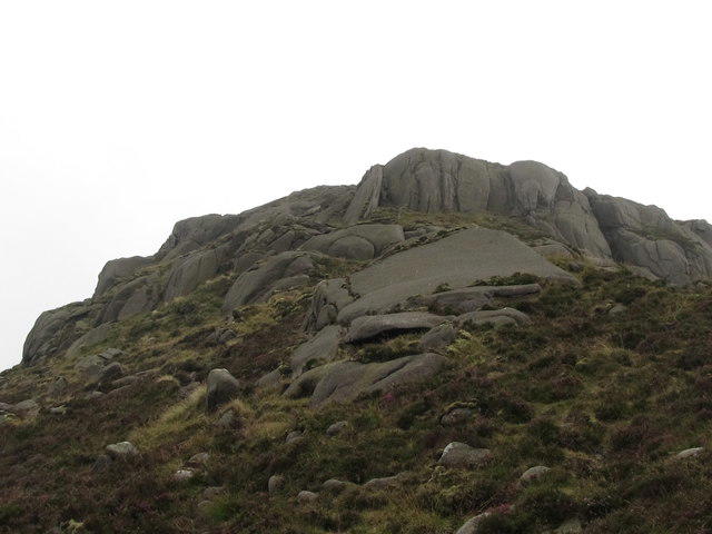 Photo could not load
J3026 : The north eastern face of the Doan summit tor
Eric Jones
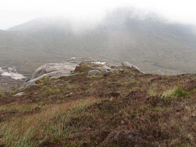
J3026 : Rock outcrop below the summit of Doan
Eric Jones
Hill facts and local notes
Classifications
Elevation
593m
1,944 ft
Prominence
115m
Coordinates
54.1685, -6.0067
J302262
OS Map
29
At the Summit
Doan has a small rocky summit. DoBIH records its high point at J 30229 26217 but lists the summit feature as “not recorded”; a particular cairn is not verified as the highest point.
Terrain & Geology
Doan has a rocky granite summit within the Mourne Mountains granite complex. BGS describes this complex as magma intruded below the ground around 56 million years ago and later exposed by erosion. It is not a Lake District basalt-and-andesite peak.
Views & Scenery
Views across the central Mournes, including Lough Shannagh and Silent Valley, with Slieve Binnian and the higher surrounding peaks in clear weather.
History & Heritage
Name Origin
Paul Tempan gives Dún Maol Chobha as “Maol Chobha’s fort”. No actual fort is recorded; he suggests the name refers to the fortress-like appearance of the craggy summit.
Historical Significance
The Ott approach crosses the Mourne Wall, built between 1904 and 1922 to enclose the reservoir catchment. Doan itself is off the wall. Its fort-related name is not evidence of an archaeological fort.
Getting There & Facilities
Check current local access restrictions, parking rules and transport timetables before travelling. These notes do not confirm public access to the summit.
Parking
Ott car park on Slievenaman Road is the start of the described out-and-back. Capacity is limited; use a lawful alternative if full and never obstruct the road or gates. Meelmore Lodge is a different start/finish requiring a separately planned walk or pre-booked shuttle.
Public Transport
No scheduled bus directly to Ott car park was verified. Council tourism information dated 28 April 2026 lists a pre-bookable Mourne Shuttle from Meelmore Lodge to Ott, with a Doan walk finishing back at Meelmore Lodge. Confirm operation and booking with the provider; this linear walk is outside the Ott out-and-back figures.
Nearby Facilities
Carry food, water and appropriate equipment. Toilets or refreshments at Ott car park were not verified; arrange these before arriving. Newcastle offers food and other visitor services away from the mountain.
Safety Information
Known Hazards
- The last rocky ascent and descent require careful route-finding and secure footing, especially when wet or icy. A false top precedes the actual summit.
- Peat hags and boggy ground can slow progress; mist can obscure paths and the return route. Carry a map and compass and suitable mountain clothing.
- Ott parking is limited. Do not block the road, gates or access, and take care when crossing the road at the start.
- Keep dogs on leads, use existing paths and follow current landowner signs and any temporary restrictions. Take litter home.
General Safety Tips
- Check weather conditions before setting out
- Carry appropriate clothing and equipment
- Let someone know your planned route
- Take a map, compass, and GPS device
- Carry emergency supplies: food, water, first aid kit, torch
Hills
Some common questions about the hills answered
Are there group walks up Doan?
Many walkers use Walkmates to join or organise walks with others. You can check for group walks around Doan through the maps
Are there other walkers around Doan?
Activity varies by location and time, but Walkmates lets you see whether others have shared walks or shown interest in this area. Find other people through the walking friends search walking friends for Doan search or of course create your own walk for Doan
Can I organise a walk to Doan?
Yes. If there aren’t any walks listed already, you can create a walk and make it available for others to join.
If you're signed up to Walkmates, you can create a walk to Doan.
How do I find a walk up this hill?
There are often multiple ways to walk this hill, depending on experience and route preference. Walkmates helps you explore walks and routes that others have shared.
Can I suggest a new route up Doan?
Yes. You can suggest or create routes to share with others. Walkmates focuses on the social side of walking, so routes are used to help people organise walks and explore areas together, rather than as detailed navigation tools or route libraries.
Other uses really appreciate knowledgeable walkers sharing their routes. Share your favourite route to Doan here
The is an error or something incorrect about this hill. How do I let you know?
We always strive to keep the information on Walkmates as accurate as possible. If you find an error, please let us know through the contact form and we'll aim to correct it as quickly as possible
Community Discussion
Comments
Location
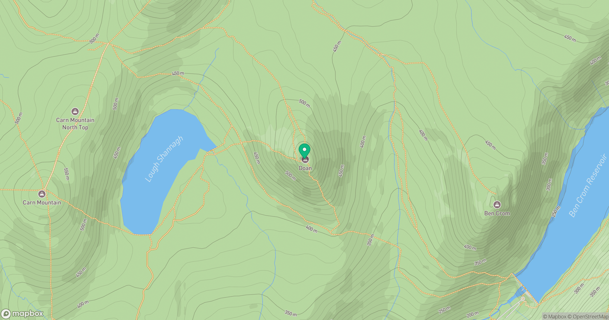
Grid reference: J302262
View on OpenStreetMapOpens a map in a new tab, centred on the hill.
Hills within 30 km
Straight-line distance, not a walking route or confirmation of access.
Slieve Bearnagh
739m
Slieve Binnian
746m
Slievelamagan
702m
Slieve Commedagh
767m
Slieve Donard
850m
No comments yet. Be the first.