
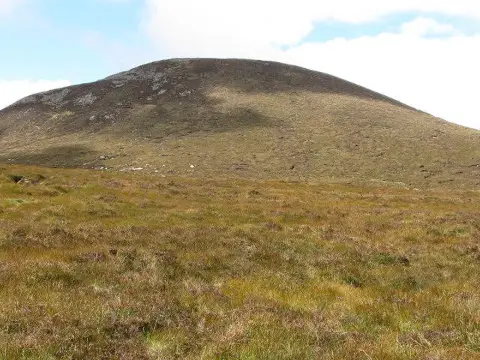
Slieve Loughshannagh
Good walks are even better shared.
Overview
Slieve Loughshannagh Hiking Guide
Introduction
Slieve Loughshannagh, towering at 566 meters, is a Marilyn peak nestled in the spectacular Mourne Mountains of Northern Ireland. It's a must-visit for any hiking enthusiast eager to experience stunning views and the thrill of an enjoyable outdoor adventure.
Geology
This mountain is primarily composed of granite, a testament to the geological forces that shaped the Mourne Mountains over millennia. The granite crags and rocky outcrops add unique challenges and spectacular scenery, making every step a new discovery.
Routes
Two popular routes lead to the summit of Slieve Loughshannagh:
- Sandy Brae Route: A 5 km trek, taking approximately 2.5 hours with a moderate difficulty rating. Traversing heath and grassy slopes, it offers gentle inclines before wowing you with views at the summit.
- Donard Park Route: For those seeking a challenge, the 6.5 km trek from Donard Park takes roughly 3 hours. The variation in terrain from forested areas to moorland will keep you engaged and is rewarding upon reaching the top.
Summit Features
At the summit, you’ll find a stone cairn, a popular spot for adventurous selfies. The panoramic views are absolutely breathtaking and worth every bit of effort it takes to reach them.
Terrain Type
The terrain is predominantly grassy interspersed with rocky patches and a few boggy areas. Be prepared for both firm ground and subtle squelches underfoot!
Views
Highlights
The summit offers remarkable vistas of familiar landmarks like Slieve Donard and the intricate Mourne Wall. On a clear day, the horizon stretches to the shimmering Irish Sea—photographers will be in their element.
Best Seasons
The views are best in spring and early autumn, where clear skies and vibrant foliage enhance the experience, making for perfect hiking weather.
Hazards
While hiking is generally safe, it's wise to be on the lookout for slippery rocks and sudden changes in weather. Additionally, be aware that phone signals can be as elusive as a leprechaun in these parts.
Nearby Summits
Hikers may wish to combine their trek with nearby peaks:
- Slieve Donard (850 m)
- Slieve Meelmore (774 m)
Access
Nearest Parking
You can park at Sandy Brae Car Park just off the A50. It's a popular spot so arriving early might be your best bet!
Public Transport
Be aware that public transport is limited; a car is undoubtedly the best way to explore the area.
Nearest Town
Newcastle is the nearest town, about 8 km away, with ample facilities.
Facilities
In Newcastle, you will find cafes, restaurants, and public toilets. Be sure to top up on water before your hike.
History
Name Meaning
The intriguing name 'Loughshannagh' comes from the Irish, meaning 'lake of the old man', rich with folklore and mystery.
Significance
The Mourne Mountains are steeped in ancient myths and cultural significance, adding a sense of adventure to every hike you embark upon.
Conclusion
Whether you’re a seasoned hiker or a weekend wanderer, Slieve Loughshannagh provides an unforgettable experience amidst the breathtaking scenery of the Mourne Mountains. Remember to leave no trace and enjoy every step!
Explore routes near Slieve Loughshannagh
Public walks starting within 80 km of this hill. Nearby does not mean a route reaches the summit; check its map and access before setting out.
Silent Valley to Ben Crom Dam: Reservoir Road Walk, County Down
View route
Tollymore Forest Park: Mountain and Drinns Trail
View route
Tollymore Forest Park: River Trail near Newcastle
View route
Newcastle, Co. Down (NI) with Men Walking & Talking
View route
Route planning notes
These notes describe possible approaches, not verified navigable routes or permission to cross land. Check current paths, local access rules and conditions before setting out.
Sandy Brae Route
A well-trodden path starting from the Sandy Brae car park, leading through scenic heaths and grassy slopes up to the summit.
Donard Park Route
This route takes you through forested areas and open moorland, providing a diverse hiking experience.
Make a day of it, together
Find someone to share the walk with, or organise a day out along a route you like.
Photo Gallery
View all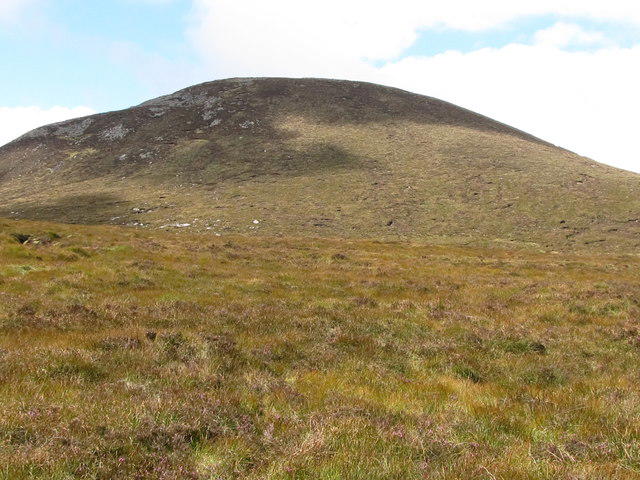 Photo could not load
J2927 : View west from the bog towards Slieve Loughshannagh
Eric Jones
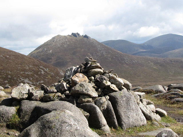 Photo could not load
J2927 : The summit cairn on Slieve Loughshannagh
Eric Jones
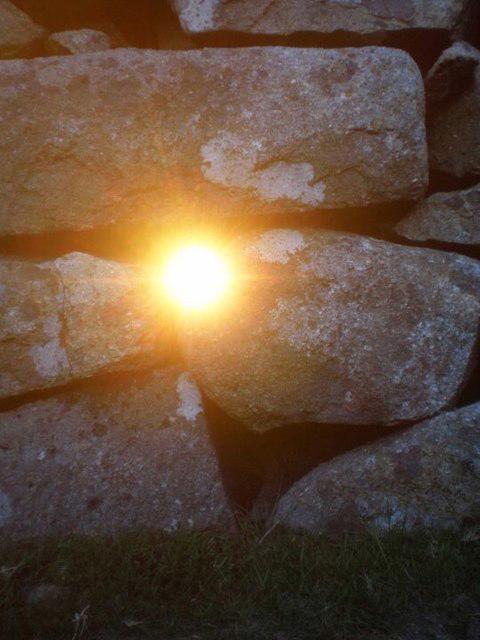 Photo could not load
J2927 : Sliabh Loch Sionnach - Slieveloughshannagh
Ciaran Mac Murchaidh
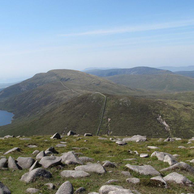 Photo could not load
J2927 : Peaks south-west of Slieve Meelmore
Eric Jones
Hill facts and local notes
Classifications
Elevation
617m
2,024 ft
Prominence
101m
Coordinates
54.1775, -6.0181
J294272
OS Map
29
At the Summit
The summit features a distinctive stone cairn, which serves as a popular photo opportunity for hikers. The views from the top are a sight to behold.
Terrain & Geology
Composed primarily of granite, Slieve Loughshannagh showcases the rugged geological history of the Mourne Mountains, formed during the last Ice Age and shaped by glacial activity.
Views & Scenery
From the summit, one can spot the impressive Slieve Donard to the east and the expansive Mourne Wall snaking across the hills. On a clear day, you might even catch a glimpse of the Irish Sea.
History & Heritage
Name Origin
The name 'Loughshannagh' is derived from the Irish 'Loch Seanach', meaning 'lake of the old man', which adds a touch of folklore to your hike.
Historical Significance
The Mourne Mountains have long been steeped in myth and legend, making Slieve Loughshannagh a part of an incredibly rich cultural heritage.
Getting There & Facilities
Check current local access restrictions, parking rules and transport timetables before travelling. These notes do not confirm public access to the summit.
Parking
Sandy Brae Car Park, located just off the A50 road with space for several cars. Arrive early to secure a spot, especially on weekends!
Public Transport
Limited public transport options; the nearest bus service operates from Newcastle to the surrounding areas. A car is recommended for easier access.
Nearby Facilities
Cafes, restaurants, and public toilets can be found in Newcastle. Water refill stations are available at some points along popular routes.
Safety Information
Known Hazards
- Potential hazards include slippery rocks, sudden weather changes, and limited phone signal in the high terrain. Always keep an eye on the sky!
General Safety Tips
- Check weather conditions before setting out
- Carry appropriate clothing and equipment
- Let someone know your planned route
- Take a map, compass, and GPS device
- Carry emergency supplies: food, water, first aid kit, torch
Hills
Some common questions about the hills answered
Are there group walks up Slieve Loughshannagh?
Many walkers use Walkmates to join or organise walks with others. You can check for group walks around Slieve Loughshannagh through the maps
Are there other walkers around Slieve Loughshannagh?
Activity varies by location and time, but Walkmates lets you see whether others have shared walks or shown interest in this area. Find other people through the walking friends search walking friends for Slieve Loughshannagh search or of course create your own walk for Slieve Loughshannagh
Can I organise a walk to Slieve Loughshannagh?
Yes. If there aren’t any walks listed already, you can create a walk and make it available for others to join.
If you're signed up to Walkmates, you can create a walk to Slieve Loughshannagh.
How do I find a walk up this hill?
There are often multiple ways to walk this hill, depending on experience and route preference. Walkmates helps you explore walks and routes that others have shared.
Can I suggest a new route up Slieve Loughshannagh?
Yes. You can suggest or create routes to share with others. Walkmates focuses on the social side of walking, so routes are used to help people organise walks and explore areas together, rather than as detailed navigation tools or route libraries.
Other uses really appreciate knowledgeable walkers sharing their routes. Share your favourite route to Slieve Loughshannagh here
The is an error or something incorrect about this hill. How do I let you know?
We always strive to keep the information on Walkmates as accurate as possible. If you find an error, please let us know through the contact form and we'll aim to correct it as quickly as possible
Community Discussion
Comments
Location
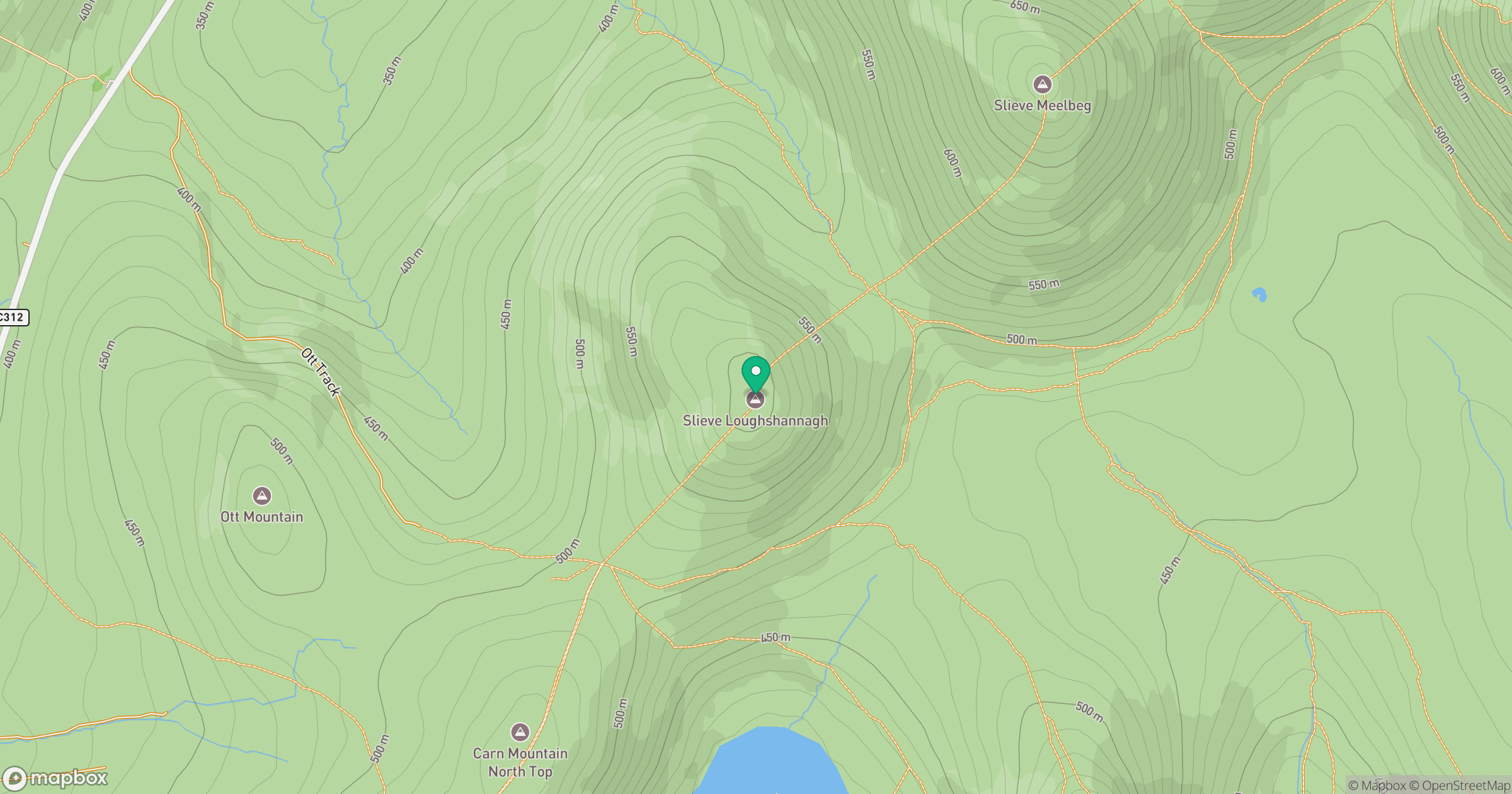
Grid reference: J294272
View on OpenStreetMapOpens a map in a new tab, centred on the hill.
Hills within 30 km
Straight-line distance, not a walking route or confirmation of access.
Slieve Bearnagh
739m
Slieve Binnian
746m
Slievelamagan
702m
Slieve Commedagh
767m
Slieve Donard
850m
No comments yet. Be the first.