

Slieve Bearnagh
Good walks are even better shared.
J3128 : The Tor-topped Slieve Bearnagh from the summit of Slieve Donard
Eric Jones Photo source
Overview
Slieve Bearnagh is a 739m mountain in the Mournes, County Down, Northern Ireland, with granite tors and very steep slopes. Approaches commonly use the Trassey valley and Hare's Gap or Pollaphuca. The lower North Tor is separate from the higher summit tor: reaching the true highest point requires scrambling, while walkers can turn back below it. Navigation skills, suitable equipment and a route matched to the weather and the group's ability are essential.
Slieve Bearnagh
Slieve Bearnagh rises to 739m in the Mourne Mountains, County Down, Northern Ireland. Its source-listed prominence is 304m. Granite tors, rock slabs and steep slopes make it a distinctive and demanding mountain.
Summit and difficulty
The lower North Tor is separate from the main summit tor. A walk to the summit area does not necessarily reach the highest point: that requires scrambling onto the main tor. Walkers may choose to stop below it. Assess the descent as well as the climb, and do not attempt exposed rock beyond your skills or in unsuitable conditions.
Approaches
The Trassey Track and Hare's Gap are established approaches. Pollaphuca, the col between Bearnagh and Meelmore to the northwest, offers another steep approach. A longer circuit combines Bearnagh and Meelmore. These are mountain-route overviews, not turn-by-turn instructions; consult a detailed map and a full route description. The upper mountain is not a waymarked family trail, and the Mourne Wall does not remove the need to navigate.
Access and facilities
Trassey car park is on Trassey Road. Meelmore Lodge offers paid parking, its own access lane and visitor facilities; check its current arrangements and opening times. Hare's Gap is a mountain pass, not a car park. Consult Translink for travel to the area and plan the onward and return connections to the trailhead.
Use established access routes, gates and stiles, keep gates closed, respect private land and any local notices, keep dogs on leads, and take litter home. Do not assume that a customary walking route is a public right of way.
Safety
Expect very steep ground, boulders, slabs and wet or muddy sections. Poor visibility, strong wind, rain, snow and ice can substantially increase the difficulty. Carry a map and compass and know how to use them; take waterproofs, warm layers, food, water, a head torch and emergency equipment. Leave a route plan and return time with someone. Check the mountain forecast and current local access notices before setting off, and be ready to turn back.
In a mountain emergency, call 999 or 112, ask for Police and then Mountain Rescue, and give your location, preferably a grid reference. Mobile coverage cannot be relied on.
Landscape and history
Views include the High and Western Mournes; the Trassey valley and Ben Crom reservoir are highlights of the approaches. The Irish name Sliabh Bearnach means 'gapped mountain', referring to its broken, tor-crowned skyline. The Mourne Wall crosses the mountain. It was built between 1904 and 1922 to define and protect the reservoir water catchment.
Explore routes near Slieve Bearnagh
Walks starting near this hill. Open a route to check its map, distance and full itinerary.
Tollymore Forest Park: Mountain and Drinns Trail
View route
Tollymore Forest Park: River Trail near Newcastle
View route
Silent Valley to Ben Crom Dam: Reservoir Road Walk, County Down
View route
Newcastle, Co. Down (NI) with Men Walking & Talking
View route
Route planning notes
These notes describe possible approaches. Check a route's map and access information when planning your walk.
Trassey Track and Hare's Gap
From Trassey car park, the Trassey Track leads to Hare's Gap. The ascent beside the Mourne Wall beyond the gap is very steep, passing the lower North Tor before the higher summit tor. Retrace the approach for an out-and-back. Reaching the highest rock requires scrambling; stopping below it is a valid turnaround. This is unwaymarked mountain terrain, and the wall does not replace navigation.
Meelmore Lodge approach
Meelmore Lodge offers paid parking and its own mountain-access lane, providing an alternative start for the Trassey Track and Hare's Gap approach. Confirm current access arrangements with the lodge. The upper mountain remains very steep; the North Tor is lower than the true summit tor, which requires scrambling. Retrace your approach for the return and plan the route on a detailed map before setting off.
Circuit via Pollaphuca and Hare's Gap
From the Trassey valley, the Pollaphuca col between Bearnagh and Meelmore gives access to Bearnagh's very steep northwestern side. Continue over the summit area and past the lower North Tor towards Hare's Gap, then return by the Trassey Track. The highest summit tor requires scrambling. Slabs, rocks and steep descents need care, and a detailed map and navigation skills are essential.
Slieve Bearnagh and Slieve Meelmore circuit
A demanding circuit from Trassey car park takes in Hare's Gap, Bearnagh's North Tor and higher summit area, then the col below Slieve Meelmore and Meelmore itself before returning to the Trassey valley. Meelmore Lodge is an alternative start. The highest Bearnagh tor requires scrambling. Steep descents and the return from Meelmore demand careful navigation, especially in cloud.
Make a day of it, together
Find someone to share the walk with, or organise a day out along a route you like.
Photo Gallery
View all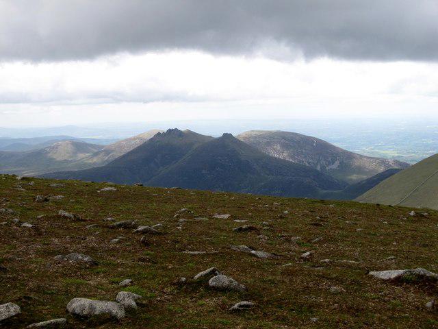 Photo could not load
J3128 : The Tor-topped Slieve Bearnagh from the summit of Slieve Donard
Eric Jones
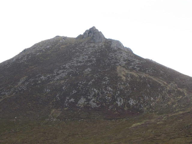 Photo could not load
J3127 : The southern slope of Slieve Bearnagh
Eric Jones
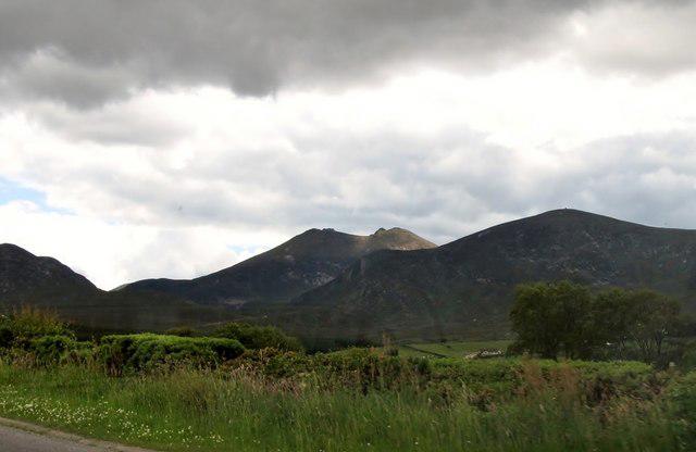 Photo could not load
J3128 : A sunlit Slieve Bearnagh from the Bryansford Road
Eric Jones
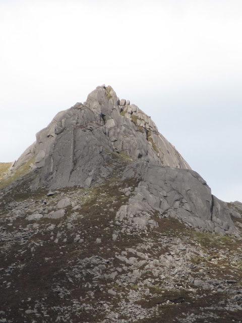 Photo could not load
J3127 : The southern tor on Slieve Bearnagh
Eric Jones
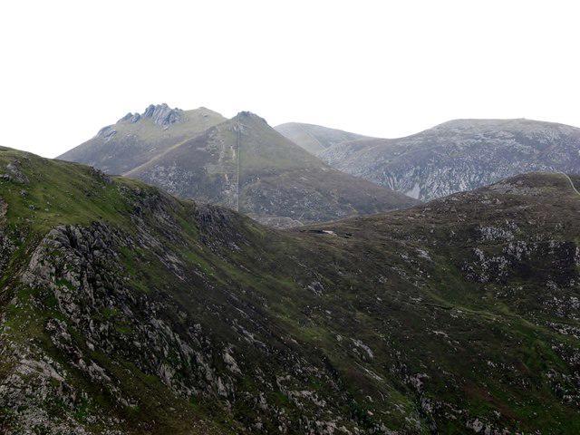 Photo could not load
J3128 : Slieve Bearnagh viewed through the col between Slieve Corragh and Slievenaglogh
Eric Jones
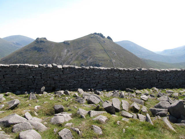 Photo could not load
J3128 : Slieve Bearnagh from the summit plateau of Slieve Meelmore
Eric Jones
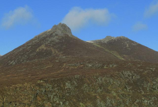 Photo could not load
J3128 : Slieve Bearnagh
Rossographer
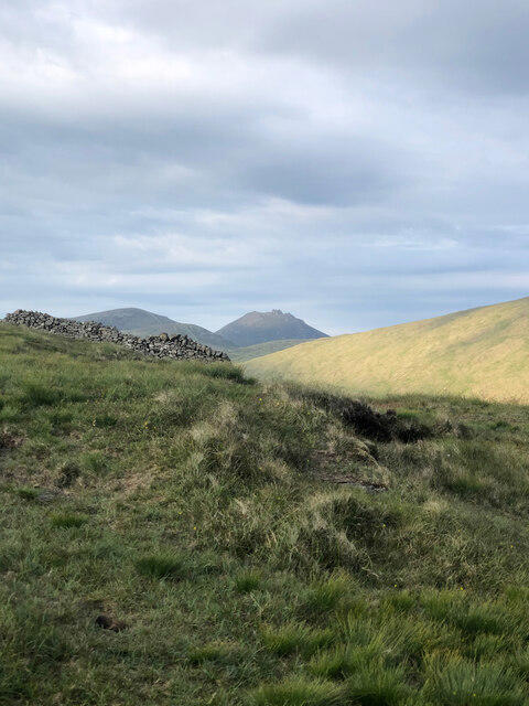 Photo could not load
J3127 : View ENE from Pigeon Rock Mountain to Slieve Bearnagh in the distance
Philip Cornwall
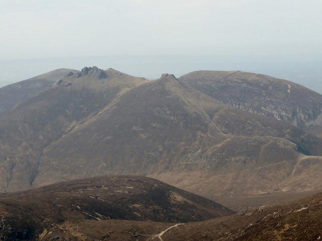 Photo could not load
J3128 : The tor-topped Slieve Bearnagh from Slieve Donard
Eric Jones
Hill facts and local notes
Classifications
Elevation
739m
2,425 ft
Prominence
304m
Coordinates
54.1842, -5.9895
J313280
OS Map
29
At the Summit
The true summit is the top of a granite tor, reached by scrambling. The lower North Tor is a separate top. The Mourne Wall crosses the summit area, but neither the wall-side walking ground nor a stop below the main tor is the highest point. The 739m summit at J313280 is south of the lower wall corner, which an older map incorrectly labelled as the summit height.
Terrain & Geology
Granite forms the distinctive summit tors, crags and smooth rock slabs. The surrounding Trassey valley and mountain passes show the influence of glaciation on the Mourne landscape.
Views & Scenery
Wide views across the High and Western Mournes. The Trassey valley and Ben Crom reservoir are highlights on the approaches; visibility depends on cloud and weather.
History & Heritage
Name Origin
From Irish Sliabh Bearnach, meaning 'gapped mountain', a reference to the gap in its rocky, tor-crowned skyline.
Historical Significance
The Mourne Wall crosses Slieve Bearnagh. Built between 1904 and 1922, it marks and protects the water catchment feeding the Silent Valley and Ben Crom reservoirs. Hare’s Gap and the nearby Brandy Pad are associated with historic smuggling routes.
Getting There & Facilities
Parking
Trassey car park on Trassey Road is a recognised start for the Trassey Track (route publishers give J311314 or J312314). Meelmore Lodge, also on Trassey Road, offers paid parking and its own mountain-access lane. Check the lodge's current arrangements. Keep roads, gates and emergency access clear. Hare's Gap is a mountain pass, not a car park.
Public Transport
Check Translink’s journey planner for travel to the Newcastle/Bryansford area and confirm onward transport to your chosen Trassey Road trailhead. Check both outward and return connections before travelling.
Nearby Facilities
Trassey car park is a basic trailhead; do not rely on toilets there. Meelmore Lodge advertises parking, toilets, showers and a bistro; check availability and opening times before travel. Carry your own food and water for the mountain.
Safety Information
Known Hazards
- Very steep approaches and descents, granite slabs, boulders and drops require sure-footedness; wet rock and peat can be slippery.
- The true highest summit is on a granite tor and requires scrambling. The lower North Tor and the walking ground below the main tor are not the true summit. Do not climb beyond your ability, and consider the descent before going up.
- These are unwaymarked mountain routes. Cloud, strong wind and cold can make route-finding and balance difficult; the Mourne Wall is not a substitute for a map, compass and navigation skills.
- Carry waterproofs, warm layers, food, water, a head torch and emergency equipment. Mobile coverage is unreliable. Leave your route and return time with someone; turn back if conditions exceed your skills.
- For a mountain emergency, call 999 or 112, ask for Police, then Mountain Rescue. Give your location, preferably a grid reference.
Seasonal Hazards
Snow and ice make the steep rocky ground and scrambling substantially more serious. Winter trips need suitable skills and equipment, with enough daylight for the return. Wet weather makes peat, steps and slabs slippery; check the mountain forecast and change or abandon the route when necessary.
General Safety Tips
- Check weather conditions before setting out
- Carry appropriate clothing and equipment
- Let someone know your planned route
- Take a map, compass, and GPS device
- Carry emergency supplies: food, water, first aid kit, torch
Hills
Some common questions about the hills answered
Are there group walks up Slieve Bearnagh?
Many walkers use Walkmates to join or organise walks with others. You can check for group walks around Slieve Bearnagh through the maps
Are there other walkers around Slieve Bearnagh?
Activity varies by location and time, but Walkmates lets you see whether others have shared walks or shown interest in this area. Find other people through the walking friends search walking friends for Slieve Bearnagh search or of course create your own walk for Slieve Bearnagh
Can I organise a walk to Slieve Bearnagh?
Yes. If there aren’t any walks listed already, you can create a walk and make it available for others to join.
If you're signed up to Walkmates, you can create a walk to Slieve Bearnagh.
How do I find a walk up this hill?
There are often multiple ways to walk this hill, depending on experience and route preference. Walkmates helps you explore walks and routes that others have shared.
Can I suggest a new route up Slieve Bearnagh?
Yes. You can suggest or create routes to share with others. Walkmates focuses on the social side of walking, so routes are used to help people organise walks and explore areas together, rather than as detailed navigation tools or route libraries.
Other uses really appreciate knowledgeable walkers sharing their routes. Share your favourite route to Slieve Bearnagh here
The is an error or something incorrect about this hill. How do I let you know?
We always strive to keep the information on Walkmates as accurate as possible. If you find an error, please let us know through the contact form and we'll aim to correct it as quickly as possible
Community Discussion
Comments
Location
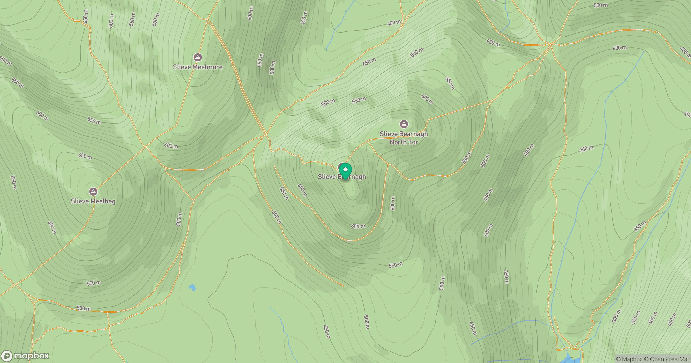
Grid reference: J313280
View on OpenStreetMapOpens a map in a new tab, centred on the hill.
No comments yet. Be the first.