

Slieve Meelbeg
Good walks are even better shared.
J2928 : Approaching the summit ridge of Slieve Meelbeg from the north-east
Eric Jones Photo source
Overview
Slieve Meelbeg rises to 701.9 m in the Mourne Mountains of County Down, Northern Ireland. A cairn marks the summit close to the Mourne Wall, between Slieve Loughshannagh and Slieve Meelmore. Ott car park gives access to a three-peak circuit; longer routes from Trassey add Bearnagh. These are exposed mountain walks with steep ground and navigation demands in poor visibility.
Slieve Meelbeg
Slieve Meelbeg is a 701.9 m mountain in the Mournes of County Down, Northern Ireland. Its summit cairn stands close to the Mourne Wall between Slieve Loughshannagh and Slieve Meelmore. The Database of British and Irish Hills records 184 m of prominence and Irish grid reference J300279. It is a Marilyn, Simm and Hewitt, and also appears on the Dillon, Arderin and Vandeleur-Lynam lists.
Summit and landscape
Rocky paths, steep grassy slopes and wet hollows characterise the approaches. From the summit ridge the wall leads towards Meelmore, whose shelter tower is visible in clear conditions; local outlooks include Lough Shannagh and other High Mourne peaks. The cairn on Meelbeg is distinct from Meelmore’s wall-side tower.
The regional Mourne granites formed when magma cooled underground. Nearby Happy Valley is a glacially carved U-shaped valley; the wider area also exposes older Silurian metasedimentary rocks.
Ott circuit
The council’s circuit starts and ends at Ott car park, J279279, on Slievenaman Road. Climb Ott Track to the col between Carn Mountain and Slieve Loughshannagh, then follow the Mourne Wall over Loughshannagh, Meelbeg and Meelmore. Retrace from Meelmore to the wall junction and descend the valley. The return joins the Ulster Way, passes Fofanny Reservoir and ends with 800 m along the road to Ott.
The council publishes 5.5 miles, about 8.9 km, for this complete circuit. OutmoreNI lists 5.4 miles for the same itinerary and a Very Strenuous desk-assessed grade, while both introductions call it moderate. Treat it as steep mountain walking requiring navigation. This valley return is different from the longer, more difficult Spellack ridge loop.
Longer circuit from Trassey
Trek NI describes a roughly 12.5 km circuit taking about five hours, from Trassey car park via Trassey Track and Hare’s Gap to Bearnagh, Meelmore and Meelbeg. From Meelbeg it descends west to Ott Track, then uses the Ulster Way northeast to Meelmore Lodge and the road back to Trassey. These figures are the guide’s approximate full-circuit estimates.
Bearnagh’s steep ground makes this unsuitable for casual walkers. Reaching its highest tor requires scrambling; walkers can omit the tor climb while passing through the summit area.
Safety and access
Cloud can make the correct ridge descent difficult to identify. Carry a map and compass and know how to use them; the wall does not remove the need for navigation. Wet or icy rock, steep grass and boggy ground require care. Hare’s Gap can be icy in cold weather. Heavy rain can make stream crossings unsafe, including the crossing on the Trassey return. Do not force a flooded crossing.
The northeast ridge of neighbouring Meelmore ends above the Spellack cliffs. Avoid confusing that variant with the Ott circuit’s valley descent. Allow for traffic on both circuits’ road returns. Follow local signs, respect landowner instructions, stay on existing paths and keep dogs on leads around livestock and ground-nesting birds.
Ott has parking and picnic facilities but no toilets listed by OutmoreNI. Hilltown is the service town identified for this western approach. Meelmore Lodge is on the longer circuit’s return; check current opening and access before relying on its facilities. Check the current Translink journey planner before planning a car-free visit, since seasonal services and timetables change.
Names and history
Paul Tempan’s place-name compilation, citing Place-Names of Northern Ireland, interprets Sliabh Míol Beag as “little mountain of the ants”. Meelbeg is nevertheless higher than Meelmore. The Mourne Wall was built in 1904–1922 to protect the reservoir catchment and is now owned by Northern Ireland Water.
Sources
Explore routes near Slieve Meelbeg
Walks starting near this hill. Open a route to check its map, distance and full itinerary.
Tollymore Forest Park: River Trail near Newcastle
View route
Silent Valley to Ben Crom Dam: Reservoir Road Walk, County Down
View route
Castlewellan Forest Park: Lake, Arboretum and Mitchell's Lake Circuit
View route
Scarva to Poyntzpass: Newry Canal and Lough Shark Return
View route
Route planning notes
These notes describe possible approaches. Check a route's map and access information when planning your walk.
Ott circuit: Loughshannagh, Meelbeg and Meelmore
Start and finish at Ott car park (J279279). Take Ott Track to the Carn–Loughshannagh col, then follow the Mourne Wall over Loughshannagh, Meelbeg and Meelmore. Retrace to the wall junction; descend the valley to the Ulster Way, pass Fofanny Reservoir and return along Slievenaman Road. The council gives 5.5 miles (about 8.9 km) for this circuit; the final road section is 800 m. Steep mountain ground requires navigation.
Trassey circuit: Bearnagh, Meelmore and Meelbeg
From Trassey car park take Trassey Track to Hare’s Gap, then the Mourne Wall over Bearnagh, Meelmore and Meelbeg. Descend west to Ott Track; use the Ulster Way northeast to Meelmore Lodge and return by road to Trassey. Trek NI gives about 12.5 km and 5 hours for the full circuit. Bearnagh’s highest tor requires an optional scramble; slopes are steep and stream crossings depend on rainfall.
Make a day of it, together
Find someone to share the walk with, or organise a day out along a route you like.
Photo Gallery
View all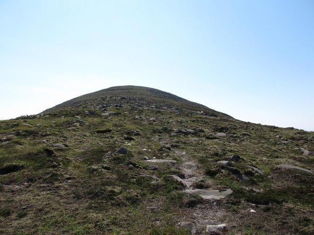 Photo could not load
J2928 : Approaching the summit ridge of Slieve Meelbeg from the north-east
Eric Jones
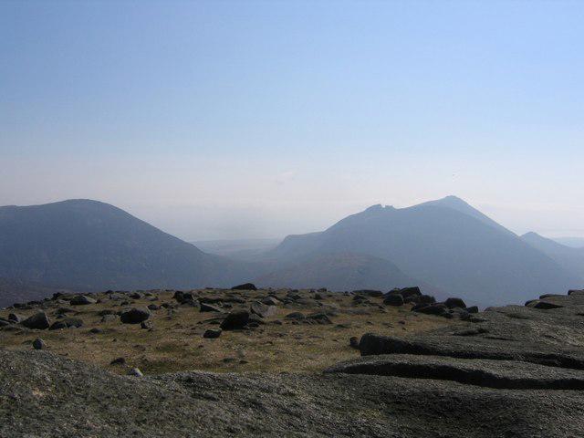 Photo could not load
J3027 : Summit view from Slieve Meelbeg
Andrew Spenceley
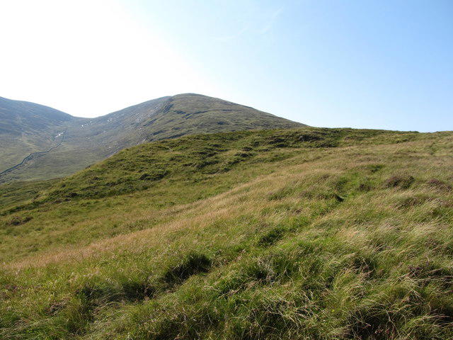 Photo could not load
J2928 : View southwards along the Slieve Meelbeg ridge
Eric Jones
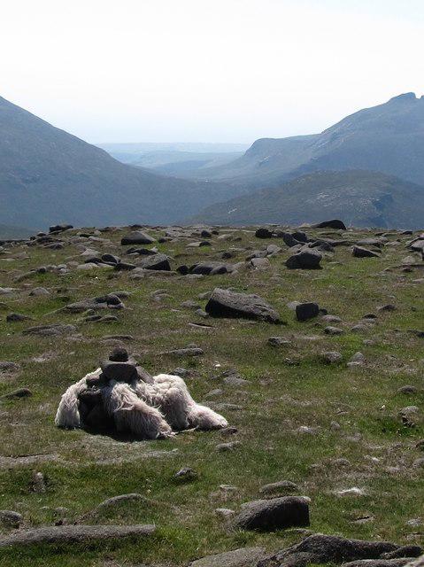 Photo could not load
J3027 : A mysterious work of art on the summit of Slieve Meelbeg
Eric Jones
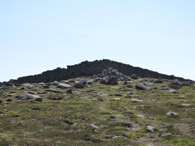 Photo could not load
J3027 : Approaching the summit cairn of Slieve Meelbeg
Eric Jones
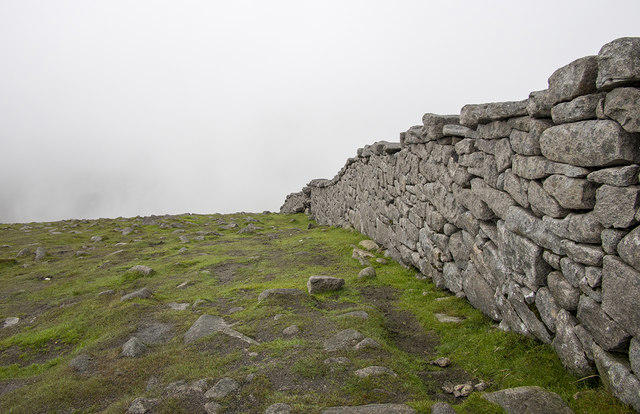 Photo could not load
J3027 : The Mourne Wall, Slieve Meelbeg
Rossographer
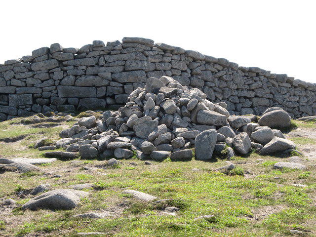 Photo could not load
J3027 : The Slieve Meelbeg summit cairn
Eric Jones
Hill facts and local notes
Classifications
Elevation
702m
2,303 ft
Prominence
184m
Coordinates
54.1837, -6.0083
J300279
OS Map
29
At the Summit
A large stone cairn marks the summit close to the Mourne Wall.
Terrain & Geology
Slieve Meelbeg belongs to the Mourne granite landscape. The granite formed as magma cooled beneath the surface; the nearby Happy Valley was carved into a U-shaped valley by ice. The surrounding area also exposes older Silurian metasedimentary rocks.
Views & Scenery
The Mourne Wall links the adjoining ridges, with Slieve Meelmore and its shelter tower visible to the northeast. Local outlooks include Lough Shannagh and the surrounding High Mourne peaks, when visibility allows.
History & Heritage
Name Origin
Sliabh Míol Beag is interpreted as “little mountain of the ants” in Paul Tempan’s Irish Hill and Mountain Names, citing Place-Names of Northern Ireland. Despite the name, Meelbeg is higher than neighbouring Meelmore.
Historical Significance
The Mourne Wall crosses Slieve Meelbeg. It was built by the Belfast Water Commissioners between 1904 and 1922 to enclose and protect the reservoir catchment, and is now owned by Northern Ireland Water.
Getting There & Facilities
Parking
Ott car park, Irish grid J279279, on Slievenaman Road, is the start and finish of the Loughshannagh–Meelbeg–Meelmore circuit. The longer Bearnagh circuit starts and ends at Trassey car park.
Nearby Facilities
Ott car park has picnic facilities; OutmoreNI lists no toilets at this start. Meelmore Lodge lies on the longer Trassey circuit’s return; check its current opening and visitor arrangements before relying on refreshments or toilets.
Safety Information
Known Hazards
- Poor visibility can lead to the wrong ridge descent from Meelbeg or Meelmore; the wall is a useful handrail but does not replace map-and-compass navigation.
- Wet or icy rock, boggy ground and steep grassy slopes can be slippery. The Bearnagh extension has steep, loose ground and an optional summit-tor scramble.
- Stream crossings can become unsafe after heavy rain. The Trassey return crossing may be impassable; do not force a flooded crossing.
- Meelmore’s northeast ridge ends above the Spellack cliffs. This is a separate descent variant, not the valley return of the Ott circuit.
- The Ott circuit and Trassey circuit both finish with road walking; take care around traffic.
Seasonal Hazards
Snow and ice can affect the uplands in cold weather; Hare’s Gap on the Trassey circuit can be particularly icy. Heavy rain raises stream-crossing risk. Keep dogs on leads around livestock and ground-nesting birds; sheep may be present beyond the main April–October grazing season.
General Safety Tips
- Check weather conditions before setting out
- Carry appropriate clothing and equipment
- Let someone know your planned route
- Take a map, compass, and GPS device
- Carry emergency supplies: food, water, first aid kit, torch
Hills
Some common questions about the hills answered
Are there group walks up Slieve Meelbeg?
Many walkers use Walkmates to join or organise walks with others. You can check for group walks around Slieve Meelbeg through the maps
Are there other walkers around Slieve Meelbeg?
Activity varies by location and time, but Walkmates lets you see whether others have shared walks or shown interest in this area. Find other people through the walking friends search walking friends for Slieve Meelbeg search or of course create your own walk for Slieve Meelbeg
Can I organise a walk to Slieve Meelbeg?
Yes. If there aren’t any walks listed already, you can create a walk and make it available for others to join.
If you're signed up to Walkmates, you can create a walk to Slieve Meelbeg.
How do I find a walk up this hill?
There are often multiple ways to walk this hill, depending on experience and route preference. Walkmates helps you explore walks and routes that others have shared.
Can I suggest a new route up Slieve Meelbeg?
Yes. You can suggest or create routes to share with others. Walkmates focuses on the social side of walking, so routes are used to help people organise walks and explore areas together, rather than as detailed navigation tools or route libraries.
Other uses really appreciate knowledgeable walkers sharing their routes. Share your favourite route to Slieve Meelbeg here
The is an error or something incorrect about this hill. How do I let you know?
We always strive to keep the information on Walkmates as accurate as possible. If you find an error, please let us know through the contact form and we'll aim to correct it as quickly as possible
Community Discussion
Comments
Location
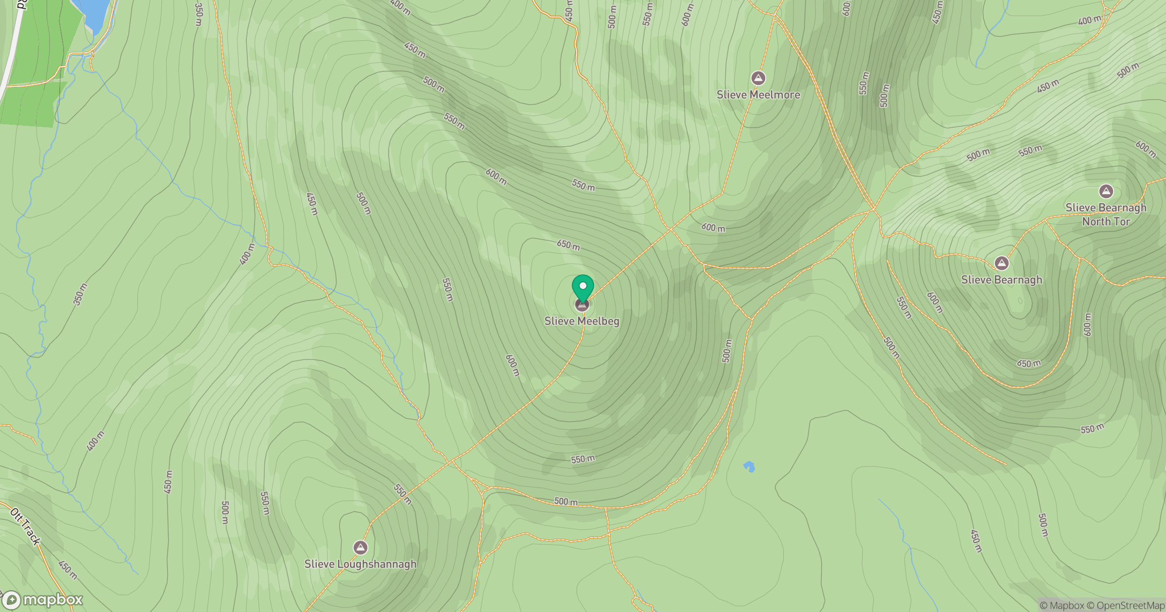
Grid reference: J300279
View on OpenStreetMapOpens a map in a new tab, centred on the hill.
Nearby Hills
Slieve Bearnagh
739m
Slievelamagan
702m
Slieve Binnian
746m
Slieve Commedagh
767m
Slieve Donard
850m
No comments yet. Be the first.