

Slieve Binnian
Good walks are even better shared.
J3223 : Stile at the junction of the south and east path up Binnian
Eric Jones Photo source
Overview
Slieve Binnian rises to 745.9 m in the Mourne Mountains of County Down, Northern Ireland. Its granite tors, Back Castles ridge and views over Silent Valley attract hillwalkers. Routes from Carrick Little involve steep mountain paths, with a short scramble to the true summit and careful navigation in poor visibility.
Slieve Binnian
Slieve Binnian is a 745.9 m mountain in the Mournes, County Down, Northern Ireland. Its long granite ridge separates the Annalong Valley from Silent Valley. The main summit is the southern high point of the ridge, rather than the separate North Top, North Tor or East Top.
Summit and ridge
The high point is among granite summit rocks. Reaching it involves a short scramble; visiting the ridge does not require climbing every tor. The Back Castles and northern tors make distinctive landmarks, but their steep rock faces are not ordinary walking paths. Clear weather gives views over Silent Valley, the Mourne peaks and the County Down coast.
Walking from Carrick Little
The usual start is Carrick Little on Head Road at J345219. Walk up the lane, pass the mountain gate and follow the path uphill beside the Mourne Wall. Near the top, take the walking approach to the gap beside the summit rocks rather than following the wall into a crag.
For a ridge circuit, continue north past the Back Castles and around the northern tors, descend to the col with Slievelamagan, then turn south-east past Blue Lough and Annalong Wood to regain the lane and car park. Tourism NI describes this complete circuit as approximately 11.2 km. A summit out-and-back using the wall-side approach is described by Get Lost Mountaineering as 7 km with about 3–4 hours for the full return.
Planning and safety
This is strenuous mountain terrain with steep paths, wet or loose stones, boggy ground and exposed summit rocks. The Annalong approach crosses small streams; after heavy rain, assess each crossing and turn back if unsafe. Low cloud can obscure the descent and the separate tops, so carry a suitable map and compass and know how to use them. Snow and ice can make the paths and scrambling substantially harder. Check the mountain forecast, start with adequate daylight and carry warm waterproof clothing, food, water and a headtorch. In an emergency call 999 or 112, ask for Police, then Mountain Rescue.
Use gates and stiles, follow current access signs and avoid blocking the lane or farm entrances. Parking is limited at the roadside car park; private parking is also available farther up the lane, subject to the operator's terms. Arrange transport in advance: a current bus to Carrick Little should not be assumed. Carry your own supplies rather than depending on mountain facilities.
Landscape and history
Binnian's granite tors are resistant rock outcrops within a landscape shaped by glaciation and continuing weathering. Their formation is more complex than a single episode of glacial carving. The Irish name Sliabh Binneáin is translated as “mountain of the small peak”. The Mourne Wall was built between 1904 and 1922 around the water catchment. Beneath Binnian, a tunnel constructed between 1947 and 1952 carries water from the Annalong River to Silent Valley.
Explore routes near Slieve Binnian
Walks starting near this hill. Open a route to check its map, distance and full itinerary.
Silent Valley to Ben Crom Dam: Reservoir Road Walk, County Down
View route
Tollymore Forest Park: River Trail near Newcastle
View route
Tollymore Forest Park: Mountain and Drinns Trail
View route
Castlewellan Forest Park: Lake, Arboretum and Mitchell's Lake Circuit
View route
Route planning notes
These notes describe possible approaches. Check a route's map and access information when planning your walk.
Carrick Little and the Binnian ridge circuit
From Carrick Little (J345219), take the lane and climb beside the Mourne Wall to the main summit area. The true summit requires a short scramble. Continue north past the Back Castles, skirt the northern tors and descend to the Slievelamagan col. Turn south-east past Blue Lough and Annalong Wood, returning down the lane to Carrick Little. The 11.2 km is the published full circuit; climbing the other tors is optional and more difficult.
Carrick Little to the main summit and back
Start at Carrick Little (J345219), follow the lane through the mountain gate and take the uphill path beside the Mourne Wall. Near the crest, leave the wall for the gap beside the summit tor; reaching the highest rocks requires a short scramble. Retrace the same path and lane to Carrick Little. Get Lost Mountaineering describes this complete return as 7 km, taking about 3–4 hours. Allow extra time for conditions and breaks.
Make a day of it, together
Find someone to share the walk with, or organise a day out along a route you like.
Photo Gallery
View all Photo could not load
J3223 : Stile at the junction of the south and east path up Binnian
Eric Jones
 Photo could not load
J3223 : The Mourne Wall, Slieve Binnian
Rossographer
 Photo could not load
J3223 : Broken wall below the Summit Tor of Slieve Binnian
Eric Jones
 Photo could not load
J3223 : View west across the summit col of Slieve Binnian
Eric Jones
 Photo could not load
J3223 : The summit ridge of Slieve Binnian viewed from its south-eastern spur
Eric Jones
 Photo could not load
J3223 : Col on the summit ridge of Slieve Binnian
Eric Jones
 Photo could not load
J3223 : Slieve Binnian from Mourne Wood on Knockchree
Eric Jones
 Photo could not load
J3223 : A summit tor on Slieve Binnian
Eric Jones
 Photo could not load
J3223 : Low cloud approaching the col in the summit ridge of Slieve Binnian
Eric Jones

J3223 : Slieve Binnian viewed across the Silent Valley Reservoir
Eric Jones
Hill facts and local notes
Classifications
Elevation
746m
2,447 ft
Prominence
351m
Coordinates
54.1419, -5.9800
J320233
OS Map
29
At the Summit
Granite summit rocks form the high point on the southern part of the Binnian ridge. Reaching the highest rocks involves a short scramble. The main summit is separate from Slieve Binnian North Top, North Tor and East Top; a ridge circuit can pass around the other tors without climbing them.
Terrain & Geology
Slieve Binnian belongs to the Mourne granite massif. Its tors are resistant bedrock outcrops, with their shapes influenced by rock structure and weathering. Glaciation shaped the surrounding valleys, while frost action and other weathering processes continued to modify the uplands. The tors should not simply be described as rocks carved by glaciers; their development has a more complex history.
Views & Scenery
In clear weather, the summit and ridge offer views over Silent Valley Reservoir, the Annalong Valley, neighbouring Mourne peaks and the County Down coast. The northern ridge provides views towards Ben Crom Reservoir.
History & Heritage
Name Origin
From Irish Sliabh Binneáin, translated by MountainViews as “mountain of the small peak”. The name refers to the rocky tors along the summit ridge.
Historical Significance
The Mourne Wall was built between 1904 and 1922 around the reservoir catchment. The Binnian Tunnel, constructed between 1947 and 1952, carries water from the Annalong River through the mountain to Silent Valley. Both are part of the Mournes’ water-supply heritage.
Getting There & Facilities
Parking
Carrick Little car park on Head Road, at its junction with Oldtown Road, is the usual start (Irish Grid J345219). Space is limited. Private parking is available farther up the approach lane; check current charges and conditions locally. Keep the lane, gateways and farm access clear.
Public Transport
Consult Translink for your travel date and confirm whether the 405 Mourne Rambler is operating and stopping at Carrick Little. Do not assume a year-round trailhead bus; arrange onward and return transport before setting out.
Nearby Facilities
Carry food and water for the mountain. Obtain supplies in Annalong or Newcastle before setting out. Carrick Cottage is on the approach lane, but check any cafe opening directly before relying on it; public toilet availability at the trailhead was not confirmed.
Safety Information
Known Hazards
- Steep rocky paths and summit drops; the highest rocks require scrambling. Other tors can involve harder climbing and need not be climbed on the ridge circuit.
- Wet granite, loose stones and boggy ground can cause slips. Small streams on the Annalong approach may become difficult after heavy rain; do not force an unsafe crossing.
- Low cloud can make the ridge and northern descent difficult to navigate. Carry a map and compass and do not rely solely on a phone or assume continuous waymarking.
- Strong winds increase risk on exposed ground. Carry warm waterproof clothing, food, water, a headtorch and emergency equipment.
Seasonal Hazards
Snow and ice can hide paths and footholds and make steep ground and summit scrambling dangerous. Winter conditions require appropriate equipment and the skills to use it. Short daylight hours leave less margin for delays. Heavy rain can swell streams and worsen boggy ground at any time of year.
General Safety Tips
- Check weather conditions before setting out
- Carry appropriate clothing and equipment
- Let someone know your planned route
- Take a map, compass, and GPS device
- Carry emergency supplies: food, water, first aid kit, torch
Hills
Some common questions about the hills answered
Are there group walks up Slieve Binnian?
Many walkers use Walkmates to join or organise walks with others. You can check for group walks around Slieve Binnian through the maps
Are there other walkers around Slieve Binnian?
Activity varies by location and time, but Walkmates lets you see whether others have shared walks or shown interest in this area. Find other people through the walking friends search walking friends for Slieve Binnian search or of course create your own walk for Slieve Binnian
Can I organise a walk to Slieve Binnian?
Yes. If there aren’t any walks listed already, you can create a walk and make it available for others to join.
If you're signed up to Walkmates, you can create a walk to Slieve Binnian.
How do I find a walk up this hill?
There are often multiple ways to walk this hill, depending on experience and route preference. Walkmates helps you explore walks and routes that others have shared.
Can I suggest a new route up Slieve Binnian?
Yes. You can suggest or create routes to share with others. Walkmates focuses on the social side of walking, so routes are used to help people organise walks and explore areas together, rather than as detailed navigation tools or route libraries.
Other uses really appreciate knowledgeable walkers sharing their routes. Share your favourite route to Slieve Binnian here
The is an error or something incorrect about this hill. How do I let you know?
We always strive to keep the information on Walkmates as accurate as possible. If you find an error, please let us know through the contact form and we'll aim to correct it as quickly as possible
Community Discussion
Comments
Location
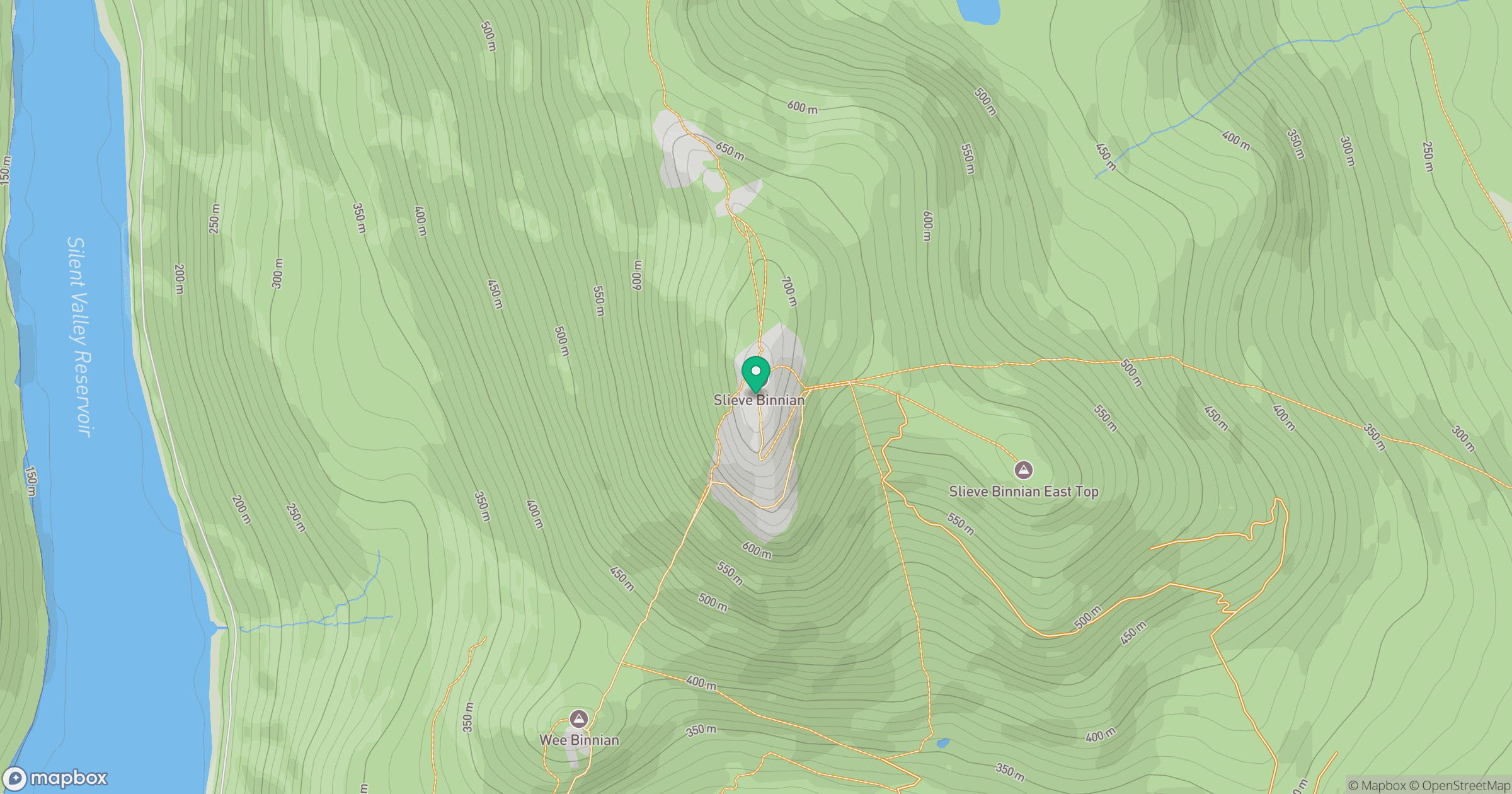
Grid reference: J320233
View on OpenStreetMapOpens a map in a new tab, centred on the hill.
No comments yet. Be the first.