

Slieve Muck
Good walks are even better shared.
J2825 : "Loyalist" sheep on the summit of Slieve Muck
Eric Jones Photo source
Overview
Slieve Muck is a 670.4m Mourne mountain in County Down, Northern Ireland, above Deer’s Meadow and near Spelga Reservoir. A broad summit area contrasts with steep wet slopes and crags. Approaches include a return via Ott Track and Carn Mountain, or a direct climb from Deer’s Meadow beside Batt’s Wall.
Slieve Muck
Slieve Muck rises to 670.4m above Deer’s Meadow in the Mourne Mountains, County Down, Northern Ireland. Its prominence is 156m. The broad summit area has a trig pillar and the meeting of Batt’s Wall and the Mourne Wall; the surveyed high point at J 28112 24995 is recorded without a marker.
Walking approaches
The Ott Track approach crosses the Carn Mountain ridge before climbing Slieve Muck. The published 8.4km itinerary returns the same way to Ott car park, with a guide time of 2.5–3.5 hours. Carn Mountain is a separate 585.2m summit to the northeast. Slieve Loughshannagh lies farther north; Pigeon Rock’s two tops are across the valley to the west.
Deer’s Meadow offers a more direct, steep ascent beside Batt’s Wall, returning down the same western slope. Wet grass, peat, streams and rocky steps make the descent slow in poor conditions. The southern Mourne Wall line towards Banns Road is a different descent with steep slabs and boggy ground.
The full Mourne Wall Challenge is a long multi-summit circuit. LDWA lists its Carrick Little start-and-finish route at 31km; it is not the individual Slieve Muck ascent described above.
Landscape and name
The summit crags are Silurian metasediments overlying the G3 granite of the Eastern Mournes. The Mourne granite intrusions formed about 56 million years ago. From the upper slopes, views open over Spelga, Deer’s Meadow and the surrounding Mourne peaks. Sliabh Muc means ‘mountain of the pigs’.
The Mourne Wall was built between 1904 and 1922 to protect the water catchment and remains in NI Water’s care.
Access and preparation
Use the existing gates, stiles and paths, keep entrances clear and follow local access notices. Upland access can depend on landowner goodwill; a well-used path does not by itself establish a public right of way. Keep dogs on leads where they are permitted. Organisers should check NI Water’s requirements before events on its land.
Public toilets are listed at Spelga Dam and in Hilltown. Carry food, water, waterproofs, warm layers, a map, compass and a head torch. The wall is a useful navigation feature, but its branches and gaps require care in cloud. In winter, ice on the steep grass and rock can require winter equipment and skills.
NI Water prohibits swimming and other water activities at Lough Shannagh, Spelga, Silent Valley and Ben Crom. Any separate visit through Silent Valley Mountain Park is subject to its entry charges, gate times and posted trail closures.
Explore routes near Slieve Muck
Walks starting near this hill. Open a route to check its map, distance and full itinerary.
Silent Valley to Ben Crom Dam: Reservoir Road Walk, County Down
View route
Tollymore Forest Park: River Trail near Newcastle
View route
Newcastle, Co. Down (NI) with Men Walking & Talking
View route
Castlewellan Forest Park: Lake, Arboretum and Mitchell's Lake Circuit
View route
Route planning notes
These notes describe possible approaches. Check a route's map and access information when planning your walk.
Slieve Muck via Ott Track and Carn Mountain: return
From Ott car park on Slievenaman Road, cross to the stile and take the Ott Track around Ott Mountain to the Mourne Wall at the saddle. Turn southwest along the Carn Mountain ridge, then descend to the intervening col and climb Slieve Muck. Retrace the same route over Carn and down the Ott Track to the car park. The published 8.4km figure covers this full return; the guide suggests 2.5–3.5 hours. Expect wet ground, rocky sections and a substantial final climb.
Slieve Muck from Deer’s Meadow: summit return
Start at Deer’s Meadow car park on Moyad Road, south of Spelga. Cross the road carefully and use the stile opposite. Climb the western slope alongside Batt’s Wall, taking the worn line around rocky obstructions, to the summit area where it meets the Mourne Wall. Return by the same western slope, stile and road crossing to Deer’s Meadow. The climb is steep, with wet grass, peat and small stream channels. Do not substitute the much steeper southern Mourne Wall descent towards Banns Road.
Make a day of it, together
Find someone to share the walk with, or organise a day out along a route you like.
Photo Gallery
View all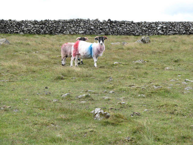 Photo could not load
J2825 : "Loyalist" sheep on the summit of Slieve Muck
Eric Jones
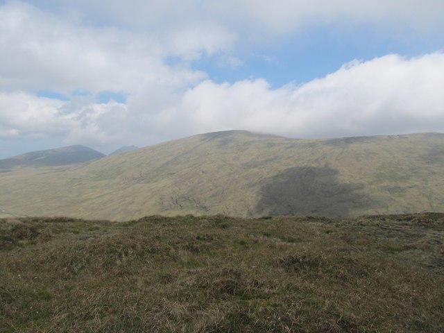 Photo could not load
J2824 : Slieve Muck viewed from Pigeon Rock Mountain
Eric Jones
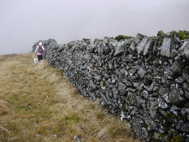 Photo could not load
J2825 : Batt's Wall, Slieve Muck
Rossographer
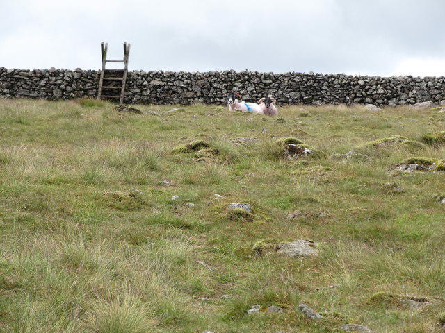 Photo could not load
J2825 : Approaching Batt's Wall on Slieve Muck
Eric Jones
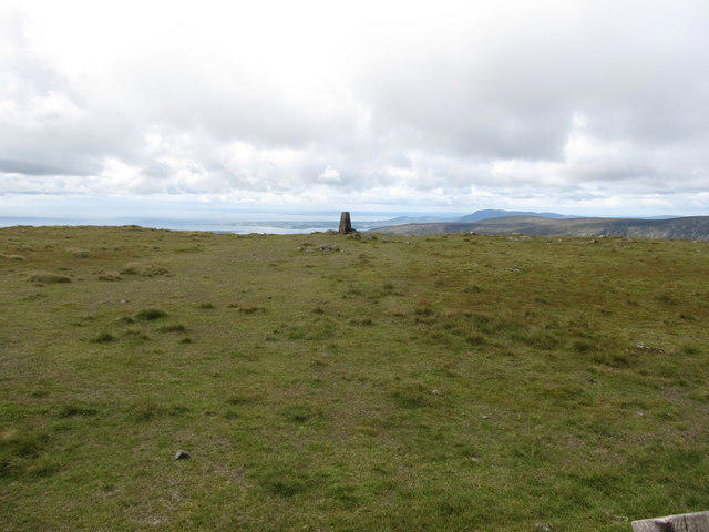 Photo could not load
J2825 : Trig pillar on the summit of Slieve Muck
Eric Jones
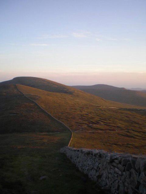 Photo could not load
J2825 : Sliabh Muc - Slieve Muck
Ciaran Mac Murchaidh
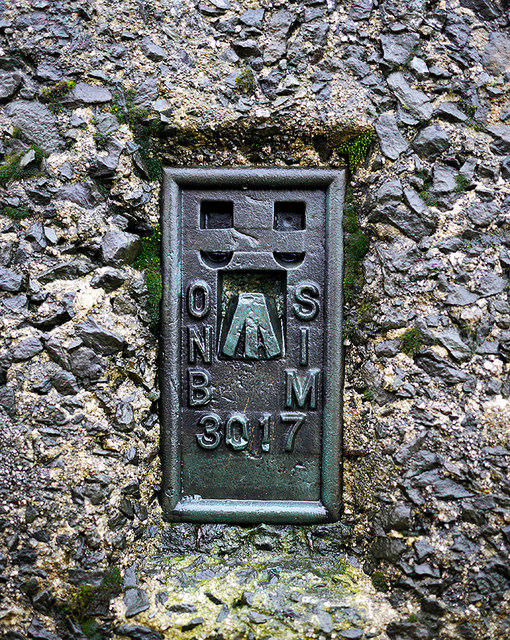 Photo could not load
J2824 : Flush Bracket, Slieve Muck Triangulation Pillar
Rossographer
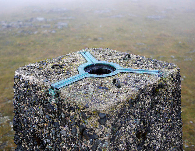 Photo could not load
J2824 : Spider, Slieve Muck Triangulation Pillar
Rossographer
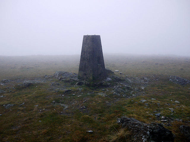 Photo could not load
J2824 : Slieve Muck Triangulation Pillar
Rossographer
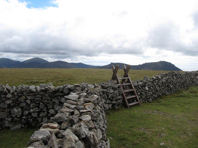 Photo could not load
J2825 : Stile over the Mourne Wall on the summit of Slieve Muck
Eric Jones
Hill facts and local notes
Classifications
Elevation
670m
2,199 ft
Prominence
156m
Coordinates
54.1580, -6.0397
J281249
OS Map
29
At the Summit
A trig pillar and the junction of Batt’s Wall with the Mourne Wall stand in the broad summit area. The surveyed high point at J 28112 24995 is recorded by DoBIH as having no feature; the pillar should not be treated as proof of the exact highest point.
Terrain & Geology
Slieve Muck’s summit crags are Silurian metasediments above the G3 granite of the Eastern Mournes. The Mourne granites intruded the older rocks about 56 million years ago, locally baking them into hornfels. The summit cap is therefore distinct from the granite beneath it.
Views & Scenery
Views over Deer’s Meadow and Spelga Reservoir, across to Pigeon Rock and the western Mournes, and towards the higher central Mourne peaks.
History & Heritage
Name Origin
From Irish Sliabh Muc, meaning ‘mountain of the pigs’, as recorded in Paul Tempan’s Irish Landscape Names, citing Place-Names of Northern Ireland volume 3.
Historical Significance
The Mourne Wall crosses Slieve Muck. Built by the Belfast Water Commissioners between 1904 and 1922, it enclosed and protected the water catchment serving the Mourne reservoirs. The listed wall remains in NI Water’s care.
Getting There & Facilities
Parking
Use Ott car park on Slievenaman Road for the Carn Mountain approach, or the small Deer’s Meadow car park on Moyad Road, south of Spelga, for the direct western ascent. Both starts involve crossing a road to a stile. Keep traffic, field gates and access tracks clear.
Public Transport
Use Translink’s journey planner for date-specific travel to the Mournes and arrange the final leg to Ott or Deer’s Meadow. NI Water advertises a paid Mourne Shuttle Service with advance booking recommended; confirm its stops and return arrangements for your chosen day.
Nearby Facilities
Public toilets are listed at Spelga Dam and Rostrevor Road in Hilltown. Check their opening times before relying on them. Bring food and water for the mountain routes.
Safety Information
Known Hazards
- Steep wet grass, peat, stream channels and rocky steps can be slippery on the Deer’s Meadow ascent and descent. The southern Mourne Wall descent towards Banns Road includes steep slabs and boggy ground.
- Cloud can hide the summit plateau, wall junctions and the return line over Carn Mountain. Navigate with a map and compass rather than following any wall downhill.
- NI Water prohibits swimming, diving, paddleboarding and other water activities at Lough Shannagh, Spelga, Silent Valley and Ben Crom.
- For a mountain emergency call 999 or 112, ask for Police and then Mountain Rescue, and give your location, preferably a grid reference. Mobile reception can be unreliable.
Seasonal Hazards
Winter ice on the steep grass and rock makes both ascent and descent more serious and may require winter equipment and skills. Wet weather increases saturation of the peat and stream channels. Short daylight reduces the margin for a slow return.
General Safety Tips
- Check weather conditions before setting out
- Carry appropriate clothing and equipment
- Let someone know your planned route
- Take a map, compass, and GPS device
- Carry emergency supplies: food, water, first aid kit, torch
Hills
Some common questions about the hills answered
Are there group walks up Slieve Muck?
Many walkers use Walkmates to join or organise walks with others. You can check for group walks around Slieve Muck through the maps
Are there other walkers around Slieve Muck?
Activity varies by location and time, but Walkmates lets you see whether others have shared walks or shown interest in this area. Find other people through the walking friends search walking friends for Slieve Muck search or of course create your own walk for Slieve Muck
Can I organise a walk to Slieve Muck?
Yes. If there aren’t any walks listed already, you can create a walk and make it available for others to join.
If you're signed up to Walkmates, you can create a walk to Slieve Muck.
How do I find a walk up this hill?
There are often multiple ways to walk this hill, depending on experience and route preference. Walkmates helps you explore walks and routes that others have shared.
Can I suggest a new route up Slieve Muck?
Yes. You can suggest or create routes to share with others. Walkmates focuses on the social side of walking, so routes are used to help people organise walks and explore areas together, rather than as detailed navigation tools or route libraries.
Other uses really appreciate knowledgeable walkers sharing their routes. Share your favourite route to Slieve Muck here
The is an error or something incorrect about this hill. How do I let you know?
We always strive to keep the information on Walkmates as accurate as possible. If you find an error, please let us know through the contact form and we'll aim to correct it as quickly as possible
Community Discussion
Comments
Location
View the hill's mapped position and surrounding paths.
Grid reference: J281249
View on OpenStreetMapOpens a map in a new tab, centred on the hill.
Nearby Hills
Slieve Bearnagh
739m
Slieve Binnian
746m
Slievelamagan
702m
Slieve Commedagh
767m
Slieve Donard
850m
No comments yet. Be the first.