
Simon's Seat
Good walks are even better shared.
Overview
Simon’s Seat
Nestled in the heart of the Yorkshire Dales, Simon’s Seat stands at a respectable elevation of 486 meters. This Marilyn offers splendid vistas and a sense of wilderness, making it a favourite for hikers seeking both exercise and scenery.
Geology
The mountain's limestone composition gives rise to stunning geological features fostered by glacial activity. When you trot to the summit, look out for distinctive rocky outcrops that could make you feel like you’re on another planet—if another planet featured shepherds and cows, that is.
Routes
Two primary routes lead adventurers to the top, each with its unique charm.
- Barden Bridge Route: Approximately 4.5 km, this moderate hike combines the thrill of ascending grassy hills with the serene experience of walking through ancient woodlands. Expect a couple of sheep to say hello on your way.
- Howgill Lane Route: A gentler ascent of about 3.2 km, perfect for families. You can even take your time to enjoy a picnic at the top!
Summit Features
Upon reaching the summit, you are greeted by a rugged rocky outcrop, the epitome of what one imagines an English mountain might look like. Instant photo opportunity—remember to tag your pals to show them what they missed out on!
Terrain Type
The lower paths are grassy, giving way to rocky sections near the summit. The combination makes for an interesting mix, as your foot may never know whether to sink in or stumble over!
Views
The view from the top is nothing short of breathtaking. You can see the entire Wharfedale valley, with prominent features like Buckden Pike glowing on the horizon. The best time for these views? Spring and early Autumn, when the landscape comes alive with colors that’ll have you thinking nature is showing off.
Hazards
While Simon's Seat generally welcomes all types of hikers, be warned: In wet conditions, some paths can become slippery. Ensure you come prepared; fancy sandals simply won't do!
Nearby Summits
If you fancy hopping about, Buckden Pike and Great Whernside are handily nearby, both offering additional trails and views to explore.
Access
Starting your adventure is simple: The nearest parking lot is situated at Barden Bridge, where hikers can safely leave their vehicles. If you're relying on public transport, local buses are available to Grassington, leading you closer to the start of your hike. Grassington itself is a quaint little town with all the essential amenities.
Facilities
While there are no facilities on the summit itself, Grassington boasts a variety of cafes and shops for those craving a warm cuppa or a bite to eat post-hike.
History
The mountain’s name could be a blend of historical significance and folklore—perfect for those imaginative types. Its charm has been capturing the hearts of locals and hikers alike for many years, becoming a staple in the hiking community.
In conclusion, Simon's Seat isn't just another bump on the map; it's a beacon for hikers, nature lovers, and anyone in need of a good cuppa at the summit. Whatever your reason for visiting, adventure awaits!
Explore routes near Simon's Seat
Walks starting near this hill. Open a route to check its map, distance and full itinerary.
Bolton Abbey: Strid Wood and Barden Bridge Circuit
View route
Skipton to Gargrave Canal Walk
View route
Fewston and Swinsty: both reservoir circuits
View route
Silsden to Kildwick Canal Walk
View route
Route planning notes
These notes describe possible approaches. Check a route's map and access information when planning your walk.
Barden Bridge Route
Starting from Barden Bridge, this popular route meanders through lush woodlands and ascending grassy slopes, perfect for a memorable hiking experience.
Howgill Lane Route
A more leisurely path that provides a gentle ascent to the summit, often used for family walks and enjoying a picnic at the top.
Make a day of it, together
Find someone to share the walk with, or organise a day out along a route you like.
Hill facts and local notes
Classifications
Elevation
485m
1,591 ft
Prominence
102m
Coordinates
54.0342, -1.8810
SE078598
OS Map
104
Explorer: OL2S 297 298
At the Summit
The summit boasts a rocky outcrop with a distinctive viewpoint, providing a stunning spot for a boil-up of a cup of tea. No trig point, but the views are the real deal!
Terrain & Geology
Simon's Seat is primarily composed of limestone, shaped by glacial activity, providing a rugged terrain with exposed rocky outcrops. The surrounding area features interesting karst landscapes with limestone pavements.
Views & Scenery
Panoramic views of the Wharfedale valley, with iconic peaks such as Buckden Pike and the nearby hills of the Yorkshire Dales on display.
History & Heritage
Name Origin
The name 'Simon's' may be derived from a historical or personal name, while 'Seat' often refers to a position or vantage point, indicating an elevated place to sit and admire the views.
Historical Significance
Simon's Seat has been a popular spot for local walkers for generations, becoming a pillar of the local hiking community.
Getting There & Facilities
Parking
The nearest parking is available at Barden Bridge, where there is a small car park suitable for hikers.
Public Transport
Buses run to the town of Skipton, which is close to Barden Bridge. Check local schedules for the best routes.
Nearby Facilities
No facilities at the summit, but Grassington offers cafes, shops, and public toilets.
Safety Information
Known Hazards
- Occasional loose rocks, particularly in wet weather. Paths can be slippery, so proper footwear is essential.
General Safety Tips
- Check weather conditions before setting out
- Carry appropriate clothing and equipment
- Let someone know your planned route
- Take a map, compass, and GPS device
- Carry emergency supplies: food, water, first aid kit, torch
Hills
Some common questions about the hills answered
Are there group walks up Simon's Seat?
Many walkers use Walkmates to join or organise walks with others. You can check for group walks around Simon's Seat through the maps
Are there other walkers around Simon's Seat?
Activity varies by location and time, but Walkmates lets you see whether others have shared walks or shown interest in this area. Find other people through the walking friends search walking friends for Simon's Seat search or of course create your own walk for Simon's Seat
Can I organise a walk to Simon's Seat?
Yes. If there aren’t any walks listed already, you can create a walk and make it available for others to join.
If you're signed up to Walkmates, you can create a walk to Simon's Seat.
How do I find a walk up this hill?
There are often multiple ways to walk this hill, depending on experience and route preference. Walkmates helps you explore walks and routes that others have shared.
Can I suggest a new route up Simon's Seat?
Yes. You can suggest or create routes to share with others. Walkmates focuses on the social side of walking, so routes are used to help people organise walks and explore areas together, rather than as detailed navigation tools or route libraries.
Other uses really appreciate knowledgeable walkers sharing their routes. Share your favourite route to Simon's Seat here
The is an error or something incorrect about this hill. How do I let you know?
We always strive to keep the information on Walkmates as accurate as possible. If you find an error, please let us know through the contact form and we'll aim to correct it as quickly as possible
Community Discussion
Comments
Location
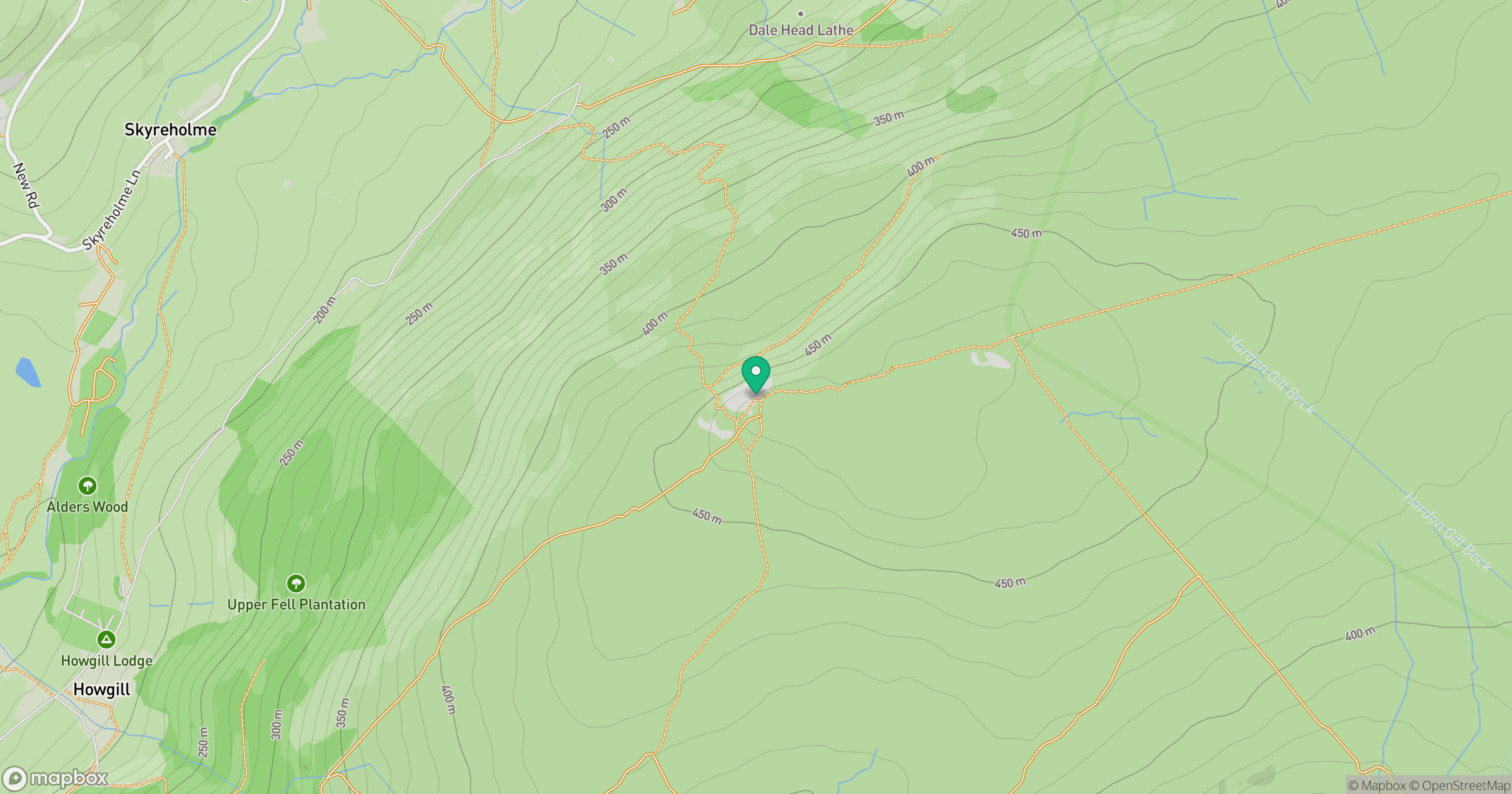
Grid reference: SE078598
View on OpenStreetMapOpens a map in a new tab, centred on the hill.
Nearby Hills
Rombalds Moor [Ilkley Moor]
402m
Buckden Pike
702m

Pen-y-ghent
694m

Pendle Hill
557m

Ingleborough
723m
No comments yet. Be the first.