

Skipton Moor
Good walks are even better shared.
SE0150 : Vicar's Allotment
Chris Heaton Photo source
Overview
Skipton Moor: A Natural Gem in the Yorkshire Dales
Nestled within the stunning expanse of the Yorkshire Dales, Skipton Moor offers outdoor enthusiasts a quaint yet invigorating hiking experience. At an elevation of 420 meters, it isn’t the highest peak, but don’t let that fool you; it certainly holds its own with splendid views and rugged charm.
Geology
The geology of Skipton Moor is predominantly defined by millstone grit, renowned for its sturdiness and distinctive formations. The area is dotted with limestone outcrops and expansive peat bogs, which play a crucial role in the local ecosystem, acting as sponges that help regulate water flow within the region.
Routes
One of the most popular routes is the Skipton Moor Circular Walk, a moderate 9.5 km trek that welcomes you to explore the natural beauty that abounds. Expect this route to take about three hours, perfect for a leisurely day out, unless you stop for too many snacks along the way—no judgment here!
Summit Features
A prominent feature at the summit is a stone cairn, where many hikers have added their own stones throughout the years, alongside a modern trig point—perfect for achieving that Instagram aesthetic of you with the glorious Yorkshire landscape behind.
Terrain Type
The terrain is an amalgamation of rocky paths, heathland, and, of course, those cheeky boggy areas that seem to delight in ambushing unsuspecting hikers. Be warned: a pair of sturdy boots is recommended to navigate the sometimes squelchy ground!
Views
The panoramic views from Skipton Moor are nothing short of spectacular. On a good day, look out for rolling hills and distant peaks like Pen-y-Ghent and Ingleborough. Early autumn and late spring are prime times to witness the diverse colours of the Yorkshire Dales in all their glory.
Hazards
Although its beauty is undeniable, hikers should remain vigilant. The moor can be prone to sudden changes in weather, and fog can sneak in faster than a Yorkshire pudding out of the oven. There are also slippery rocks and boggy patches that can turn your hike into an unplanned game of hopscotch.
Access
Accessing Skipton Moor is relatively straightforward. You’ll find parking at Bracewell, just a stone’s throw from the trailhead. If you prefer to leave the car at home, the bus services from Skipton provide a convenient drop-off in the vicinity.
Facilities
After a satisfying hike, feel free to head back to Skipton, where a plethora of cafes and pubs await to serve you a well-deserved pint or a slice of cake, because who doesn’t deserve a little treat after a good trek?
History
The name ‘Skipton’ itself is steeped in rich history, tracing back to Old Norse origins. This highlights the area's connection to waterways and commerce from centuries past. Today, Skipton Moor is revered not just for its natural beauty, but also for the role it plays in enjoying and preserving the cultural heritage of the Yorkshire Dales.
In conclusion, whether you are an avid hiker or just someone looking to stretch their legs, Skipton Moor welcomes you with open arms—and perhaps a bit of squelch underfoot! Happy hiking!
Explore routes near Skipton Moor
Walks starting near this hill. Open a route to check its map, distance and full itinerary.
Skipton to Gargrave Canal Walk
View route
Silsden to Kildwick Canal Walk
View route
Bolton Abbey: Strid Wood and Barden Bridge Circuit
View route
St Ives Reservoir and Water Garden Loops
View route
Route planning notes
These notes describe possible approaches. Check a route's map and access information when planning your walk.
Skipton Moor Circular Walk
A moderate circular route commencing from the village of Bracewell, offering scenic views and the opportunity to explore the surrounding area.
Make a day of it, together
Find someone to share the walk with, or organise a day out along a route you like.
Photo Gallery
View all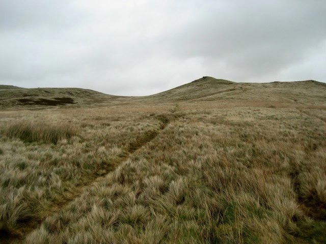 Photo could not load
SE0150 : Vicar's Allotment
Chris Heaton
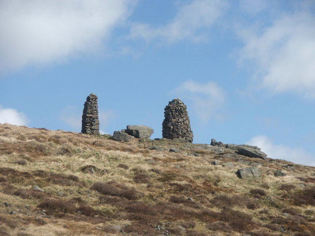 Photo could not load
SE0150 : Cairns on Skipton Moor.
Steve Partridge
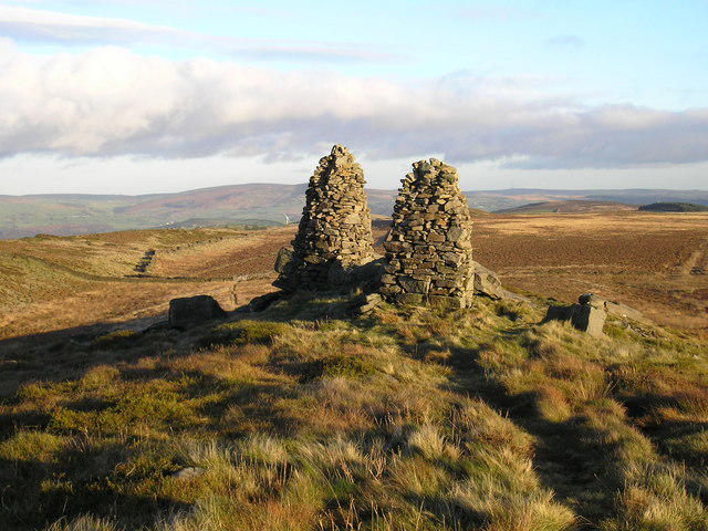 Photo could not load
SE0150 : Cairns on Skipton Moor
John Illingworth
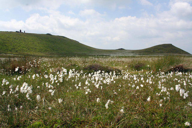 Photo could not load
SE0150 : Cotton Grass on Skipton Moor
Roger Templeman
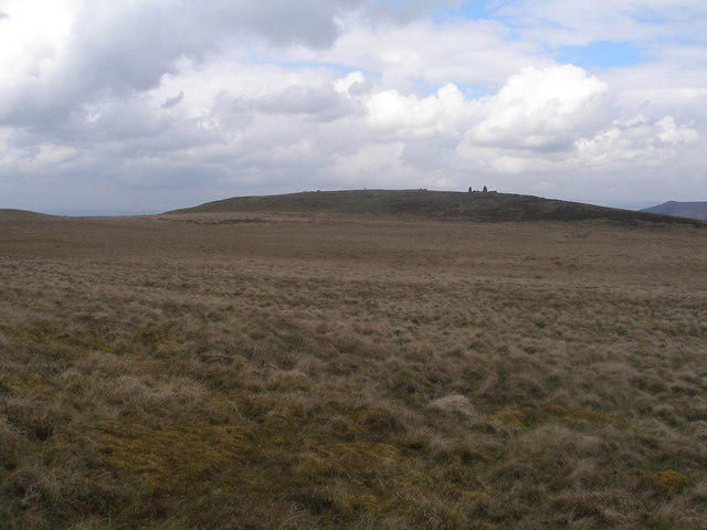 Photo could not load
SE0150 : Vicar's Allotment
John Slater
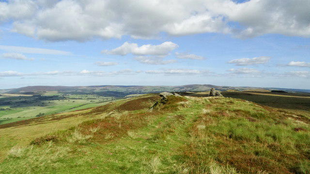 Photo could not load
SE0150 : At Vicar's Allotment, Skipton Moor - view towards cairn
Colin Park
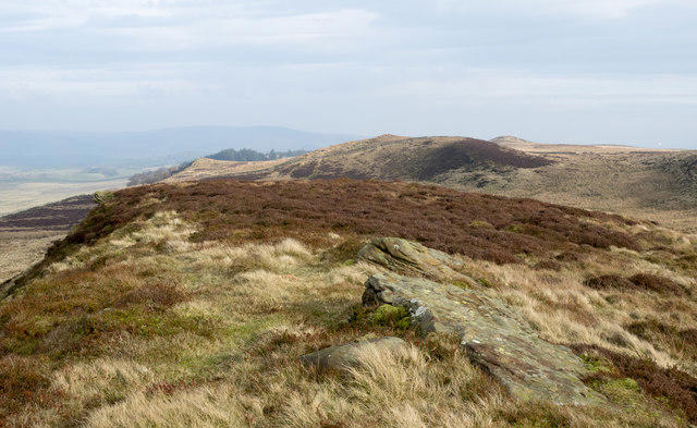 Photo could not load
SE0151 : Rocks of ridge on Skipton Moor
Trevor Littlewood
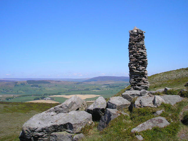 Photo could not load
SE0150 : Cairn on Skipton Moor
John Illingworth
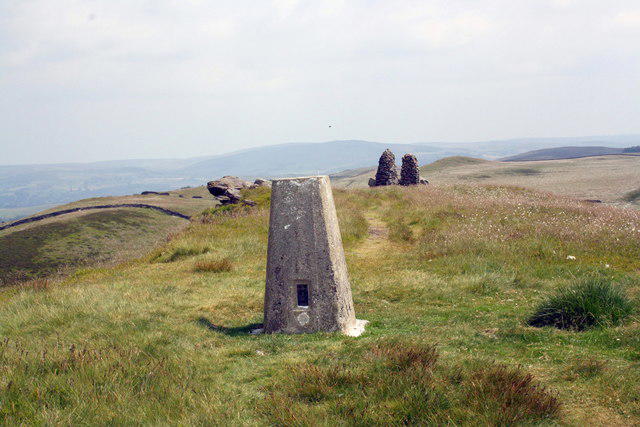 Photo could not load
SE0150 : Trig point and cairns on Vicar's Allotment
Roger Templeman
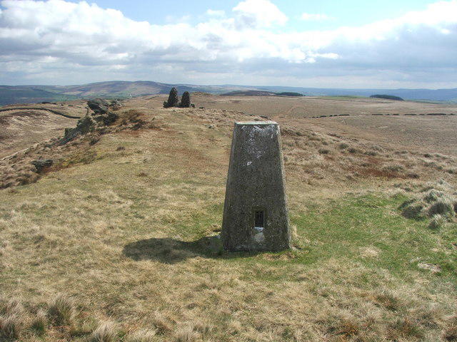
SE0150 : Trig point and cairns on Skipton Moor.
Steve Partridge
Hill facts and local notes
Classifications
Elevation
373m
1,224 ft
Prominence
137m
Coordinates
53.9542, -1.9806
SE013509
OS Map
104
Explorer: OL2S OL21N
At the Summit
The summit boasts a small stone cairn as well as a modern trig point, both of which make fine landmarks for your summit selfie!
Terrain & Geology
The moor is primarily composed of millstone grit, giving rise to its characteristic rugged terrain. Occasional limestone formations can be seen, alongside expansive peat bogs, which accumulate organic matter over thousands of years.
Views & Scenery
From the summit, hikers can enjoy breathtaking views of the surrounding Yorkshire Dales, including Pen-y-Ghent and Ingleborough. On a clear day, the peaks of the South Pennines can also be spotted.
History & Heritage
Name Origin
The name 'Skipton' originates from Old Norse 'skip' meaning boat and 'tun' meaning town, hinting at the area's historical connections to water transport.
Historical Significance
Skipton Moor has been a popular recreational area for locals and visitors alike, treasured for its natural beauty and wildlife.
Getting There & Facilities
Parking
There is a small car park at Bracewell, just a short walk from the start of the circular route.
Public Transport
The nearest bus service runs from Skipton to Bracewell, with a pleasant ride to start your adventure.
Nearby Facilities
While there are no facilities directly on the moor, the town of Skipton offers numerous cafes, pubs, and toilets to prep before or recap after your hike.
Safety Information
Known Hazards
- Moorland conditions can be unpredictable, and fog can roll in quite quickly. Be wary of slippery rocks and boggy patches which can cause mischief for unsuspecting hikers.
General Safety Tips
- Check weather conditions before setting out
- Carry appropriate clothing and equipment
- Let someone know your planned route
- Take a map, compass, and GPS device
- Carry emergency supplies: food, water, first aid kit, torch
Hills
Some common questions about the hills answered
Are there group walks up Skipton Moor?
Many walkers use Walkmates to join or organise walks with others. You can check for group walks around Skipton Moor through the maps
Are there other walkers around Skipton Moor?
Activity varies by location and time, but Walkmates lets you see whether others have shared walks or shown interest in this area. Find other people through the walking friends search walking friends for Skipton Moor search or of course create your own walk for Skipton Moor
Can I organise a walk to Skipton Moor?
Yes. If there aren’t any walks listed already, you can create a walk and make it available for others to join.
If you're signed up to Walkmates, you can create a walk to Skipton Moor.
How do I find a walk up this hill?
There are often multiple ways to walk this hill, depending on experience and route preference. Walkmates helps you explore walks and routes that others have shared.
Can I suggest a new route up Skipton Moor?
Yes. You can suggest or create routes to share with others. Walkmates focuses on the social side of walking, so routes are used to help people organise walks and explore areas together, rather than as detailed navigation tools or route libraries.
Other uses really appreciate knowledgeable walkers sharing their routes. Share your favourite route to Skipton Moor here
The is an error or something incorrect about this hill. How do I let you know?
We always strive to keep the information on Walkmates as accurate as possible. If you find an error, please let us know through the contact form and we'll aim to correct it as quickly as possible
Community Discussion
Comments
Location
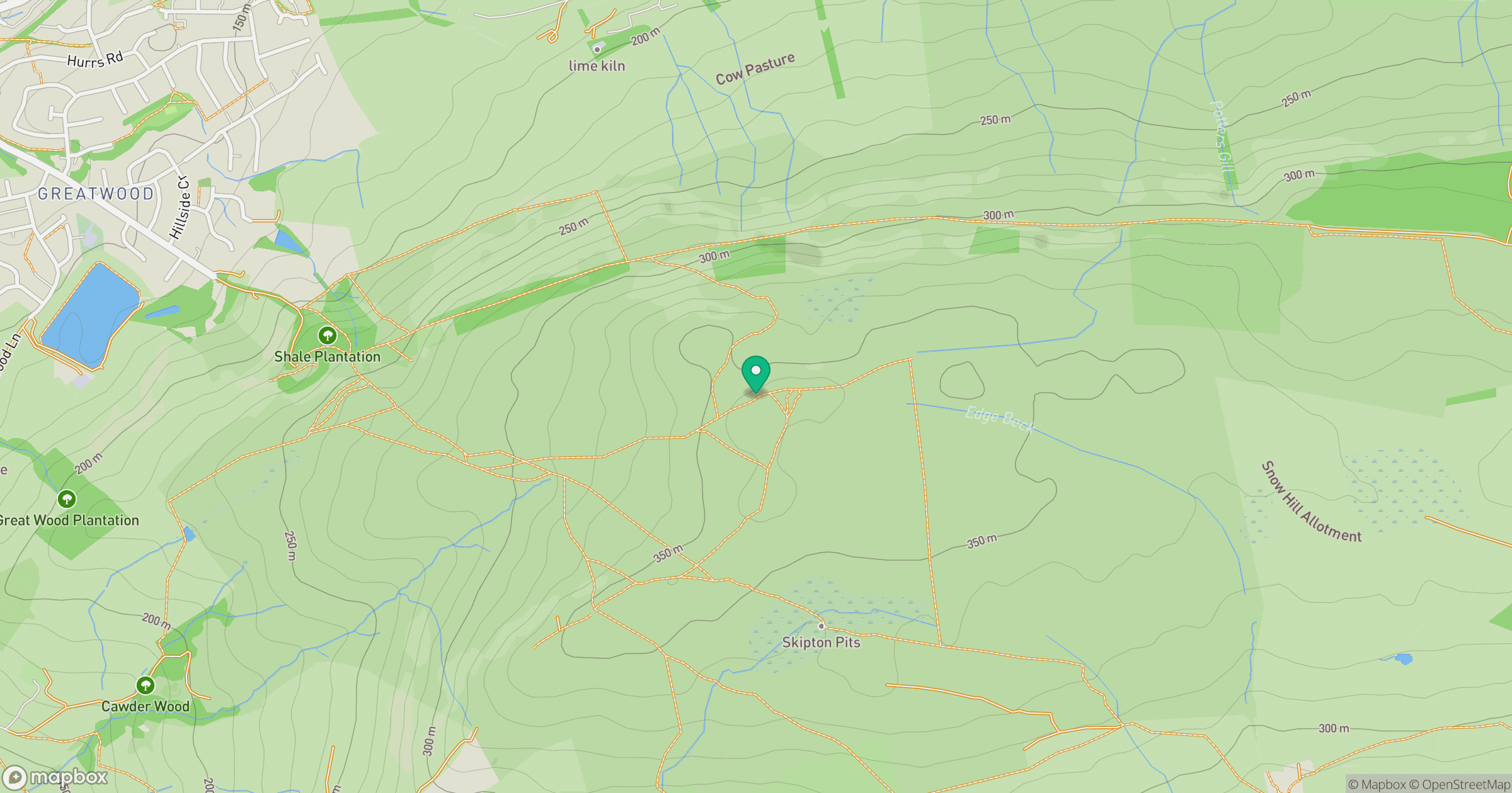
Grid reference: SE013509
View on OpenStreetMapOpens a map in a new tab, centred on the hill.
Nearby Hills
Rombalds Moor [Ilkley Moor]
402m
Buckden Pike
702m

Pendle Hill
557m

Pen-y-ghent
694m

Ingleborough
723m
No comments yet. Be the first.