

Sidhean nan Ealachan
Good walks are even better shared.
Overview
Sidhean nan Ealachan
Sidhean nan Ealachan, at a respectable 705 meters, stands proudly in the breathtaking Scottish Highlands. Its name, meaning 'The Fairy Hill of the Swans', hints at the enchanting narratives rooted in local folklore. As you approach this Marilyn, the landscape unfolds like an ancient storybook, with each rock and glen contributing to its rich tapestry.
Geology
The mountain boasts fascinating geology, predominantly made up of schist. This metamorphic rock tells a story of massive geological changes over millions of years. The sharply defined ridges and rugged terrain create a dramatic silhouette against the sky, a visual treat for any hiking enthusiast.
Routes
One of the most popular hiking routes is the North Glen Gyle Route. This 8-kilometre journey is wonderfully scenic, allowing you to take in the enchanting views as you traverse the hills. Approximately 3.5 hours is needed to reach the summit, making it suitable for those looking for a moderately challenging adventure. But let’s be honest, the best kind of exercise is always followed by a good meal!
Summit Features
Reaching the summit reveals a quaint stone cairn and sublime panoramic views. Prepare your camera; this spot is perfect for those 'look what I did today' photos!
Terrain
The terrain is a mix of grassy expanses dotted with rocky outcrops. While it presents a relatively gentle ascent, it can get a bit choppy in places – just the Highlands showing off its rugged charm.
Views
The splendid vistas from the top include iconic landmarks such as Loch Katrine and the mystical reach of the Trossachs National Park. It is best to hike during late spring or early autumn for breathtaking colours and clear views – ideal for any nature lover's Instagram feed.
Hazards
As with any Highland adventure, be mindful of some hazards. The rocky sections can be slippery, particularly in wet conditions. A good pair of hiking boots is your best friend here, and always be prepared for Scotland’s notorious weather changes.
Nearby Summits
Don't miss the opportunity to explore nearby heights, including Ben Venue and Ben Lomond, each presenting their own challenges and rewards. They say variety is the spice of life, after all!
Access
The nearest parking area is located at North Glen Gyle, convenient for starting your quest up the hill. For those relying on public transport, buses run from Aberfoyle multiple times a day. The friendly little town of Aberfoyle also offers cafes where you can fuel up before your trek.
Facilities
While there are no facilities on the mountain itself, Aberfoyle has you covered with local cafes and toilets. Remember, a true explorer should never venture out on an empty stomach nor should they forget to heed nature’s call!
History
The mountain’s name resonates with a charming etymology, invoking the spirit of fairytales and local lore. Historically, it has carved its niche in the cultural backdrop of the region, often associated with nature and myth.
Last updated: 2023-10-05
Source: Various local hiking guides and geological surveys
Explore routes near Sidhean nan Ealachan
Public walks starting within 80 km of this hill. Nearby does not mean a route reaches the summit; check its map and access before setting out.
Ben Klibreck
View route
Fairy Lochs Liberator Wreckage Circuit
View route
Loch Migdale from Torroy: Spinningdale pinewood and loch shore walk
View route
Beinn Eighe Lancaster Wreckage at Coire Mhic Fhearchair
View route
Route planning notes
These notes describe possible approaches, not verified navigable routes or permission to cross land. Check current paths, local access rules and conditions before setting out.
North Glen Gyle Route
This scenic route starts from North Glen Gyle, offering a relatively straightforward ascent with breathtaking views of the surrounding landscapes.
Make a day of it, together
Find someone to share the walk with, or organise a day out along a route you like.
Photo Gallery
View all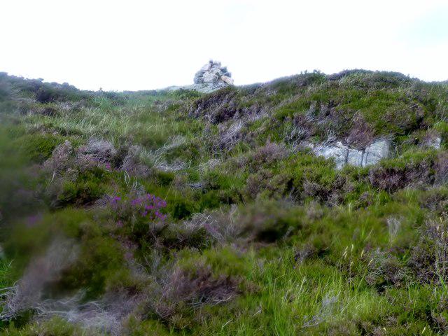 Photo could not load
NC0834 : Sìdhean nan Ealachan, Oldany Island
Rude Health
Hill facts and local notes
Classifications
Elevation
104m
341 ft
Prominence
104m
Coordinates
58.2605, -5.2640
NC086348
OS Map
15
Explorer: 442W
At the Summit
At the summit, expect to find a small stone cairn, a traditional feature marking the highest point. There's also a stunning panorama that greets the adventurous climber.
Terrain & Geology
Sidhean nan Ealachan is primarily composed of schist, a metamorphic rock that showcases the geological complexities of the region. The landscape reflects ancient geological processes, with its rugged appearance and the sharp ridges visible from various points across the Highlands.
Views & Scenery
From the summit, hikers can enjoy impressive views of the Trossachs National Park, Loch Katrine, and even glimpses of the distant Ben Lomond. On clear days, the landscape stretches out like a green quilt.
History & Heritage
Name Origin
The name 'Sidhean nan Ealachan' translates to 'The Fairy Hill of the Swans', embodying the enchanting lore that envelops this beautiful area.
Historical Significance
The mountain holds cultural significance in local folklore and is referenced in numerous tales, often associated with nature and mythical beings.
Getting There & Facilities
Check current local access restrictions, parking rules and transport timetables before travelling. These notes do not confirm public access to the summit.
Parking
There is a small car park near North Glen Gyle which can accommodate a limited number of vehicles. Keep an eye out for parking signs on the approach road.
Public Transport
The nearest public transport is available from Aberfoyle, with bus services operating several times a day. Check local schedules ahead of your visit.
Nearby Facilities
While there are no facilities directly on the mountain, Aberfoyle features several cafes, and public toilets, and is a good hub for supplies.
Safety Information
Known Hazards
- Potentially slippery rocky sections, especially in wet conditions. Always watch where you step and be mindful of sudden weather changes typical in the Highlands.
General Safety Tips
- Check weather conditions before setting out
- Carry appropriate clothing and equipment
- Let someone know your planned route
- Take a map, compass, and GPS device
- Carry emergency supplies: food, water, first aid kit, torch
Hills
Some common questions about the hills answered
Are there group walks up Sidhean nan Ealachan?
Many walkers use Walkmates to join or organise walks with others. You can check for group walks around Sidhean nan Ealachan through the maps
Are there other walkers around Sidhean nan Ealachan?
Activity varies by location and time, but Walkmates lets you see whether others have shared walks or shown interest in this area. Find other people through the walking friends search walking friends for Sidhean nan Ealachan search or of course create your own walk for Sidhean nan Ealachan
Can I organise a walk to Sidhean nan Ealachan?
Yes. If there aren’t any walks listed already, you can create a walk and make it available for others to join.
If you're signed up to Walkmates, you can create a walk to Sidhean nan Ealachan.
How do I find a walk up this hill?
There are often multiple ways to walk this hill, depending on experience and route preference. Walkmates helps you explore walks and routes that others have shared.
Can I suggest a new route up Sidhean nan Ealachan?
Yes. You can suggest or create routes to share with others. Walkmates focuses on the social side of walking, so routes are used to help people organise walks and explore areas together, rather than as detailed navigation tools or route libraries.
Other uses really appreciate knowledgeable walkers sharing their routes. Share your favourite route to Sidhean nan Ealachan here
The is an error or something incorrect about this hill. How do I let you know?
We always strive to keep the information on Walkmates as accurate as possible. If you find an error, please let us know through the contact form and we'll aim to correct it as quickly as possible
Community Discussion
Comments
Location
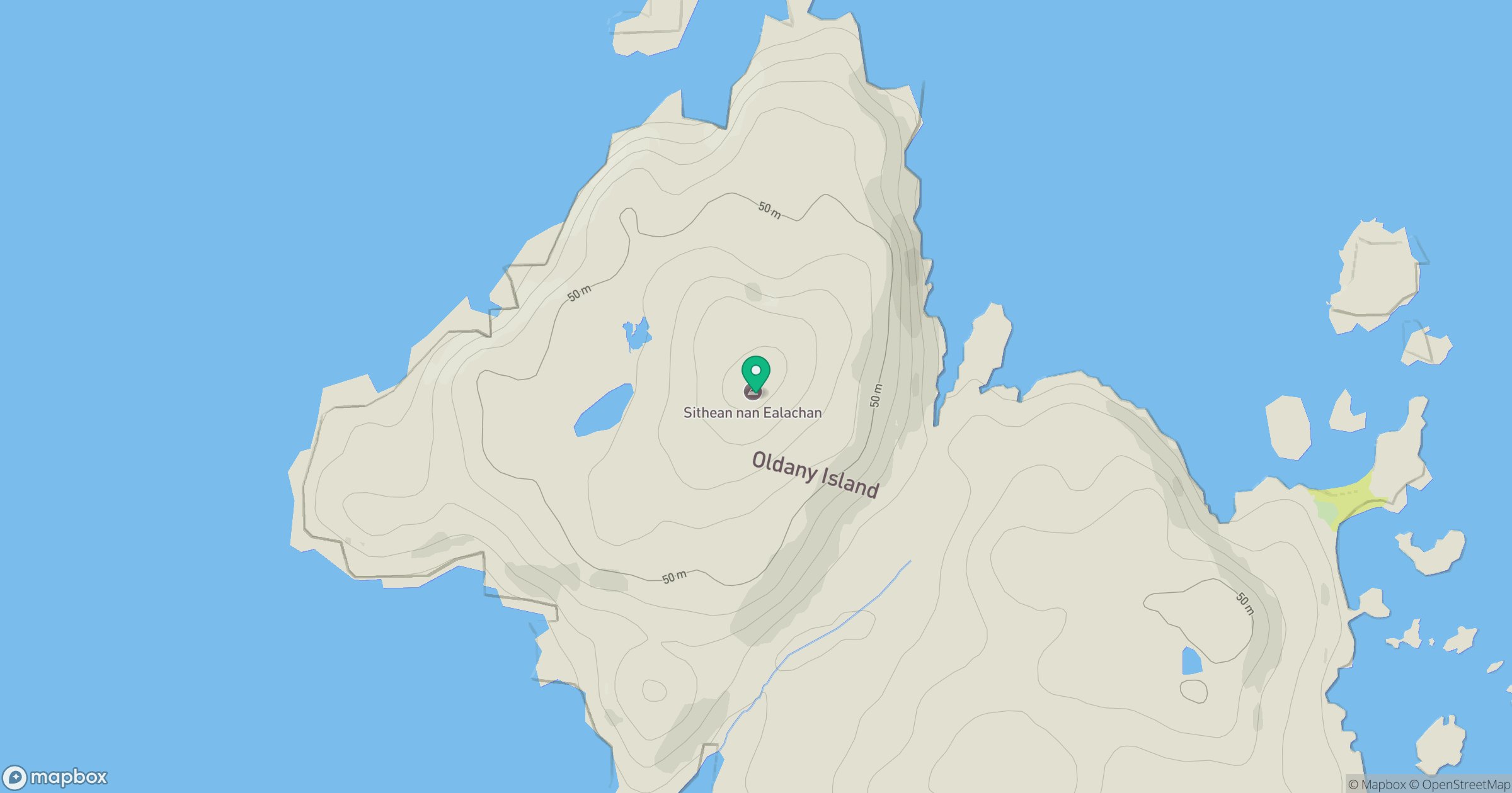
Grid reference: NC086348
View on OpenStreetMapOpens a map in a new tab, centred on the hill.
Hills within 30 km
Straight-line distance, not a walking route or confirmation of access.
Suilven
731m
Quinag - Sail Ghorm [Sail Gorm]
776m
Quinag - Spidean Coinich
764m
Quinag - Sail Gharbh
809m
Stac Pollaidh
612m
No comments yet. Be the first.