

Stac Pollaidh
Good walks are even better shared.
NC1010 : Cùl Mòr and Cùl Beag from the ridge of Stac Pollaidh
Stephen Crawshaw Photo source
Overview
Stac Pollaidh is a 612.4 m sandstone hill in Coigach above Loch Lurgainn. Its circuit and ridge viewpoints look across Assynt and the Summer Isles. The western true summit requires exposed scrambling and is separate from the usual hillwalk.
Stac Pollaidh
Stac Pollaidh rises above Loch Lurgainn in Coigach. Its surveyed height is 612.4 m, and the catalogue lists it as a Marilyn, Graham and Simm. The familiar castellated skyline is Torridonian sandstone over older Lewisian gneiss.
Circuit and ridge viewpoints
Start at Stac Pollaidh car park, NC107095. Cross the road and follow the constructed path around the eastern flank to the fork north of the hill. For the ridge col, take the steep uphill branch. The eastern high point is optional and requires a short scramble. Return down to the fork, then follow the circuit around the western flank, rejoin the outward path and descend to the same car park.
This ridge circuit is about 4.5 km with 510 m ascent; allow 2–4 hours. The western part of the circuit is rougher and wetter. Walkers can instead retrace the eastern approach from the fork. Those remaining on the lower circuit omit the ridge ascent; the ridge-circuit figures do not describe that shorter option.
The true summit
The western summit is a separate technical objective, with exposed scrambling and potentially serious falls. The hillwalking route above does not reach it. A rock beside a cairn marks the surveyed high point. Do not treat an ordinary ridge viewpoint walk as a summit ascent.
Landscape and access
Weathered sandstone towers rise above lochs and rocky moorland in the Assynt–Coigach landscape. Established paths help protect slopes damaged by earlier direct ascents.
The car park is beside Loch Lurgainn on the Achiltibuie road, with charged parking and toilets. D&E Coaches lists limited weekday 811/811A services at Stac Pollaidh Car Park; check the current school-day or holiday timetable and your return journey. Bring supplies for the hill. Snow, ice, wind and poor visibility can greatly increase the difficulty.
Sources
Explore routes near Stac Pollaidh
Walks starting near this hill. Open a route to check its map, distance and full itinerary.
Ben Klibreck
View route
Fairy Lochs Liberator Wreckage Circuit
View route
Beinn Eighe Lancaster Wreckage at Coire Mhic Fhearchair
View route
Loch Migdale from Torroy: Spinningdale pinewood and loch shore walk
View route
Route planning notes
These notes describe possible approaches. Check a route's map and access information when planning your walk.
Stac Pollaidh circuit and ridge viewpoints
From Stac Pollaidh car park (NC107095), cross the road and follow the east-flank path to the north-side fork. Climb to the ridge col; the eastern high point adds a short scramble. Retrace to the fork, continue round the west flank and rejoin the outward path back to the car park. Allow 2–4 hours for this 4.5 km ridge circuit with about 510 m ascent. It excludes the technical western true summit.
Make a day of it, together
Find someone to share the walk with, or organise a day out along a route you like.
Photo Gallery
View all Photo could not load
NC1010 : Cùl Mòr and Cùl Beag from the ridge of Stac Pollaidh
Stephen Crawshaw
 Photo could not load
NC1010 : Stac Pollaidh, Suilven, Canisp and Quinag
Anne Burgess
 Photo could not load
NC1010 : Cùl Mòr, Cùl Beag and Stac Pollaidh
Anne Burgess
 Photo could not load
NC1010 : Stac Pollaidh
John Allan
 Photo could not load
NC1010 : On top of Stac Pollaidh looking east
russell
 Photo could not load
NC1010 : On Stac Pollaidh's summit ridge
Gordon Hatton
 Photo could not load
NC1010 : Stac Pollaidh from the south east
Nigel Brown
 Photo could not load
NC1010 : Stac Pollaidh in Winter
Ike Gibson
 Photo could not load
NC1010 : West Face of Stac Pollaidh
Adam Ward

NC1010 : The airy summit ridge of Stac Pollaidh
Alan Reid
Hill facts and local notes
Classifications
Elevation
612m
2,009 ft
Prominence
440m
Coordinates
58.0441, -5.2085
NC107106
OS Map
15
Explorer: 439E
At the Summit
Rock beside a cairn on the western summit, 612.4 m. This is reached by exposed technical scrambling. The ridge col and eastern viewpoint reached from the walking path are lower points.
Terrain & Geology
Torridonian sandstone and conglomerate, deposited by rivers about one billion years ago, form the hill. These rocks overlie much older Lewisian gneiss. Weathering has broken the ridge into towers and pinnacles, with scree and fallen blocks below.
Views & Scenery
The paths and ridge viewpoints overlook Loch Lurgainn, the Assynt hills including Cul Beag, Cul Mor and Suilven, and the Summer Isles. Loch Sionascaig lies to the north-west.
History & Heritage
Name Origin
The North West Highlands Geopark interprets Stac Pollaidh as “the pinnacle of the pool river”, from Norse Stakkr Pollå. Stac Polly is a common anglicised spelling.
Historical Significance
Heavy use once eroded the direct southern ascent. A constructed path now approaches around the eastern flank to reduce damage. Use the established paths rather than cutting across recovering slopes.
Getting There & Facilities
Parking
Use Stac Pollaidh car park beside Loch Lurgainn on the Achiltibuie road, at NC107095. Cross the road for the hill path. Parking is charged and toilets are provided; check the Outdoor Access Trust for Scotland for current charges. Keep the single-track road and passing places clear.
Public Transport
D&E Coaches lists limited weekday services 811/811A between Ullapool and Coigach, stopping at Stac Pollaidh Car Park. School-day and holiday timetables differ. Check the operator’s current timetable and both outward and return journeys before setting off.
Nearby Facilities
The trailhead car park has off-grid toilets. Bring food, water and hillwalking equipment. Ullapool is the main nearby service town.
Safety Information
Known Hazards
- The western true summit requires exposed technical scrambling, with serious falls possible. It is unsuitable as a normal walking continuation.
- Loose or wet sandstone, steep steps and boggy or eroded path sections require care.
- Strong winds and low cloud can make the ridge hazardous. Be prepared to turn back.
Seasonal Hazards
Snow and ice make the steep path and rocky ridge substantially more serious. Winter conditions require suitable skills and equipment, and short daylight leaves less time for the return.
General Safety Tips
- Check weather conditions before setting out
- Carry appropriate clothing and equipment
- Let someone know your planned route
- Take a map, compass, and GPS device
- Carry emergency supplies: food, water, first aid kit, torch
Hills
Some common questions about the hills answered
Are there group walks up Stac Pollaidh?
Many walkers use Walkmates to join or organise walks with others. You can check for group walks around Stac Pollaidh through the maps
Are there other walkers around Stac Pollaidh?
Activity varies by location and time, but Walkmates lets you see whether others have shared walks or shown interest in this area. Find other people through the walking friends search walking friends for Stac Pollaidh search or of course create your own walk for Stac Pollaidh
Can I organise a walk to Stac Pollaidh?
Yes. If there aren’t any walks listed already, you can create a walk and make it available for others to join.
If you're signed up to Walkmates, you can create a walk to Stac Pollaidh.
How do I find a walk up this hill?
There are often multiple ways to walk this hill, depending on experience and route preference. Walkmates helps you explore walks and routes that others have shared.
Can I suggest a new route up Stac Pollaidh?
Yes. You can suggest or create routes to share with others. Walkmates focuses on the social side of walking, so routes are used to help people organise walks and explore areas together, rather than as detailed navigation tools or route libraries.
Other uses really appreciate knowledgeable walkers sharing their routes. Share your favourite route to Stac Pollaidh here
The is an error or something incorrect about this hill. How do I let you know?
We always strive to keep the information on Walkmates as accurate as possible. If you find an error, please let us know through the contact form and we'll aim to correct it as quickly as possible
Community Discussion
Comments
Location
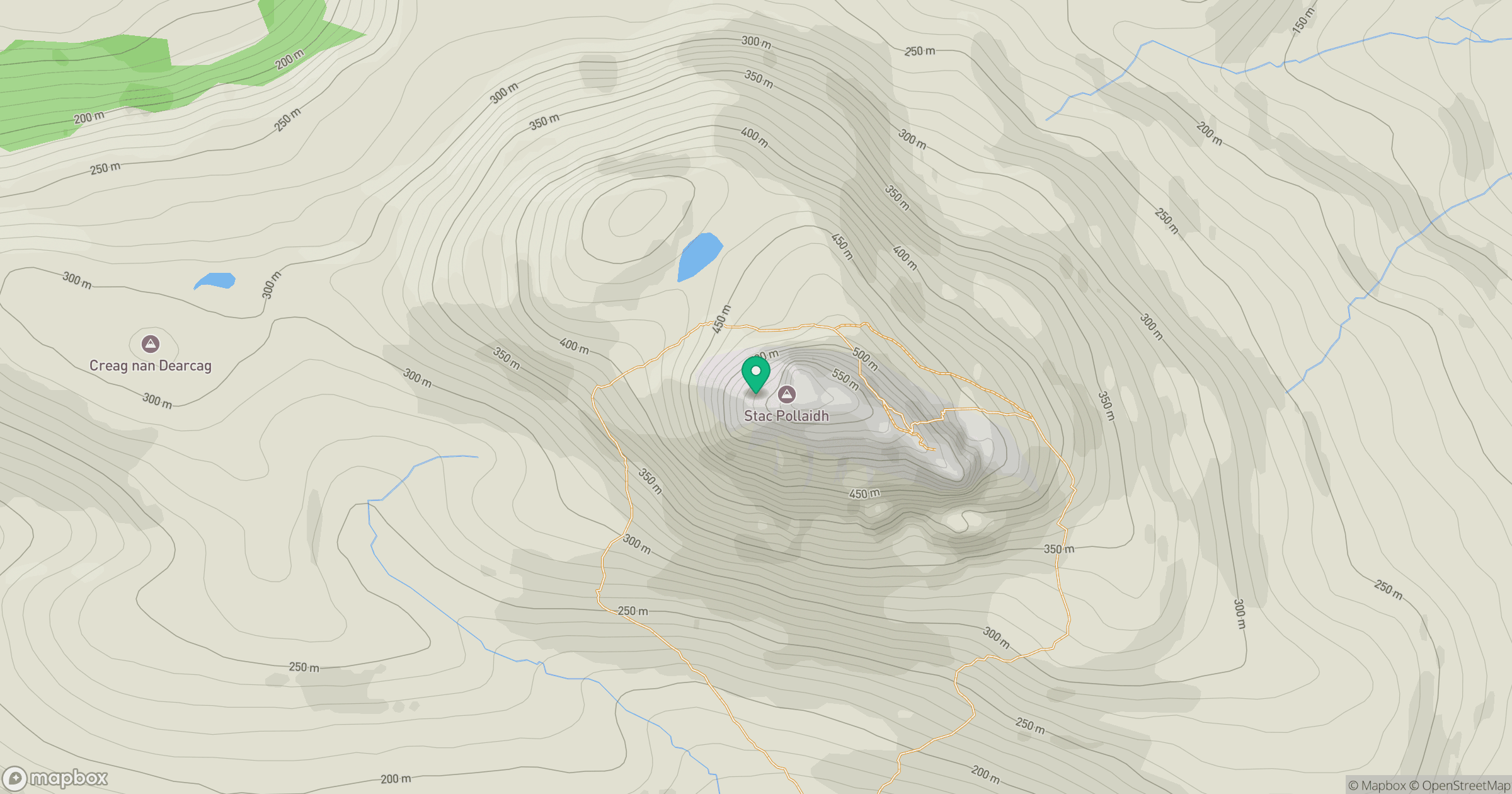
Grid reference: NC107106
View on OpenStreetMapOpens a map in a new tab, centred on the hill.
No comments yet. Be the first.