

Ben More Assynt
Good walks are even better shared.
NC3120 : Conival and Ben More Assynt
Richard Webb Photo source
Overview
Ben More Assynt is the 998.9 m main summit east of Conival in Assynt, Scotland. The high point is a quartzite outcrop; DoBIH records the cairn about 60 m south as probably lower. The normal Inchnadamph outing crosses both Munros and returns over Conival, involving a long day on very rough, rocky ground.
Ben More Assynt
DoBIH 1183 is the main summit, 998.9 m, at NC318201. Its high point is a quartzite outcrop. The cairn about 60 m south is probably lower; the West and South Tops are separate hills.
Returning routes
Both route cards begin and end at Inchnadamph and include Conival. The return crosses the same rocky ridge and reascends Conival before descending its north ridge into the glen. The remote south ridge is excluded.
The cave-mouth variant has a pathless link, a burn crossing and possible potholes. Its publisher’s ascent total is substantially higher than the normal-route figure and has not been independently reconciled. Figures remain attributed to their own complete itineraries. No midpoint time, winter time or standalone Ben More Assynt total has been invented. Do not enter the caves as part of this walk.
Geology and name
The summit is Cambrian quartz arenite, with Lewisian gneiss beneath a contact along the south ridge. The mountain lies in the Ben More Thrust Sheet. Smith’s place-name study interprets beinn mhòr Asainte as “great mountain of Assynt”; its directions and older summit grid are not used for navigation here.
Access and conditions
NatureScot recommends checking deer-management information throughout the year. Its Area 2 table, updated 1 September 2026 and checked 17 October 2026, marks Ben More Assynt and Conival as having no stalking information supplied. That is not clearance and does not mean there are no stalking issues. Follow current reasonable local advice and signs.
Check parking, any bus service and available facilities before travel. Rough ground, burn conditions, weather and limited daylight can affect the outing. Carry adequate provisions, navigation and mountain equipment.
Sources checked 17 October 2026. No field visit, mapped-track verification or current-conditions inspection is claimed.
Explore routes near Ben More Assynt
Walks starting near this hill. Open a route to check its map, distance and full itinerary.
Ben Klibreck
View route
Loch Migdale from Torroy: Spinningdale pinewood and loch shore walk
View route
Fairy Lochs Liberator Wreckage Circuit
View route
Beinn Eighe Lancaster Wreckage at Coire Mhic Fhearchair
View route
Route planning notes
These notes describe possible approaches. Check a route's map and access information when planning your walk.
Ben More Assynt and Conival from Inchnadamph (return)
Start and finish at the public car park by Inchnadamph Hotel, NC251216. Cross the River Traligill by the A837 bridge, take the lane past Inchnadamph Lodge and continue past Glenbain. Keep left at the cave-path fork. Ascend beside Allt a’ Choinne Mhill, cross the burn and negotiate the quartzite steps to the bealach between Conival and Beinn an Fhurain. Climb Conival’s north ridge, then traverse east over the rough intervening ridge to Ben More Assynt. Retrace the entire route, including reascending Conival, its north ridge and the glen, to the same car park. Walkhighlands gives 17.25 km, 1,077 m ascent and 8.5–10 hours for this two-Munro return. Cave detours and the remote south-ridge scramble are excluded.
Conival and Ben More Assynt with Traligill cave-mouth detours (return)
From Inchnadamph Hotel, NC251216, cross the River Traligill and pass Glenbain to the lower and upper Traligill cave mouths. Use the source’s pathless link and burn crossing to regain the north-bank path, then ascend via the Conival–Beinn an Fhurain bealach, Conival and the rocky ridge to Ben More Assynt. Reverse that same outward route, reascending Conival and returning via the cave-mouth detours to Inchnadamph. Scotland Off the Beaten Track reports 18 km, 1,490 m ascent and 8.5–9.5 hours. Its ascent is uncorroborated and 413 m higher than the main-route figure; the cause is unresolved. Do not transfer these totals between routes. Cave entry is excluded. Beware potholes and assess the burn crossing; no safe crossing is guaranteed.
Make a day of it, together
Find someone to share the walk with, or organise a day out along a route you like.
Photo Gallery
View all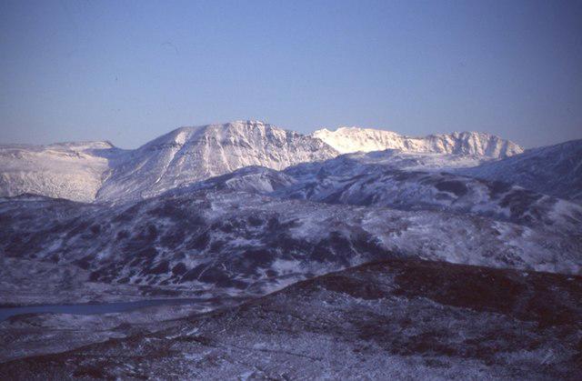 Photo could not load
NC3120 : Conival and Ben More Assynt
Richard Webb
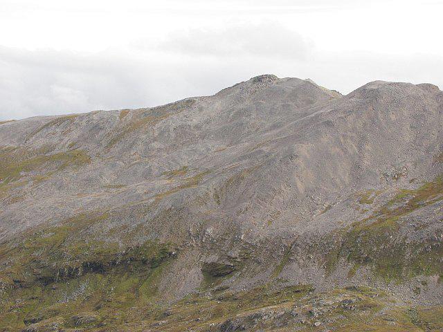 Photo could not load
NC3120 : Screes, Ben More Assynt
Richard Webb
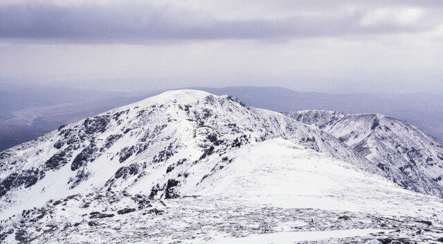 Photo could not load
NC3120 : Ridge heading south from summit of Ben More Assynt
Trevor Littlewood
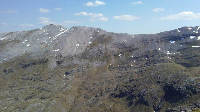 Photo could not load
NC3120 : Ben More Assynt from Na Tuadhan
Colin Park
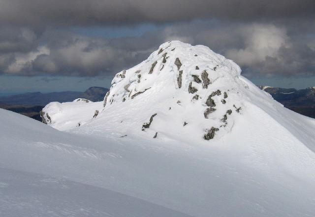 Photo could not load
NC3120 : Summit Ben More Assynt
Hill Walker
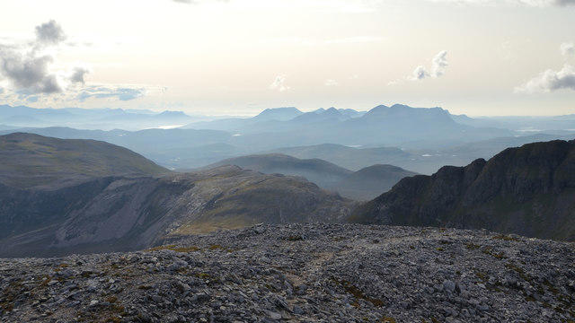 Photo could not load
NC3120 : View of Scottish Mountains from Ben More Assynt, Sutherland
Andrew Tryon
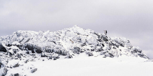 Photo could not load
NC3120 : Arriving at the summit of Ben More Assynt
Trevor Littlewood
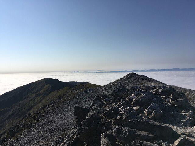 Photo could not load
NC3120 : Summit of Ben More Assynt
Steven Brown
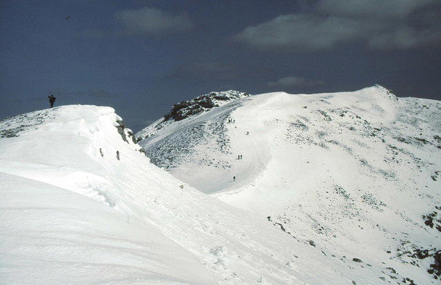 Photo could not load
NC3120 : Heading for Ben More Assynt
Russel Wills
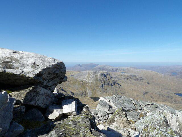 Photo could not load
NC3120 : On Ben More Assynt
David Bremner
Hill facts and local notes
Classifications
Elevation
999m
3,277 ft
Prominence
836m
Coordinates
58.1382, -4.8582
NC318201
OS Map
15
Explorer: 442E
At the Summit
DoBIH identifies the 998.9 m summit as a quartzite outcrop at NC 31832 20137. The cairn about 60 m south, at NC 31840 20084, is recorded as probably lower. No summit trig point is established by this record; West Top and South Top are separate summits.
Terrain & Geology
The BGS-hosted geological excursion identifies pebbly, cross-bedded quartz arenite of the Cambrian Basal Quartzite Member at the summit. Lewisian gneiss occurs beneath a contact along the south ridge. These contrasting rocks form part of the Ben More Thrust Sheet; describing the summit as primarily Lewisian gneiss is misleading.
Views & Scenery
In clear conditions the ridge gives views over Assynt and its lochs; Loch Assynt is visible on the Conival section and the cave-route source identifies an eastward view towards Loch Shin from Ben More Assynt. Cloud can remove these views.
History & Heritage
Name Origin
Gemma Smith’s Assynt place-name study gives the Gaelic form beinn mhòr Asainte, meaning “great mountain of Assynt”. The study is dated September 2019, revised November 2021.
Historical Significance
The Ben More Thrust Sheet is a subject of geological study. The BGS-hosted excursion describes the contact between Cambrian quartzite and underlying Lewisian gneiss and explains that a shear zone along that contact was incorrectly mapped as a sill on the 1923 Assynt Map.
Getting There & Facilities
Parking
The published routes start at the public car park by Inchnadamph Hotel, NC251216, beside the A837. Current availability and charges have not been verified; follow local parking signs and do not assume a space is available.
Public Transport
Route publishers describe bus access to Inchnadamph as limited or extremely infrequent. Verify current services and the return journey for the intended date before relying on public transport.
Nearby Facilities
Carry food, water and essential equipment for the whole mountain day. Current toilet, refreshment and accommodation opening arrangements at Inchnadamph have not been verified; check directly before relying on them.
Safety Information
Known Hazards
- Very rough boulders, scree and rock steps can make progress slow. The lower approach includes boggy and eroded ground.
- The return requires reascending Conival. The remote south ridge is a different scrambling route and is not an easier descent or part of either return described here.
- Poor visibility and changing weather increase navigation difficulty. Carry mountain navigation and emergency equipment and allow enough daylight.
- Burn crossings require an assessment on the day. The cave-mouth variant includes pathless ground and possible potholes; entering caves is excluded.
General Safety Tips
- Check weather conditions before setting out
- Carry appropriate clothing and equipment
- Let someone know your planned route
- Take a map, compass, and GPS device
- Carry emergency supplies: food, water, first aid kit, torch
Hills
Some common questions about the hills answered
Are there group walks up Ben More Assynt?
Many walkers use Walkmates to join or organise walks with others. You can check for group walks around Ben More Assynt through the maps
Are there other walkers around Ben More Assynt?
Activity varies by location and time, but Walkmates lets you see whether others have shared walks or shown interest in this area. Find other people through the walking friends search walking friends for Ben More Assynt search or of course create your own walk for Ben More Assynt
Can I organise a walk to Ben More Assynt?
Yes. If there aren’t any walks listed already, you can create a walk and make it available for others to join.
If you're signed up to Walkmates, you can create a walk to Ben More Assynt.
How do I find a walk up this hill?
There are often multiple ways to walk this hill, depending on experience and route preference. Walkmates helps you explore walks and routes that others have shared.
Can I suggest a new route up Ben More Assynt?
Yes. You can suggest or create routes to share with others. Walkmates focuses on the social side of walking, so routes are used to help people organise walks and explore areas together, rather than as detailed navigation tools or route libraries.
Other uses really appreciate knowledgeable walkers sharing their routes. Share your favourite route to Ben More Assynt here
The is an error or something incorrect about this hill. How do I let you know?
We always strive to keep the information on Walkmates as accurate as possible. If you find an error, please let us know through the contact form and we'll aim to correct it as quickly as possible
Community Discussion
Comments
Location
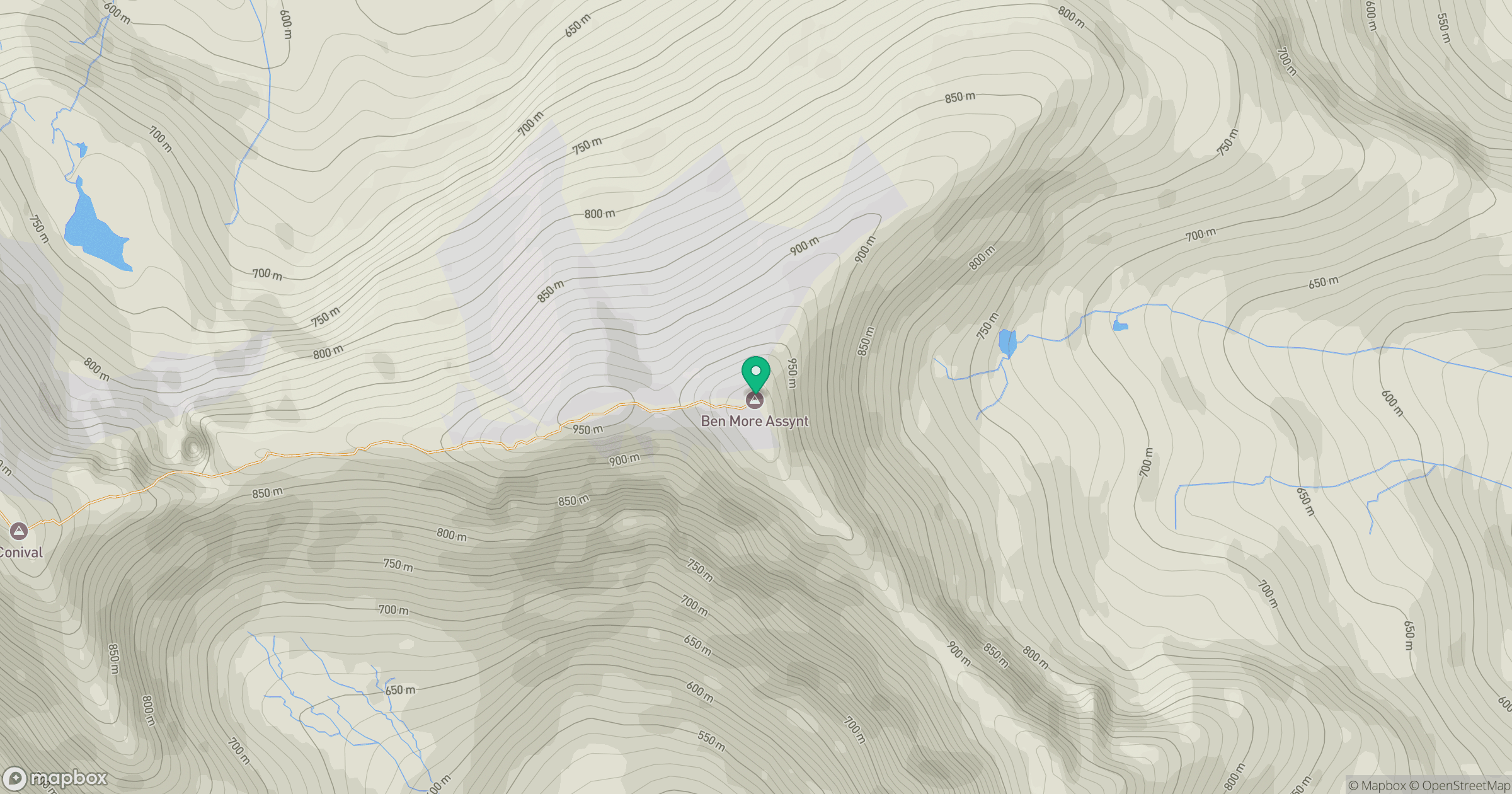
Grid reference: NC318201
View on OpenStreetMapOpens a map in a new tab, centred on the hill.
Nearby Hills
Canisp
847m
Quinag - Spidean Coinich
764m
Quinag - Sail Gharbh
809m
Ben Stack
721m
Quinag - Sail Ghorm [Sail Gorm]
776m
No comments yet. Be the first.