

Quinag - Spidean Coinich
Good walks are even better shared.
NC2027 : On Spidean Coinich, Sutherland
Andrew Tryon Photo source
Overview
Quinag - Spidean Coinich
Overview
Nestled within the enchanting surroundings of the Scottish Highlands, Quinag boasts its majestic peak known as Spidean Coinich. This Munro stands proud at 808 meters, offering an adventurous challenge for hikers looking for breathtaking views and a connection with nature.
Geology
Quinag is primarily made of Torridonian sandstone, creating a unique and dramatic landscape. The rock formations tell a tale that dates back millions of years, presenting an interesting study for geology enthusiasts. Much of the terrain varies significantly, adding an element of surprise with every step.
Routes
The most popular route is the Glen Cearnaic track. This moderate hike covers approximately 11.5 km and takes around 6 hours to complete. Starting from the parking area near Loch Assynt, hikers will find well-worn paths that lead into the heart of Quinag, through rocky outcrops and lush terrain.
Summit Features
Upon reaching the summit, adventurers are greeted by a substantial cairn, often used as a landmark by fellow hikers. The panoramic views from this vantage point are stunning and worth every drop of sweat.
Terrain
Expect a blend of rocky paths, patches of grass, and occasional bog; it’s all part of the authentic Highland experience. Good footwear is essential – no one enjoys soggy socks!
Views
The summit offers spectacular views over Loch Assynt and beyond, with notable peaks like Ben More Assynt and Conival appearing on the horizon. Spring and autumn are most favourable for clear visibility, allowing for picturesque landscapes that seem straight out of a storybook.
Hazards
While generally accessible, take care as the paths can be slippery following rain. Weather conditions change rapidly in the Highlands, so ensure you're well-prepared with suitable clothing and gear.
Access
Neatly tucked away near Inchnadamph, there’s a car park about 4 miles from Loch Assynt. If you're relying on public transport, keep in mind that services from Ullapool can be infrequent. Always check schedules in advance!
Facilities
While you'll need to pack your snacks for the mountain, Ullapool – the nearest town – offers several cafes and public toilets. It’s wise to be ready for a full day in the wild!
History
The name 'Quinag' likely translates to 'the mountain of the head', reflecting the prominence of its features. It's a beloved spot among outdoor enthusiasts and holds a special place in local folklore.
Conclusion
Quinag - Spidean Coinich is well worth the trek, providing a blend of exhilarating adventure, stunning views, and a rich slice of Scottish natural history. So lace up your boots and get ready to find out why this mountain is often regarded as a hidden gem in the Highlands!
Whether you’re after challenging hikes or leisurely strolls, Quinag offers something for every outdoor lover.
Happy hiking!
Explore routes near Quinag - Spidean Coinich
Walks starting near this hill. Open a route to check its map, distance and full itinerary.
Ben Klibreck
View route
Loch Migdale from Torroy: Spinningdale pinewood and loch shore walk
View route
Fairy Lochs Liberator Wreckage Circuit
View route
Beinn Eighe Lancaster Wreckage at Coire Mhic Fhearchair
View route
Route planning notes
These notes describe possible approaches. Check a route's map and access information when planning your walk.
Quinag - Spidean Coinich via Standard Route
This is the most popular route to the summit of Spidean Coinich, starting from the car park on the A894. The path is well-trodden and climbs steadily, offering stunning views of Loch Assynt and the surrounding landscape. The route involves some rocky sections but is manageable for most walkers with a reasonable level of fitness.
Quinag - Spidean Coinich and Sail Gharbh Circuit
This loop takes in two of Quinag's three summits, starting with Spidean Coinich and continuing to Sail Gharbh. From the A894 car park, ascend Spidean Coinich before following the ridge to Sail Gharbh. The descent loops around the base of Quinag, providing a full experience of this spectacular mountain massif.
Quinag - Spidean Coinich Sunrise Ascent
A shorter route designed for those looking to experience sunrise from the summit of Spidean Coinich. This route starts from the A894 car park and follows the standard ascent path. The early start is rewarded with breathtaking sunrise views over the surrounding Assynt and Sutherland landscapes.
Quinag Traverse - Full Ridge Walk
This demanding route covers the entire Quinag ridge, including all three summits: Spidean Coinich, Sail Gharbh, and Sail Ghorm. Starting from the A894 car park, this epic traverse offers panoramic views of Assynt's rugged landscape and is ideal for experienced walkers seeking a full-day adventure.
Quinag - Spidean Coinich Family Approach
A shorter, family-friendly version of the standard route. This ascent focuses on reaching the lower slopes and enjoying the scenic beauty of Quinag without attempting the full summit. Perfect for those with younger children or limited time.
Make a day of it, together
Find someone to share the walk with, or organise a day out along a route you like.
Photo Gallery
View all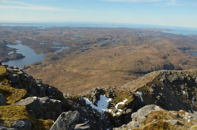 Photo could not load
NC2027 : On Spidean Coinich, Sutherland
Andrew Tryon
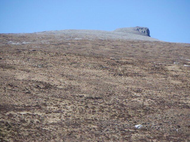 Photo could not load
NC2027 : Spidean Còintich
Richard Webb
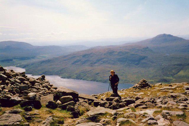 Photo could not load
NC2027 : Approaching the summit of Spidean Coinich
Gordon Hatton
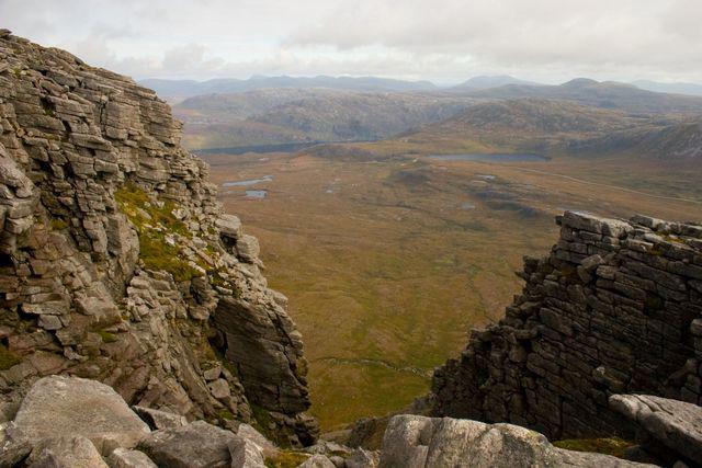 Photo could not load
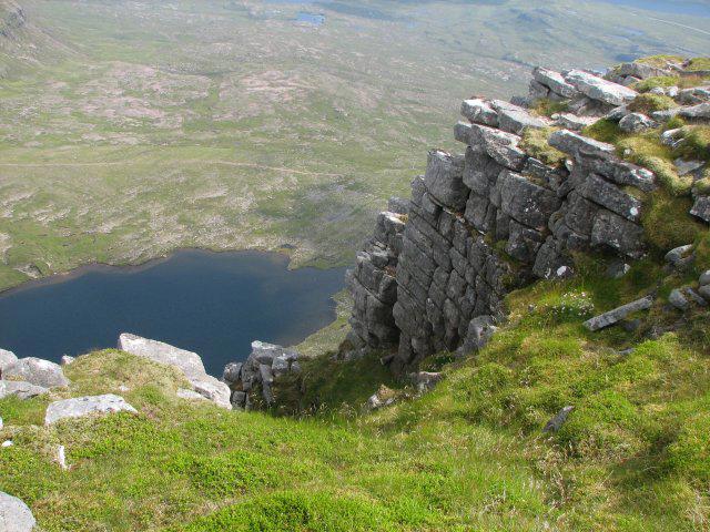
NC2027 : The crags of Spidean Coinich on Quinag
John Street
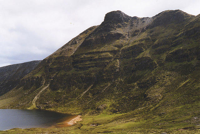 Photo could not load
NC2027 : Spidean Còinich from the north
Nigel Brown
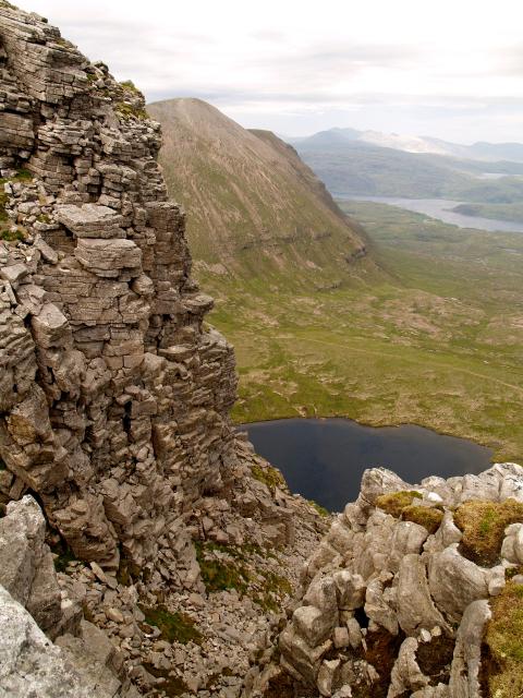 Photo could not load
NC2027 : SE ridge Spidean Còinich
Chris Eilbeck
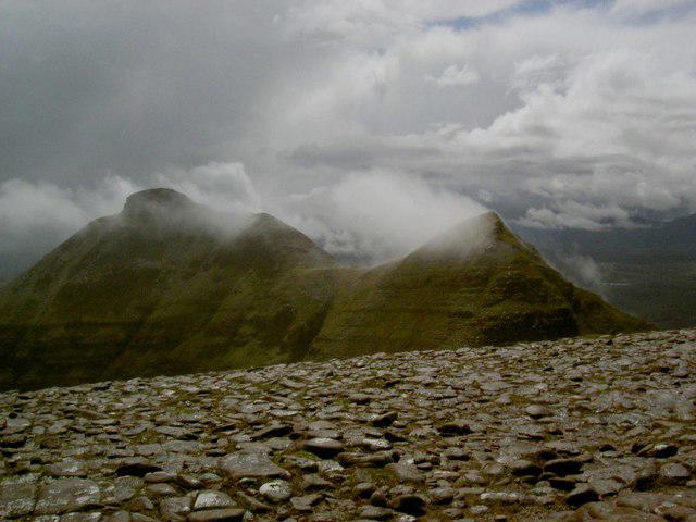 Photo could not load
NC2027 : South ridge of Quinag
Alan Reid
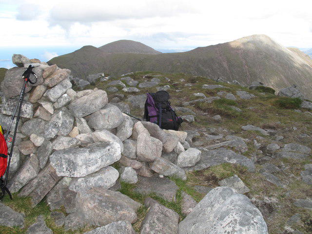 Photo could not load
NC2027 : Spidean Còinich, Quinag
Rude Health
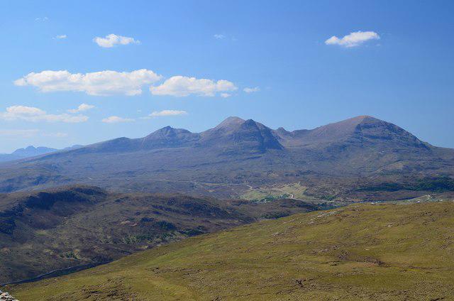 Photo could not load
NC2027 : Quinag from Beinn a' Ghrianain
Jim Barton
NC2027 : Spidean Còinich
Callum Black
Hill facts and local notes
Classifications
Elevation
764m
2,507 ft
Prominence
192m
Coordinates
58.2019, -5.0545
NC206277
OS Map
15
Explorer: 442E
At the Summit
At the summit, hikers will find a prominent cairn and spectacular panoramic views stretching across the rugged landscapes of Sutherland.
Terrain & Geology
The mountain is primarily composed of Torridonian sandstone, which gives rise to its rugged terrain. The varying rock formations offer a fascinating insight into the geological history of the region.
Views & Scenery
From the summit, you can see the breathtaking landscapes of Assynt and the distant peaks of the North West Highlands, including Ben More Assynt and the mysterious waters of Loch Assynt.
History & Heritage
Name Origin
The name 'Quinag' is reputed to translate to 'the mountain of the head', possibly referring to its prominent ridge.
Historical Significance
Quinag is often considered a hidden gem of the Scottish Highlands, cherished for its striking beauty and diverse wildlife, making it a favourite among hikers.
Getting There & Facilities
Parking
There is a car park located near the hamlet of Inchnadamph, about 4 miles from Loch Assynt. Make sure to arrive early during peak season as it can fill up quickly.
Public Transport
Buses run from the nearby town of Ullapool to Inchnadamph, although scheduling can be infrequent. Plan accordingly!
Nearby Facilities
There are a few cafes and toilets in Ullapool. While on the mountain, it's best to bring sufficient supplies as facilities are sparse.
Safety Information
Known Hazards
- Lochside terrains can be slippery after rain, ensure proper footwear. Weather can change rapidly, so bring appropriate gear.
General Safety Tips
- Check weather conditions before setting out
- Carry appropriate clothing and equipment
- Let someone know your planned route
- Take a map, compass, and GPS device
- Carry emergency supplies: food, water, first aid kit, torch
Hills
Some common questions about the hills answered
Are there group walks up Quinag - Spidean Coinich?
Many walkers use Walkmates to join or organise walks with others. You can check for group walks around Quinag - Spidean Coinich through the maps
Are there other walkers around Quinag - Spidean Coinich?
Activity varies by location and time, but Walkmates lets you see whether others have shared walks or shown interest in this area. Find other people through the walking friends search walking friends for Quinag - Spidean Coinich search or of course create your own walk for Quinag - Spidean Coinich
Can I organise a walk to Quinag - Spidean Coinich?
Yes. If there aren’t any walks listed already, you can create a walk and make it available for others to join.
If you're signed up to Walkmates, you can create a walk to Quinag - Spidean Coinich.
How do I find a walk up this hill?
There are often multiple ways to walk this hill, depending on experience and route preference. Walkmates helps you explore walks and routes that others have shared.
Can I suggest a new route up Quinag - Spidean Coinich?
Yes. You can suggest or create routes to share with others. Walkmates focuses on the social side of walking, so routes are used to help people organise walks and explore areas together, rather than as detailed navigation tools or route libraries.
Other uses really appreciate knowledgeable walkers sharing their routes. Share your favourite route to Quinag - Spidean Coinich here
The is an error or something incorrect about this hill. How do I let you know?
We always strive to keep the information on Walkmates as accurate as possible. If you find an error, please let us know through the contact form and we'll aim to correct it as quickly as possible
Community Discussion
Comments
Location
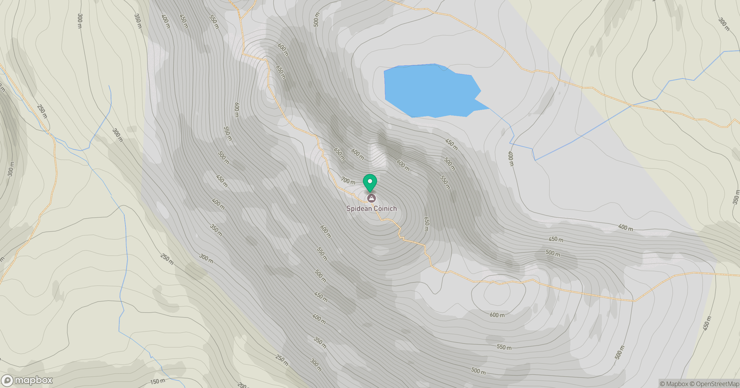
Grid reference: NC206277
View on OpenStreetMapOpens a map in a new tab, centred on the hill.
No comments yet. Be the first.