

Cul Mor
Good walks are even better shared.
NC1611 : Cul Mor, Suilven & Canisp from N.E. of Stac Pollaidh
djmacpherson Photo source
Overview
Introduction
Cul Mor, a striking Munro in the heart of the Scottish Highlands, stands majestically at 849 meters.
Geology
Made predominantly of quartzite and sandstone, this mountain showcases the breathtaking erosive power of nature. Its unique geology results in steep faces and stunning silhouettes, making it a photographer's dream!
Route Overview
The most popular route begins at Elphin and takes you through varied terrain before ascending to the summit. It’s a demanding trek, but your efforts will be rewarded with views that will take your breath away (and make you reconsider that last biscuit).
Route Details
- Distance: 16 km
- Duration: Approximately 6 hours
- Difficulty: Challenging
Summit Features
At the peak, a sturdy cairn awaits climbers, a classic sight at many hill summits. Be sure to take a moment to enjoy the panoramic vistas that unfold, showcasing the rugged beauty of the Highlands.
Terrain Type
Be prepared for rocky outcrops and marshy areas that can be quite tricky, especially after rainfall. Good sturdy boots are a must!
Views
Highlights from Cul Mor include views of Suilven and Stac Pollaidh, as well as the serene Lochinver. The best time to appreciate these landscapes is during spring and autumn, when the skies are clearer and the colours truly pop.
Hazards
Keep your eyes glued to the ever-changing weather conditions—the Highlands have a reputation for quick changes!
Access and Facilities
Elphin offers a small parking area, and Lochinver, just a stone's throw away, boasts a number of cafes where one can savour a well-deserved meal post-hike.
Conclusion
In a nutshell, Cul Mor is a must-do for any hiker in Scotland. It doesn't just challenge your physical stamina; it also rewards you with some of the most breathtaking views in the country. So grab your walking stick and get ready for an adventure you won't soon forget!
Explore routes near Cul Mor
Walks starting near this hill. Open a route to check its map, distance and full itinerary.
Ben Klibreck
View route
Fairy Lochs Liberator Wreckage Circuit
View route
Loch Migdale from Torroy: Spinningdale pinewood and loch shore walk
View route
Beinn Eighe Lancaster Wreckage at Coire Mhic Fhearchair
View route
Route planning notes
These notes describe possible approaches. Check a route's map and access information when planning your walk.
Cul Mor via Knockan Crag
This is the most common route to the summit of Cul Mor, starting from the Knockan Crag car park. The route climbs steadily across open moorland before ascending steeply to the summit plateau. The views from the top include the dramatic Assynt peaks and the surrounding lochs.
Cul Mor from Blughasary
A slightly less frequent but equally rewarding route approaches Cul Mor from the southeast, starting near Blughasary. This route offers a quieter alternative and includes some rugged terrain, with a final steep ascent to the top. It provides excellent opportunities to spot wildlife and enjoy solitude.
Circular Route: Cul Mor and Lochan Dearg
This circular route starts at Knockan Crag and includes a detour to Lochan Dearg on the way back. It follows the main ascent to Cul Mor, descending via a different path for a varied experience. The route showcases the area's distinctive geology and offers stunning scenery throughout.
Cul Mor via Inverpolly Forest
This longer and more challenging route starts from the Inverpolly Forest to the west, providing a more adventurous approach to Cul Mor. The path is less defined in places and requires good navigation skills, but it rewards hikers with spectacular remote landscapes and a sense of achievement.
Cul Mor and Cul Beag Traverse
For experienced hikers looking for an extended day out, this traverse combines the ascents of both Cul Mor and Cul Beag. Starting at Knockan Crag, the route first tackles Cul Mor before heading southwest to Cul Beag. This is a demanding but highly rewarding undertaking.
Make a day of it, together
Find someone to share the walk with, or organise a day out along a route you like.
Photo Gallery
View all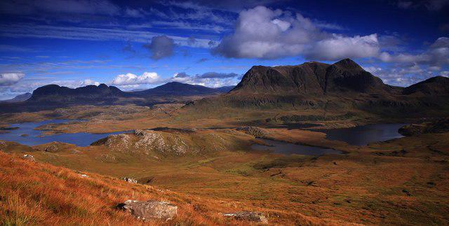 Photo could not load
NC1611 : Cul Mor, Suilven & Canisp from N.E. of Stac Pollaidh
djmacpherson
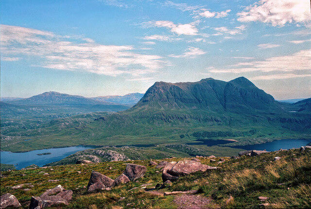 Photo could not load
NC1611 : Cùl Mòr from the ridge of Stac Pollaidh
Julian Paren
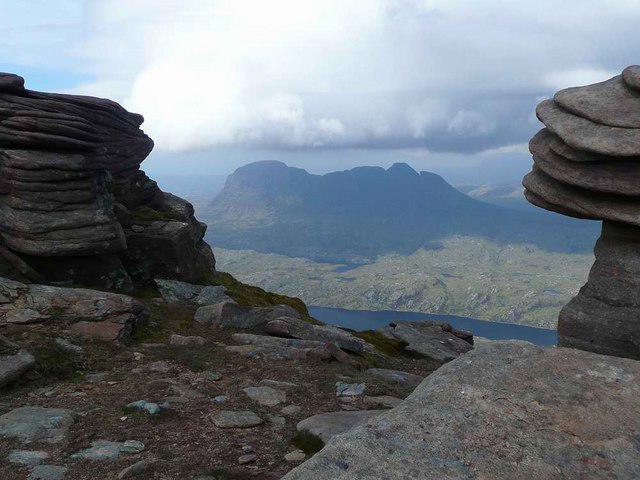 Photo could not load
NC1611 : Rock pillars on Cul Mor
Gordon Brown
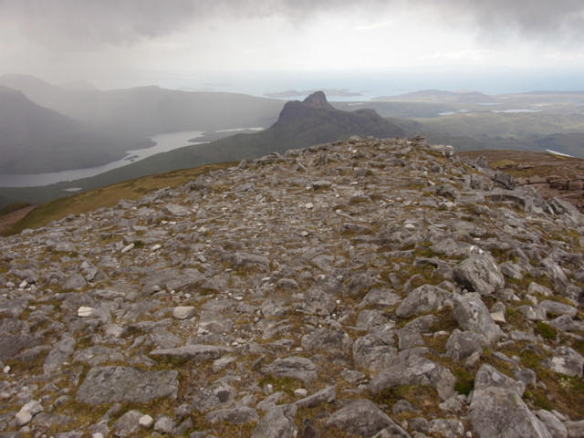 Photo could not load
NC1611 : Summit of Cul Mor looking towards Stac Pollaidh
Jonathan Venn
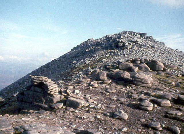 Photo could not load
NC1611 : Sandstone to quartzite on Cùl Mòr
Alan Reid
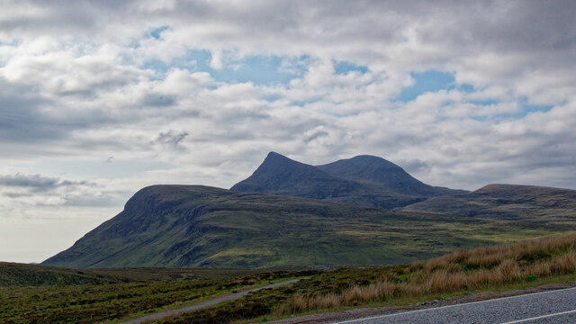 Photo could not load
NC1611 : Cùl Mòr from the A835 north of Drumrunie
Julian Paren
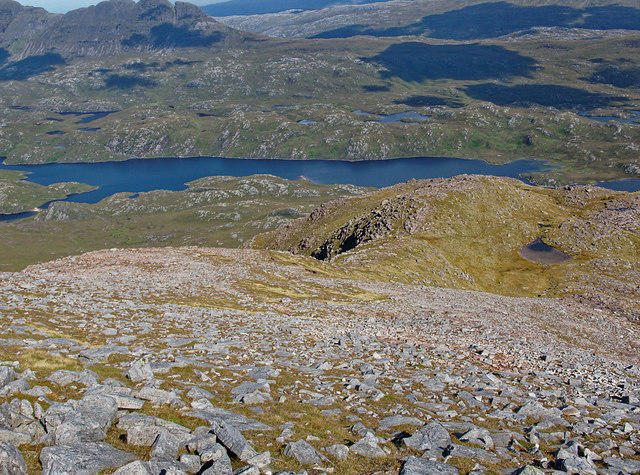 Photo could not load
NC1611 : Looking down the east ridge of Cùl Mòr
Julian Paren
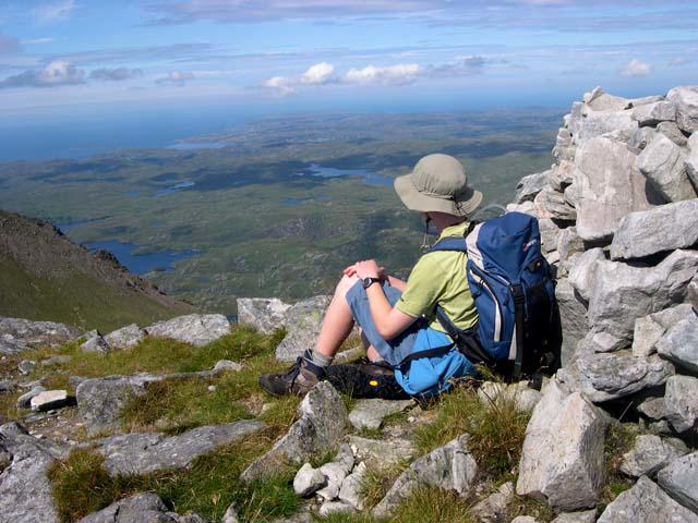 Photo could not load
NC1611 : Summit of Cùl Mòr
Nick Ray
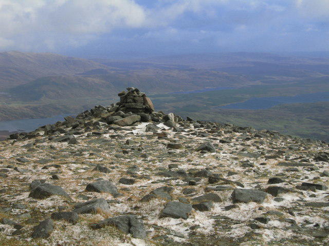 Photo could not load
NC1611 : Cairn Near Summit of Cul Mor
Calum McRoberts
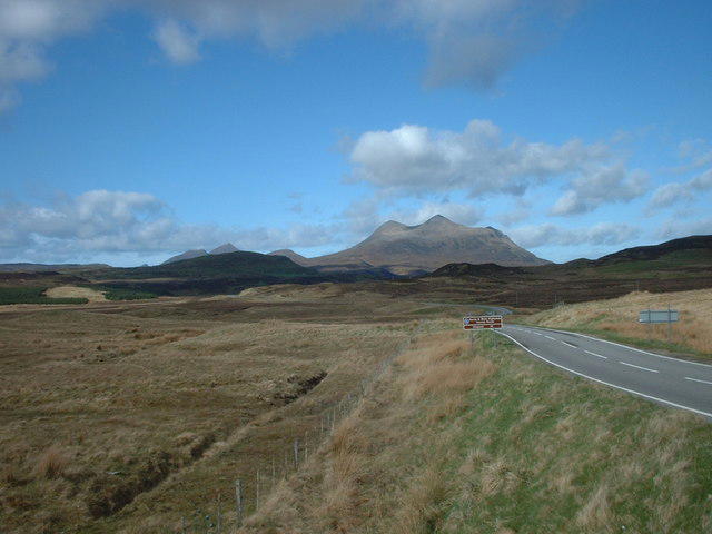
NC1611 : Cul Mor
CMackay
Hill facts and local notes
Classifications
Elevation
850m
2,788 ft
Prominence
652m
Coordinates
58.0581, -5.1168
NC162119
OS Map
15
Explorer: 439E
At the Summit
The summit is marked by a prominent cairn and offers stunning views of the surrounding lochs and mountains. On a clear day, you might even see the Isle of Lewis!
Terrain & Geology
Cul Mor is primarily composed of quartzite and sandstone, with an underlying granite formation. The wear and erosion from centuries of weather have shaped its distinctive contours and steep faces.
Views & Scenery
From the summit, you can feast your eyes on the stunning peaks of Suilven, Stac Pollaidh and the expanse of Lochinver.
History & Heritage
Name Origin
The name 'Cul Mor' translates to 'Big Back' in Gaelic, likely referring to its imposing shape as it rises from the surrounding countryside.
Historical Significance
Cul Mor is a revered peak among hillwalkers in Scotland and is often a part of climbers' Munro-bagging endeavours.
Getting There & Facilities
Parking
Parking is available at Elphin, a small but convenient area that can accommodate several vehicles, typically free of charge.
Public Transport
The closest public transport can be found in Lochinver, which has bus services from Inverness and Ullapool.
Nearby Facilities
In Lochinver, you'll find a few cafes and shops to grab a bite or stock up on supplies before your hike.
Safety Information
Known Hazards
- Weather can change rapidly in the Highlands; be prepared for rain, and consider the risks of slippery rocks and boggy areas.
General Safety Tips
- Check weather conditions before setting out
- Carry appropriate clothing and equipment
- Let someone know your planned route
- Take a map, compass, and GPS device
- Carry emergency supplies: food, water, first aid kit, torch
Hills
Some common questions about the hills answered
Are there group walks up Cul Mor?
Many walkers use Walkmates to join or organise walks with others. You can check for group walks around Cul Mor through the maps
Are there other walkers around Cul Mor?
Activity varies by location and time, but Walkmates lets you see whether others have shared walks or shown interest in this area. Find other people through the walking friends search walking friends for Cul Mor search or of course create your own walk for Cul Mor
Can I organise a walk to Cul Mor?
Yes. If there aren’t any walks listed already, you can create a walk and make it available for others to join.
If you're signed up to Walkmates, you can create a walk to Cul Mor.
How do I find a walk up this hill?
There are often multiple ways to walk this hill, depending on experience and route preference. Walkmates helps you explore walks and routes that others have shared.
Can I suggest a new route up Cul Mor?
Yes. You can suggest or create routes to share with others. Walkmates focuses on the social side of walking, so routes are used to help people organise walks and explore areas together, rather than as detailed navigation tools or route libraries.
Other uses really appreciate knowledgeable walkers sharing their routes. Share your favourite route to Cul Mor here
The is an error or something incorrect about this hill. How do I let you know?
We always strive to keep the information on Walkmates as accurate as possible. If you find an error, please let us know through the contact form and we'll aim to correct it as quickly as possible
Community Discussion
Comments
Location
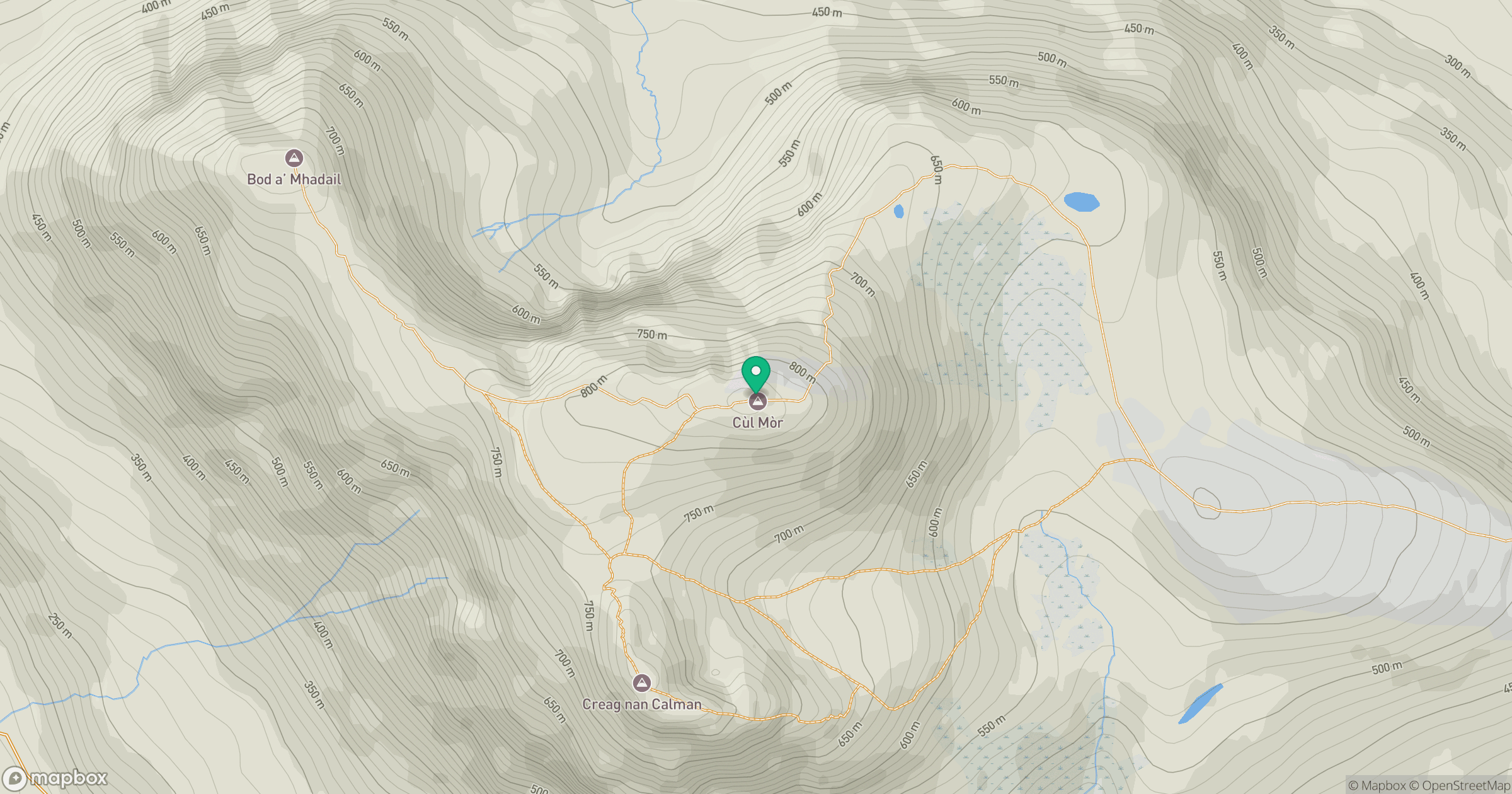
Grid reference: NC162119
View on OpenStreetMapOpens a map in a new tab, centred on the hill.
No comments yet. Be the first.