

Quinag - Sail Gharbh
Good walks are even better shared.
NC2029 : View from the Trig at Sail Gharbh
Dave Thompson Photo source
Overview
Sail Gharbh is the highest of Quinag’s three Corbetts in Assynt, at 808.8 m (rounded to 809 m in the hill data). Its eastern ridge links to the mountain’s central junction; Sail Ghorm and Spidean Coinich are separate Corbett summits. The A894 approach can be used for Sail Gharbh alone or a longer, strenuous ridge circuit with steep ground and some scrambling.
Quinag – Sail Gharbh
Sail Gharbh is the highest of Quinag’s three Corbetts in Assynt. DoBIH records 808.8 m, rounded to 809 m in this page’s hill data. The other Corbetts are Sail Ghorm, 775.6 m, and Spidean Coinich, 764.7 m. Sail Gharbh occupies the eastward branch of the ridges; it is not the northernmost summit.
The exact summit
The highest point is a boulder 15 m northwest of the trig point and windshelter at grid reference NC209292. DoBIH records the boulder as 1 m above the base of the trig point. The trig point is a landmark rather than the exact highest ground.
Choosing a walk
- Sail Gharbh alone: Walking Britain’s return route is 8.8 km with 539 m ascent and a guide time of 4 hours 10 minutes. It follows the corrie approach towards Bealach a’ Chornaidh before climbing to the summit ridge. The upper path is steep.
- All three Corbetts: Walkhighlands describes a 14 km circuit, 1130 m ascent and 7.5–8.5 hours. Its order is Spidean Coinich, Sail Ghorm and Sail Gharbh, followed by the established descent towards the bealach and corrie. The linked ridges include very steep ground and some scrambling.
- Sail Gharbh with Spidean Coinich: The Great Outdoors gives 11 km, 929 m ascent and 5–6 hours for its two-Corbett circuit. It leaves out Sail Ghorm.
- A return to Bealach a’ Chornaidh offers a mountain viewpoint without a summit. A return over Spidean Coinich alone is another shorter option described by Walkhighlands; it does not reach Sail Gharbh.
These totals belong to the individual publishers’ itineraries. Choose a route to suit your experience and conditions.
Start, access and safety
The usual start is the car park east of the A894 at NC232273, between Loch Assynt and Unapool. Cross carefully to the approach path a little farther south. The John Muir Trust asks visitors to use the repaired path and protect the fragile peat.
Avoid the direct northward climb from halfway along Lochan Bealach Cornaidh: published landowner advice warns that rocks can be dislodged. This is separate from the established slanting path nearer the bealach. The full ridge circuit needs sound navigation and confidence on steep, exposed ground. Wet rock, strong winds and cloud increase the seriousness. Carry a map and backup navigation; the visitor leaflet is not a navigation map.
Walkhighlands and The Great Outdoors list no public transport to the start. Arrange onward and return travel before setting out. The Rock Stop at Unapool has seasonal visitor facilities; check current opening dates and carry your own hill food and water.
Snow and ice require a different level of skill and preparation. Mountaineering Scotland’s winter guidance covers navigation, short daylight, equipment, cornices and avalanche awareness.
Landscape and names
North West Highlands Geopark describes Torridonian sandstone over Lewisian gneiss, with east-dipping Cambrian quartzite. The John Muir Trust translates Quinag from Gaelic A’ Chuinneag as “the milk pail”, and Sail Gharbh as “rough heel”. Clear conditions reveal Assynt’s peaks and lochans, the western coastline and the mountains of northwest Sutherland.
Explore routes near Quinag - Sail Gharbh
Walks starting near this hill. Open a route to check its map, distance and full itinerary.
Ben Klibreck
View route
Loch Migdale from Torroy: Spinningdale pinewood and loch shore walk
View route
Fairy Lochs Liberator Wreckage Circuit
View route
Beinn Eighe Lancaster Wreckage at Coire Mhic Fhearchair
View route
Route planning notes
These notes describe possible approaches. Check a route's map and access information when planning your walk.
Quinag: three-Corbett circuit
From A894 car park NC232273, follow the repaired approach, then visit Spidean Coinich, Sail Ghorm and Sail Gharbh using the linked ridges. Return via the established path towards Bealach a’ Chornaidh and north of Lochan Bealach Cornaidh. Walkhighlands gives 14 km, 1130 m ascent and 7.5–8.5 hours. Very steep ground, exposure and short scrambling make this a strenuous mountain day.
Sail Gharbh only: return from the A894
From NC232273, take the path into the corrie north of Lochan Bealach Cornaidh. Near Bealach a’ Chornaidh, the established rising path leads to Sail Gharbh’s eastward ridge. Return the same way. Walking Britain gives 8.8 km, 539 m ascent and 4 hours 10 minutes. Avoid the steep direct shortcut north from halfway along the lochan.
Sail Gharbh and Spidean Coinich
The Great Outdoors’ two-Corbett circuit starts at NC232273, follows the corrie path to Bealach a’ Chornaidh and climbs via the central ridge junction to Sail Gharbh. Retrace to the bealach, continue over Spidean Coinich and descend its broad southeast shoulder. The guide gives 11 km, 929 m ascent and 5–6 hours. Steep, exposed sections and careful navigation are required; Sail Ghorm is omitted.
Bealach a’ Chornaidh return: no summit
From NC232273, stay on the repaired approach and take the corrie path north of Lochan Bealach Cornaidh to Bealach a’ Chornaidh. Return along the same path without climbing the summit ridges. The John Muir Trust describes this saddle as a rewarding viewpoint, but good fitness, suitable clothing and a mountain forecast are still important. This outing does not reach Sail Gharbh or either other Corbett.
Spidean Coinich return: no Sail Gharbh
From NC232273, take the left fork at the cairned junction and follow the rocky rib and broad east ridge to Spidean Coinich. Return by the same route rather than continuing onto the much steeper connecting ridges. Walkhighlands identifies this as a shorter alternative to the complete circuit. It reaches a different Corbett and does not climb Sail Gharbh.
Make a day of it, together
Find someone to share the walk with, or organise a day out along a route you like.
Photo Gallery
View all Photo could not load
NC2029 : View from the Trig at Sail Gharbh
Dave Thompson
 Photo could not load
NC2029 : Quinag - Sail Gharbh (with Suilven in distance)
John Earnshaw
 Photo could not load
NC2129 : Boulder field, Sail Gharbh
Chris Eilbeck
 Photo could not load
NC2029 : Sail Gharbh summit
David Brown
 Photo could not load
NC2029 : Trig point and shelter at summit of Sàil Gharbh
Trevor Littlewood
 Photo could not load
NC2029 : The summit of Sail Gharbh, Quinag
Colin Park
 Photo could not load
NC2029 : Quinag
Anne Burgess
 Photo could not load
NC2029 : The north eastern spur from the summit of Sail Gharbh, Quinag
Colin Park
 Photo could not load
NC2029 : Sàil Gharbh
Anne Burgess

NC2029 : Sail Garbh summit
Gordon Hatton
Hill facts and local notes
Classifications
Elevation
809m
2,654 ft
Prominence
550m
Coordinates
58.2152, -5.0499
NC209292
OS Map
15
Explorer: 442E
At the Summit
The highest point is a boulder 15 m northwest of the trig point and windshelter. DoBIH records it as 1 m higher than the trig-point base; the trig point is a useful landmark, but it is not the exact summit.
Terrain & Geology
Quinag is largely Torridonian sandstone resting on older Lewisian gneiss, with Cambrian quartzite capping parts of the mountain. The quartzite layers dip eastwards; Sail Gharbh’s upper ridge changes from sandstone to quartzite. Glacial erosion helped shape the corries and exposed rock.
Views & Scenery
In clear weather, views take in Assynt’s mountains and lochans, including Suilven, Canisp and Ben More Assynt, with the west coast and mountains of northwest Sutherland beyond.
History & Heritage
Name Origin
Quinag comes from the Gaelic A’ Chuinneag, meaning “the milk pail”. Sail Gharbh means “rough heel”; Sail Ghorm means “blue heel”, and Spidean Coinich “mossy peak”.
Historical Significance
Quinag is known for its unique geology and biodiversity, attracting naturalists and geologists alike.
Getting There & Facilities
Parking
Quinag car park on the east side of the A894 at NC232273, between Loch Assynt and Unapool. The walking path starts across the road a short distance south of the parking area. Follow the restored approach path.
Public Transport
Walkhighlands and The Great Outdoors list no public transport to the NC232273 walking start. Check current regional bus arrangements and arrange any onward travel and a reliable return before setting out.
Nearby Facilities
The Rock Stop visitor centre at Unapool has a seasonal café and shop; check its current opening dates before relying on refreshments. Bring food and water for the hill. The A894 walking start is separate from these facilities.
Safety Information
Known Hazards
- The ridge circuits include very steep slopes, exposed sections and short scrambling steps. Wet rock and strong winds increase the difficulty.
- Careful route-finding is needed in cloud, especially around the ridge junctions and on the descent from Spidean Coinich.
- Avoid the direct climb north from halfway along Lochan Bealach Cornaidh: published John Muir Trust advice warns of dislodged rocks. Use the established approach towards the bealach.
- Cross the A894 carefully and follow the repaired lower path rather than shortcuts through fragile peat.
Seasonal Hazards
Snow and ice make the steep slopes and ridge steps more serious and can conceal paths. Winter travel needs suitable skills and equipment, including trained use of an ice axe and crampons where conditions require them. Allow for short daylight, strong winds and poor visibility, and assess snow, cornice and avalanche hazards before committing.
General Safety Tips
- Check weather conditions before setting out
- Carry appropriate clothing and equipment
- Let someone know your planned route
- Take a map, compass, and GPS device
- Carry emergency supplies: food, water, first aid kit, torch
Hills
Some common questions about the hills answered
Are there group walks up Quinag - Sail Gharbh?
Many walkers use Walkmates to join or organise walks with others. You can check for group walks around Quinag - Sail Gharbh through the maps
Are there other walkers around Quinag - Sail Gharbh?
Activity varies by location and time, but Walkmates lets you see whether others have shared walks or shown interest in this area. Find other people through the walking friends search walking friends for Quinag - Sail Gharbh search or of course create your own walk for Quinag - Sail Gharbh
Can I organise a walk to Quinag - Sail Gharbh?
Yes. If there aren’t any walks listed already, you can create a walk and make it available for others to join.
If you're signed up to Walkmates, you can create a walk to Quinag - Sail Gharbh.
How do I find a walk up this hill?
There are often multiple ways to walk this hill, depending on experience and route preference. Walkmates helps you explore walks and routes that others have shared.
Can I suggest a new route up Quinag - Sail Gharbh?
Yes. You can suggest or create routes to share with others. Walkmates focuses on the social side of walking, so routes are used to help people organise walks and explore areas together, rather than as detailed navigation tools or route libraries.
Other uses really appreciate knowledgeable walkers sharing their routes. Share your favourite route to Quinag - Sail Gharbh here
The is an error or something incorrect about this hill. How do I let you know?
We always strive to keep the information on Walkmates as accurate as possible. If you find an error, please let us know through the contact form and we'll aim to correct it as quickly as possible
Community Discussion
Comments
Location
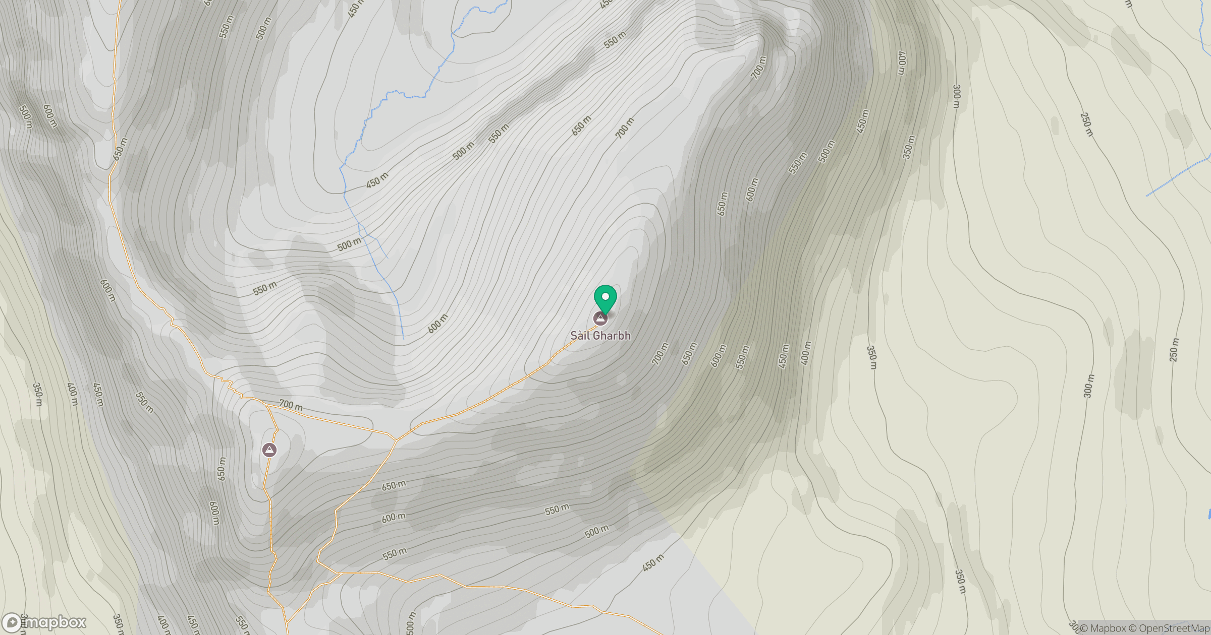
Grid reference: NC209292
View on OpenStreetMapOpens a map in a new tab, centred on the hill.
No comments yet. Be the first.