

Cnoc an Dubharlainn
Good walks are even better shared.
Overview
Cnoc an Dubharlainn
Nestled in the picturesque Scottish Highlands, Cnoc an Dubharlainn stands as a proud Marilyn, reaching an impressive height of 611 meters. As you tackle this delightful climb, you’ll quickly discover that while it may not be the tallest mountain in Scotland, it certainly has the heart of one!
Geology
Featuring ancient schist formations, Cnoc an Dubharlainn’s rocky facade is shaped by millennia of glacial activity. The geological history here is akin to reading a well-worn book, with each layer telling tales of a past dominated by ice and time.
Routes
The most popular route is the Cnoc an Dubharlainn Circuit, which begins in the quaint village of Strontian. This moderate loop covers approximately 10.5 km and takes about 4.5 hours. The path winds through lush woodlands before ascending steeply towards the summit. Just remember: the only thing steeper than the slope may be your expectations of reaching the summit!
Summit Features
At the summit, you’ll find a humble cairn waiting to welcome tired feet and a thirsty spirit. It’s a perfect place to linger, enjoy a snack, and take in the breathtaking vistas that unfold before you. Consider jotting down your thoughts or a funny quip in the summit log – laughter is indeed good for the soul!
Terrain Type
Expect a varied terrain that combines rocky paths with grassy slopes. Watch out—some parts can be a bit boggy, especially following rain. It’s a bit of a minefield out there, so sturdy waterproof boots are your best mates!
Views
The summit rewards travellers with staggering views over Loch Sunart, dotted with small islands, and a panorama of towering Munros nearby. It’s a feast for the eyes, so bring your camera but don’t forget to soak it all in!
Hazards
As with any adventure in the outdoors, be prepared for sudden weather changes. Conditions in the Highlands can be as unpredictable as British rail schedules. A bit of mud here and there means you may find yourself doing the Highland jig to keep upright!
Access
To kick off your adventure, there’s a small car park in Strontian, NC090681, where about ten cars can park. But do arrive early to avoid the last-minute scramble! Public transport to Strontian can be sparse, so check the latest bus schedules when planning your trip.
Nearby Facilities
Once you’ve dusted off your hiking boots, Strontian’s charming café awaits, perfect for a post-adventure brew. Plus, they do a mean slice of cake – because what’s an adventure without a treat?
History
The name Cnoc an Dubharlainn translates to ‘Hill of the Black Thicket’, a nod to the lush vegetation that carpets the lower slopes. This mountain isn’t just a pretty face; it’s steeped in local lore with tales of mythical creatures lurking amid the trees.
Conclusion
Whether you’re an experienced hiker or just fancy a gentle wander with stunning views thrown in, Cnoc an Dubharlainn has something for everyone. Lace up your boots, grab your gear, and get ready for an unforgettable day in the heart of the Scottish Highlands!
Happy Hiking!
Explore routes near Cnoc an Dubharlainn
Public walks starting within 80 km of this hill. Nearby does not mean a route reaches the summit; check its map and access before setting out.
Ben Klibreck
View route
Fairy Lochs Liberator Wreckage Circuit
View route
Loch Migdale from Torroy: Spinningdale pinewood and loch shore walk
View route
Beinn Eighe Lancaster Wreckage at Coire Mhic Fhearchair
View route
Route planning notes
These notes describe possible approaches, not verified navigable routes or permission to cross land. Check current paths, local access rules and conditions before setting out.
Cnoc an Dubharlainn Circuit
A scenic loop starting from the small village of Strontian, taking you through lush woodlands before climbing steeply to the summit.
Make a day of it, together
Find someone to share the walk with, or organise a day out along a route you like.
Photo Gallery
View all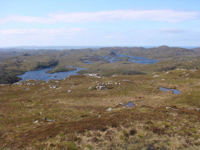 Photo could not load
NC1128 : View southwest from Cnoc an Dubharlainn
Sally
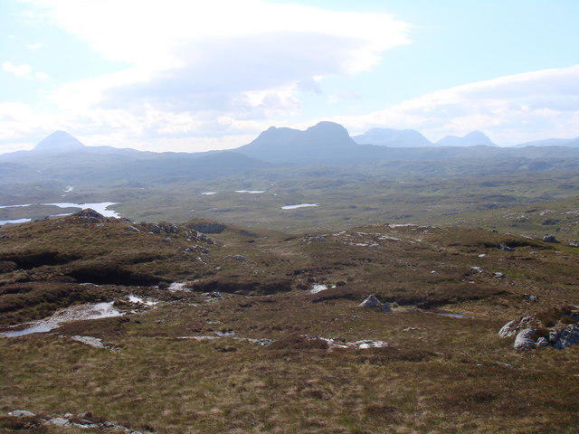 Photo could not load
NC1128 : View southeast from Cnoc an Dubharlainn
Sally
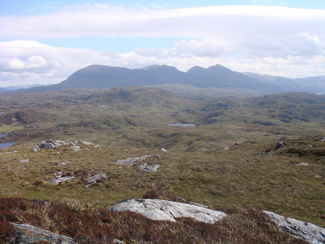 Photo could not load
NC1128 : View east from Cnoc an Dubharlainn
Sally
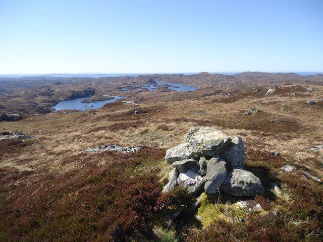 Photo could not load
NC1128 : Western slopes of Cnoc an Dubharlainn
Michael Earnshaw
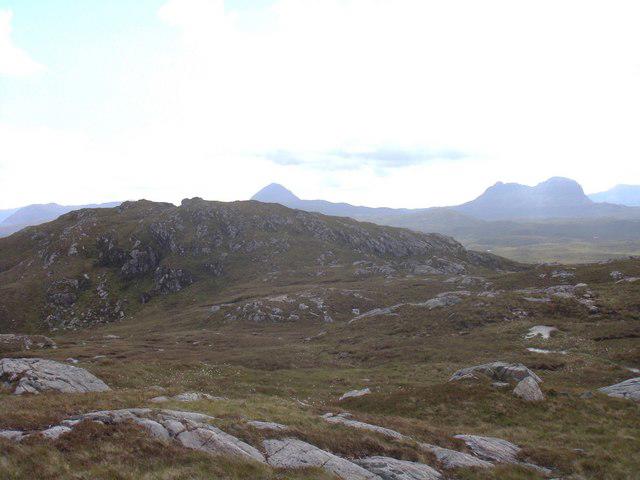 Photo could not load
NC1128 : Cnoc an Dubharlainn
Sally
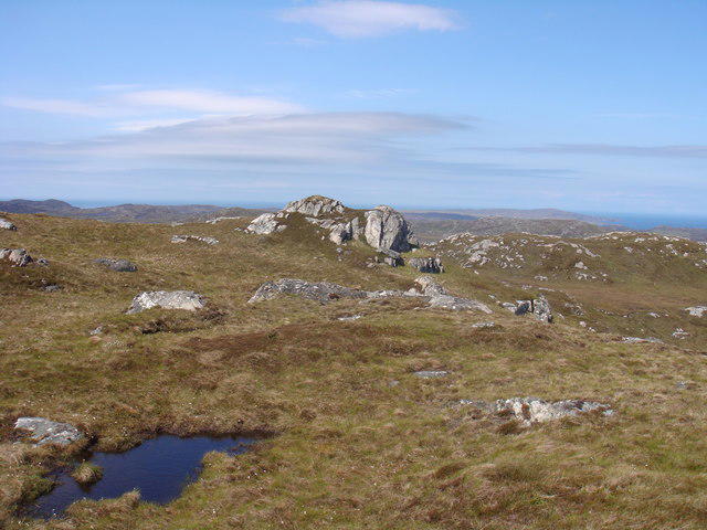 Photo could not load
NC1128 : Summit of Cnoc an Dubharlainn
Sally
Hill facts and local notes
Classifications
Elevation
225m
738 ft
Prominence
123m
Coordinates
58.2021, -5.2027
NC118281
OS Map
15
Explorer: 442W
At the Summit
The summit features a small cairn, providing a perfect spot for a well-deserved rest and scenic photographs. Don't forget to sign the summit log and perhaps, add a joke to lighten the mood!
Terrain & Geology
Cnoc an Dubharlainn is primarily composed of ancient schist, characteristic of the region, offering a combination of smooth slopes and rocky outcrops. The terrain showcases evidence of glacial activity, providing hikers with an insight into the geological history of the Highlands.
Views & Scenery
From the summit, hikers can enjoy stunning views of Loch Sunart and the rugged landscape of the surrounding hills, including the iconic Munros that pepper the skyline.
History & Heritage
Name Origin
The name ‘Cnoc an Dubharlainn’ translates to ‘Hill of the Black Thicket’ in Gaelic, referring to the dense vegetation that once covered the area.
Historical Significance
This mountain is part of the ancient landscape steeped in local folklore, with stories of mythical creatures and historical figures associated with the area.
Getting There & Facilities
Check current local access restrictions, parking rules and transport timetables before travelling. These notes do not confirm public access to the summit.
Parking
There is a small car park in Strontian (NC090681), with space for around ten cars. Arrive early to nab a spot, especially on weekends!
Public Transport
The nearest bus service operates from Fort William to Strontian, although services can be infrequent. Check local timetables for the latest information.
Nearby Facilities
Strontian offers several amenities including a small shop, café, and public toilets. A perfect pit stop for a cuppa before or after your adventure.
Safety Information
Known Hazards
- Be mindful of sudden changes in weather, as conditions can shift rapidly in the Highlands. Additionally, some sections can be slippery, especially after rain.
General Safety Tips
- Check weather conditions before setting out
- Carry appropriate clothing and equipment
- Let someone know your planned route
- Take a map, compass, and GPS device
- Carry emergency supplies: food, water, first aid kit, torch
Hills
Some common questions about the hills answered
Are there group walks up Cnoc an Dubharlainn?
Many walkers use Walkmates to join or organise walks with others. You can check for group walks around Cnoc an Dubharlainn through the maps
Are there other walkers around Cnoc an Dubharlainn?
Activity varies by location and time, but Walkmates lets you see whether others have shared walks or shown interest in this area. Find other people through the walking friends search walking friends for Cnoc an Dubharlainn search or of course create your own walk for Cnoc an Dubharlainn
Can I organise a walk to Cnoc an Dubharlainn?
Yes. If there aren’t any walks listed already, you can create a walk and make it available for others to join.
If you're signed up to Walkmates, you can create a walk to Cnoc an Dubharlainn.
How do I find a walk up this hill?
There are often multiple ways to walk this hill, depending on experience and route preference. Walkmates helps you explore walks and routes that others have shared.
Can I suggest a new route up Cnoc an Dubharlainn?
Yes. You can suggest or create routes to share with others. Walkmates focuses on the social side of walking, so routes are used to help people organise walks and explore areas together, rather than as detailed navigation tools or route libraries.
Other uses really appreciate knowledgeable walkers sharing their routes. Share your favourite route to Cnoc an Dubharlainn here
The is an error or something incorrect about this hill. How do I let you know?
We always strive to keep the information on Walkmates as accurate as possible. If you find an error, please let us know through the contact form and we'll aim to correct it as quickly as possible
Community Discussion
Comments
Location
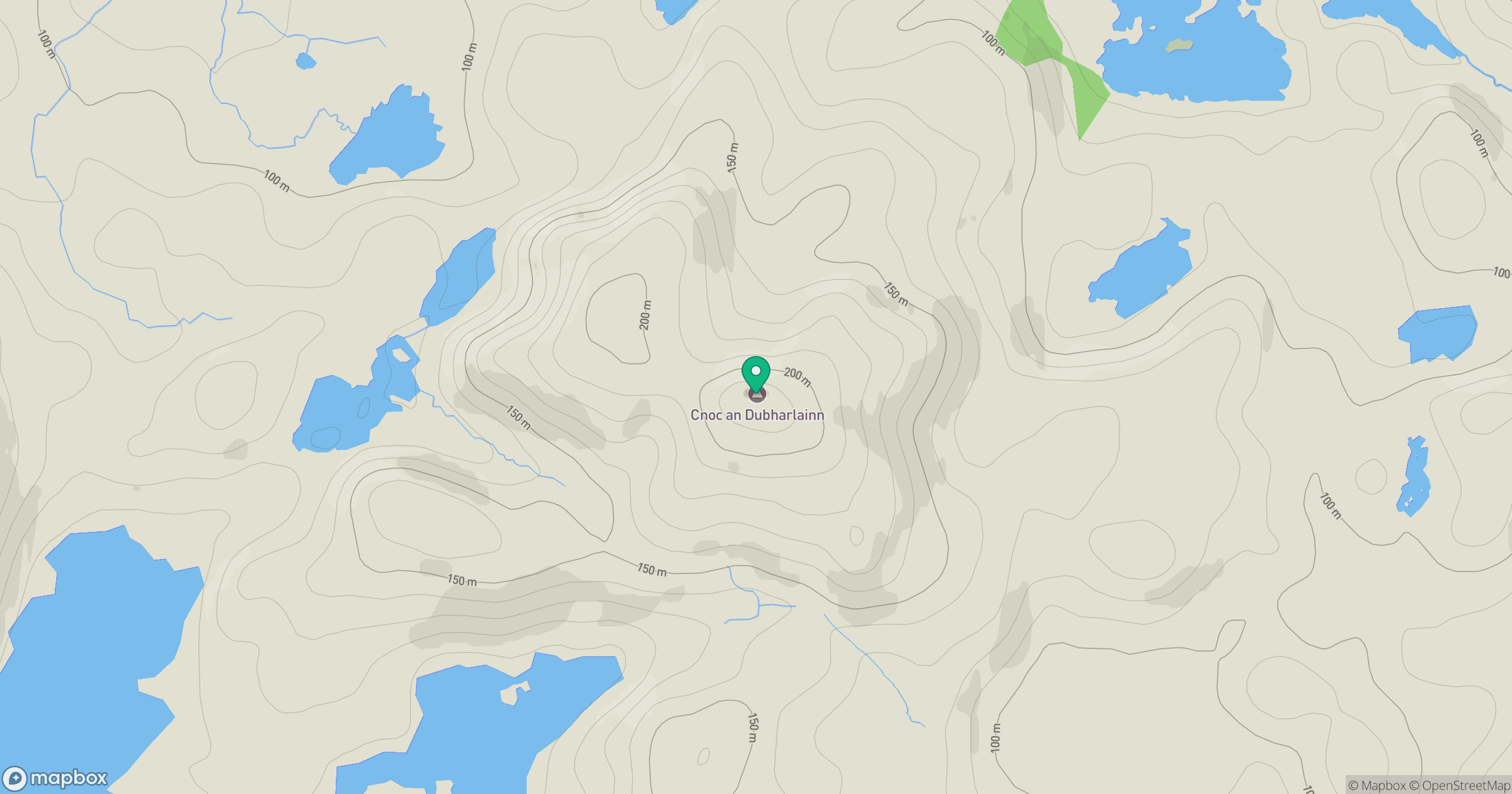
Grid reference: NC118281
View on OpenStreetMapOpens a map in a new tab, centred on the hill.
Hills within 30 km
Straight-line distance, not a walking route or confirmation of access.
Suilven
731m
Quinag - Sail Ghorm [Sail Gorm]
776m
Quinag - Spidean Coinich
764m
Quinag - Sail Gharbh
809m
Stac Pollaidh
612m
No comments yet. Be the first.