

Sgurr nan Clach Geala
Good walks are even better shared.
NH1871 : Sgùrr nan Clach Geala
Richard Webb Photo source
Overview
Sgurr nan Clach Geala
Overview
Sgurr nan Clach Geala, a proud Munro, stands tall at an elevation of 1023 meters in the heart of the Scottish Highlands. The name, meaning 'Peak of the White Stones,' reflects the striking granite that characterises this majestic mountain. The peak is a favourite amongst hikers due to its panoramic vistas and engaging routes.
Geology
This mountain is made up of resilient granite, which has resisted erosion to create its rugged profile. Glacial activity has shaped its valleys and features, providing not only a natural playground for climbers but also a fascinating exhibit for geology enthusiasts.
Routes
There are several routes to reach the summit, with the Glen Affric Route being the most popular. Itis generally regarded as moderate, with an approximate distance of 16 km and an expected walking time of about 6 hours. For those seeking a bit more of a challenge, the Alltbeithe Route is shorter but steeper, offering a direct ascent that can be tackled in around 4.5 hours.
Summit Features
The summit itself is crowned by a sturdy cairn—a traditional marker for those who brave the ascent. It is also a superb vantage point to take in the sweeping views surrounding you. Don't forget to snap a photo; your pals need to see you conquering yet another peak!
Terrain
Expect a mix of rocky paths and grassy slopes, meaning good footwear will serve you well. Parts of the lower trails can be particularly boggy after rainfall, transforming your boots into reluctant sponges.
Views
The views from Sgurr nan Clach Geala are simply breathtaking! You’ll find yourself gazing over Loch Affric and the towering peaks of the Kintail range. Late spring to early autumn is the best time to witness these landscapes in full glory, adorned with the colors of wildflowers.
Hazards
As with most Highland trails, weather conditions can be a fickle friend. Clear skies can quickly descend into mist, so always be prepared for sudden changes. Keep an eye on your footing, especially in wet areas or rocky sections, as they can become treacherous.
Access
Access is quite straightforward, with parking available at the end of the Glen Affric road. Should you opt for public transport, buses run from Inverness to Fort Augustus, but be ready for a bit of a stroll to reach your adventure.
Nearby Summits
Don't miss the opportunity to explore nearby peaks like Sgurr na Lapaich (1055m) and Carn Eige (1183m) for extended hiking options.
Facilities
While there are no facilities directly on the mountain, nearby towns such as Drumnadrochit provide cafes and shops to replenish your supplies.
Conclusion
Whether you're a seasoned hiker or a curious beginner, Sgurr nan Clach Geala promises an unforgettable Scottish experience. Don’t forget to pack your camera and enjoy a wee dram at the summit, it’s the Highland way to celebrate dedication!
Explore routes near Sgurr nan Clach Geala
Walks starting near this hill. Open a route to check its map, distance and full itinerary.
Beinn Eighe Lancaster Wreckage at Coire Mhic Fhearchair
View route
Fairy Lochs Liberator Wreckage Circuit
View route
Glen Affric: Coire Loch Woodland Trail
View route
Loch Migdale from Torroy: Spinningdale pinewood and loch shore walk
View route
Route planning notes
These notes describe possible approaches. Check a route's map and access information when planning your walk.
Glen Affric Route
A popular ascent that begins at the scenic Glen Affric, offering stunning views and engaging terrain as it leads you to the summit.
Alltbeithe Route
Starting from the Alltbeithe bothy, this route offers a more direct but slightly steeper ascent to the summit, rewarding hikers with breathtaking scenery.
Make a day of it, together
Find someone to share the walk with, or organise a day out along a route you like.
Photo Gallery
View all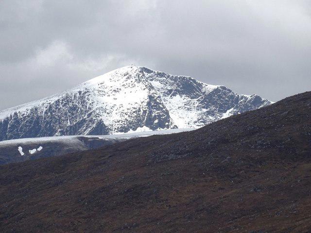 Photo could not load
NH1871 : Sgùrr nan Clach Geala
Richard Webb
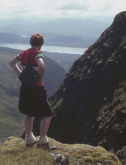 Photo could not load
NH1871 : On the edge at Eagan Tuill Bhig
Alan Reid
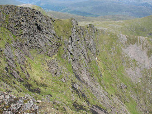 Photo could not load
NH1871 : Eagan Tuill Bhig
Callum Black
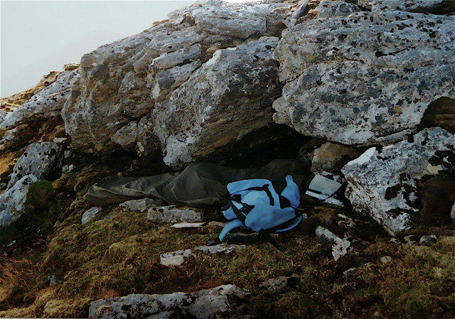 Photo could not load
NH1871 : Sgùrr nan Clach Geala - high living
AlastairG
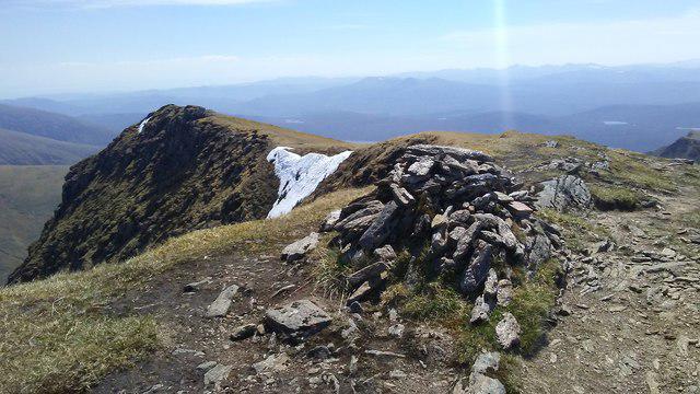 Photo could not load
NH1871 : On the summit of Sgurr nan Clach Geala, Fannichs
Colin Park
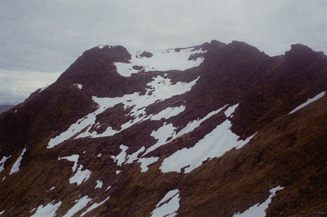 Photo could not load
NH1871 : High in the Fannichs
Peter Moore
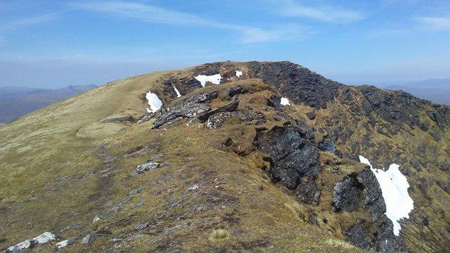 Photo could not load
NH1871 : View NW to summit of Sgurr nan Clach Geala, Fannichs
Colin Park
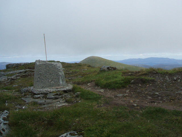 Photo could not load
NH1871 : Remains of the Trig pillar on Sgurr nan Clach Geala
David Brown
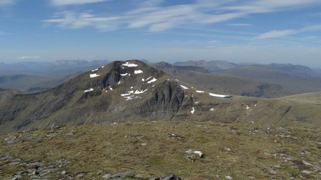 Photo could not load
NH1871 : On the summit of Sgurr Mor, Fannichs - view to Sgurr nan Clach Geala
Colin Park
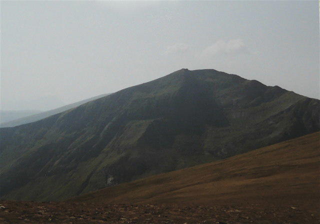
NH1871 : Sgurr nan Clach Geala
AlastairG
Hill facts and local notes
Classifications
Elevation
1,093m
3,586 ft
Prominence
229m
Coordinates
57.6963, -5.0482
NH184714
OS Map
20
Explorer: 436S
At the Summit
The summit is marked by a prominent cairn and offers a viewshed that stretches across the glens and peaks of the Highlands, perfect for a celebratory picture.
Terrain & Geology
Composed predominantly of granite, the mountain showcases classic Highland geology with glacial features and rugged terrain, ideal for both eager climbers and geology buffs.
Views & Scenery
From the summit, one can enjoy panoramic views of Loch Affric and the adjacent peaks, including the stunning peaks of the Kintail range.
History & Heritage
Name Origin
The name 'Sgurr nan Clach Geala' translates as 'Peak of the White Stones,' a nod to the characteristic granite outcrops adorning its slopes.
Historical Significance
This mountain is part of the rich cultural tapestry of the Scottish Highlands, holding historical significance in local folklore and natural heritage.
Getting There & Facilities
Parking
Parking is available at the end of the Glen Affric road, offering ample space for several vehicles. Arrive early during peak seasons!
Public Transport
Public transport options are limited; however, Fort Augustus is the nearest village with bus routes connecting to Inverness.
Nearby Facilities
There are no facilities directly on the mountain; however, nearby settlements like Drumnadrochit do offer cafes and local shops.
Safety Information
Known Hazards
- Be cautious of changing weather conditions, especially in higher altitudes. The rocky terrain can also be slippery when wet.
General Safety Tips
- Check weather conditions before setting out
- Carry appropriate clothing and equipment
- Let someone know your planned route
- Take a map, compass, and GPS device
- Carry emergency supplies: food, water, first aid kit, torch
Hills
Some common questions about the hills answered
Are there group walks up Sgurr nan Clach Geala?
Many walkers use Walkmates to join or organise walks with others. You can check for group walks around Sgurr nan Clach Geala through the maps
Are there other walkers around Sgurr nan Clach Geala?
Activity varies by location and time, but Walkmates lets you see whether others have shared walks or shown interest in this area. Find other people through the walking friends search walking friends for Sgurr nan Clach Geala search or of course create your own walk for Sgurr nan Clach Geala
Can I organise a walk to Sgurr nan Clach Geala?
Yes. If there aren’t any walks listed already, you can create a walk and make it available for others to join.
If you're signed up to Walkmates, you can create a walk to Sgurr nan Clach Geala.
How do I find a walk up this hill?
There are often multiple ways to walk this hill, depending on experience and route preference. Walkmates helps you explore walks and routes that others have shared.
Can I suggest a new route up Sgurr nan Clach Geala?
Yes. You can suggest or create routes to share with others. Walkmates focuses on the social side of walking, so routes are used to help people organise walks and explore areas together, rather than as detailed navigation tools or route libraries.
Other uses really appreciate knowledgeable walkers sharing their routes. Share your favourite route to Sgurr nan Clach Geala here
The is an error or something incorrect about this hill. How do I let you know?
We always strive to keep the information on Walkmates as accurate as possible. If you find an error, please let us know through the contact form and we'll aim to correct it as quickly as possible
Community Discussion
Comments
Location
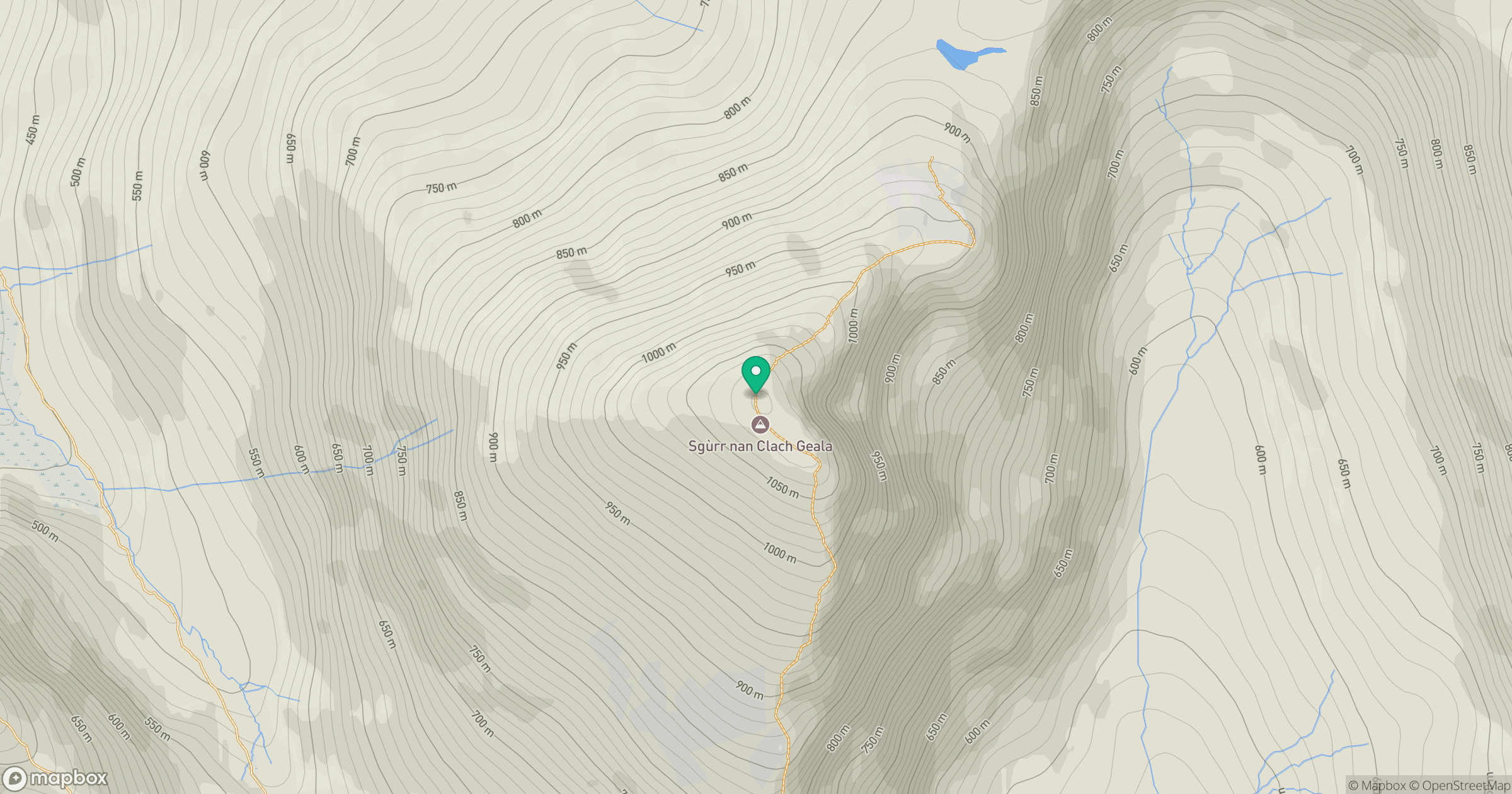
Grid reference: NH184714
View on OpenStreetMapOpens a map in a new tab, centred on the hill.
Nearby Hills
Seana Bhraigh
926m
Mullach Coire Mhic Fhearchair
1,015m
An Teallach - Bidein a' Ghlas Thuill
1,063m
An Teallach - Sgurr Fiona
1,059m
Sgurr a' Choire Ghlais
1,084m
No comments yet. Be the first.