

Sgurr na Muice
Good walks are even better shared.
Overview
Sgurr na Muice: A Hidden Highland Gem
Nestled in the stunning Scottish Highlands, Sgurr na Muice stands at an elevation of 702 meters, offering hikers a slice of nature that is nothing short of spectacular.
Geology
Sgurr na Muice is primarily made up of granite gneiss. Its rugged landscape is a testament to the geological forces that shaped it over millennia. The rock formations tell tales of ancient environments that once existed, and the beauty of the mountain only emphasizes the power of nature.
Routes
One of the most popular routes is from the A832, a moderate trek of about 11 kilometers that takes approximately 4.5 hours to complete. This route offers splendid views as it winds through glen landscapes, making the journey as enjoyable as the destination.
Summit Features
Upon reaching the summit, you'll be greeted by a prominent cairn that marks the highest point. The views from the top are astonishing. On a clear day, you can see the Torridon hills, Loch Maree, and a breathtaking expanse of wild heather and rocky peaks.
Terrain
The terrain is a mix of rocky paths, grassy sections, and potentially boggy areas, particularly in spring or after heavy rain. Sturdy footwear is recommended, as is a good sense of direction—getting lost is all too easy when everything looks like mountain!
Views
The views from Sgurr na Muice are best in spring and autumn when the conditions are often clearer and the light is fantastic for photography. If you’re in for a long summer day, be sure to pack sun cream; the Scottish sun can surprise you!
Hazards
Hikers should be cautious of the rocky conditions that can become slippery, especially if rain decides to join your adventure. Sudden weather changes can also occur in the Highlands, so it’s wise to be prepared for all seasons—sunshine, rain, and the occasional snow flurry, just to keep you on your toes.
Nearby Summits
For those looking to continue their adventure, nearby peaks such as Sgurr an Fhidhleir (664 meters) and Beinn Eighe (1010 meters) offer more challenges and spectacular views.
Access
Accessing Sgurr na Muice is straightforward. The nearest parking is conveniently located near the A832, and public transport options run to Kinlochewe, the closest village.
Facilities
While there are no facilities on the mountain itself, the nearby village of Kinlochewe has a pub and a small shop, perfect for recharging after your hike or bracing yourself for the next.
History
The name Sgurr na Muice, translating to 'Peak of the Pig', might draw a few chuckles, but no pigs are actually in sight. Instead, this Munro is significant for its beauty and challenge, a beloved destination for hikers eager to explore the Highlands.
In conclusion, whether you’re an experienced mountaineer or a casual walker, Sgurr na Muice offers a fantastic day out in one of the most picturesque areas of Scotland. Just make sure you pack your sense of adventure alongside your snacks, and enjoy the journey!
Happy hiking!
Explore routes near Sgurr na Muice
Public walks starting within 80 km of this hill. Nearby does not mean a route reaches the summit; check its map and access before setting out.
Glen Affric: Coire Loch Woodland Trail
View route
Loch Affric full circuit from River Affric
View route
Beinn Eighe Lancaster Wreckage at Coire Mhic Fhearchair
View route
Great Glen Way low route: Fort Augustus to Invermoriston Old Bridge
View route
Route planning notes
These notes describe possible approaches, not verified navigable routes or permission to cross land. Check current paths, local access rules and conditions before setting out.
Sgurr na Muice from the A832
An enjoyable route that starts from the main road, leading hikers through beautiful glen landscapes to the summit.
Make a day of it, together
Find someone to share the walk with, or organise a day out along a route you like.
Photo Gallery
View all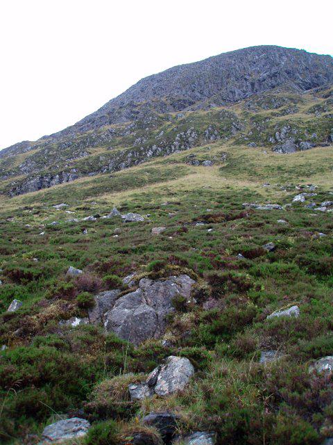 Photo could not load
NH2241 : Sgurr na Muice
Chris Eilbeck
Hill facts and local notes
Classifications
Elevation
890m
2,920 ft
Prominence
129m
Coordinates
57.4322, -4.9565
NH226418
OS Map
25
Explorer: 430
At the Summit
The summit features a prominent cairn and provides impressive views of the surrounding peaks and valleys. There’s something about standing on top of a mountain that makes you feel like you could conquer the world — or at least the next pint.
Terrain & Geology
Sgurr na Muice is primarily composed of granite gneiss, a type of metamorphic rock that has endured intense heat and pressure. The rugged landscapes and craggy outcrops are a result of the mountain's glacial history.
Views & Scenery
Views of the striking Torridon hills to the north, as well as the expansive Loch Maree. A good day offers vistas that stretch for miles, providing ample opportunity for photography or daydreaming.
History & Heritage
Name Origin
Sgurr na Muice translates to 'Peak of the Pig' in Scottish Gaelic, though one might do a double take trying to spot any porcine residents on the peak!
Historical Significance
This Munro holds historical significance for local hikers and mountaineers, often regarded as a hidden gem within the vast landscapes of the Highlands.
Getting There & Facilities
Check current local access restrictions, parking rules and transport timetables before travelling. These notes do not confirm public access to the summit.
Parking
There is a small parking area near the A832 just south of Kinlochewe, providing access to the trailhead.
Public Transport
The nearest bus service runs to Kinlochewe from Inverness, which can be a helpful starting point for hikes in the area.
Nearby Facilities
While there are no facilities on the mountain, Kinlochewe has a pub and a small shop where you can grab a bite to eat or stock up on supplies.
Safety Information
Known Hazards
- Rocky terrain can be slippery, especially in wet weather. Be cautious of sudden weather changes typical of the Scottish Highlands.
General Safety Tips
- Check weather conditions before setting out
- Carry appropriate clothing and equipment
- Let someone know your planned route
- Take a map, compass, and GPS device
- Carry emergency supplies: food, water, first aid kit, torch
Hills
Some common questions about the hills answered
Are there group walks up Sgurr na Muice?
Many walkers use Walkmates to join or organise walks with others. You can check for group walks around Sgurr na Muice through the maps
Are there other walkers around Sgurr na Muice?
Activity varies by location and time, but Walkmates lets you see whether others have shared walks or shown interest in this area. Find other people through the walking friends search walking friends for Sgurr na Muice search or of course create your own walk for Sgurr na Muice
Can I organise a walk to Sgurr na Muice?
Yes. If there aren’t any walks listed already, you can create a walk and make it available for others to join.
If you're signed up to Walkmates, you can create a walk to Sgurr na Muice.
How do I find a walk up this hill?
There are often multiple ways to walk this hill, depending on experience and route preference. Walkmates helps you explore walks and routes that others have shared.
Can I suggest a new route up Sgurr na Muice?
Yes. You can suggest or create routes to share with others. Walkmates focuses on the social side of walking, so routes are used to help people organise walks and explore areas together, rather than as detailed navigation tools or route libraries.
Other uses really appreciate knowledgeable walkers sharing their routes. Share your favourite route to Sgurr na Muice here
The is an error or something incorrect about this hill. How do I let you know?
We always strive to keep the information on Walkmates as accurate as possible. If you find an error, please let us know through the contact form and we'll aim to correct it as quickly as possible
Community Discussion
Comments
Location
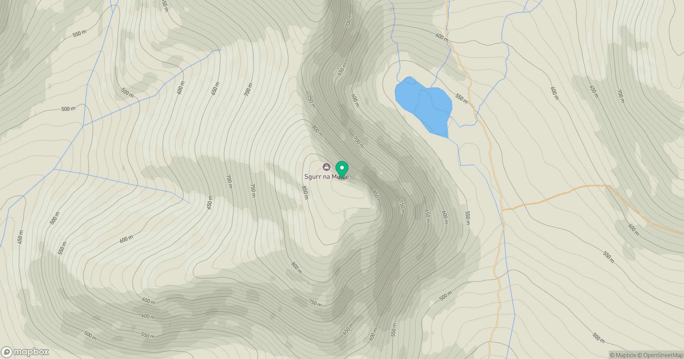
Grid reference: NH226418
View on OpenStreetMapOpens a map in a new tab, centred on the hill.
Hills within 30 km
Straight-line distance, not a walking route or confirmation of access.
No comments yet. Be the first.