

Sgurr na Bana-Mhoraire
Good walks are even better shared.
Overview
Sgurr na Bana-Mhoraire
Sgurr na Bana-Mhoraire stands proud at 938 metres, a distinguished Munro that graces the rugged Scottish Highlands. Known for its spectacular views, the summit offers a bit of everything a hiker could hope for, provided you're not afraid to work up a sweat!
Geology
The geological composition of Sgurr na Bana-Mhoraire is a mix of granite and schist, creating a fascinating landscape of steep rocky faces and rolling grassy knolls. This mountain essentially tells the geological story of the Highlands, chock-full of dramatic formations and breathtaking sights.
Routes
From Strathcarron
This route, approximately 16.5 km long, is the most popular and suitable for moderate hikers. Along the way, you'll enjoy gentle slopes and picturesque views, making it an enjoyable outing. Expect to spend around 6 hours conquering this lovely path.
The Circuit via Gleann Lichd
If you're feeling adventurous, this challenging circuit is approximately 20 km and showcases multiple peaks, with Sgurr na Bana-Mhoraire as the jewel in the crown. Mark out at least 8 hours here, it's not a stroll in the park but a true Highland experience!
Summit Features
Upon reaching the summit, you'll be greeted by a small but sturdy cairn, a traditional marker for fellow adventurers. Settle in for a breather while soaking up the magnificent views - you'll want to ensure your camera is handy!
Terrain Type
Expect to encounter rocky and grassy terrains with a few boggy spots, especially after those cheeky Highland rains. A good pair of hiking boots will go a long way here.
Views
The panoramic views from the top are a highlight of this hike. You'll see the grand peaks of Beinn Alligin to the east and the rugged beauty of Liathach to the south, among many other scenic vistas. The best times for these spectacular views are generally late spring to early autumn, when the weather plays nice.
Hazards
While Sgurr na Bana-Mhoraire is accessible, be mindful of loose rocks and changing weather. A sunny start can turn into a wet afternoon, so always pack for unpredictable Scottish weather!
Access
Nearest Parking
A small parking area near Strathcarron offers space for several cars, but it's wise to arrive early to secure a spot.
Public Transport
Connecting public transport is relatively limited; the nearest train station is at Strathcarron. Double-check local bus services, as they may vary.
Nearest Town
After your hike, unwind in Lochcarron, where cafes and shops will help you replenish your energy levels!
Facilities
Facilities on the mountain are non-existent - it’s just you, the peak, and Mother Nature. Best find a comfy café in Lochcarron.
History
The name 'Sgurr na Bana-Mhoraire' holds a story of its own, translating as 'Peak of the woman of the sea', steeped in local mythology. The mountain is a true gem in the Highland landscape, beloved by locals and hikers alike.
In conclusion, Sgurr na Bana-Mhoraire is not just a hike; it's an experience that offers a perfect blend of natural beauty, challenge, and a slice of Scottish culture. So lace up those boots and embark on an adventure you are unlikely to forget!
Time to hit the hills!
Explore routes near Sgurr na Bana-Mhoraire
Public walks starting within 80 km of this hill. Nearby does not mean a route reaches the summit; check its map and access before setting out.
Beinn Eighe Lancaster Wreckage at Coire Mhic Fhearchair
View route
Fairy Lochs Liberator Wreckage Circuit
View route
Loch Affric full circuit from River Affric
View route
Glen Affric: Coire Loch Woodland Trail
View route
Route planning notes
These notes describe possible approaches, not verified navigable routes or permission to cross land. Check current paths, local access rules and conditions before setting out.
From Strathcarron
A scenic route starting from Strathcarron, offering a gradual ascent with beautiful views along the way. Perfect for those who appreciate a good meander.
The Circuit via Gleann Lichd
This circuit takes in multiple peaks with Sgurr na Bana-Mhoraire as a highlight. It’s a bit of a leg-stretcher but worth every step.
Make a day of it, together
Find someone to share the walk with, or organise a day out along a route you like.
Photo Gallery
View all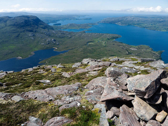 Photo could not load
NG8652 : Cairn below the summit of Sgur na Bana-Mhoraire
Julian Paren
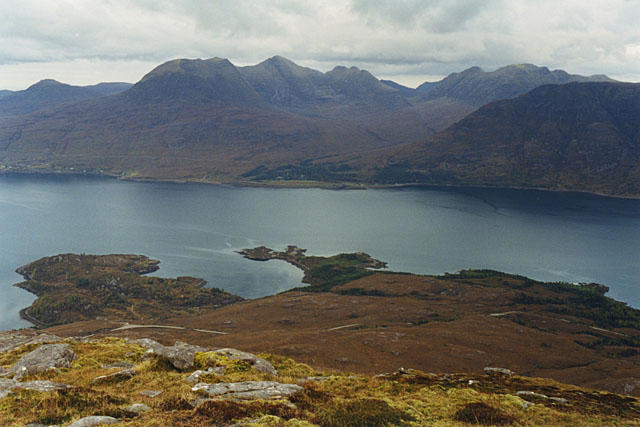 Photo could not load
NG8752 : View north from Sgurr na Bana Mhoraire
Nigel Brown
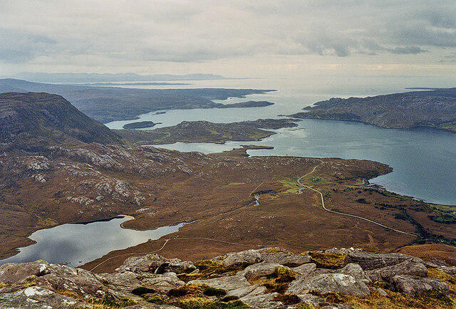 Photo could not load
NG8652 : View towards the mouth of Upper Loch Torridon
Nigel Brown
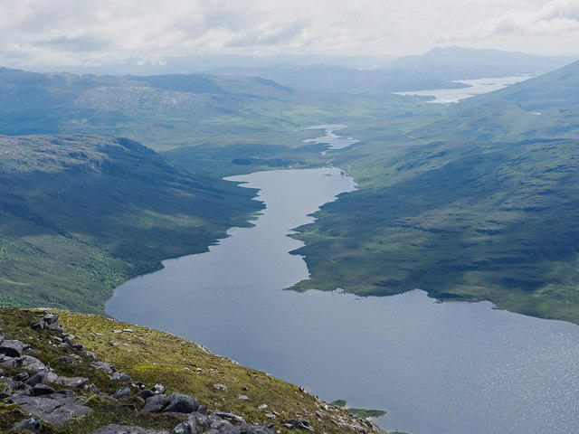 Photo could not load
NG8752 : Loch Damh, Loch Cloustie and Loch Kishorn
Julian Paren
Hill facts and local notes
Classifications
Elevation
687m
2,253 ft
Prominence
102m
Coordinates
57.5138, -5.5578
NG870526
OS Map
24
Explorer: 428N
At the Summit
The summit is adorned with a small cairn and offers an expansive view of the surrounding peaks and valleys, perfect for a well-earned breather.
Terrain & Geology
The mountain is primarily composed of granite and schist, featuring rugged cliffs and impressive rock formations that offer a glimpse into the geological history of the region.
Views & Scenery
From the summit, you can admire the majestic Beinn Alligin and Liathach, along with the sprawling landscape of the Torridon hills.
History & Heritage
Name Origin
The name 'Sgurr na Bana-Mhoraire' derives from Gaelic, meaning ‘Peak of the woman of the sea’.
Historical Significance
This mountain is beloved in local folklore, often symbolising resilience and the beauty of the Highlands.
Getting There & Facilities
Check current local access restrictions, parking rules and transport timetables before travelling. These notes do not confirm public access to the summit.
Parking
There is a small parking area near the start of the Strathcarron route, with space for about 6-8 cars.
Public Transport
The nearest train station is in Strathcarron, from where local buses might operate. Always check service times!
Nearby Facilities
While there are no facilities up the mountain, Lochcarron has cafes and public toilets to refresh weary travellers.
Safety Information
Known Hazards
- Loose rocks on steeper sections and sudden weather changes can occur. Ensure you're prepared for a bit of Scottish drizzle.
General Safety Tips
- Check weather conditions before setting out
- Carry appropriate clothing and equipment
- Let someone know your planned route
- Take a map, compass, and GPS device
- Carry emergency supplies: food, water, first aid kit, torch
Hills
Some common questions about the hills answered
Are there group walks up Sgurr na Bana-Mhoraire?
Many walkers use Walkmates to join or organise walks with others. You can check for group walks around Sgurr na Bana-Mhoraire through the maps
Are there other walkers around Sgurr na Bana-Mhoraire?
Activity varies by location and time, but Walkmates lets you see whether others have shared walks or shown interest in this area. Find other people through the walking friends search walking friends for Sgurr na Bana-Mhoraire search or of course create your own walk for Sgurr na Bana-Mhoraire
Can I organise a walk to Sgurr na Bana-Mhoraire?
Yes. If there aren’t any walks listed already, you can create a walk and make it available for others to join.
If you're signed up to Walkmates, you can create a walk to Sgurr na Bana-Mhoraire.
How do I find a walk up this hill?
There are often multiple ways to walk this hill, depending on experience and route preference. Walkmates helps you explore walks and routes that others have shared.
Can I suggest a new route up Sgurr na Bana-Mhoraire?
Yes. You can suggest or create routes to share with others. Walkmates focuses on the social side of walking, so routes are used to help people organise walks and explore areas together, rather than as detailed navigation tools or route libraries.
Other uses really appreciate knowledgeable walkers sharing their routes. Share your favourite route to Sgurr na Bana-Mhoraire here
The is an error or something incorrect about this hill. How do I let you know?
We always strive to keep the information on Walkmates as accurate as possible. If you find an error, please let us know through the contact form and we'll aim to correct it as quickly as possible
Community Discussion
Comments
Location
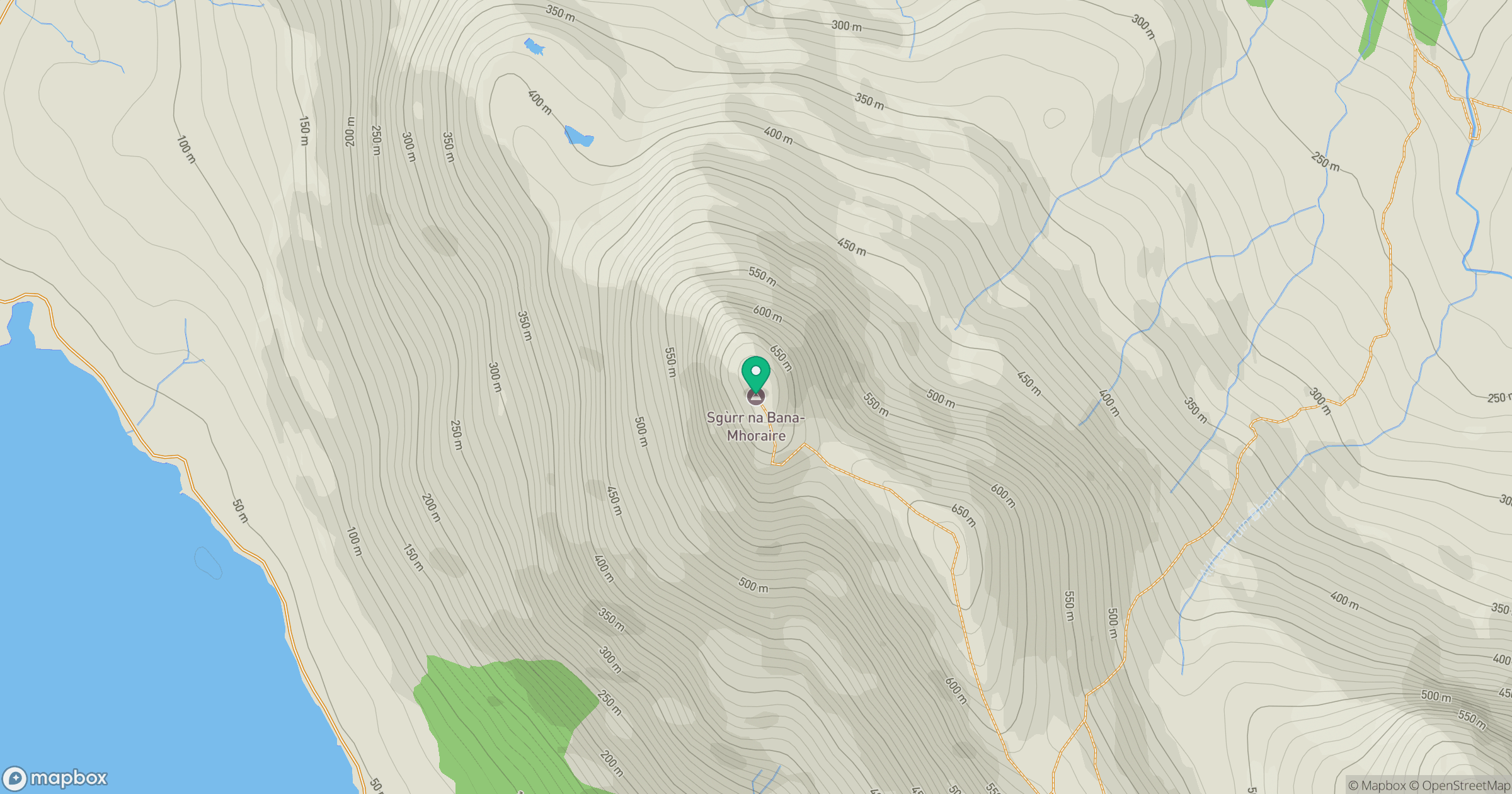
Grid reference: NG870526
View on OpenStreetMapOpens a map in a new tab, centred on the hill.
Hills within 30 km
Straight-line distance, not a walking route or confirmation of access.
Beinn Alligin - Tom na Gruagaich
922m
Beinn Alligin - Sgurr Mor
986m
Liathach - Mullach an Rathain
1,024m
Liathach - Spidean a' Choire Leith
1,055m
Beinn Eighe - Ruadh-stac Mor
1,010m
No comments yet. Be the first.