
Sgurr Breac
Good walks are even better shared.
Overview
Sgurr Breac: A Highland Gem
Sgurr Breac, boasting an elevation of 648 meters, is a stunning Munro located in the heart of the Scottish Highlands. With a prominence of 169 meters, this peak is well worth the trek for those seeking to immerse themselves in Scotland’s rugged beauty.
Geology
The mountain is predominantly composed of granite and schist, remnants from a time when glaciers mercilessly carved the landscape during the last Ice Age. The rocky outcrops add to the charm, showcasing nature's own handiwork and providing excellent photo opportunities for geology enthusiasts.
Routes
The most popular route starts from Strathfarrar, covering around 10 km and taking approximately 5 hours to complete. Be prepared for a moderate challenge, as the path winds through verdant glens and up rocky slopes. It’s a fantastic way to work off that extra scone from your Beauly cafe visit.
Summit Features
Upon reaching the summit, you’re greeted by a rocky outcrop topped with a small cairn. It’s the perfect spot to catch your breath (or your wits) and snap that all-important selfie to prove you’ve conquered another Munro.
Terrain
Expect a mixed bag of rocky and grassy terrain, with occasional boggy patches that will remind you of Scotland’s penchant for a good muggy day. A sturdy pair of boots is highly recommended, unless you enjoy aquatics on dry land!
Views
The views from Sgurr Breac are simply breathtaking. The expansive vistas reveal Loch Monar and the majestic peaks of Fisherfield Forest, providing endless opportunities for awe—so remember to bring your camera, or prepare to share the tale with your friends as a ‘you had to be there’ moment.
Best Seasons
To witness the peak in its full glory, aim for spring or autumn. The clear skies and vibrant foliage make for scenery straight out of a postcard, or so we’d like to think!
Hazards
Hikers should be diligent as trails can get slippery in wet conditions, and the ever-unpredictable Highland weather can bring rain and mist without a moment's notice. Always be prepared!
Nearby Summits
If you find yourself on Sgurr Breac and want more, consider tackling nearby giants like Sgurr na Lapaich (965 meters) and Càrn nan Gobhar (925 meters). After all, who doesn’t want to brag about climbing multiple Munros?
Access
Parking is available near Strathfarrar, which offers a convenient starting point for your adventure. Regular buses run to Beauly, with taxi services available for the final stretch. This charming village is the gateway to your Highland escapade!
Facilities
Beauly has a handful of cafes and shops where you can stock up before heading into the wild. A bonus? Public toilets are easily accessible, so there's no need to fret about nature calling!
History
The name 'Sgurr Breac' meaning 'Spotted Peak' reflects its geological character, and it holds a special place in local folklore. This mountain has long captured the imaginations of adventurers and storytellers alike, a testament to the Highlands’ rich cultural tapestry.
Conclusion
Embarking on a hike up Sgurr Breac is not just a physical journey; it’s an adventure through Scottish history and nature. From the exhilarating climb to the majestic views, you’re in for an unforgettable experience. So grab your gear, lace up those boots, and set off on an adventure that promises to be anything but boring!
Happy hiking!
Explore routes near Sgurr Breac
Walks starting near this hill. Open a route to check its map, distance and full itinerary.
Beinn Eighe Lancaster Wreckage at Coire Mhic Fhearchair
View route
Fairy Lochs Liberator Wreckage Circuit
View route
Glen Affric: Coire Loch Woodland Trail
View route
Loch Migdale from Torroy: Spinningdale pinewood and loch shore walk
View route
Route planning notes
These notes describe possible approaches. Check a route's map and access information when planning your walk.
The Standard Approach from Strathfarrar
A well-trodden path leading you through lush glens and rocky outcrops, this route offers a mixture of delightful scenery and moderate physical challenge.
Make a day of it, together
Find someone to share the walk with, or organise a day out along a route you like.
Hill facts and local notes
Classifications
Elevation
1,000m
3,280 ft
Prominence
451m
Coordinates
57.6919, -5.0913
NH158711
OS Map
20
Explorer: 435S 436S
At the Summit
The summit of Sgurr Breac features a prominent rocky outcrop and a small cairn, providing a perfect spot for that obligatory summit selfie.
Terrain & Geology
Sgurr Breac is primarily composed of granite and schist, with stunning rock formations offering insight into the ancient geological processes shaped by glaciers during the last Ice Age.
Views & Scenery
From the summit, you can enjoy expansive views of Loch Monar, the surrounding peaks of the Fisherfield Forest, and the undulating landscape of the Highlands.
History & Heritage
Name Origin
Sgurr Breac translates to 'Spotted Peak' in Scots Gaelic, likely referring to the mottled appearance of the granite rocks.
Historical Significance
The mountain holds cultural significance in local folklore, often associated with tales of spirits and fairies, reflecting the rich storytelling tradition of the Highlands.
Getting There & Facilities
Parking
There is a parking area at the entrance to Strathfarrar, which is just a short walk from the trailhead.
Public Transport
Regular bus services operate to the nearby village of Beauly, with connections to taxi services for the short trip to Strathfarrar.
Nearby Facilities
Beauly offers a few cafes and shops for supplies, and public toilets are available.
Safety Information
Known Hazards
- Care should be taken in wet weather as the paths can become slippery. Watch out for sudden changes in the weather, which can occur unexpectedly in the Highlands.
General Safety Tips
- Check weather conditions before setting out
- Carry appropriate clothing and equipment
- Let someone know your planned route
- Take a map, compass, and GPS device
- Carry emergency supplies: food, water, first aid kit, torch
Hills
Some common questions about the hills answered
Are there group walks up Sgurr Breac?
Many walkers use Walkmates to join or organise walks with others. You can check for group walks around Sgurr Breac through the maps
Are there other walkers around Sgurr Breac?
Activity varies by location and time, but Walkmates lets you see whether others have shared walks or shown interest in this area. Find other people through the walking friends search walking friends for Sgurr Breac search or of course create your own walk for Sgurr Breac
Can I organise a walk to Sgurr Breac?
Yes. If there aren’t any walks listed already, you can create a walk and make it available for others to join.
If you're signed up to Walkmates, you can create a walk to Sgurr Breac.
How do I find a walk up this hill?
There are often multiple ways to walk this hill, depending on experience and route preference. Walkmates helps you explore walks and routes that others have shared.
Can I suggest a new route up Sgurr Breac?
Yes. You can suggest or create routes to share with others. Walkmates focuses on the social side of walking, so routes are used to help people organise walks and explore areas together, rather than as detailed navigation tools or route libraries.
Other uses really appreciate knowledgeable walkers sharing their routes. Share your favourite route to Sgurr Breac here
The is an error or something incorrect about this hill. How do I let you know?
We always strive to keep the information on Walkmates as accurate as possible. If you find an error, please let us know through the contact form and we'll aim to correct it as quickly as possible
Community Discussion
Comments
Location
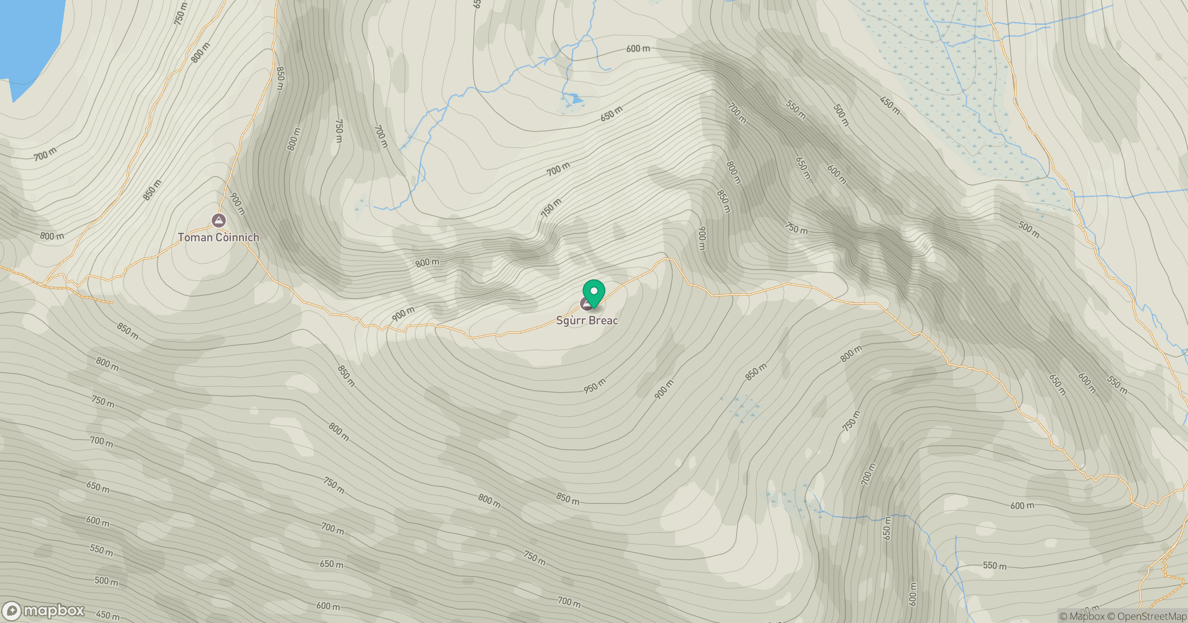
Grid reference: NH158711
View on OpenStreetMapOpens a map in a new tab, centred on the hill.
No comments yet. Be the first.