

Sgurr Ban
Good walks are even better shared.
NH0574 : Boulderfield on Sgurr Ban
Russel Wills Photo source
Overview
Sgurr Ban: A Munro Worth Climbing
Introduction
Sgurr Ban, or the 'White Peak', stands proudly in the Scottish Highlands, showcasing the rugged beauty that Scotland is famed for. With an elevation of 919 metres, it’s a manageable climb that's popular among hikers looking for a taste of Munro climbing without the daunting heights of some of its taller neighbours.
Geology
The mountain's geology features ancient Lewisian gneiss, forming a sturdy backdrop against which nature displays its genius. This metamorphic rock tells tales that stretch back over three billion years, giving hikers a sense of walking on the very fabric of the Earth.
Routes
The most popular ascent is via the Northwest Ridge Route. This route, moderate in difficulty, provides a steady climb with breathtaking views that may tempt you to stop for a selfie more than once! Distance: Approximately 10.0 km.
Summit Features
Once at the top, hikers are greeted by a substantial stone cairn, a quintessential feature of Scottish summits, signalling your achievement. As you catch your breath and enjoy the environment, don’t forget to look around— the scenery is nothing short of spectacular!
Terrain Type
The terrain varies from rocky stretches to heather-covered patches, presenting hikers with a feast for both the eyes and the legs. Be sure-footed as you navigate rocky outcrops and the occasional muddy patch.
Views
Standing atop Sgurr Ban, you are treated to multi-dimensional vistas. Loch Duich glimmers below while the Five Sisters of Kintail loom majestically, each contour telling a story of its own. Best enjoyed during late spring and early autumn, the views seem to come straight out of a postcard.
Hazards
As with all Highland hikes, the weather is unpredictable. Bring a waterproof jacket and prepare for sudden changes. Keep your wits about you on the stony paths to avoid any unfortunate trips!
Nearby Summits
Not to be outdone, nearby summits like Sgurr na Ciche and Beinn Fhada offer even more adventure if you’re up for the challenge!
Access
Nearest Parking
To kick off your adventure, there's a handy layby along the A87; however, it can fill up quickly. Get there early if you want to secure your spot!
Public Transport
The nearest public transport drop-off is in Dornie, where friendly taxi drivers can whisk you away to the trailhead.
Nearest Town
Dornie is not just your closest town; it’s also brimming with charm and hospitality, perfect for a pre-hike coffee.
Facilities
While Sgurr Ban is devoid of facilities, Dornie has cafes and toilets that should cover your needs before you embark on your journey.
History
The name Sgurr Ban, meaning 'White Peak', pays homage to the beauty and majesty of the Highland peaks. The mountain is steeped in local folklore, making it an essential part of the region's cultural landscape.
Conclusion
Overall, Sgurr Ban offers a delightful escape into nature, beckoning adventurers near and far. Whether you’re a seasoned hiker or simply looking for a day of exploration, it’s a climb not to be missed. So lace up those boots and get ready for a memorable adventure!
Explore routes near Sgurr Ban
Walks starting near this hill. Open a route to check its map, distance and full itinerary.
Beinn Eighe Lancaster Wreckage at Coire Mhic Fhearchair
View route
Fairy Lochs Liberator Wreckage Circuit
View route
Glen Affric: Coire Loch Woodland Trail
View route
Loch Migdale from Torroy: Spinningdale pinewood and loch shore walk
View route
Route planning notes
These notes describe possible approaches. Check a route's map and access information when planning your walk.
Northwest Ridge Route
A popular ascent starting from the A87, enjoyable for its gradual incline and breathtaking views.
Make a day of it, together
Find someone to share the walk with, or organise a day out along a route you like.
Photo Gallery
View all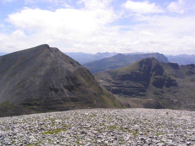 Photo could not load
NH0574 : Boulderfield on Sgurr Ban
Russel Wills
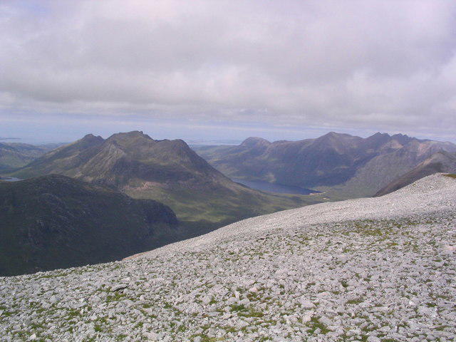 Photo could not load
NH0574 : Boulderfield on Sgurr Ban
Russel Wills
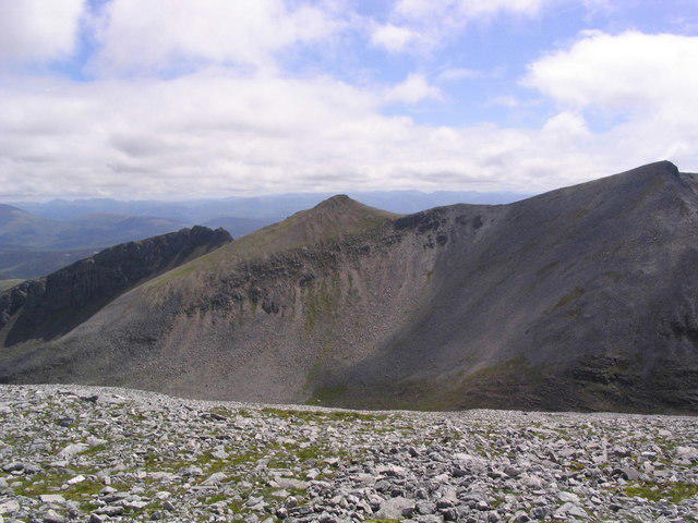 Photo could not load
NH0574 : Boulderfield on Sgurr Ban
Russel Wills
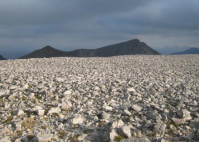 Photo could not load
NH0574 : Sgurr Ban - Summit
Hill Walker
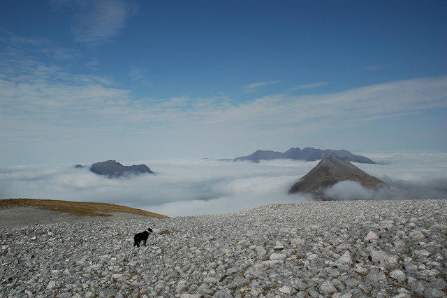 Photo could not load
NH0574 : Temperature inversion in Wester Ross from the summit of Sgurr Ban
charlie kennedy
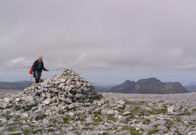 Photo could not load
NH0574 : Summit cairn on Sgurr Ban
Russel Wills
Hill facts and local notes
Classifications
Elevation
989m
3,245 ft
Prominence
165m
Coordinates
57.7185, -5.2659
NH055745
OS Map
19
Explorer: 435S
At the Summit
At the summit, you will find a substantial stone cairn, along with stunning panoramic views that will make even the most seasoned hikers gasp at the beauty below.
Terrain & Geology
Sgurr Ban is primarily composed of ancient Lewisian gneiss, a type of metamorphic rock that is as tough as old boots. This foundation provides not only stunning views but also a peek into the Earth's geological past.
Views & Scenery
From the summit, you can see the mighty Loch Duich, the Five Sisters of Kintail, and on a clear day, the Isle of Skye appears like a mirage in the distance.
History & Heritage
Name Origin
Sgurr Ban translates to 'White Peak' in Gaelic, indicative of the occasional snowcap that adorns its summit during colder months.
Historical Significance
Sgurr Ban is part of the rich cultural tapestry of the Highlands, often noted in local folklore and appreciated for its striking natural beauty.
Getting There & Facilities
Parking
There is a layby at the A87 near the starting point of the route, though spaces can be limited—arrive early to bag a spot!
Public Transport
The nearest bus stop is in the village of Dornie, from where you can arrange for a taxi or walk to the route start.
Nearby Facilities
While you won’t find many facilities atop Sgurr Ban, Dornie provides cafes and toilets, ensuring your pre-hike needs are met.
Safety Information
Known Hazards
- The weather can change rapidly in the Highlands, so be prepared for anything, from sunshine to rain—sometimes in the same hour! Additionally, the terrain can be uneven, and care should be taken near crags.
General Safety Tips
- Check weather conditions before setting out
- Carry appropriate clothing and equipment
- Let someone know your planned route
- Take a map, compass, and GPS device
- Carry emergency supplies: food, water, first aid kit, torch
Hills
Some common questions about the hills answered
Are there group walks up Sgurr Ban?
Many walkers use Walkmates to join or organise walks with others. You can check for group walks around Sgurr Ban through the maps
Are there other walkers around Sgurr Ban?
Activity varies by location and time, but Walkmates lets you see whether others have shared walks or shown interest in this area. Find other people through the walking friends search walking friends for Sgurr Ban search or of course create your own walk for Sgurr Ban
Can I organise a walk to Sgurr Ban?
Yes. If there aren’t any walks listed already, you can create a walk and make it available for others to join.
If you're signed up to Walkmates, you can create a walk to Sgurr Ban.
How do I find a walk up this hill?
There are often multiple ways to walk this hill, depending on experience and route preference. Walkmates helps you explore walks and routes that others have shared.
Can I suggest a new route up Sgurr Ban?
Yes. You can suggest or create routes to share with others. Walkmates focuses on the social side of walking, so routes are used to help people organise walks and explore areas together, rather than as detailed navigation tools or route libraries.
Other uses really appreciate knowledgeable walkers sharing their routes. Share your favourite route to Sgurr Ban here
The is an error or something incorrect about this hill. How do I let you know?
We always strive to keep the information on Walkmates as accurate as possible. If you find an error, please let us know through the contact form and we'll aim to correct it as quickly as possible
Community Discussion
Comments
Location
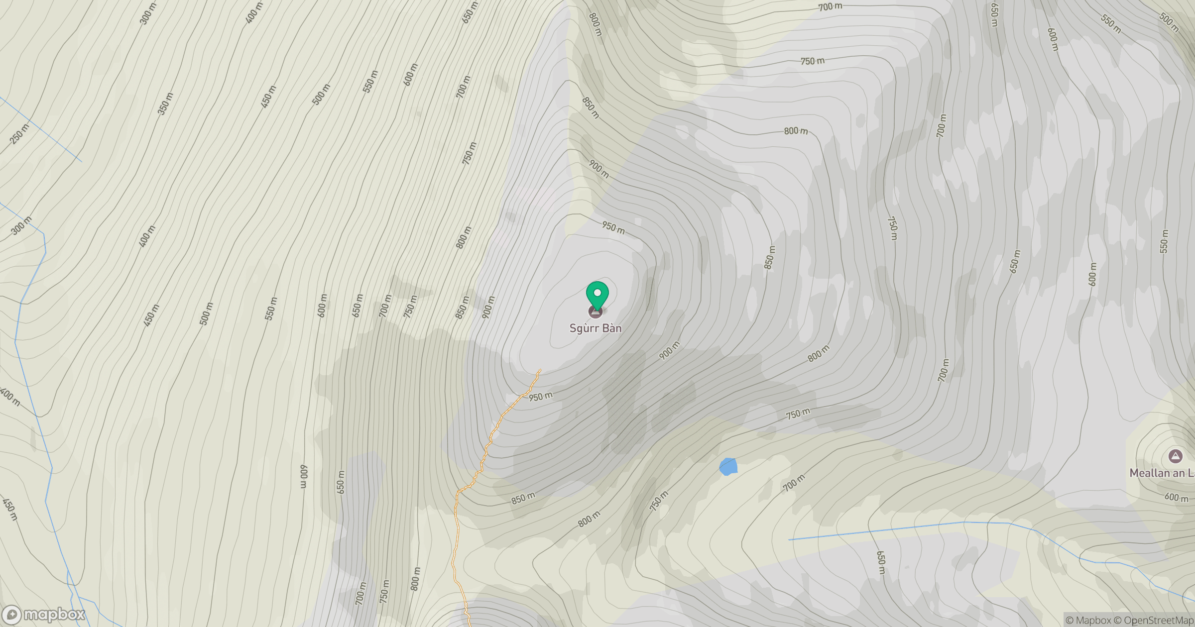
Grid reference: NH055745
View on OpenStreetMapOpens a map in a new tab, centred on the hill.
No comments yet. Be the first.