
Revidge
Good walks are even better shared.
Overview
Exploring Revidge
Overview
Revidge is a lesser-known gem nestled near Accrington in North West England. Standing at 168 meters, it may not be the highest hill on the block, but it offers a delightful escape for walkers and nature lovers alike. Whether it's a leisurely stroll or a hunt for some top-notch photographs, Revidge welcomes all with open arms.
Geology
The hill is made up of limestone, forming fascinating karst features that showcase nature's artistry. Keep your eyes peeled for interesting stony formations and a variety of flora that flourishes in this unique environment.
Routes
The Revidge Circular Walk is a popular choice, offering great scenery without leaving you gasping for breath. Covering about 5 km in roughly 2 hours, it’s suitable for families and casual walkers. Just remember to bring your sense of adventure!
Summit Features
At the summit, you’ll come across a trig point, which serves as a lovely marker for your achievement. Don’t forget to snap a picture; your social media followers will want to know you conquered Revidge!
Terrain
The terrain is predominantly grassy, dotted with occasional rocky patches that keep things interesting. The vistas are nothing short of delightful, with views stretching to the stunning Pendle Hill.
Views
The summit promises breathtaking views, especially in spring and autumn. These seasons allow hikers to enjoy vibrant landscapes that will leave you in awe.
Hazards
The only real hazard you’ll encounter is the unpredictable British weather, but good footwear will help you stay upright on those slippery sections.
Access
Getting to Revidge couldn’t be easier. You’ll find parking in Oswaldtwistle, with public transport links to Accrington yielding convenient access to the start of your journey.
Facilities
Once you've conquered Revidge, pop into one of Accrington's cafes to savour a well-deserved refreshment. Be sure to check out the public toilets as well!
History
Revidge’s name reflects its natural history, suggesting a link to old English roots. The hill is surrounded by fascinating tales and legends, particularly tied to nearby Pendle Hill and its infamous witchcraft history.
Conclusion
Whether you’re tackling the Revidge Circular Walk or simply pausing to appreciate the scenery, Revidge is a delightful destination that promises pure enjoyment. So pack your hiking boots and let nature do the talking!
Explore routes near Revidge
Walks starting near this hill. Open a route to check its map, distance and full itinerary.
Brockholes Reserve Tour
View route
Brockholes Wildflower Year guided walk
View route
Brockholes Reserve Tour
View route
History of Christmas guided walk
View route
Route planning notes
These notes describe possible approaches. Check a route's map and access information when planning your walk.
Revidge Circular Walk
A delightful circular route that allows you to soak in the sights while also giving your legs a gentle workout.
Make a day of it, together
Find someone to share the walk with, or organise a day out along a route you like.
Hill facts and local notes
Classifications
Elevation
229m
751 ft
Prominence
55m
Coordinates
53.7598, -2.4943
SD675293
OS Map
103
Explorer: 287
At the Summit
The summit boasts a modest trig point which stands proud, allowing hikers to claim their victory with a photo – because we all know that if it's not on Instagram, it didn't happen!
Terrain & Geology
Revidge is primarily composed of limestone and holds significant geological interest due to its karst formations. This means you might occasionally marvel at the ground beneath your feet while avoiding the odd slippery patch!
Views & Scenery
Guests are treated to stunning views of the surrounding areas, including the peaks of the nearby Forest of Bowland. Keep an eye out for the iconic Pendle Hill in the distance!
History & Heritage
Name Origin
The name 'Revidge' might be derived from Old English, meaning 'a ridge with a reedy area.' But don't let that confuse you, it’s not a great place for picking up reeds!
Historical Significance
The area surrounding Revidge is steeped in local history, with tales of witchcraft and folklore particularly tied to the nearby Pendle Hill.
Getting There & Facilities
Parking
There is limited parking at the nearby village of Oswaldtwistle; be considerate of local residents.
Public Transport
Public transport options include local bus services running from Blackburn and Accrington.
Nearby Facilities
Cafés and public toilets can be found in Accrington, so you can refuel before or after your hike.
Safety Information
Known Hazards
- While the route is generally safe, some areas may be slippery when wet. It’s wise to wear appropriate footwear—unless you're a fan of soggy socks.
General Safety Tips
- Check weather conditions before setting out
- Carry appropriate clothing and equipment
- Let someone know your planned route
- Take a map, compass, and GPS device
- Carry emergency supplies: food, water, first aid kit, torch
Hills
Some common questions about the hills answered
Are there group walks up Revidge?
Many walkers use Walkmates to join or organise walks with others. You can check for group walks around Revidge through the maps
Are there other walkers around Revidge?
Activity varies by location and time, but Walkmates lets you see whether others have shared walks or shown interest in this area. Find other people through the walking friends search walking friends for Revidge search or of course create your own walk for Revidge
Can I organise a walk to Revidge?
Yes. If there aren’t any walks listed already, you can create a walk and make it available for others to join.
If you're signed up to Walkmates, you can create a walk to Revidge.
How do I find a walk up this hill?
There are often multiple ways to walk this hill, depending on experience and route preference. Walkmates helps you explore walks and routes that others have shared.
Can I suggest a new route up Revidge?
Yes. You can suggest or create routes to share with others. Walkmates focuses on the social side of walking, so routes are used to help people organise walks and explore areas together, rather than as detailed navigation tools or route libraries.
Other uses really appreciate knowledgeable walkers sharing their routes. Share your favourite route to Revidge here
The is an error or something incorrect about this hill. How do I let you know?
We always strive to keep the information on Walkmates as accurate as possible. If you find an error, please let us know through the contact form and we'll aim to correct it as quickly as possible
Community Discussion
Comments
Location
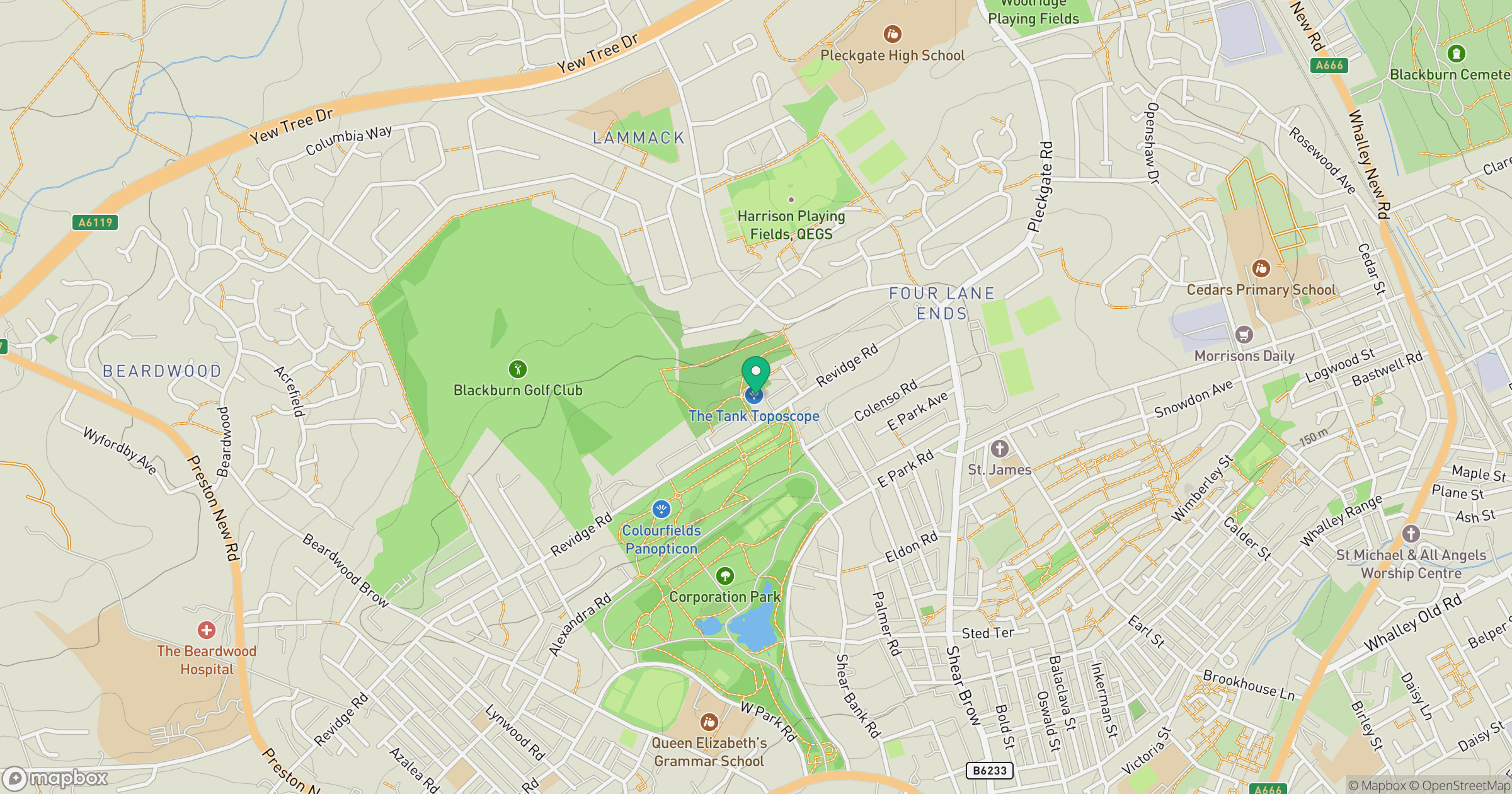
Grid reference: SD675293
View on OpenStreetMapOpens a map in a new tab, centred on the hill.




No comments yet. Be the first.