

Revidge
Good walks are even better shared.
SK0759 : Track through a wood east of Revidge Moor
Neil Theasby Photo source
Overview
Revidge: A Hidden Gem in Lancashire
Revidge is a Marilyn classification hill in Lancashire, standing at a proud 202 meters above sea level. Nestled in the picturesque landscape, it serves as a perfect jaunt for those looking to escape the hustle and bustle of urban life.
Geology
The foundation of Revidge is primarily sandstone, dating back to the Permian and Triassic periods. This rocky terrain forms a classic English hill, with a backdrop of dramatic cliffs and rolling pastures. It’s just the place for those with a curiosity for geological wonders!
Parking and Access
Getting to Revidge is a breeze. The nearest parking can be found at a small car park in the village of Houghton. Once parked, it’s just a short stroll to the start of the Revidge Circular Walk, which gets you up and about in no time.
Public transport users will find bus services emerging regularly from nearby towns, connecting adventurers with this delightful hill. The village of Houghton itself is filled with charm, and is your best bet for amenities.
Summit Features
At the summit, hikers are greeted by a humble stone cairn, perfect for a quick photo op or a casual snack break. It might not be the highest peak around, but the views are absolutely worth the climb!
Terrain
The terrain features a mix of grassy slopes interspersed with rocky patches and the occasional blooming heather. It’s a classic British hillwalk—laugh at the mud, graze on some grass, and soak up the fresh air.
Views
From the top, you’ll be treated to breathtaking panoramas of the Forest of Bowland and the distant Pennines. On particularly clear days—not just when a cloud decides to take a snooze—you might be able to spot Blackpool's Tower peeking through the landscape like an old friend! The best seasons for views? Spring and autumn are absolute show-stoppers, with nature's palette on full display.
Hazards
Every hill has its quirks, and Revidge is no exception. After rain, be cautious of slippery patches. And keep an eye out for the local sheep—they're friendly, but they might not know the term 'personal space'!
Conclusion
Revidge offers a delightful escape with picturesque views and accessible trails, making it an ideal spot for families or solo adventurers alike. So grab your walking boots, pack a sandwich, and enjoy the wonders of Lancashire’s greenery!
“If you find yourself lost on Revidge, just follow the sheep; they know where the good grass is!”
Explore routes near Revidge
Walks starting near this hill. Open a route to check its map, distance and full itinerary.
Tissington Trail: Parsley Hay, Hartington Station and Heathcote
View route
Tittesworth Reservoir
View route
High Peak Trail: Friden, Newhaven Tunnel and Hurdlow Bridge
View route
Rudyard Lake Circuit near Leek
View route
Route planning notes
These notes describe possible approaches. Check a route's map and access information when planning your walk.
Revidge Circular Walk
A lovely walk starting from the nearest village, taking you around the hill and up to the summit.
Make a day of it, together
Find someone to share the walk with, or organise a day out along a route you like.
Photo Gallery
View all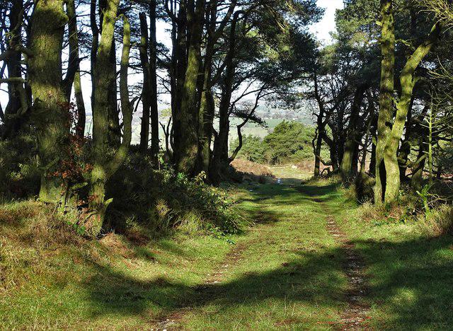 Photo could not load
SK0759 : Track through a wood east of Revidge Moor
Neil Theasby
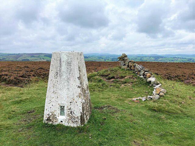 Photo could not load
SK0759 : Triangulation Pillar and Cairn on Revidge Moor
Jonathan Clitheroe
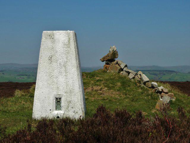 Photo could not load
SK0759 : The triangulation pillar on Revidge Moor
Neil Theasby
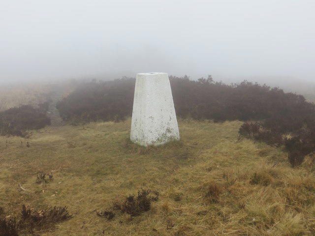 Photo could not load
SK0759 : Ordnance Survey Trig Pillar S4171
Peter Wood
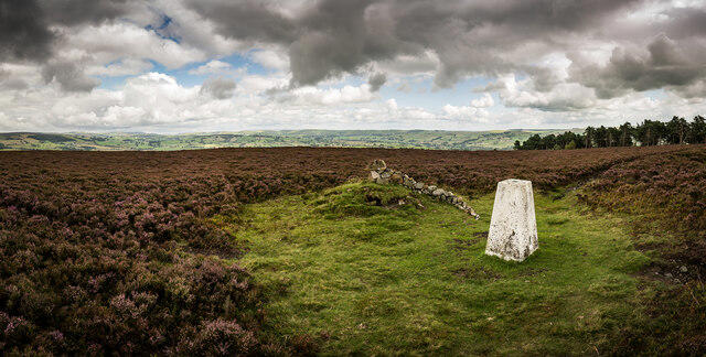 Photo could not load
SK0759 : Revidge Moor and Trigpoint
Brian Deegan
Hill facts and local notes
Classifications
Elevation
401m
1,316 ft
Prominence
40m
Coordinates
53.1364, -1.8858
SK077599
OS Map
119
Explorer: OL24W
At the Summit
On the summit, you'll find a modest rocky outcrop with a small stone cairn that’s perfect for resting and eating that sandwich you’ve lugged up.
Terrain & Geology
Revidge is primarily composed of sandstone, which forms the rolling “cliffs” that give the hill its character. The rock formations here were laid down in the Permian and Triassic periods, making it a geologist's delight.
Views & Scenery
From the summit, you can see stunning vistas of the Forest of Bowland, the distant Pennines, and on a clear day, even Blackpool's Tower poking through the landscape.
History & Heritage
Name Origin
The name Revidge is derived from Old Norse, meaning ‘grazing land’—quite fitting given the area's pastoral nature.
Historical Significance
Historically, Revidge has been a local landmark for centuries, used by shepherds and travellers navigating the lush pastures of Lancashire.
Getting There & Facilities
Parking
There is a small car park near the village of Houghton, just a short walk from the trailhead.
Public Transport
The nearest bus station is in Houghton, with services running from nearby towns.
Nearby Facilities
Houghton has a couple of pubs and cafes, but don't hold your breath for toilets; it’s best to use facilities before heading out.
Safety Information
Known Hazards
- Watch out for wet and slippery sections after rain, and be wary of the occasional sheep ambush; they can be surprisingly bold!
General Safety Tips
- Check weather conditions before setting out
- Carry appropriate clothing and equipment
- Let someone know your planned route
- Take a map, compass, and GPS device
- Carry emergency supplies: food, water, first aid kit, torch
Hills
Some common questions about the hills answered
Are there group walks up Revidge?
Many walkers use Walkmates to join or organise walks with others. You can check for group walks around Revidge through the maps
Are there other walkers around Revidge?
Activity varies by location and time, but Walkmates lets you see whether others have shared walks or shown interest in this area. Find other people through the walking friends search walking friends for Revidge search or of course create your own walk for Revidge
Can I organise a walk to Revidge?
Yes. If there aren’t any walks listed already, you can create a walk and make it available for others to join.
If you're signed up to Walkmates, you can create a walk to Revidge.
How do I find a walk up this hill?
There are often multiple ways to walk this hill, depending on experience and route preference. Walkmates helps you explore walks and routes that others have shared.
Can I suggest a new route up Revidge?
Yes. You can suggest or create routes to share with others. Walkmates focuses on the social side of walking, so routes are used to help people organise walks and explore areas together, rather than as detailed navigation tools or route libraries.
Other uses really appreciate knowledgeable walkers sharing their routes. Share your favourite route to Revidge here
The is an error or something incorrect about this hill. How do I let you know?
We always strive to keep the information on Walkmates as accurate as possible. If you find an error, please let us know through the contact form and we'll aim to correct it as quickly as possible
Community Discussion
Comments
Location
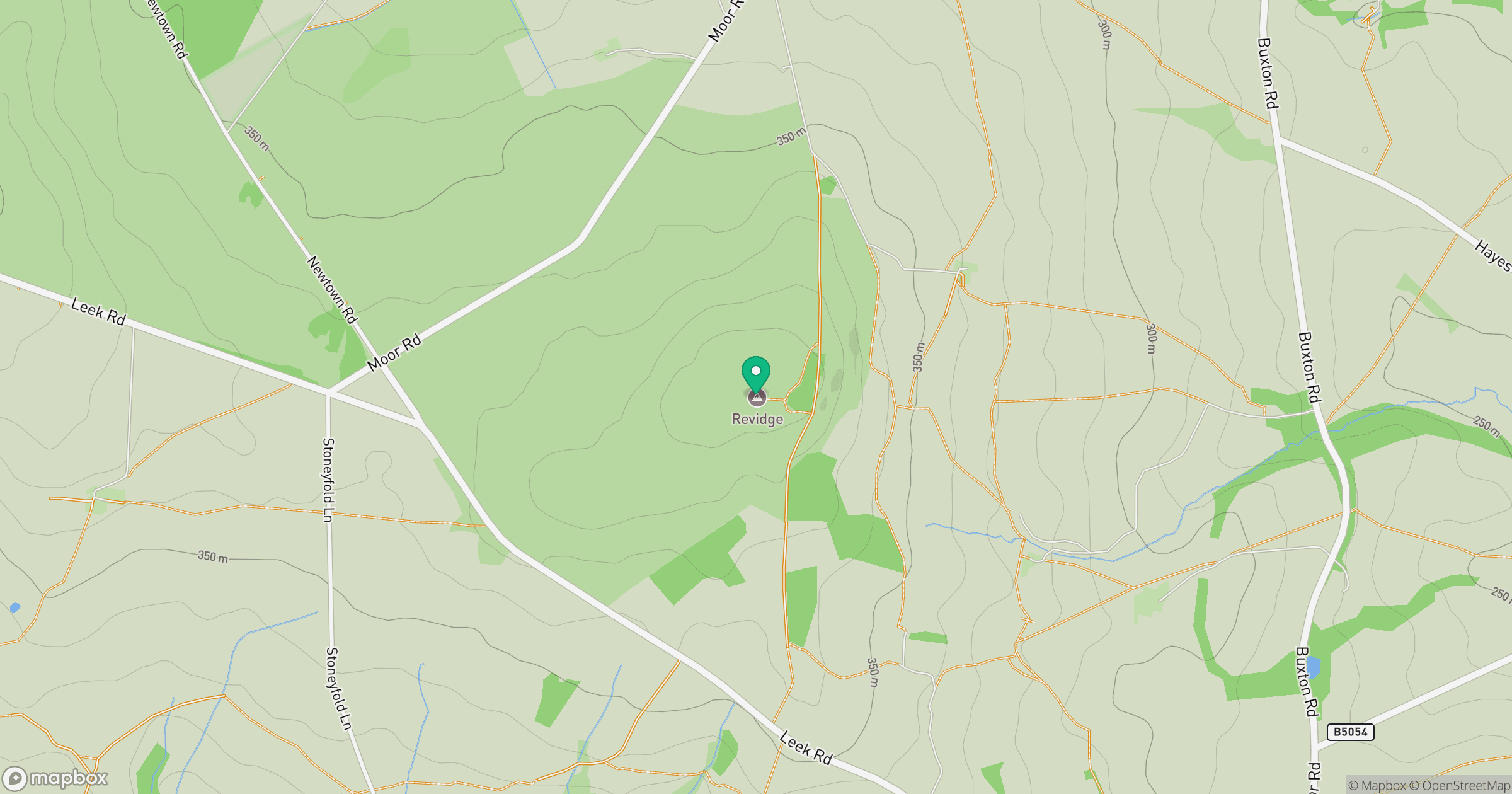
Grid reference: SK077599
View on OpenStreetMapOpens a map in a new tab, centred on the hill.
Nearby Hills
The Roaches
505m

Kinder Scout
636m
Rombalds Moor [Ilkley Moor]
402m
Winter Hill
456m

The Wrekin
407m
No comments yet. Be the first.