

Ravelrig Hill
Good walks are even better shared.
NT1466 : Mast and barley, Ravelrig
Richard Webb Photo source
Overview
Ravelrig Hill
Overview
Ravelrig Hill, standing at a proud 389 meters, is considered a Marilyn and is the perfect spot for both seasoned hikers and ambling adventurers. Nestled in the Pentland Hills, just a stone's throw from the bustling city of Edinburgh, this hill offers a welcome escape into the wild.
Geology
The formation of Ravelrig Hill is a testament to the volcanic activity of the Carboniferous period, and its craggy surface is a natural playground for geology enthusiasts and budding rock hounds alike. You might even stumble upon fossils if you keep your eyes peeled!
Routes
For those keen to explore, the Ravelrig Hill Circular route is a must-do. Spanning 6.0 km, it weaves through vibrant meadows and rocky outcrops, taking around 2 hours to complete. With a moderate difficulty rating, it’s seen as a rewarding day out without having to climb Everest—there’s no Sherpa needed!
Summit Features
The summit is capped by a classic trig point, often marked by the eclectic memories of climbers and cyclists alike. It’s a spot that begs for a photo op, so don’t forget to strike a pose!
Terrain Type
Get ready for a mix of grassy patches complemented by rocky outcrops. Watch your step—this ain’t a stroll in the park, especially when the weather’s not playing nice!
Views
Gaze upon the Edinburgh skyline stretching to your left, while the majestic landscapes of the Scottish Highlands loom in the background. The best views occur in spring or early autumn when the earth is draped in vibrant colours—all the better for bragging rights in your hiking group!
Access Information
Parking is found at the Harlaw Reservoir car park, situated conveniently for those keen to hit the trails. Public transport options from Edinburgh include Lothian Buses routes 10 and 14, with a pleasant walk leading you to the hill.
Nearby Facilities
Once you’ve conquered Ravelrig, head down to the quaint town of Balerno, where you can find cafes to quench your thirst and refill your energy.
History
The name 'Ravelrig' is said to refer to the hill's topography—quite a poetic way to connect with the land. As part of the Pentland Hills Regional Park, this area carries historical significance, having been part of pastoral lands for centuries.
You’ll find that Ravelrig Hill is not just a hill but an experience to be enjoyed—so lace up those boots and set off for a day of adventure! Don’t get lost in the wilderness, or you might just end up becoming one with the heather!
Final Thoughts
Ravelrig Hill is an inviting destination for those looking to explore the great outdoors. Whether you’re a local or a tourist, it promises a unique and captivating experience among the Scottish landscape.
Explore routes near Ravelrig Hill
Walks starting near this hill. Open a route to check its map, distance and full itinerary.
East Calder: Almondell, Mandela Bridge and River Almond Circuit
View route
Artists’ walk in Craigmillar Castle Park (group meeting)
View route
To Absent Friends: Holyrood Park walk
View route
Linlithgow: Beecraigs Loch and Southern Woodland Circuit
View route
Route planning notes
These notes describe possible approaches. Check a route's map and access information when planning your walk.
Ravelrig Hill Circular
A delightful circular route starting from the small car park near the base, providing panoramic views and a gentle ascent.
Make a day of it, together
Find someone to share the walk with, or organise a day out along a route you like.
Photo Gallery
View all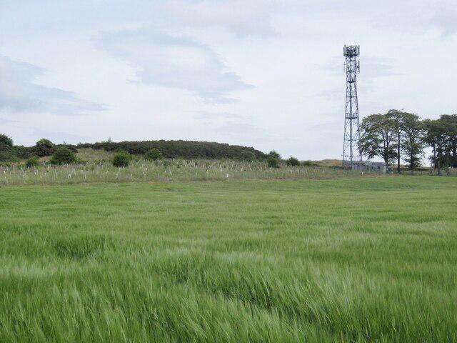 Photo could not load
NT1466 : Mast and barley, Ravelrig
Richard Webb
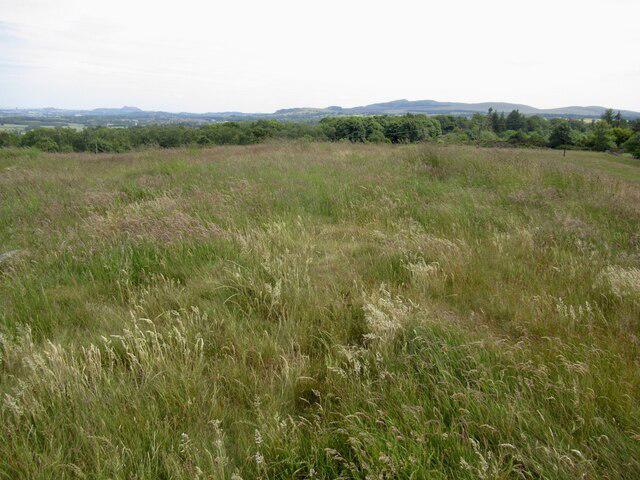 Photo could not load
NT1566 : Summit, Ravelrig Hill
Richard Webb
Hill facts and local notes
Classifications
Elevation
218m
714 ft
Prominence
33m
Coordinates
55.8873, -3.3602
NT150668
OS Map
65
Explorer: 344 350
At the Summit
At the summit, you'll find a well-maintained trig point, which is a family favourite for selfies, as well as scenic views stretching across the Pentland Hills.
Terrain & Geology
Ravelrig Hill is primarily comprised of volcanic rock formed during the Carboniferous period. The hill's rugged terrain creates a fascinating geological tapestry, interspersed with patches of softer sedimentary deposits.
Views & Scenery
From the summit, enjoy stunning vistas across the Edinburgh skyline, the Firth of Forth, and the rugged expanses of the Scottish Highlands in the distance.
History & Heritage
Name Origin
The name 'Ravelrig' is believed to derive from 'Ravill Rig', meaning 'hill of the ravine' in Scots, aptly describing its landscape.
Historical Significance
The hill is part of the Pentland Hills Regional Park, an area historically used for grazing and recreation since medieval times.
Getting There & Facilities
Parking
There is a small car park at the entrance of the Harlaw Reservoir, located a short distance from the trailhead.
Public Transport
Accessible via Lothian Buses, routes 10 and 14 connect to the nearby village of Balerno, from which it's a pleasant walk to the trailhead.
Nearby Facilities
The closest facilities are located in Balerno, where you can find cafes for a post-hike coffee and toilets.
Safety Information
Known Hazards
- Care is needed in wet conditions as paths can become slippery, and visibility may be compromised in fog. Always check the weather before heading out!
General Safety Tips
- Check weather conditions before setting out
- Carry appropriate clothing and equipment
- Let someone know your planned route
- Take a map, compass, and GPS device
- Carry emergency supplies: food, water, first aid kit, torch
Hills
Some common questions about the hills answered
Are there group walks up Ravelrig Hill?
Many walkers use Walkmates to join or organise walks with others. You can check for group walks around Ravelrig Hill through the maps
Are there other walkers around Ravelrig Hill?
Activity varies by location and time, but Walkmates lets you see whether others have shared walks or shown interest in this area. Find other people through the walking friends search walking friends for Ravelrig Hill search or of course create your own walk for Ravelrig Hill
Can I organise a walk to Ravelrig Hill?
Yes. If there aren’t any walks listed already, you can create a walk and make it available for others to join.
If you're signed up to Walkmates, you can create a walk to Ravelrig Hill.
How do I find a walk up this hill?
There are often multiple ways to walk this hill, depending on experience and route preference. Walkmates helps you explore walks and routes that others have shared.
Can I suggest a new route up Ravelrig Hill?
Yes. You can suggest or create routes to share with others. Walkmates focuses on the social side of walking, so routes are used to help people organise walks and explore areas together, rather than as detailed navigation tools or route libraries.
Other uses really appreciate knowledgeable walkers sharing their routes. Share your favourite route to Ravelrig Hill here
The is an error or something incorrect about this hill. How do I let you know?
We always strive to keep the information on Walkmates as accurate as possible. If you find an error, please let us know through the contact form and we'll aim to correct it as quickly as possible
Community Discussion
Comments
Location
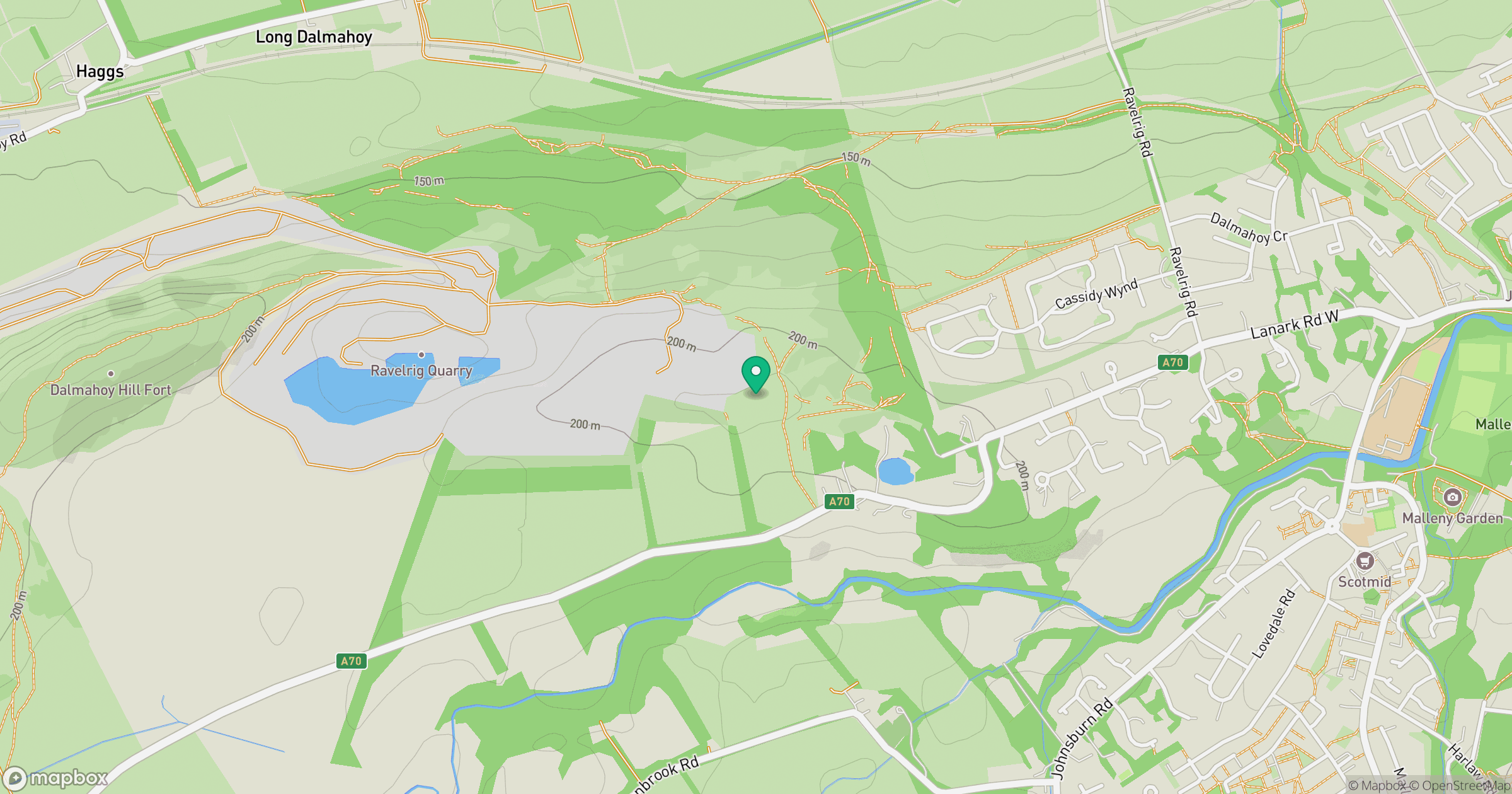
Grid reference: NT150668
View on OpenStreetMapOpens a map in a new tab, centred on the hill.


No comments yet. Be the first.