
Byrehope Mount
Good walks are even better shared.
Overview
Byrehope Mount: A Hidden Gem in the Southern Uplands
Nestled in the picturesque Southern Uplands, Byrehope Mount offers hikers a delightful blend of natural beauty, rich history, and a small dose of adventure. Standing at an elevation of 613 meters, it may not be the highest peak in the region, but its charm is undeniable.
Geology
The mountain’s impressive geology is primarily composed of sandstone and mudstone, tell-tale signs of the tumultuous geological past that shaped the Southern Uplands. As you traverse its slopes, you can almost feel the ancient forces beneath your feet.
Routes
One of the most favoured routes is the Dumfriesshire Horse Trail. This scenic loop of approximately 8 km takes you from Byrehope village through rolling green pastures. Expect a leisurely ascent, peppered with enough gentle inclines to get your heart pumping while still being manageable for the average hiker. You'll love the sights along the way, and the summit offers ample opportunities for a well-deserved breather.
Summit Features
Upon reaching the summit, you’ll encounter a modest cairn marking the peak. It’s the perfect spot for a selfie or just to take a moment to appreciate the vistas unfolding below.
Terrain Type
The terrain on Byrehope Mount is predominantly grassy with some rocky sections, particularly near the summit, making it ideal for walkers of varying skills. Just watch your footing, particularly after rain!
Views
From the top, you’re treated to breathtaking views, including the rolling hills of Dumfries and Galloway, the impressive Criffel, and on clear days, the shimmering expanse of the Solway Firth. The best views can be savoured in spring and early autumn, when the landscape's colours come alive.
Hazards
While mainly a friendly hike, take heed of the weather conditions. Paths can become slippery in rain, and fog can roll in faster than a cat on a hot tin roof - obscuring those lovely views!
Nearby Summits
If you're feeling ambitious, consider tackling nearby Kirkconnel Hill or Criffel for a full day of exploration.
Access
Parking is located at the Byrehope village hall. It’s a cozy little spot where villages blend seamlessly with the pastoral setting. Nearest public transport can be found in Moniaive, approximately 6 km away, with buses running from Dumfries.
Facilities
After your trek, why not pop into Moniaive for a cup of tea and a well-deserved slice of cake? It’s the perfect way to round off your adventure.
History
The name Byrehope holds an agricultural significance that ties it closely to the region's farming history. Its grassy slopes were once home to flocks of sheep, which suggests a rich tapestry of life and livelihood on its slopes.
Byrehope Mount may not be the most famous peak, but it is undoubtedly a beautiful spot for those looking to escape the hustle and bustle. Whether you are an experienced hiker or just fancy a gentle ramble, this mountain offers a warm welcome to all.
Happy hiking!
Explore routes near Byrehope Mount
Public walks starting within 80 km of this hill. Nearby does not mean a route reaches the summit; check its map and access before setting out.
East Calder: Almondell, Mandela Bridge and River Almond Circuit
View route
Water of Leith: Slateford to Leith
View route
Peebles to Neidpath Castle: Tweed Riverside Walk
View route
Cademuir Forest Pilots Trail
View route
Route planning notes
These notes describe possible approaches, not verified navigable routes or permission to cross land. Check current paths, local access rules and conditions before setting out.
Dumfriesshire Horse Trail
A scenic loop trail leading from the nearby village of Byrehope, through lush valleys and gentle ascents to the summit, offering a blend of adventure and leisure.
Make a day of it, together
Find someone to share the walk with, or organise a day out along a route you like.
Photo Gallery
View all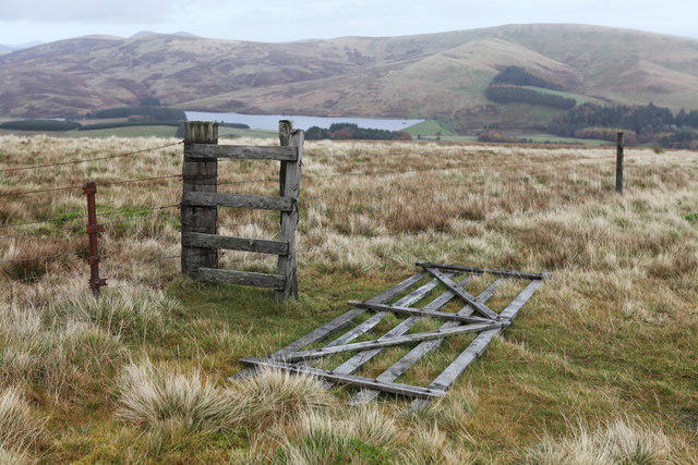 Photo could not load
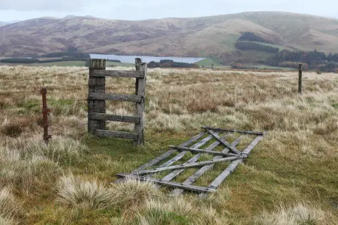
NT1154 : Broken gate on Byrehope Mount
Calum McRoberts
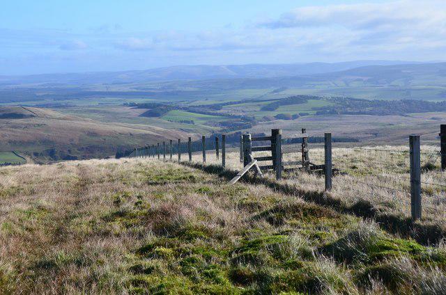 Photo could not load
NT1154 : Fence junction, Byrehope Mount
Jim Barton
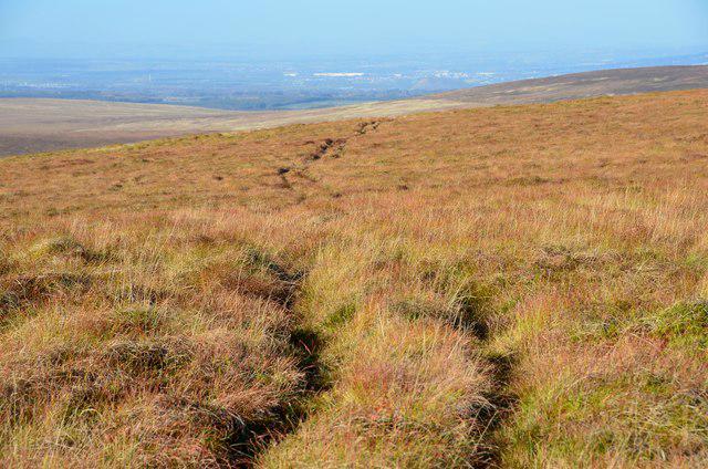 Photo could not load
NT1054 : Vehicle track, Byrehope Mount
Jim Barton
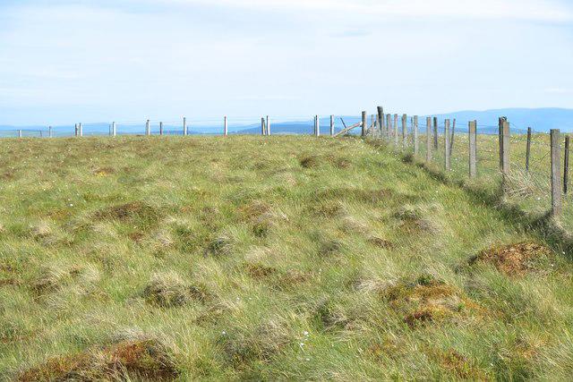 Photo could not load
NT1154 : Summit of Byrehope Mount
Anthony O'Neil
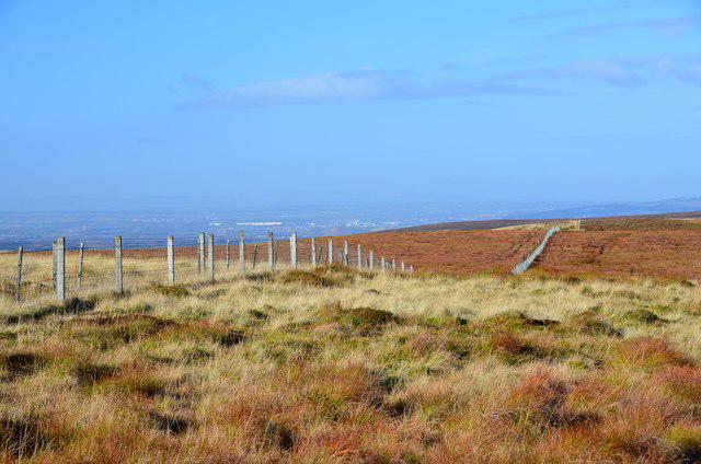 Photo could not load
NT1154 : Summit fence, Byrehope Mount
Jim Barton
Hill facts and local notes
Classifications
Elevation
536m
1,759 ft
Prominence
101m
Coordinates
55.7779, -3.4202
NT110547
OS Map
65 72
Explorer: 344
At the Summit
The summit features a modest cairn, offering a perfect place for a rest and a snack while enjoying the panoramic views.
Terrain & Geology
Byrehope Mount predominantly comprises sandstone and mudstone formations characteristic of the Southern Uplands, reflecting the geological history of complex tectonic forces shaping the landscape.
Views & Scenery
From the summit, you can gaze over the rolling hills of Dumfries and Galloway, plus the majestic Criffel and the Solway Firth on a clear day.
History & Heritage
Name Origin
The name 'Byrehope' is believed to derive from the old Scots word 'byre', meaning a barn, while 'hope' refers to a valley - a fitting homage to the agricultural roots of the area.
Historical Significance
Historically, the region was a hub for sheep farming, and the presence of ancient settlements hints at its importance over the centuries.
Getting There & Facilities
Check current local access restrictions, parking rules and transport timetables before travelling. These notes do not confirm public access to the summit.
Parking
Parking is available at the Byrehope village hall, accommodating up to 10 vehicles. Please be respectful to local residents.
Public Transport
The nearest bus stop is located in Moniaive, about 6 km away, with services running from Dumfries.
Nearby Facilities
The nearest facilities, including cafés and toilets, are located in Moniaive. A good cuppa is the perfect reward after a hike!
Safety Information
Known Hazards
- Care should be taken during wet weather as the paths can become slippery. Additionally, visibility can quickly diminish in fog.
General Safety Tips
- Check weather conditions before setting out
- Carry appropriate clothing and equipment
- Let someone know your planned route
- Take a map, compass, and GPS device
- Carry emergency supplies: food, water, first aid kit, torch
Hills
Some common questions about the hills answered
Are there group walks up Byrehope Mount?
Many walkers use Walkmates to join or organise walks with others. You can check for group walks around Byrehope Mount through the maps
Are there other walkers around Byrehope Mount?
Activity varies by location and time, but Walkmates lets you see whether others have shared walks or shown interest in this area. Find other people through the walking friends search walking friends for Byrehope Mount search or of course create your own walk for Byrehope Mount
Can I organise a walk to Byrehope Mount?
Yes. If there aren’t any walks listed already, you can create a walk and make it available for others to join.
If you're signed up to Walkmates, you can create a walk to Byrehope Mount.
How do I find a walk up this hill?
There are often multiple ways to walk this hill, depending on experience and route preference. Walkmates helps you explore walks and routes that others have shared.
Can I suggest a new route up Byrehope Mount?
Yes. You can suggest or create routes to share with others. Walkmates focuses on the social side of walking, so routes are used to help people organise walks and explore areas together, rather than as detailed navigation tools or route libraries.
Other uses really appreciate knowledgeable walkers sharing their routes. Share your favourite route to Byrehope Mount here
The is an error or something incorrect about this hill. How do I let you know?
We always strive to keep the information on Walkmates as accurate as possible. If you find an error, please let us know through the contact form and we'll aim to correct it as quickly as possible
Community Discussion
Comments
Location
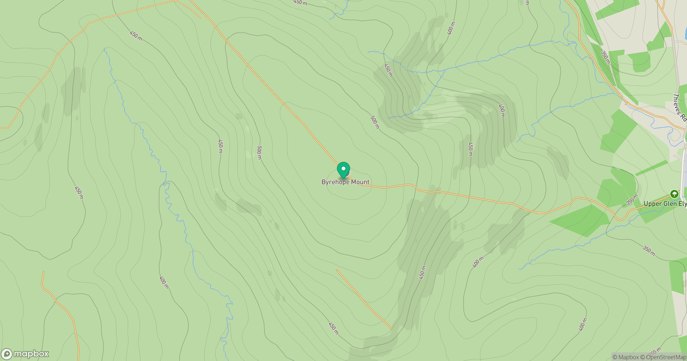
Grid reference: NT110547
View on OpenStreetMapOpens a map in a new tab, centred on the hill.
Hills within 30 km
Straight-line distance, not a walking route or confirmation of access.

No comments yet. Be the first.