

Allermuir Hill
Good walks are even better shared.
NT2266 : Allermuir Hill Winter View
Adam Ward Photo source
Overview
Allermuir Hill
Perched at a height of 493 meters, Allermuir Hill stands as one of the more accessible peaks of the Pentland Hills, making it a beloved hiking destination for both locals and visitors alike. Its volcanic origins give it a unique geological charm, while the varied terrain offers an interesting challenge to walkers.
Geology
Allermuir Hill’s volcanic rock, primarily basalt, is a reminder of Scotland's fiery geological past. The landscape reflects millions of years of erosion, creating the rugged beauty that we see today. A sip of history to go with every step!
Routes
One of the most celebrated routes is the Allermuir Hill Circular, which takes you on a 6.5 km adventure through stunning woodlands and moorland before leading you triumphantly to the summit. The moderate degree of difficulty and estimated time of 2.5 hours makes this hike accessible while still being rewarding.
Summit Features
Upon reaching the summit, hikers are greeted by a sturdy trig point and a celebratory cairn—perfect for all those Insta-worthy selfies. And when you look out, the views over Edinburgh and beyond are nothing short of spectacular!
Terrain Type
Expect a mix, my friends! This hike combines grassy paths alongside rocky patches and a few boggy areas that could test your balance. Proper footgear is worth its weight in gold!
Views
From the summit, you’re treated to panoramic views including the majestic Edinburgh Castle, the sprawling Firth of Forth, and the iconic Arthur’s Seat standing guard in the distance. Best times for views? In autumn and spring, when nature wears its finest colours and the skies are clearer.
Hazards
While Allermuir Hill is generally safe, be prepared for quick weather changes. And if you’re not careful, you might end up dancing with the mud in those slippery sections after a rain shower.
Nearby Summits
If you fancy a hill-hopping challenge, why not continue your journey to the nearby Black Hill (522 m) and Capelaw Hill (also 493 m)? Each offers its own unique views and trails.
Access
Accessing Allermuir Hill is straightforward. The Harlaw Car Park is your gateway, providing ample parking and a pleasing start. Public transport choices are available from Edinburgh to Balerno, followed by a short stroll. The nearest darling little village, Balerno, is just around 2 miles away and has all the facilities you might need.
Facilities
While there aren't amenities on the hill, the Harlaw area offers toilets and picnic spots, and Balerno has a selection of cafes and shops to fuel your adventure.
History
The name Allermuir means 'big crag' in Scots Gaelic, a fitting title for this imposing peak. Historically significant as a recreation spot, it has delighted walkers for generations, being a part of the stunning Pentland Hills Regional Park.
So grab your walking boots, pack a sandwich, and make your way to Allermuir Hill—you won’t regret it!
Last updated: 2023-10-11
Explore routes near Allermuir Hill
Walks starting near this hill. Open a route to check its map, distance and full itinerary.
Artists’ walk in Craigmillar Castle Park (group meeting)
View route
To Absent Friends: Holyrood Park walk
View route
Dalkeith Country Park: Estate and North Woods Green Trail
View route
East Calder: Almondell, Mandela Bridge and River Almond Circuit
View route
Route planning notes
These notes describe possible approaches. Check a route's map and access information when planning your walk.
Allermuir Hill Circular
A popular circular route starting from the car park at Harlaw and taking you through beautiful scenery including woodlands and moorland before summiting Allermuir Hill.
Make a day of it, together
Find someone to share the walk with, or organise a day out along a route you like.
Photo Gallery
View all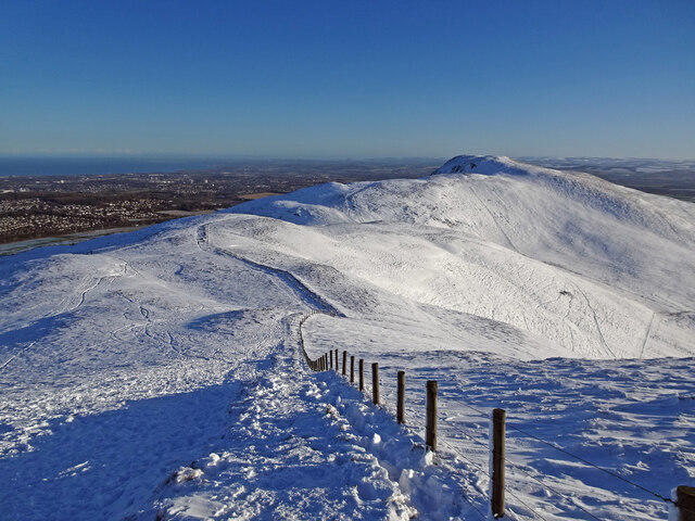 Photo could not load
NT2266 : Allermuir Hill Winter View
Adam Ward
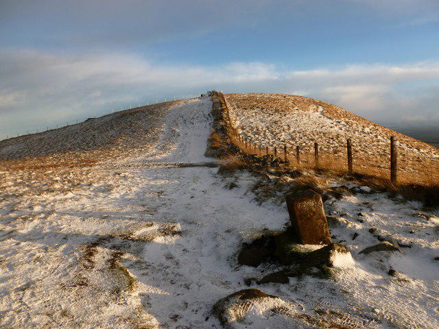 Photo could not load
NT2266 : Light snow cover on Allermuir Hill
Alan O'Dowd
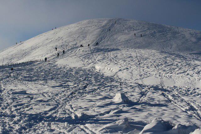 Photo could not load
NT2266 : Allermuir Hill
Graeme Yuill
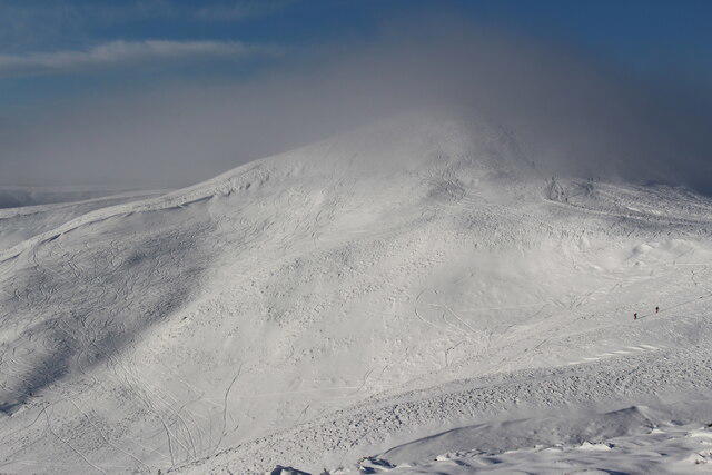 Photo could not load
NT2266 : Allermuir Hill
Graeme Yuill
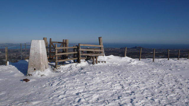 Photo could not load
NT2266 : Allermuir Hill Trig Point
Calum McRoberts
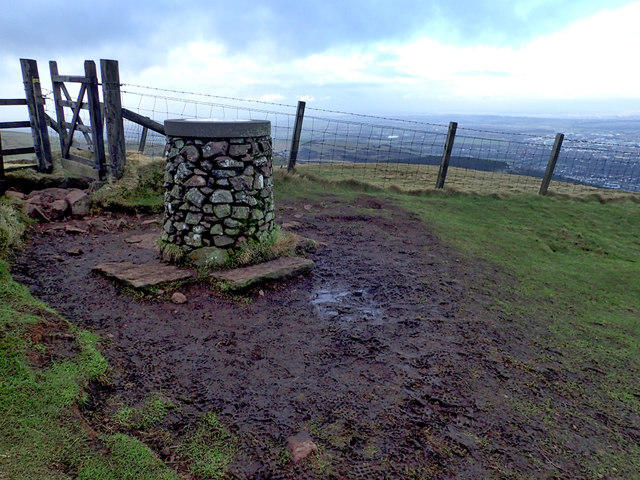 Photo could not load
NT2266 : Toposcope, Allermuir Hill Summit
Mick Garratt
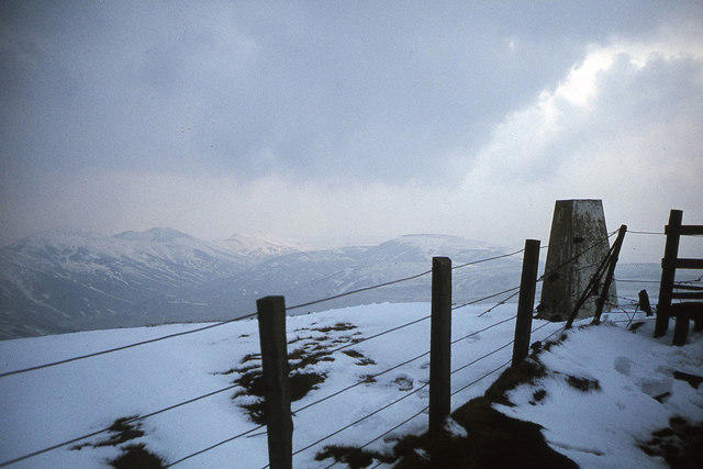 Photo could not load
NT2266 : Summit of Allermuir Hill, Pentland Hills
Colin Park
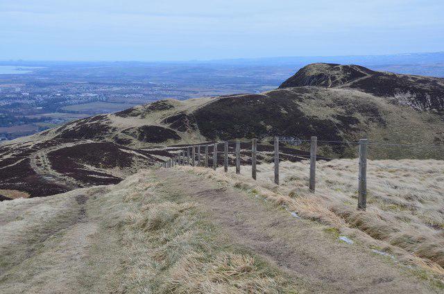 Photo could not load
NT2266 : Ridge eastwards from Allermuir Hill
Jim Barton
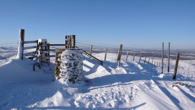 Photo could not load
NT2266 : Viewing Indicator, Allermuir Hill
Calum McRoberts
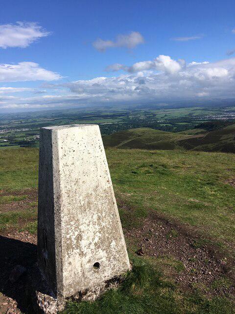
NT2266 : Trig point on Allermuir Hill
Steven Brown
Hill facts and local notes
Classifications
Elevation
493m
1,617 ft
Prominence
236m
Coordinates
55.8825, -3.2372
NT227661
OS Map
66
Explorer: 344 350
At the Summit
The summit features a prominent cairn and fantastic views over Edinburgh and the surrounding hills, complete with a trig point for the avid peak bagger.
Terrain & Geology
Allermuir Hill is primarily composed of volcanic rock, specifically basalt, which gives the hill its distinctive rugged character. The geological history dates back millions of years, showcasing an ancient volcanic landscape.
Views & Scenery
From the summit, you can see Edinburgh Castle, the Firth of Forth, and the striking silhouette of Arthur's Seat to the southeast.
History & Heritage
Name Origin
The name 'Allermuir' is derived from the Scots Gaelic 'Aillse Mòire', meaning 'big crag' or 'great rock', providing an insight into its formidable appearance.
Historical Significance
The hill has been a focal point for local recreation and a treasured spot for walkers for generations, being part of the wider Pentland Hills Regional Park.
Getting There & Facilities
Parking
The nearest parking is at Harlaw Car Park, which provides easy access to the trailhead and has ample space.
Public Transport
Buses from Edinburgh to Balerno operate regularly, with a short walk to the car park required.
Nearby Facilities
There are no facilities directly on the hill, but Harlaw has toilets and picnic areas. The nearby village of Balerno has cafes and shops.
Safety Information
Known Hazards
- Be wary of sudden weather changes, as the hill can become quite windy. Some path sections may be slippery, particularly after rain.
General Safety Tips
- Check weather conditions before setting out
- Carry appropriate clothing and equipment
- Let someone know your planned route
- Take a map, compass, and GPS device
- Carry emergency supplies: food, water, first aid kit, torch
Hills
Some common questions about the hills answered
Are there group walks up Allermuir Hill?
Many walkers use Walkmates to join or organise walks with others. You can check for group walks around Allermuir Hill through the maps
Are there other walkers around Allermuir Hill?
Activity varies by location and time, but Walkmates lets you see whether others have shared walks or shown interest in this area. Find other people through the walking friends search walking friends for Allermuir Hill search or of course create your own walk for Allermuir Hill
Can I organise a walk to Allermuir Hill?
Yes. If there aren’t any walks listed already, you can create a walk and make it available for others to join.
If you're signed up to Walkmates, you can create a walk to Allermuir Hill.
How do I find a walk up this hill?
There are often multiple ways to walk this hill, depending on experience and route preference. Walkmates helps you explore walks and routes that others have shared.
Can I suggest a new route up Allermuir Hill?
Yes. You can suggest or create routes to share with others. Walkmates focuses on the social side of walking, so routes are used to help people organise walks and explore areas together, rather than as detailed navigation tools or route libraries.
Other uses really appreciate knowledgeable walkers sharing their routes. Share your favourite route to Allermuir Hill here
The is an error or something incorrect about this hill. How do I let you know?
We always strive to keep the information on Walkmates as accurate as possible. If you find an error, please let us know through the contact form and we'll aim to correct it as quickly as possible
Community Discussion
Comments
Location
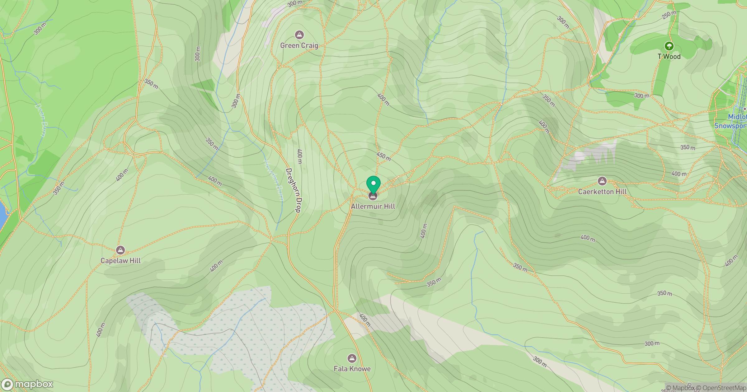
Grid reference: NT227661
View on OpenStreetMapOpens a map in a new tab, centred on the hill.


No comments yet. Be the first.