

Scald Law
Good walks are even better shared.
NT1961 : On Scald Law
Richard Webb Photo source
Overview
Scald Law: A Hiker's Delight
Scald Law, standing proud at 575 meters, is the highest point in the Pentland Hills and a beloved destination for hikers.
Geology
The mountain is a stunning example of volcanic rock formation overlaid with sedimentary strata. Hikers can witness the fascinating geological history of the area through its various rock types and formations, reminding us that the earth's story is written in stone.
Routes
One of the most favourite routes is the Scald Law Circular Route, which covers approximately 8.0 kilometres. Start at the Flotterstone car park and prepare for a moderate trek that takes you through lush valleys and up to the imposing summit. It typically takes about 3 hours to complete.
Summit Features
When you reach the summit, you’ll be greeted by a robust stone cairn, perfect for snapping a selfie with a breathtaking backdrop. And remember, no trip is complete without a celebratory snack!
Terrain Type
The terrain is a blend of grassy fields and rocky paths. While it may remind you of a lovely picnic spot, don’t be fooled! Be prepared for squelchy patches when the weather has been less than friendly. A good pair of hiking boots will be your best ally.
Views
The summit rewards climbers with spectacular views. To the North lies Edinburgh and the Firth of Forth, while surrounding peaks provide a dramatic landscape that paints a beautiful picture in any season. The best times to soak in these views are during the spring and autumn months, although winter offers its own frosty charm.
Hazards
Hiking on Scald Law is predominantly safe, but it’s important to be aware of the area's quickly changing weather. Make sure you have appropriate clothing and equipment, and be cautious of slippery conditions in wet weather.
Nearby Summits
Just a hop and a skip away are East Kip (600 meters) and West Kip (573 meters), both of which are fantastic additions to your hiking itinerary if you're feeling adventurous!
Access
The nearest parking is at the Flotterstone Car Park, with plenty of space to leave your vehicle while you explore. Bus routes from Edinburgh lead you directly to the area, making it easily accessible for day-trippers. The closest town is Penicuik, where you can find necessities before hitting the trail.
Facilities
While facilities at the summit itself are nonexistent, the Flotterstone area boasts toilets and quaint cafés where you can satisfy your cravings for tea and cake.
History
The name 'Scald Law' literally translates as 'the hill of the skalds,' honouring the rich storytelling traditions of Scotland. The mountain has long been a vital part of local culture and serveth as an idyllic escape into nature.
So pack your rucksack, lace up your boots, and set off to experience the wonders of Scald Law—a gem in the Scottish landscape that promises adventure, beauty, and a tad of cheeky humour along the way.
Happy hiking!
Explore routes near Scald Law
Walks starting near this hill. Open a route to check its map, distance and full itinerary.
East Calder: Almondell, Mandela Bridge and River Almond Circuit
View route
Artists’ walk in Craigmillar Castle Park (group meeting)
View route
To Absent Friends: Holyrood Park walk
View route
Dalkeith Country Park: Estate and North Woods Green Trail
View route
Route planning notes
These notes describe possible approaches. Check a route's map and access information when planning your walk.
Classic Circuit via The Howe
This popular circular route starts at the Flotterstone car park (grid ref NT234631). Follow the well-maintained path along Glencorse Reservoir before ascending steadily via The Howe. From here, a clear path leads you up the southwestern flank of Scald Law. The summit offers stunning views across the Pentland Hills and beyond. Descend via the ridge towards South Black Hill and return to the car park through the valley.
Direct Ascent from The Howe
For a shorter and more direct ascent, begin at the Flotterstone car park (grid ref NT234631) and proceed along the Glencorse Reservoir path until The Howe. From here, take the steep path directly up Scald Law's western flank. This route is more challenging due to its steeper gradient but rewards walkers with quick access to the summit. Retrace your steps to return.
Scald Law Ridge Walk
This linear route begins at the car park near the Hillend Ski Centre (grid ref NT251669). Ascend Caerketton Hill and follow the ridge over Allermuir Hill and Castlelaw Hill before reaching Scald Law. This route showcases the best of the Pentland ridge and offers panoramic views throughout. You can either retrace your steps or arrange transport for a one-way hike.
Family-Friendly Route from Bavelaw
Start at the Bavelaw car park (grid ref NT166608) near Balerno. Follow the path through Green Cleugh valley, gradually ascending until you reach the saddle between Scald Law and East Kip. From there, a short but steep climb leads to the summit. Return via the same route, enjoying the peaceful valley views.
Extended Pentland Traverse
For experienced walkers seeking a longer day out, this route covers multiple summits in the Pentlands. Start at Flotterstone car park (grid ref NT234631) and ascend Turnhouse Hill, Carnethy Hill, and Scald Law. Continue over East Kip and West Kip before descending to Threipmuir Reservoir. The route requires good navigation skills and stamina.
Make a day of it, together
Find someone to share the walk with, or organise a day out along a route you like.
Photo Gallery
View all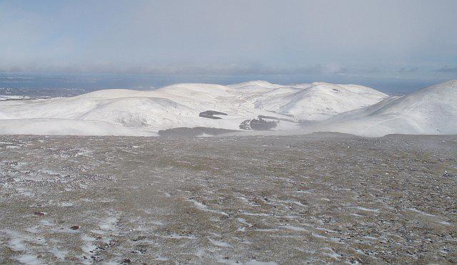 Photo could not load
NT1961 : On Scald Law
Richard Webb
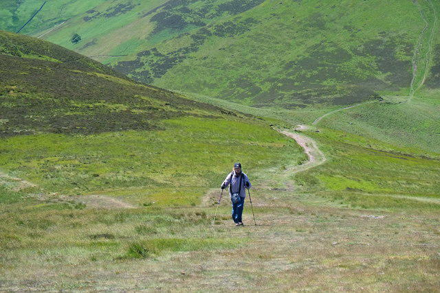 Photo could not load
NT1961 : Ascending Scald Law
Anthony O'Neil
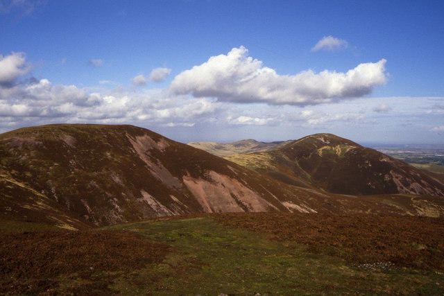 Photo could not load
NT1961 : Scald Law as seen from South Black Hill
Colin Park
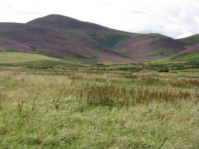 Photo could not load
NT1961 : Scald Law from near Silverburn
M J Richardson
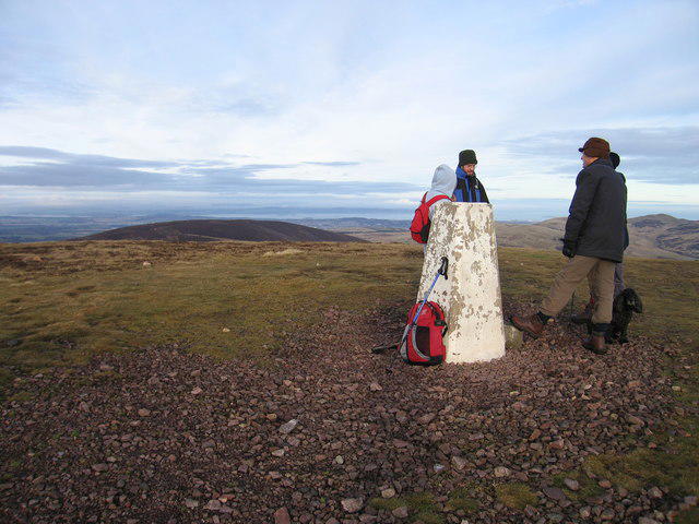 Photo could not load
NT1961 : Scald Law
Rude Health
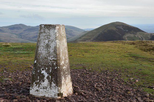 Photo could not load
NT1961 : Carnethy Hill from Scald Law
Jim Barton
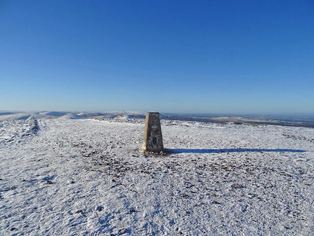 Photo could not load
NT1961 : Pentland High Point
Adam Ward
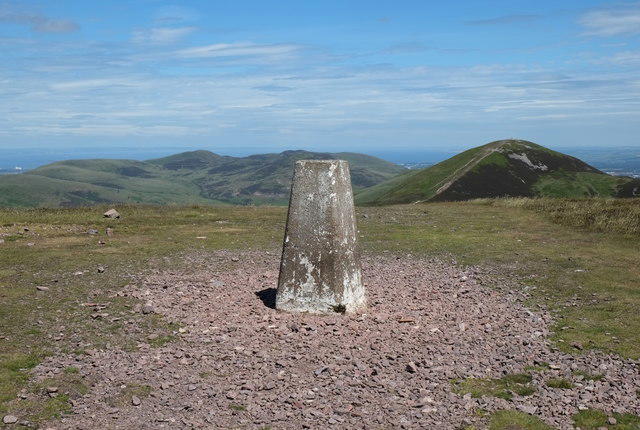 Photo could not load
NT1961 : Highest Trig. Point
Anthony O'Neil
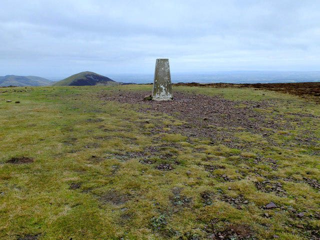 Photo could not load
NT1961 : Summit of Scald Law
John Allan
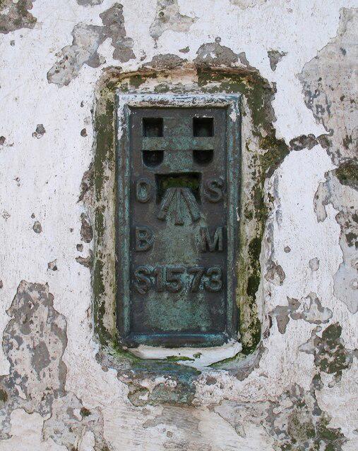
NT1961 : Flush Bracket, Scald Law
Adrian Taylor
Hill facts and local notes
Classifications
Elevation
579m
1,900 ft
Prominence
314m
Coordinates
55.8362, -3.2922
NT191610
OS Map
65 66
Explorer: 344
At the Summit
At the summit, hikers are greeted by a substantial stone cairn, providing an ideal spot for a quick picnic or a well-deserved breather while enjoying the panoramic views.
Terrain & Geology
Composed primarily of volcanic rock with underlying sedimentary layers, Scald Law showcases a rich geological history. Its craggy outcrops and age-old formations offer a fascinating glimpse into the Earth's past.
Views & Scenery
Incredible vistas of Edinburgh, the Firth of Forth, and other nearby peaks such as East and West Kip. On a clear day, you might even spot the North Sea!
History & Heritage
Name Origin
The name 'Scald Law' is derived from Old Norse, meaning 'the hill of the skalds', reflecting the cultural tapestry woven through the history of the region.
Historical Significance
Scald Law holds historical significance in Scottish culture as part of the Pentland Hills range, which has been a focal point for outdoor activities and a natural border throughout history.
Getting There & Facilities
Parking
Flotterstone Car Park, which offers ample parking and serves as a great starting point for various routes in the area.
Public Transport
Buses run from Edinburgh to the Flotterstone area. Check local schedules for up-to-date information and safe travel options.
Nearby Facilities
While there are no facilities at the summit, the Flotterstone area has toilets and several nearby cafés where you can grab a bite before or after your hike.
Safety Information
Known Hazards
- Watch out for sudden weather changes, especially at higher elevations. The terrain can be slippery when wet or icy, and visibility can drop quickly.
General Safety Tips
- Check weather conditions before setting out
- Carry appropriate clothing and equipment
- Let someone know your planned route
- Take a map, compass, and GPS device
- Carry emergency supplies: food, water, first aid kit, torch
Hills
Some common questions about the hills answered
Are there group walks up Scald Law?
Many walkers use Walkmates to join or organise walks with others. You can check for group walks around Scald Law through the maps
Are there other walkers around Scald Law?
Activity varies by location and time, but Walkmates lets you see whether others have shared walks or shown interest in this area. Find other people through the walking friends search walking friends for Scald Law search or of course create your own walk for Scald Law
Can I organise a walk to Scald Law?
Yes. If there aren’t any walks listed already, you can create a walk and make it available for others to join.
If you're signed up to Walkmates, you can create a walk to Scald Law.
How do I find a walk up this hill?
There are often multiple ways to walk this hill, depending on experience and route preference. Walkmates helps you explore walks and routes that others have shared.
Can I suggest a new route up Scald Law?
Yes. You can suggest or create routes to share with others. Walkmates focuses on the social side of walking, so routes are used to help people organise walks and explore areas together, rather than as detailed navigation tools or route libraries.
Other uses really appreciate knowledgeable walkers sharing their routes. Share your favourite route to Scald Law here
The is an error or something incorrect about this hill. How do I let you know?
We always strive to keep the information on Walkmates as accurate as possible. If you find an error, please let us know through the contact form and we'll aim to correct it as quickly as possible
Community Discussion
Comments
Location
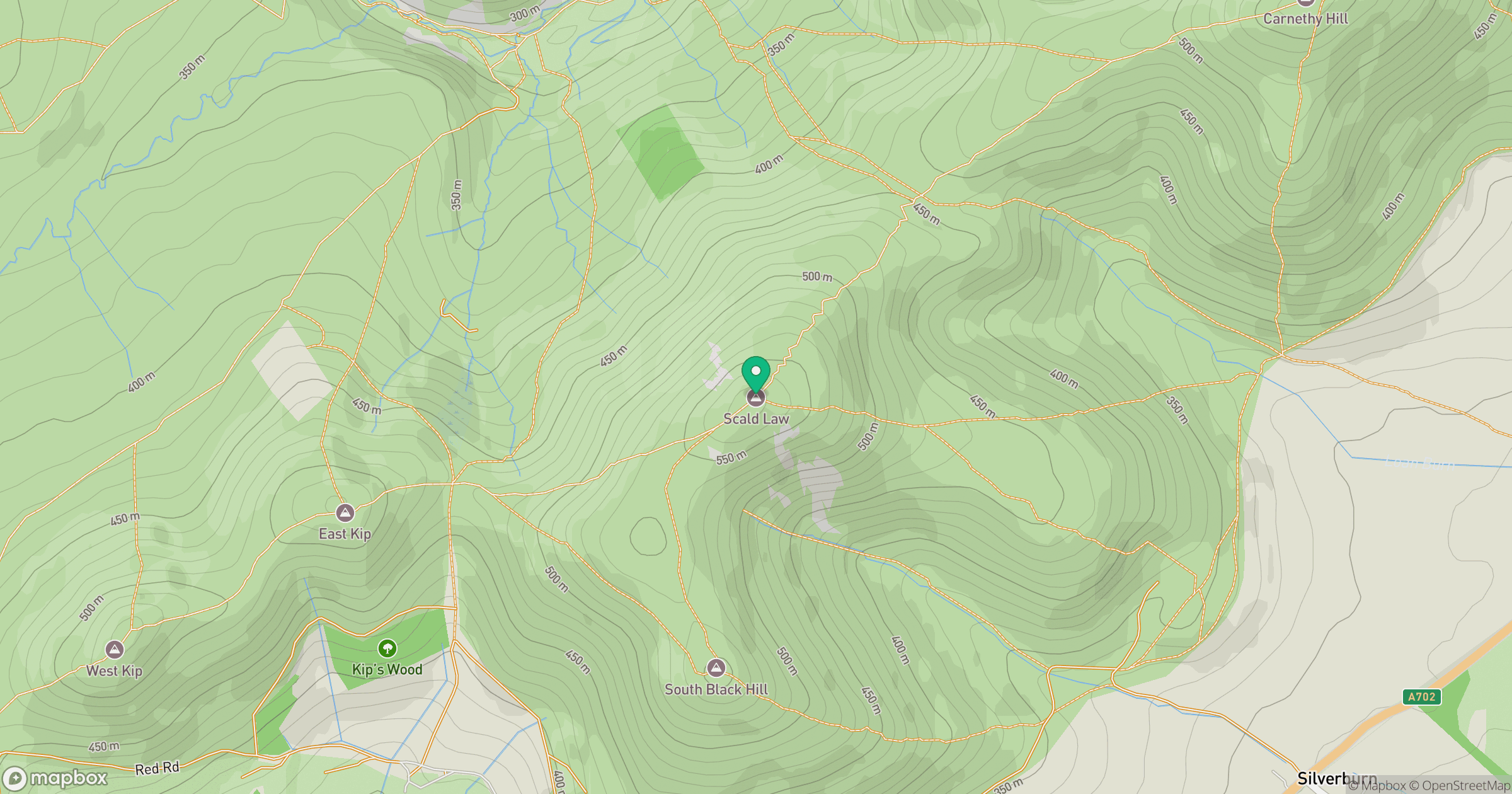
Grid reference: NT191610
View on OpenStreetMapOpens a map in a new tab, centred on the hill.


No comments yet. Be the first.