
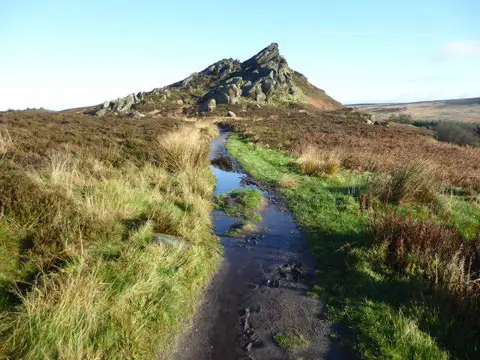
Ramshaw Rocks
Good walks are even better shared.
SK0162 : Path on Ramshaw Rocks
Marathon Photo source
Overview
Ramshaw Rocks
Introduction
Nestled in the heart of the Peak District, Ramshaw Rocks stands as a beacon for hikers and climbers alike. With its rocky outcrops and fascinating geological features, this area is more than just a pretty face.
Geology
Ramshaw Rocks is an exquisite example of gritstone formation, where erosion has crafted striking cliffs that are a paradise for rock climbers. Ideal for sport climbing, the harder routes challenge even the most seasoned climbers, while beginners can enjoy easier climbs nearby.
Hiking Routes
One popular route is the Ramshaw Rocks Circular. This moderate trail of about 8 km winds through beautiful woodland, offering an immersive nature experience. Expect to complete this route in about 2.5 hours, keeping your camera ready!
Summit Features
Reaching the summit unveils the notable gritstone outcrops, offering expansive views of the surrounding landscape. A small, prideful stone cairn graces the top, a delightful spot to pause and take in the vista.
Terrain
Expect a rocky and rugged terrain with sections of grassy heathland. Ensure sturdy footwear is a must, as the terrain can be uneven in places.
Views
When you summit, you will be rewarded with breathtaking views of the Peak District, including sights of iconic landmarks like the Roaches and sprawling Churnet Valley. The best time to appreciate these views is undoubtedly during spring or autumn, when the colours are most vibrant.
Hazards
Be aware of loose stones and slippery paths, especially after a rain shower, as one can easily end up on an unintentional slide! Steep cliff edges are also present, so keep a safe distance for peace of mind.
Nearby Summits
If you are up for more exploration, both The Roaches and Bald Hill are nearby, offering additional routes to test your hiking mettle.
Access
For those wondering about transport, there is a small car park at the bottom of Ramshaw Rocks, located near the quaint village of Meerbrook. If you prefer public transport, local buses from Leek and Buxton are available, though you’ll want to check the schedules ahead of time.
Facilities
After a day of hiking, Meerbrook provides basic facilities including cafes and toilets, perfect for refreshing yourself with a warm drink.
History
Name Meaning
The name 'Ramshaw' hints at a rich pastoral heritage, translating to 'Rams' hill'.
Significance
A historic climbing destination in the Peak District, Ramshaw Rocks has seen climbers since the early 20th century, contributing significantly to the area's climbing culture.
With its rich offerings, Ramshaw Rocks is undoubtedly a destination to put on your hiking bucket list. Whether you’re climbing its rugged surfaces or just enjoying the views, there’s something for everyone!
Happy hiking!
Explore routes near Ramshaw Rocks
Walks starting near this hill. Open a route to check its map, distance and full itinerary.
Tittesworth Reservoir
View route
Rudyard Lake Circuit near Leek
View route
Three Shires guided hike
View route
Deep Hayes Country Park: Cumberledge Pool and woodland circuit
View route
Route planning notes
These notes describe possible approaches. Check a route's map and access information when planning your walk.
Ramshaw Rocks Circular
A scenic circular route starting from the nearby village, winding through woodland and offering remarkable views.
Make a day of it, together
Find someone to share the walk with, or organise a day out along a route you like.
Photo Gallery
View all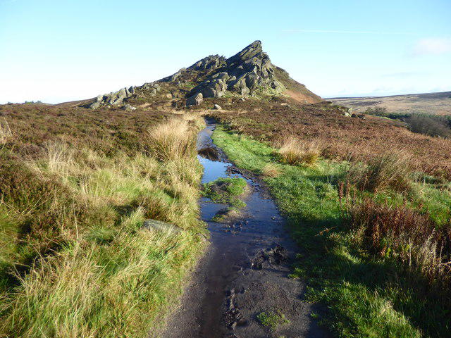 Photo could not load
SK0162 : Path on Ramshaw Rocks
Marathon
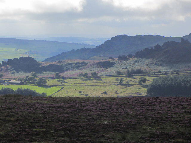 Photo could not load
SK0162 : Ramshaw Rocks & The Roaches from Merryton Low
Colin Park
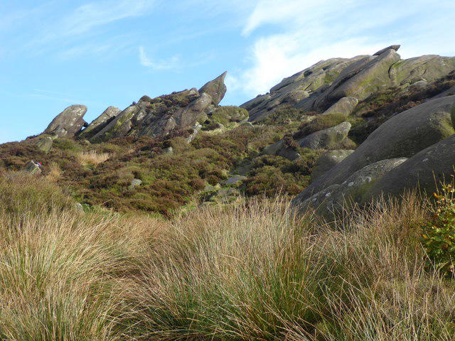 Photo could not load
SK0162 : Ramshaw Rocks
Marathon
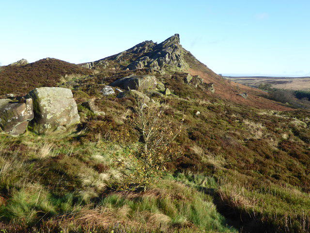 Photo could not load
SK0162 : Ramshaw Rocks
Marathon
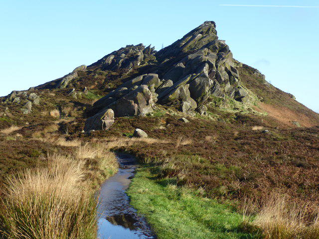 Photo could not load
SK0162 : The Churnet Way on Ramshaw Rocks
Marathon
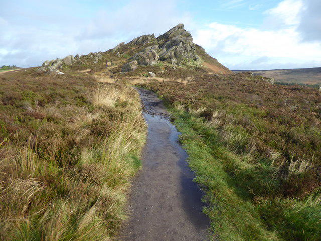 Photo could not load
SK0162 : The Churnet Way on Ramshaw Rocks
Marathon
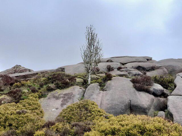 Photo could not load
SK0162 : A birch tree amongst the rocks
Ian Calderwood
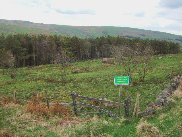 Photo could not load
SK0262 : Privately owned field
John Poyser
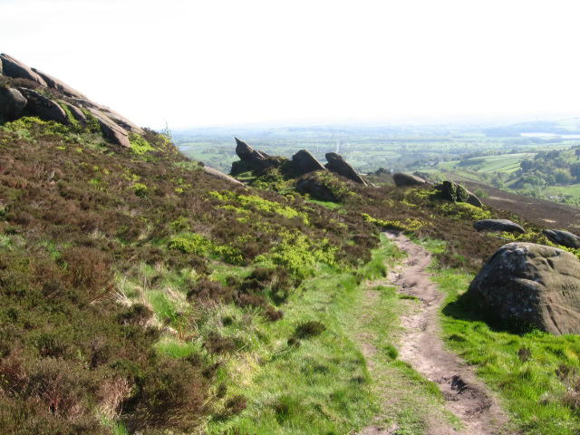 Photo could not load
SK0162 : Footpath at Ramshaw Rocks
Chris Wimbush
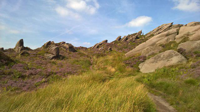
SK0162 : Churnet Way ascends towards Ramshaw Rocks
Chris Morgan
Hill facts and local notes
Classifications
Elevation
460m
1,509 ft
Prominence
31m
Coordinates
53.1592, -1.9715
SK020624
OS Map
119
Explorer: OL24W
At the Summit
The summit offers rugged gritstone outcrops, an impressive view and a small stone cairn that stands proudly as a testament to countless hikers who have passed.
Terrain & Geology
Ramshaw Rocks is primarily composed of gritstone, which has formed stunning cliff formations over millennia. Flatter areas often feature assorted sandstone formations, adding a touch of diversity to the landscape.
Views & Scenery
Breathtaking panoramic views encompassing the Peak District, including iconic features like the Roaches and the Churnet Valley.
History & Heritage
Name Origin
The name 'Ramshaw' is thought to derive from 'Rams' hill', indicative of the local sheep-farming heritage.
Historical Significance
Ramshaw Rocks has long been a favourite among climbers and walkers, with its dramatic geology and historical importance in the development of climbing in the Peak District.
Getting There & Facilities
Parking
There is a small parking area at the bottom of the hill near the village of Meerbrook, but space can be limited during busy periods.
Public Transport
Accessible via local buses from Leek and Buxton, but check timetables as they may vary.
Nearby Facilities
Basic facilities are available in Meerbrook, including a couple of lovely cafes and public toilets.
Safety Information
Known Hazards
- Loose stones and slippery paths, particularly after rainfall; always watch your step!
- Steep drops near cliff edges may pose risks to the unwary.
General Safety Tips
- Check weather conditions before setting out
- Carry appropriate clothing and equipment
- Let someone know your planned route
- Take a map, compass, and GPS device
- Carry emergency supplies: food, water, first aid kit, torch
Hills
Some common questions about the hills answered
Are there group walks up Ramshaw Rocks?
Many walkers use Walkmates to join or organise walks with others. You can check for group walks around Ramshaw Rocks through the maps
Are there other walkers around Ramshaw Rocks?
Activity varies by location and time, but Walkmates lets you see whether others have shared walks or shown interest in this area. Find other people through the walking friends search walking friends for Ramshaw Rocks search or of course create your own walk for Ramshaw Rocks
Can I organise a walk to Ramshaw Rocks?
Yes. If there aren’t any walks listed already, you can create a walk and make it available for others to join.
If you're signed up to Walkmates, you can create a walk to Ramshaw Rocks.
How do I find a walk up this hill?
There are often multiple ways to walk this hill, depending on experience and route preference. Walkmates helps you explore walks and routes that others have shared.
Can I suggest a new route up Ramshaw Rocks?
Yes. You can suggest or create routes to share with others. Walkmates focuses on the social side of walking, so routes are used to help people organise walks and explore areas together, rather than as detailed navigation tools or route libraries.
Other uses really appreciate knowledgeable walkers sharing their routes. Share your favourite route to Ramshaw Rocks here
The is an error or something incorrect about this hill. How do I let you know?
We always strive to keep the information on Walkmates as accurate as possible. If you find an error, please let us know through the contact form and we'll aim to correct it as quickly as possible
Community Discussion
Comments
Location
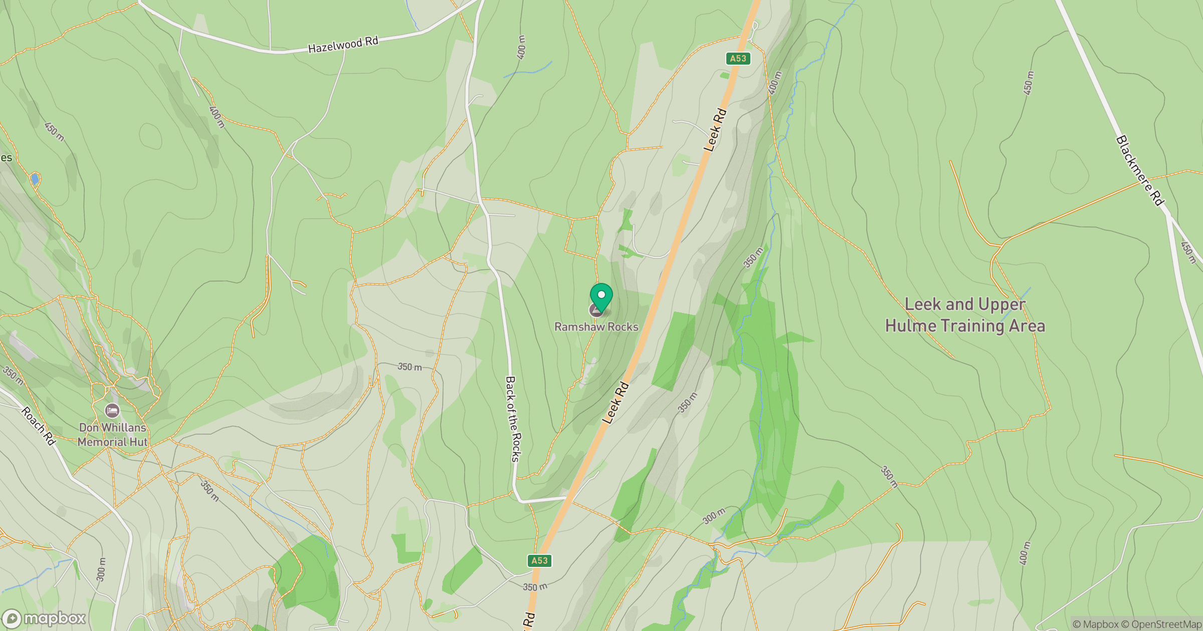
Grid reference: SK020624
View on OpenStreetMapOpens a map in a new tab, centred on the hill.
Nearby Hills
The Roaches
505m

Kinder Scout
636m
Winter Hill
456m
Rombalds Moor [Ilkley Moor]
402m

The Wrekin
407m
No comments yet. Be the first.