

Frenni Fawr
Good walks are even better shared.
SN2035 : Heather moorland north of Frenni Fawr
John H Darch Photo source
Explore routes near Frenni Fawr
Walks starting near this hill. Open a route to check its map, distance and full itinerary.
Abergwili to Nantgaredig: Tywi Valley Path out and back
View route
Llanerchaeron: Lanlas, Aberaeron and Aeron Valley circular
View route
Neyland to Johnston: Brunel and Westfield Railway Trail
View route
Llanelli North Dock to Machynys Point and Wetland Centre
View route
Route planning notes
These notes describe possible approaches. Check a route's map and access information when planning your walk.
Frenni Fawr Circular Route
A circular walk starting from the village of Maenclochog that takes you through beautiful heathland and offers stunning views.
North Ridge Ascent
A steeper path up the northern ridge, perfect for those looking for a bit more challenge and a few scrambles.
Make a day of it, together
Find someone to share the walk with, or organise a day out along a route you like.
Photo Gallery
View all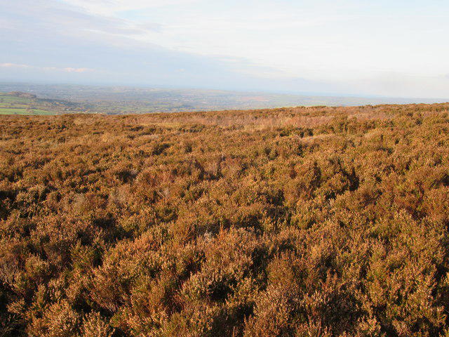 Photo could not load
SN2035 : Heather moorland north of Frenni Fawr
John H Darch
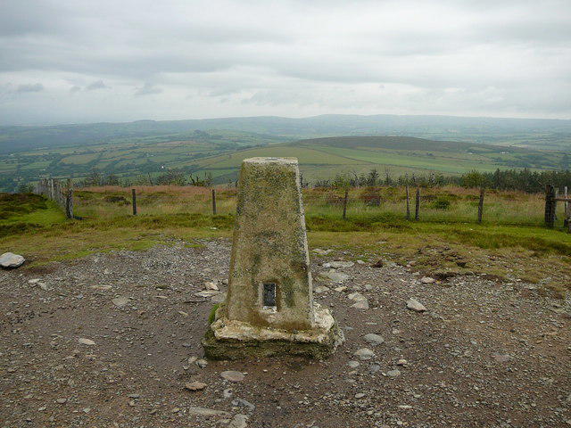 Photo could not load
SN2034 : Trig point on Frenni Fawr
Colin Park
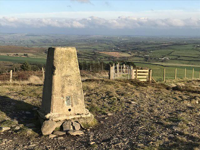 Photo could not load
SN2034 : Trig point on Frenni Fawr 1297' / 395m
John H Darch
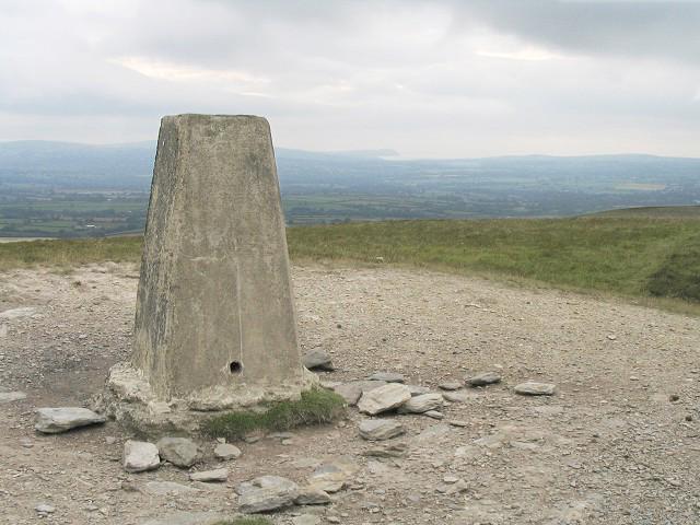 Photo could not load
SN2034 : Frenni Fawr trig pillar
Nigel Davies
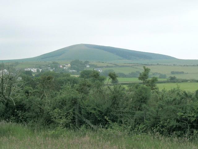 Photo could not load
SN2034 : Frenni Fawr from the southeast
Nigel Davies
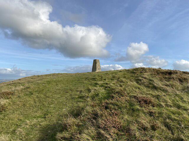 Photo could not load
SN2034 : Freni Fawr Trig Point Flush Bracket S5900
thejackrustles
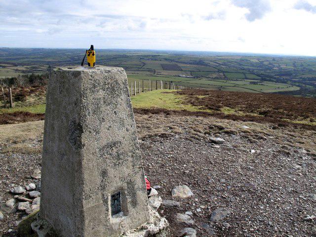 Photo could not load
SN2034 : Frenni Fawr
Rude Health
Hill facts and local notes
Classifications
Elevation
395m
1,296 ft
Prominence
177m
Coordinates
51.9835, -4.6183
SN202349
OS Map
145
Explorer: 185
At the Summit
The summit is marked by a prominent cairn and a trig point, offering a perfect spot for a wee picnic and a selfie to show off your achievement.
Terrain & Geology
Frenni Fawr is predominantly composed of volcanic rock known as andesite, which gives the mountain its characteristic ruggedness. The surrounding area features classic glacially-eroded landforms, providing fascinating insights into past geological activity.
Views & Scenery
From the summit, you can see the Preseli Hills, the distant coastline of Cardigan Bay, and on a clear day, even the mountains of Snowdonia.
History & Heritage
Name Origin
The name 'Frenni Fawr' translates to 'Big Frenni' and is said to refer to the old Welsh word 'frenhines', meaning 'queen'.
Historical Significance
The mountain has historical significance in local mythology and was once believed to be a place of ancient rites.
Getting There & Facilities
Parking
Parking is available at the village of Maenclochog, just a short walk from the trailhead.
Public Transport
Regular bus services run to Maenclochog from larger towns in Pembrokeshire, including Haverfordwest.
Nearby Facilities
There are no facilities on the mountain trails, but Maenclochog offers a small shop and a friendly café for post-hike refreshments.
Safety Information
Known Hazards
- Some areas can be slippery, particularly after rain, and visibility can change rapidly, so keep a close eye on the weather forecast.
General Safety Tips
- Check weather conditions before setting out
- Carry appropriate clothing and equipment
- Let someone know your planned route
- Take a map, compass, and GPS device
- Carry emergency supplies: food, water, first aid kit, torch
Hills
Some common questions about the hills answered
Are there group walks up Frenni Fawr?
Many walkers use Walkmates to join or organise walks with others. You can check for group walks around Frenni Fawr through the maps
Are there other walkers around Frenni Fawr?
Activity varies by location and time, but Walkmates lets you see whether others have shared walks or shown interest in this area. Find other people through the walking friends search walking friends for Frenni Fawr search or of course create your own walk for Frenni Fawr
Can I organise a walk to Frenni Fawr?
Yes. If there aren’t any walks listed already, you can create a walk and make it available for others to join.
If you're signed up to Walkmates, you can create a walk to Frenni Fawr.
How do I find a walk up this hill?
There are often multiple ways to walk this hill, depending on experience and route preference. Walkmates helps you explore walks and routes that others have shared.
Can I suggest a new route up Frenni Fawr?
Yes. You can suggest or create routes to share with others. Walkmates focuses on the social side of walking, so routes are used to help people organise walks and explore areas together, rather than as detailed navigation tools or route libraries.
Other uses really appreciate knowledgeable walkers sharing their routes. Share your favourite route to Frenni Fawr here
The is an error or something incorrect about this hill. How do I let you know?
We always strive to keep the information on Walkmates as accurate as possible. If you find an error, please let us know through the contact form and we'll aim to correct it as quickly as possible
Community Discussion
Comments
Location
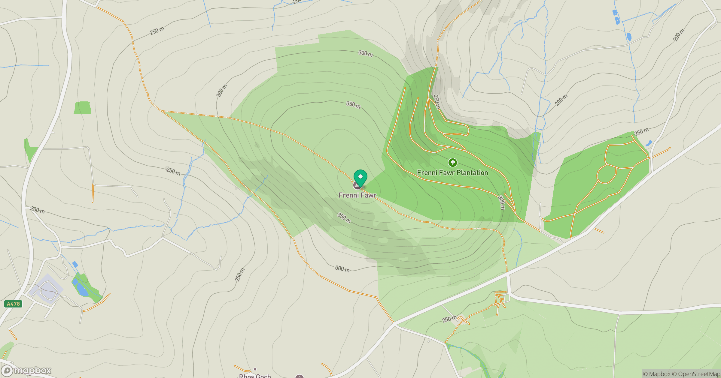
Grid reference: SN202349
View on OpenStreetMapOpens a map in a new tab, centred on the hill.

No comments yet. Be the first.