
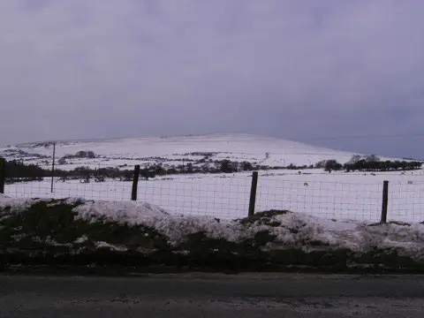
Foel Dyrch
Good walks are even better shared.
Overview
Foel Dyrch
Nestled within the majestic Brecon Beacons, Foel Dyrch is a delightful Marilyn that beckons hikers of all levels. Standing at an elevation of 690 meters, it offers a manageable ascent with bountiful rewards.
Geology
Foel Dyrch’s rocky outcrops are made from the highly resistant sandstones of the Old Red Sandstone era. Hiking here not only provides breathtaking views but also a fascinating glimpse into the Earth’s history. Each step taken is like walking across the chapters of a geological novel that dates back millions of years.
Routes
From Cwm Dyrch
The most popular route starts from Cwm Dyrch. This scenic trek meanders upward through grassy slopes and rocky paths. The trail has a moderate difficulty, making it a favourite among families and casual hikers alike. Just remember, those sheep have been known to play a rousing game of leapfrog — so keep your eyes peeled!
Distance and Duration
- Distance: 4.5 km
- Approximate Time: 2.5 hours
Summit Features
At the summit, the trig point serves as an excellent vantage point. This little structure provides the perfect backdrop for triumphant selfies. Keep an eye out for squirrels; they tend to enjoy the view too!
Terrain Type
Foel Dyrch’s terrain varies from rocky paths to lush grass, but be warned — it can get boggy, especially after a good old Welsh rain. Sturdy boots are a must!
Views
Highlights
From the summit, you’ll be treated to stunning views of nearby Pen y Fan, and on exceptionally clear days, the Severn Estuary can be spotted in the distance. Fables tell of mythical creatures that can be seen from atop, but make sure you’re not just imagining things after a long uphill trek!
Best Seasons
The ideal time for breathtaking views is late spring and early autumn. The blooming heather and warm light are perfect for photos. Plus, there's nothing quite like the smell of gorse in the springtime.
Hazards
While Foel Dyrch is a gem of a hike, caution is advisable. Be aware of slippery paths during wet conditions and sudden weather changes, which are common in the Brecon Beacons. And do watch out for brambles — they’re the mountain's way of saying 'not today!'
Nearby Summits
The mountain is surrounded by breathtaking peaks, including:
- Pen y Fan (886 m): The highest peak in South Wales, a must-visit nearby giant.
- Cribyn (795 m): A neighbouring hill that shares the stunning views.
Access
Nearest Parking
The Cwm Dyrch car park (SN 162 287) is your best bet for parking, offering ample space but do arrive early, especially on sunny weekends!
Public Transport
Buses from Brecon connect to Libanus, though services can be sparse, so check schedules before you head out.
Nearest Town
The quaint village of Libanus is closest, where you can find a café for a quick fuel up.
Facilities
While there are no facilities on the mountain, nearby Libanus has a small café and public toilets, perfect for a bit of refreshment before your climb.
History
Foel Dyrch's name translates to 'Hill of the Hoarse Voice.' The area is rich with tales of local folklore and has been significant for sheep farming, adding layers of cultural history to your hike.
In summary, a trek up Foel Dyrch is not just an escape into nature but a foray into the rich geology and history of the Brecon Beacons. Pack your boots, a sense of adventure, and perhaps a sense of humour — you never know what you might encounter!
Happy hiking!
Explore routes near Foel Dyrch
Public walks starting within 80 km of this hill. Nearby does not mean a route reaches the summit; check its map and access before setting out.
Pembrokeshire Coast Path: Newport Parrog to Fishguard via Dinas Head
View route
Abergwili to Nantgaredig: Tywi Valley Path out and back
View route
Neyland to Johnston: Brunel and Westfield Railway Trail
View route
Stackpole Estate: Bosherston Lily Ponds and Lodge Park Woodland Circuit
View route
Route planning notes
These notes describe possible approaches, not verified navigable routes or permission to cross land. Check current paths, local access rules and conditions before setting out.
From Cwm Dyrch
This popular route starts at Cwm Dyrch, ascending steadily with delightful views to your left. It’s perfect for those who appreciate a moderate incline and the sound of the occasional sheep bleating their approval.
Make a day of it, together
Find someone to share the walk with, or organise a day out along a route you like.
Photo Gallery
View all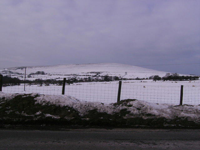 Photo could not load
SN1629 : Foel Drych
chris whitehouse
Hill facts and local notes
Classifications
Elevation
368m
1,207 ft
Prominence
116m
Coordinates
51.9393, -4.6774
SN160301
OS Map
145
Explorer: OL35E
At the Summit
The summit boasts a trig point that stands proudly against the skyline, a great photo op to prove you made it to the top. The surrounding rocky outcrops provide a sense of adventure, as if they are daring you to climb further.
Terrain & Geology
Foel Dyrch is predominantly formed of highly resistant sandstones from the Old Red Sandstone period, making it a sturdy presence in the Brecon Beacons. The ridges offer an insight into the area's geological history, showcasing layers that tell tales of ancient river systems.
Views & Scenery
From the summit, you can see Pen y Fan to the north, and on a clear day, even the Severn Estuary peeking through the valleys. It’s said that if you look closely enough, you might spot a few local legends wandering about too.
History & Heritage
Name Origin
Foel Dyrch translates roughly to 'Hill of the Hoarse Voice', which may refer to the sound of the wind whipping through the valleys.
Historical Significance
Historically, the area has been significant for sheep farming and carries tales of local folklore that add to its charm.
Getting There & Facilities
Check current local access restrictions, parking rules and transport timetables before travelling. These notes do not confirm public access to the summit.
Parking
Cwm Dyrch car park (SN 162 287) provides a convenient spot to start your adventure. It’s reasonably spacious, but do arrive early on weekends.
Public Transport
Buses connect to nearby towns such as Brecon. Local services may be limited, so check the timetables before you head out.
Nearby Facilities
There are no facilities directly on the mountain; however, the nearest village has a small café and public toilets, perfect for a pre-hike snack or post-hike treat.
Safety Information
Known Hazards
- Slippery paths in wet weather, sudden changes in weather conditions, and the occasional bramble waiting to snag an unwary leg.
General Safety Tips
- Check weather conditions before setting out
- Carry appropriate clothing and equipment
- Let someone know your planned route
- Take a map, compass, and GPS device
- Carry emergency supplies: food, water, first aid kit, torch
Hills
Some common questions about the hills answered
Are there group walks up Foel Dyrch?
Many walkers use Walkmates to join or organise walks with others. You can check for group walks around Foel Dyrch through the maps
Are there other walkers around Foel Dyrch?
Activity varies by location and time, but Walkmates lets you see whether others have shared walks or shown interest in this area. Find other people through the walking friends search walking friends for Foel Dyrch search or of course create your own walk for Foel Dyrch
Can I organise a walk to Foel Dyrch?
Yes. If there aren’t any walks listed already, you can create a walk and make it available for others to join.
If you're signed up to Walkmates, you can create a walk to Foel Dyrch.
How do I find a walk up this hill?
There are often multiple ways to walk this hill, depending on experience and route preference. Walkmates helps you explore walks and routes that others have shared.
Can I suggest a new route up Foel Dyrch?
Yes. You can suggest or create routes to share with others. Walkmates focuses on the social side of walking, so routes are used to help people organise walks and explore areas together, rather than as detailed navigation tools or route libraries.
Other uses really appreciate knowledgeable walkers sharing their routes. Share your favourite route to Foel Dyrch here
The is an error or something incorrect about this hill. How do I let you know?
We always strive to keep the information on Walkmates as accurate as possible. If you find an error, please let us know through the contact form and we'll aim to correct it as quickly as possible
Community Discussion
Comments
Location
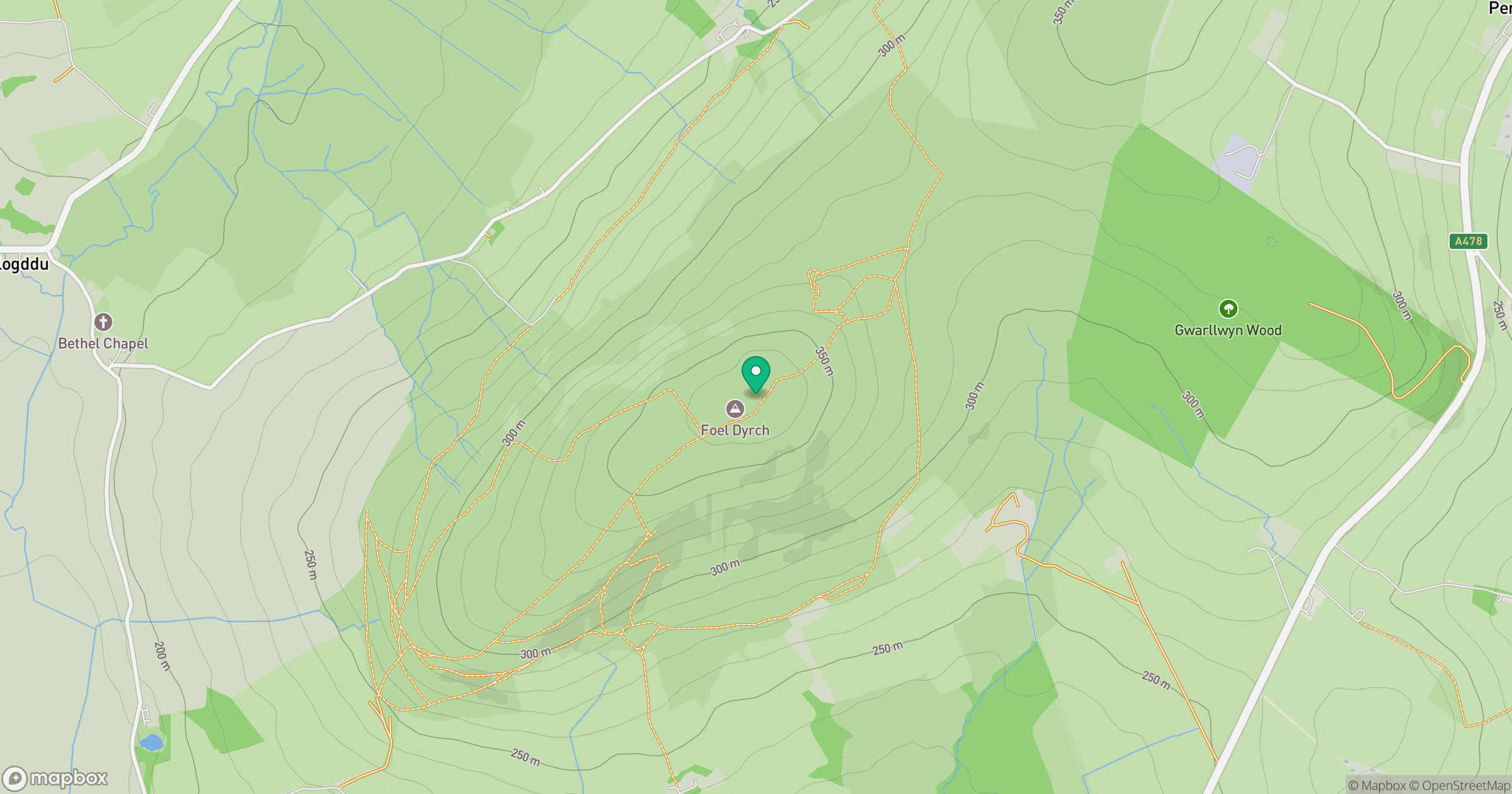
Grid reference: SN160301
View on OpenStreetMapOpens a map in a new tab, centred on the hill.
Hills within 30 km
Straight-line distance, not a walking route or confirmation of access.
No comments yet. Be the first.