

Old Man of Storr
Good walks are even better shared.
NG5053 : Mist swirling around The Storr, Skye
Carol Walker Photo source
Overview
The Old Man of Storr is the rock pinnacle below The Storr’s eastern cliffs on Skye. This record identifies its 535 m summit, not the separate 718.7 m summit of The Storr. Visitor paths from the A855 lead to viewpoints among the Sanctuary’s rock formations, with views across the Sound of Raasay. Reaching the top of the pinnacle requires technical rock climbing; the popular walks do not ascend it.
Old Man of Storr: pinnacle and viewpoints
The Old Man of Storr is the detached rock tower below the eastern cliffs of The Storr on Skye’s Trotternish peninsula. This hill record is for the 535 m pinnacle, with 79 m prominence, at NG500539. These are summit elevation and prominence figures, not the height of the tower above its immediate base. The Storr, 718.7 m, is a separate hill behind it. DoBIH
The popular visitor walks lead to views of the Old Man and the surrounding Sanctuary. They do not reach the top of the pinnacle. That summit is a technical rock-climbing objective: a contemporary account of its 1955 ascent records difficult climbing on poor rock. It should never be presented as the final few steps of the tourist walk. Alpine Journal
Choose the right outing
- Visitor viewpoints: the main paths rise from the A855 car park into the rock scenery. Walkhighlands’ longer viewpoint circuit is 5 km with 340 m of ascent and a 1.5–2 hour walking estimate. Add time for stops and conditions. Its higher loop encounters rockfall terrain; the guide advises avoiding the section behind the pinnacles after heavy rain. Visitor circuit
- The Storr summit: this is a separate 8 km hill circuit, estimated at 3.5–4.5 hours, with 640 m ascent. It includes rocky passages and boggy, pathless ground. Use the complete current description and a map rather than improvising a ridge descent. The Storr ascent
- Sunrise or a shorter family outing: these are timing or distance variations on the visitor paths. A dark start needs a headtorch and sound navigation; a shorter walk still climbs uphill. Neither implies access to the pinnacle top or an accessible, step-free trail.
- Loch Leathan circuit: the existing named option has not been validated. The loch is southeast of the pinnacle, and the old westward instruction is wrong. Do not follow that description as a route.
Landscape and views
The Old Man and Needle Rock are pieces of the volcanic lava succession displaced by landsliding. Palaeogene lavas overlie weaker Jurassic sedimentary rocks, and the Storr’s post-glacial landslips created the distinctive broken landscape. The pinnacle is not correctly described as a Jurassic sandstone-and-basalt mixture or an ancient volcanic plug. BGS geological account · NatureScot’s Trotternish Ridge citation
The appeal of the visitor paths is the changing relationship between the Old Man, the Cathedral’s rock windows and the cliffs behind. Clear weather opens views across the Sound of Raasay towards Raasay and the mainland, with the Cuillin to the south. Low cloud can obscure both the views and the route.
Access and facilities
Start at the Storr car park, NG508528, beside the A855 north of Portree. The path begins at the car park; the old parking reference NG496537 is not the roadhead. Paid parking, toilets and the Storr Centre are available on site. Buses from Portree stop at Storr; check the current timetable and return service. Check the official site for opening arrangements and current charges. Plan your visit
The expanded Storr Centre opened in August 2026. Highland Council reports more than 300,000 visitors to the site in 2025; that is a visitor-site count, not a count of pinnacle ascents. Council update
Safety and responsible visits
Expect uneven footing and avoid standing below unstable rock or close to drops for photographs. Respect closures, repairs and warning signs. Carry waterproofs, warm layers, food, water and a usable map; make the decision to turn back before deteriorating conditions become a problem. Snow or ice and short winter days can make an ordinary viewpoint outing substantially more serious. Winter planning
Skye Mountain Rescue identifies the Old Man of Storr among its regular walking-injury locations. For a mountain emergency, call 999, ask for Police, then Mountain Rescue. Skye MRT
Name and history
The official visitor site uses Bodach an Stòir as the Gaelic name. Tales of an old man’s face or a buried giant’s thumb belong to the area’s folklore. In 2005 the wider Storr landscape hosted NVA’s Unfolding Landscape light-and-sound artwork. About The Storr
Information checked 15 October 2026 (UTC). None of the visitor routes is a climbing guide to the pinnacle.
Explore routes near Old Man of Storr
Walks starting near this hill. Open a route to check its map, distance and full itinerary.
Fairy Lochs Liberator Wreckage Circuit
View route
Beinn Eighe Lancaster Wreckage at Coire Mhic Fhearchair
View route
Berneray Community Hall to the beautiful beach
View route
Beautiful private beach walk Isle of Harris
View route
Route planning notes
These notes describe possible approaches. Check a route's map and access information when planning your walk.
Classic Old Man of Storr Route
Visitor viewpoint circuit from the Storr car park on the A855 (NG508528). Walkhighlands describes a 5 km outing through the Sanctuary, with views of the Old Man and Cathedral Rock, taking 1.5–2 hours before extra stops. Higher paths are steep and rocky; heed rockfall signs and avoid the section behind the pinnacles after heavy rain. This walk does not reach the pinnacle summit. Use the current published route and on-site signs.
Extended Circuit via the Storr Ridge
A separate hill walk to The Storr (718.7 m), rather than an ascent of the Old Man pinnacle. Walkhighlands publishes an 8 km circuit with 640 m ascent and a 3.5–4.5 hour estimate. Steep rocky passages, cliff-edge terrain and a pathless boggy finish require hillwalking and navigation skills. Follow the complete current guide and a suitable map; an improvised descent from the ridge can lead into cliffs.
Sunrise Hike to the Old Man of Storr
An early-morning version of a chosen visitor viewpoint walk, rather than a separate established route. Plan the turnaround and return before setting off; carry a working headtorch and backup power, warm layers and navigation that works without signal. Darkness makes uneven steps and cliff margins harder to judge. Keep to the paths and choose a viewpoint away from drops. Sunrise and clear views are not guaranteed.
Old Man of Storr and Loch Leathan Circular
Unverified circuit: the existing itinerary is not supported by the reliable route sources reviewed and must not be used for navigation. Loch Leathan lies southeast of the Old Man, so the original instruction to head west towards it is incorrect. No continuous loch circuit or safe connecting descent is established here. Use a separately verified walk until this route has been mapped and checked.
Lower Storr viewpoint out-and-back
A shortened out-and-back on the lower visitor paths, with a turnaround chosen to suit the group. The ascent begins near the car park and remains uphill; a shorter visit should not be assumed to be easy, step-free or suitable for limited mobility. The full close-up viewpoint walk includes steep, uneven steps. Choose the turnaround according to conditions, ability and available daylight.
Make a day of it, together
Find someone to share the walk with, or organise a day out along a route you like.
Photo Gallery
View all Photo could not load
NG5053 : Mist swirling around The Storr, Skye
Carol Walker
 Photo could not load
NG5053 : The Old Man Of Storr
Carol Walker
 Photo could not load
NG5053 : The Old Man of Storr
don cload
 Photo could not load
NG5053 : The Old Man of Storr
Richard Croft
 Photo could not load
NG5053 : The Old Man of Storr
David Dixon
 Photo could not load
NG5053 : The Old Man of Storr
N Chadwick
 Photo could not load
NG5053 : The Old Man of Storr
N Chadwick
 Photo could not load
NG5053 : The Old Man of Storr
N Chadwick
 Photo could not load
NG5053 : The Old Man of Storr
N Chadwick

NG5053 : The Old Man of Storr
N Chadwick
Hill facts and local notes
Classifications
Elevation
535m
1,755 ft
Prominence
79m
Coordinates
57.5060, -6.1753
NG500539
OS Map
23 24
Explorer: 408 409
At the Summit
The top of the detached Old Man of Storr rock pinnacle. This 535 m summit is a technical rock-climbing objective, separate from both the visitor viewpoints below and the 718.7 m summit of The Storr.
Terrain & Geology
The Old Man is a landslipped outlier of the Storr’s volcanic lava succession. Palaeogene lavas overlie weaker Jurassic sedimentary rocks; major post-glacial landslides displaced parts of the lava pile eastwards and left the pinnacles below the escarpment. The Beinn Edra Group lavas include basalt flows with zeolite-filled cavities. Distinguish the age of the lava from the much later landsliding.
Views & Scenery
From the visitor paths and viewpoints, the Old Man, Cathedral Rock and Storr cliffs form the foreground. Clear weather opens views across the Sound of Raasay towards Raasay and the mainland, with the Cuillin to the south. These views do not require climbing the pinnacle.
Best Seasons
Cloud and visibility determine whether the pinnacles and sea views are visible in any season. Sunrise visits involve an approach in darkness; winter photography needs extra allowance for short daylight and possible snow or ice.
History & Heritage
Name Origin
Bodach an Stòir is the Gaelic name used by the official visitor site for Old Man of Storr. Local stories connect the rock with an old man’s face or a giant’s thumb; these are folklore.
Historical Significance
The first recorded ascent was in 1955, associated with Don Whillans and his climbing companions; the contemporary Alpine Journal describes difficult climbing on poor rock. In 2005 the wider Storr landscape hosted NVA’s Unfolding Landscape light-and-sound artwork. Folklore about a giant is part of the site’s cultural story, not geological history.
Getting There & Facilities
Parking
Storr car park beside the A855, north of Portree, at approximately NG508528. The visitor path starts here. Parking is charged; use designated spaces and return later if full rather than parking on verges. Check current tariffs and vehicle restrictions on the official Storr website.
Public Transport
Buses from Portree serve the Old Man of Storr stop near the visitor car park. The official site lists Stagecoach 57A from Somerled Square; check the current timetable, operating days and return service before travelling.
Nearby Facilities
At the roadhead: Storr Centre, toilets including an accessible toilet requiring a RADAR key, baby-changing facilities, cycle parking, EV charging and motorhome waste disposal. Food and drink provision varies by season. Check official opening information; no hilltop facilities are implied.
Safety Information
Known Hazards
- Technical rock climbing is required for the pinnacle summit; visitor paths do not reach it.
- Rockfall from cliffs and pinnacles; follow warnings and avoid the higher circuit behind the pinnacles after heavy rain.
- Steep uneven steps, loose stones, slippery wet ground and steep drops.
- Strong wind, low cloud and poor visibility; carry independent navigation and do not improvise a cliff descent.
- Busy paths and photography stops require care; keep away from edges.
Seasonal Hazards
Heavy rain worsens footing and rockfall exposure. Snow or ice can make the steep paths hazardous, and short winter daylight leaves less margin for delays. Carry a headtorch and suitable clothing; choose a shorter objective or turn back if conditions exceed the group’s skills.
General Safety Tips
- Check weather conditions before setting out
- Carry appropriate clothing and equipment
- Let someone know your planned route
- Take a map, compass, and GPS device
- Carry emergency supplies: food, water, first aid kit, torch
Hills
Some common questions about the hills answered
Are there group walks up Old Man of Storr?
Many walkers use Walkmates to join or organise walks with others. You can check for group walks around Old Man of Storr through the maps
Are there other walkers around Old Man of Storr?
Activity varies by location and time, but Walkmates lets you see whether others have shared walks or shown interest in this area. Find other people through the walking friends search walking friends for Old Man of Storr search or of course create your own walk for Old Man of Storr
Can I organise a walk to Old Man of Storr?
Yes. If there aren’t any walks listed already, you can create a walk and make it available for others to join.
If you're signed up to Walkmates, you can create a walk to Old Man of Storr.
How do I find a walk up this hill?
There are often multiple ways to walk this hill, depending on experience and route preference. Walkmates helps you explore walks and routes that others have shared.
Can I suggest a new route up Old Man of Storr?
Yes. You can suggest or create routes to share with others. Walkmates focuses on the social side of walking, so routes are used to help people organise walks and explore areas together, rather than as detailed navigation tools or route libraries.
Other uses really appreciate knowledgeable walkers sharing their routes. Share your favourite route to Old Man of Storr here
The is an error or something incorrect about this hill. How do I let you know?
We always strive to keep the information on Walkmates as accurate as possible. If you find an error, please let us know through the contact form and we'll aim to correct it as quickly as possible
Community Discussion
Comments
Location
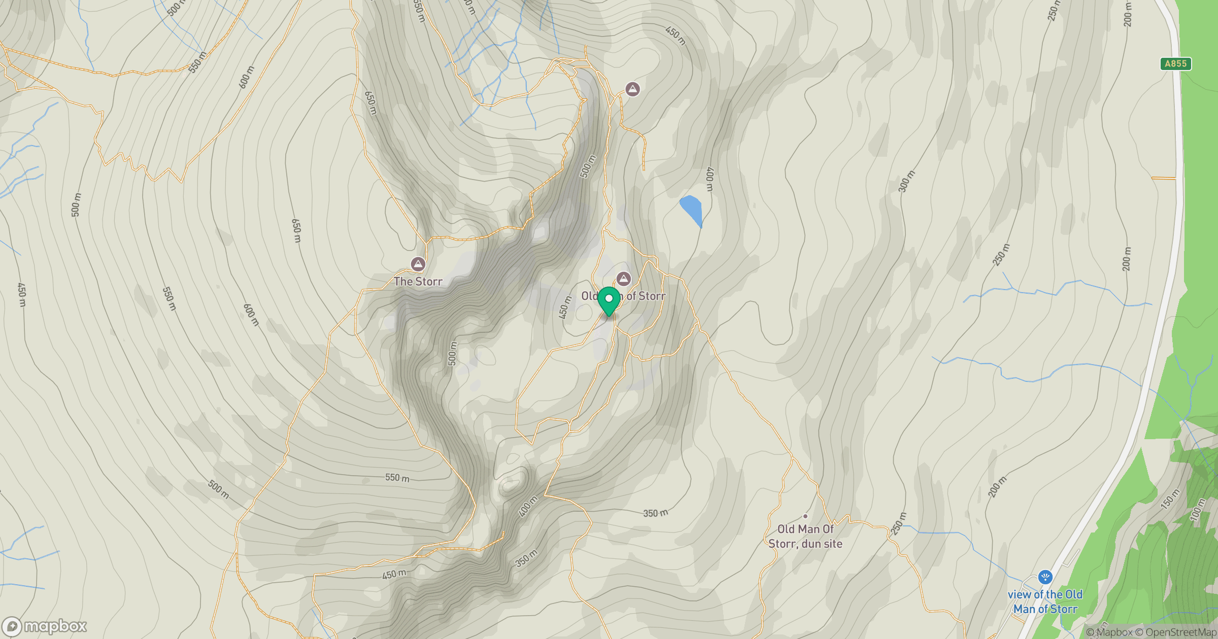
Grid reference: NG500539
View on OpenStreetMapOpens a map in a new tab, centred on the hill.
No comments yet. Be the first.