

Mynydd Mallaen
Good walks are even better shared.
SN7245 : Crugiau Merched trig and Cefn Branddu
Rob Woodall Photo source
Overview
Overview
Mynydd Mallaen, prominent in the stunning Brecon Beacons National Park, is an inviting hill for hikers of all experience levels. With its elevation of 613 meters, it offers an accessible challenge coupled with rewarding views.
Geology
This mountain is primarily made up of Old Red Sandstone, which can be seen in the rocky outcrops scattered across the summit. The layers of sediment speak of a time long gone when this area was covered by ancient seas.
Route Information
The most popular route is the circular hike starting from Mallaen, covering approximately 8.5 km in around 3.5 hours. As you ascend, you’ll encounter both grassy slopes and occasional rocky patches, with stunning vistas along the way.
Summit Features
At the top, hikers are greeted with a stone cairn and a trig point, perfect for a quick selfie or a break to soak in the landscape. Just avoid pretending you’re at the top of Everest; it’s a lot more casual than that!
Terrain and Hazards
As with many hills in Wales, the terrain can be somewhat forgiving in summer but boggier during wet weather. Watch your step to avoid a muddy mishap! Sudden weather changes can also catch you off guard, so be prepared to don your waterproof jacket at a moment's notice.
Views
The panoramic views from Mynydd Mallaen are nothing short of spectacular. To the south, Pen y Fan dominates the skyline, while the Black Mountains can be spotted in the distance. Spring and autumn are ideal for photography enthusiasts, who will appreciate the vibrant colours that these seasons bring.
Access Details
Accessing Mynydd Mallaen is straightforward, with a small parking area located in the village of Mallaen. Keep in mind that public transport is limited, with the nearest bus service running from Brecon, so be sure to plan ahead! Nearby Brecon offers ample facilities for thirsty and hungry explorers, including a charming tea room famously known for its delightful cakes.
Conclusion
In short, Mynydd Mallaen provides a delightful escape for outdoor enthusiasts looking to enjoy the beauty of the Brecon Beacons. Whether you’re in it for the hike, the views, or simply to indulge in some scrumptious cake post-adventure, this hill is indeed a gem waiting to be explored.
Explore routes near Mynydd Mallaen
Walks starting near this hill. Open a route to check its map, distance and full itinerary.
Dolaucothi Estate: Cothi Valley and Red Waymarked Circuit
View route
Usk Reservoir: Glasfynydd Forest and Dam Circuit
View route
Elan Valley: Reservoir Trail to Pen y Garreg Dam
View route
Llanerchaeron: Lanlas, Aberaeron and Aeron Valley circular
View route
Route planning notes
These notes describe possible approaches. Check a route's map and access information when planning your walk.
Mynydd Mallaen circular route
A popular circular route starting from the village of Mallaen, offering panoramic views and well-trodden paths.
Make a day of it, together
Find someone to share the walk with, or organise a day out along a route you like.
Photo Gallery
View all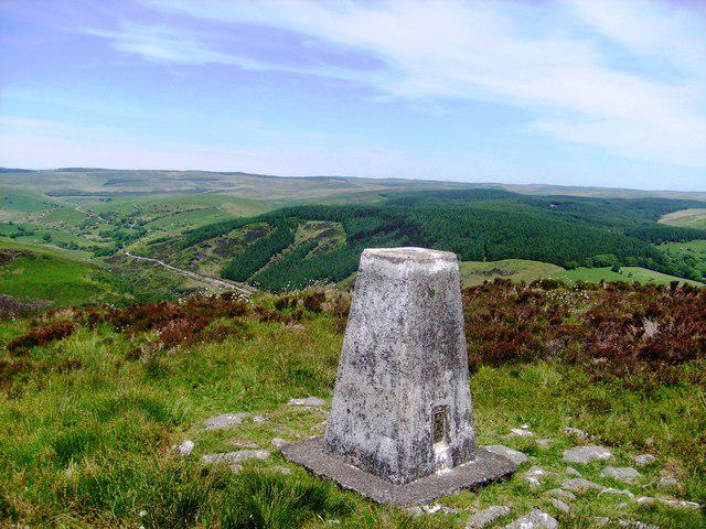 Photo could not load
SN7245 : Crugiau Merched trig and Cefn Branddu
Rob Woodall
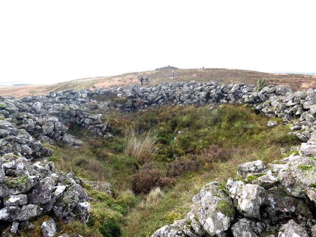 Photo could not load
SN7245 : Crugiau Merched
Alan Richards
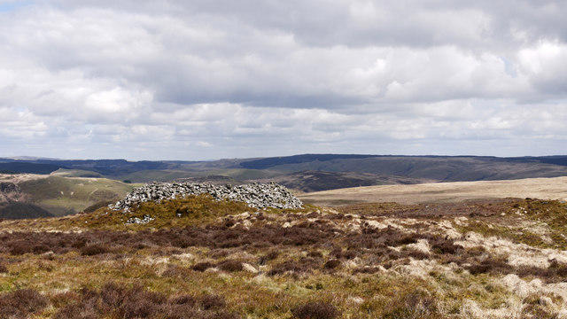 Photo could not load
SN7245 : Ancient cairn close to the summit of Crugiau Merched
Trevor Littlewood
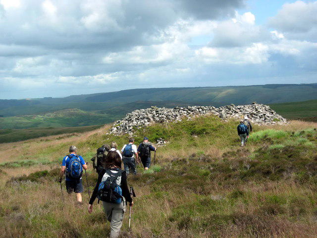 Photo could not load
SN7245 : Crugiau Merched
Alan Richards
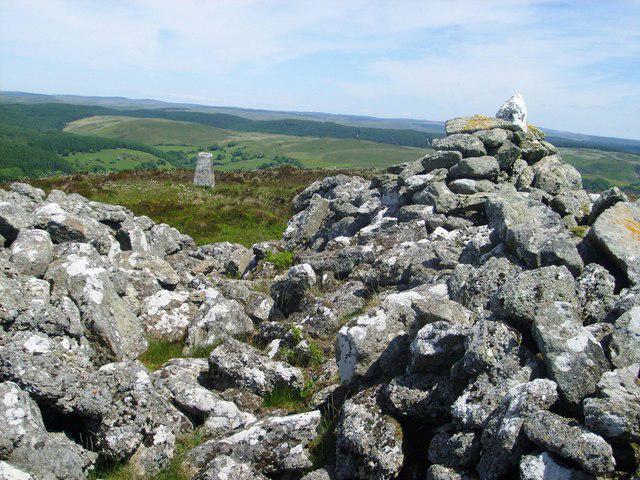 Photo could not load
SN7245 : Crugiau Merched: ancient cairn and trig
Rob Woodall
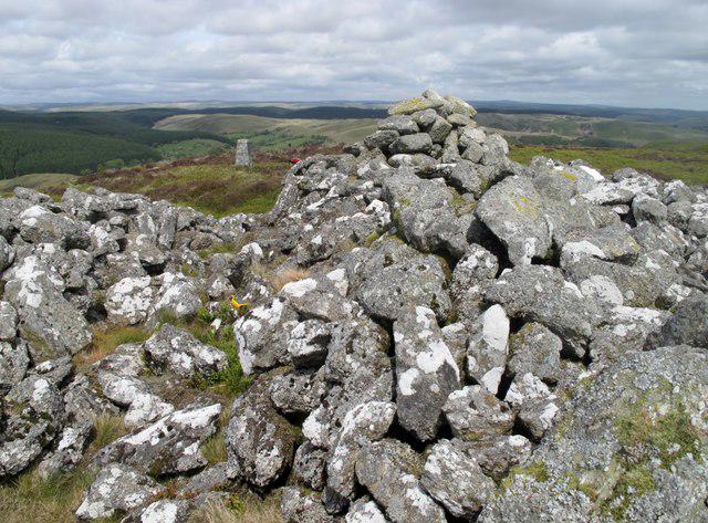 Photo could not load
SN7245 : Crugiau Merched
Rude Health
Hill facts and local notes
Classifications
Elevation
461m
1,512 ft
Prominence
202m
Coordinates
52.0934, -3.8667
SN722455
OS Map
146 147
Explorer: 187S
At the Summit
The summit is marked by a large stone cairn and a trig point, providing an excellent photo opportunity for those who reach the top. The view of surrounding hills is often described as 'sheer bliss'.
Terrain & Geology
Mynydd Mallaen is primarily composed of Old Red Sandstone, which gives the hill its characteristic rocky outcrops. The sedimentary layers are testament to a geological history spanning millions of years.
Views & Scenery
From the summit, you can see Pen y Fan, the highest peak in South Wales, and the expanse of the Brecon Beacons. On a clear day, the view stretches as far as the Black Mountains and even the Malvern Hills.
History & Heritage
Name Origin
The name 'Mynydd Mallaen' translates to 'hill of the spot' in Welsh, a reference to its distinctive location and prominence.
Historical Significance
Historically, this hill has been a landmark for local shepherds and walkers for centuries, and is rich in folklore about the surrounding area.
Getting There & Facilities
Parking
There is a small parking area in Mallaen village, which can accommodate around 10 vehicles. Be mindful of village residents when parking.
Public Transport
The nearest bus service operates from Brecon, about 15 km away. Check local schedules as services may be infrequent.
Nearby Facilities
In Brecon, you'll find cafes, shops, and public toilets. There's also a lovely tea room that prides itself on homemade cakes—the perfect fuel for your hike!
Safety Information
Known Hazards
- Beware of sudden weather changes common in the area. Muddied paths can be slippery, and watch for loose rocks on steeper sections.
General Safety Tips
- Check weather conditions before setting out
- Carry appropriate clothing and equipment
- Let someone know your planned route
- Take a map, compass, and GPS device
- Carry emergency supplies: food, water, first aid kit, torch
Hills
Some common questions about the hills answered
Are there group walks up Mynydd Mallaen?
Many walkers use Walkmates to join or organise walks with others. You can check for group walks around Mynydd Mallaen through the maps
Are there other walkers around Mynydd Mallaen?
Activity varies by location and time, but Walkmates lets you see whether others have shared walks or shown interest in this area. Find other people through the walking friends search walking friends for Mynydd Mallaen search or of course create your own walk for Mynydd Mallaen
Can I organise a walk to Mynydd Mallaen?
Yes. If there aren’t any walks listed already, you can create a walk and make it available for others to join.
If you're signed up to Walkmates, you can create a walk to Mynydd Mallaen.
How do I find a walk up this hill?
There are often multiple ways to walk this hill, depending on experience and route preference. Walkmates helps you explore walks and routes that others have shared.
Can I suggest a new route up Mynydd Mallaen?
Yes. You can suggest or create routes to share with others. Walkmates focuses on the social side of walking, so routes are used to help people organise walks and explore areas together, rather than as detailed navigation tools or route libraries.
Other uses really appreciate knowledgeable walkers sharing their routes. Share your favourite route to Mynydd Mallaen here
The is an error or something incorrect about this hill. How do I let you know?
We always strive to keep the information on Walkmates as accurate as possible. If you find an error, please let us know through the contact form and we'll aim to correct it as quickly as possible
Community Discussion
Comments
Location
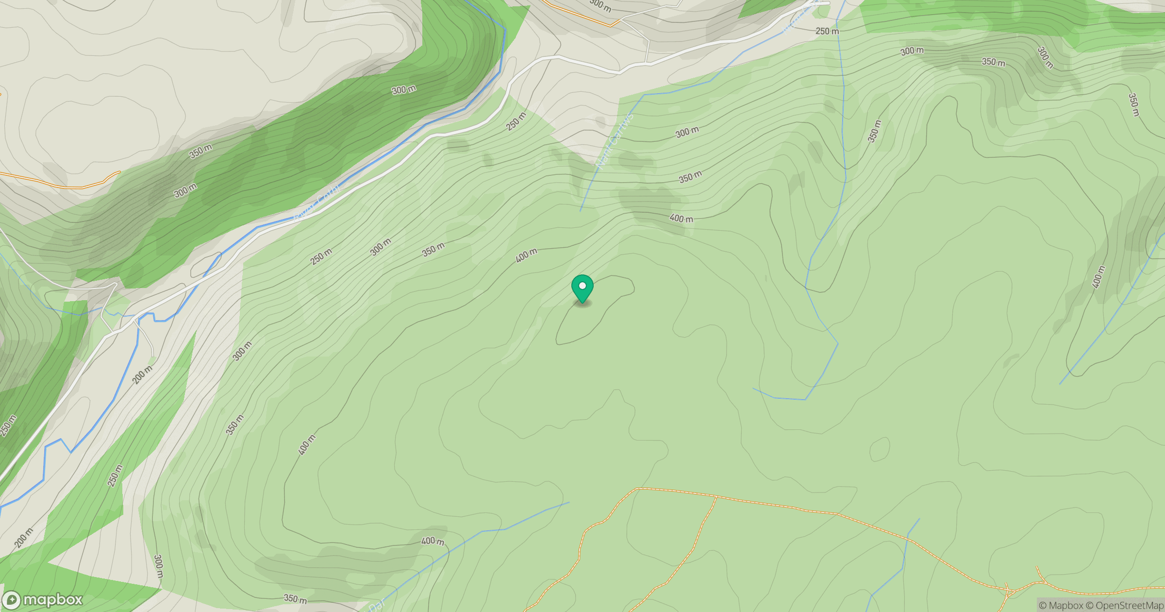
Grid reference: SN722455
View on OpenStreetMapOpens a map in a new tab, centred on the hill.


No comments yet. Be the first.