
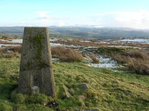
Mynydd Llansadwrn
Good walks are even better shared.
Overview
Mynydd Llansadwrn: A Hidden Gem in Snowdonia
Overview
Nestled in the heart of Snowdonia National Park, Mynydd Llansadwrn is an inviting mountain that boasts stunning panoramic views and a charming landscape. Standing at an elevation of 350 meters, it offers a delightful escape for both seasoned hikers and casual walkers alike.
Geology
This mountain is predominantly sculpted from volcanic rock, a remnant of the continent's fiery and fascinating geological past. Its rugged exterior and dramatic outcrops serve as a reminder of the earth's powerful forces at play. Geologists and rock aficionados will find plenty of interest here!
Routes
When it comes to hiking Mynydd Llansadwrn, there are a couple of routes to consider:
- Llansadwrn Village Route: Starting from the village of Llansadwrn, this easy-going trail covers about 5.5 km and offers picturesque views suitable for all hikers. Expect a leisurely 2 hours of walking, surrounded by rural beauty.
- Cwm y Glo Route: For those seeking a little more challenge, this moderate 4.2 km trek takes you through a stunning valley and climbs towards the summit over roughly 3 hours. The effort is well rewarded with breathtaking views.
Terrain Type
Be prepared for a blend of rocky surfaces, grassy slopes, and the occasional boggy patch. A bit of variety keeps things interesting, doesn’t it?
Summit Features
Upon reaching the summit, you’ll be greeted by a trig point, an iconic feature for any mountain enthusiast. Take a moment to bask in the marvel of nature and maybe pose for a cheeky photograph with the trig point as your backdrop.
Views
Stand on the summit and feast your eyes on the stunning vistas that stretch across Anglesey and the Menai Strait. It’s firmly on the ‘wow factor’ list, particularly in spring or late summer when the skies are often clear and inviting.
Hazards
As with any trek in the great outdoors, keep an eye on the weather. Conditions can change swiftly in the mountains, so ensure you’re adequately prepared. The terrain can become slippery during wet conditions, so sturdy footwear is a must.
Nearby Summits
Take your exploring further by venturing to nearby peaks such as Mynydd Parys (560m) and Moel y Dyffryn (440m), both offering unique experiences.
Access
The village of Llansadwrn has limited parking options, so arrive early to snag a spot. Public transport to the area is available, but it may require some patience. The nearest town is Menai Bridge, which is about 6 miles away and has more facilities.
Facilities
While Llansadwrn boasts a lovely little pub for refreshment, facilities such as toilets are not abundantly available. It might be wise to plan accordingly before setting out.
History
The name 'Mynydd Llansadwrn', translates to ‘Mountain of St. Sadwrn’. The mountain holds cultural significance, steeped in local legends and spiritual connections to the region.
A trip to Mynydd Llansadwrn promises a pleasant hike, breathtaking views, and a sprinkle of Welsh culture. Whether you're seeking solitude or adventure, this mountain has something special in store!
Happy hiking!
Explore routes near Mynydd Llansadwrn
Public walks starting within 80 km of this hill. Nearby does not mean a route reaches the summit; check its map and access before setting out.
Dolaucothi Estate: Cothi Valley and Red Waymarked Circuit
View route
Usk Reservoir: Glasfynydd Forest and Dam Circuit
View route
Aircraft Crash Site - Wellington Bomber and Vampire Jet (Black Mountain range)
View route
Abergwili to Nantgaredig: Tywi Valley Path out and back
View route
Route planning notes
These notes describe possible approaches, not verified navigable routes or permission to cross land. Check current paths, local access rules and conditions before setting out.
Llansadwrn Village Route
A scenic and straightforward route starting from the village of Llansadwrn. This route meanders through rolling hills and grassy pastures, making it ideal for families and beginners.
Cwm y Glo Route
This route climbs through a picturesque valley, providing a more challenging ascent towards the summit. Expect some steep sections but equally rewarding views.
Make a day of it, together
Find someone to share the walk with, or organise a day out along a route you like.
Photo Gallery
View all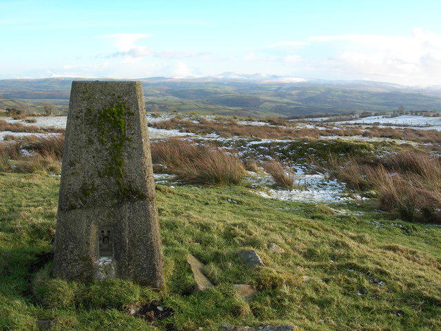 Photo could not load
SN6834 : Triangulation Pillar (S5524)
Adrian Dust
Hill facts and local notes
Classifications
Elevation
345m
1,132 ft
Prominence
114m
Coordinates
51.9970, -3.9120
SN688348
OS Map
146
Explorer: OL12W 187S
At the Summit
The summit is marked by a distinctive trig point, affording a perfect spot for a selfie. A couple of small stone cairns can also be found nearby, giving a traditional touch to the landscape.
Terrain & Geology
Mynydd Llansadwrn is primarily composed of volcanic rock which gives it a rugged and remarkable appearance. The steep slopes and rocky outcrops are a testimony to its tumultuous geological history, shaped by ancient volcanic activity.
Views & Scenery
From the summit, enjoy panoramic views of Anglesey and the Menai Strait, along with breathtaking sights of Snowdonia's mighty peaks. Look north for stunning views towards the Isle of Anglesey.
History & Heritage
Name Origin
The name 'Mynydd Llansadwrn' translates to 'Mountain of St. Sadwrn', indicating its cultural and religious significance in ancient Welsh history.
Historical Significance
The mountain has been a site of reverence for centuries, often associated with local legends and folklore.
Getting There & Facilities
Check current local access restrictions, parking rules and transport timetables before travelling. These notes do not confirm public access to the summit.
Parking
There is limited parking available at Llansadwrn village, with a small layby that accommodates a few cars.
Public Transport
The nearest bus service runs from Menai Bridge, providing access to Llansadwrn, but services can be infrequent.
Nearby Facilities
The nearby village of Llansadwrn offers a quaint pub for refreshments during the warmer months; however, facilities such as toilets may be scarce.
Safety Information
Known Hazards
- Beware of sudden weather changes, which can occur rapidly in the mountains; ensure you're well-prepared. Some sections can be slippery when wet, so appropriate footwear is essential.
General Safety Tips
- Check weather conditions before setting out
- Carry appropriate clothing and equipment
- Let someone know your planned route
- Take a map, compass, and GPS device
- Carry emergency supplies: food, water, first aid kit, torch
Hills
Some common questions about the hills answered
Are there group walks up Mynydd Llansadwrn?
Many walkers use Walkmates to join or organise walks with others. You can check for group walks around Mynydd Llansadwrn through the maps
Are there other walkers around Mynydd Llansadwrn?
Activity varies by location and time, but Walkmates lets you see whether others have shared walks or shown interest in this area. Find other people through the walking friends search walking friends for Mynydd Llansadwrn search or of course create your own walk for Mynydd Llansadwrn
Can I organise a walk to Mynydd Llansadwrn?
Yes. If there aren’t any walks listed already, you can create a walk and make it available for others to join.
If you're signed up to Walkmates, you can create a walk to Mynydd Llansadwrn.
How do I find a walk up this hill?
There are often multiple ways to walk this hill, depending on experience and route preference. Walkmates helps you explore walks and routes that others have shared.
Can I suggest a new route up Mynydd Llansadwrn?
Yes. You can suggest or create routes to share with others. Walkmates focuses on the social side of walking, so routes are used to help people organise walks and explore areas together, rather than as detailed navigation tools or route libraries.
Other uses really appreciate knowledgeable walkers sharing their routes. Share your favourite route to Mynydd Llansadwrn here
The is an error or something incorrect about this hill. How do I let you know?
We always strive to keep the information on Walkmates as accurate as possible. If you find an error, please let us know through the contact form and we'll aim to correct it as quickly as possible
Community Discussion
Comments
Location
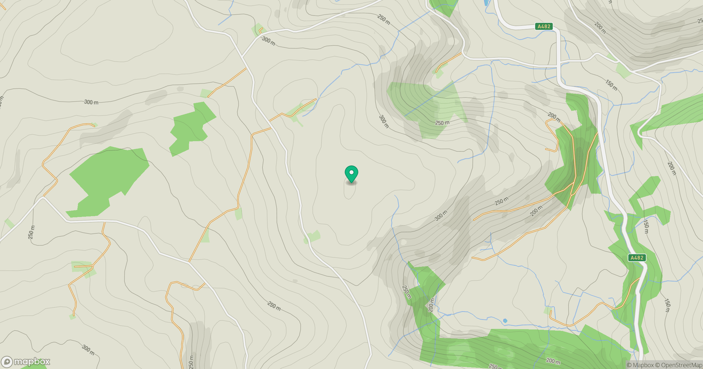
Grid reference: SN688348
View on OpenStreetMapOpens a map in a new tab, centred on the hill.
Hills within 30 km
Straight-line distance, not a walking route or confirmation of access.
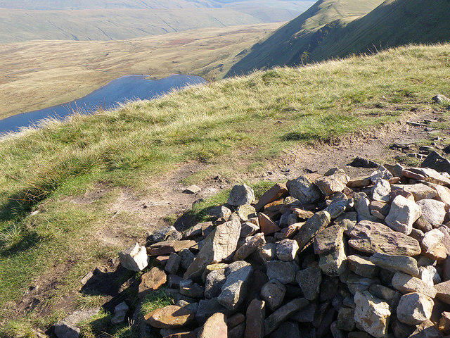
Fan Brycheiniog - Twr y Fan Foel
802m
Fan Gyhirych
726m
Banc y Garreg
332m
Allt Ddu
244m
Allt yr Hebog
342m
No comments yet. Be the first.