
Allt yr Hebog
Good walks are even better shared.
Overview
Allt yr Hebog: A Hidden Gem in Snowdonia
Overview
Allt yr Hebog, standing proudly at 450 meters, might not be the tallest mountain in Snowdonia, but what it lacks in stature, it more than compensates with stunning views and a vibrant ecosystem.
Geology
This ancient volcanic creation boasts fascinating geology, comprising andesite and rhyolite which tell a story of a land shaped by fiery forces millions of years ago. With every step, it’s like walking through a geological museum.
Routes
The Hebog Way is the most popular route. Starting from Beddgelert, it offers a rewarding hike that meanders alongside the Afon Glazig. The ascent provides ample photo opportunities, and the promise of breathtaking views at the summit is like icing on a cake.
Summit Features
At the top, you’ll find a compact cairn, perfect for a quick snap or two! Mind the wind, as it has been known to swipe snacks right out of unsuspecting hiker's hands.
Terrain Type
The terrain here is a mix of grassy paths and rocky outcrops, which can be a bit of a workout but utterly rewarding once you reach the top. Ideal for those who enjoy a bit of variety in their walks.
Views
Once at the summit, take a moment to soak in panoramic views extending towards the Snowdon range and beyond. The best time for photography is usually late spring or early autumn when the skies are clear, offering visibility unmatched by the usual Welsh drizzle.
Hazards
Like any peak, be mindful of loose rocks and changing weather. A classic Welsh saying to remember: 'If at first you don’t see the mountain, give it a moan and it will reveal itself from the mist!'
Nearby Summits
Be sure to check out Moel Hebog nearby, standing at 785 meters, for those seeking further adventure after Allt yr Hebog.
Access
Nearest Parking
To begin your adventure, there's parking available in Beddgelert, just a stone's throw from the trailhead.
Public Transport
You can also hop on local bus services from towns like Porthmadog or Caernarfon, reducing your carbon footprint while embracing the beautiful Welsh landscape.
Nearest Town
Beddgelert, a picturesque village with a rich history, serves as your gateway to explore Allt yr Hebog and beyond.
Facilities
Don't forget to refuel at one of Beddgelert’s charming cafes post-hike. A well-deserved reward awaits!
History
The name 'Allt yr Hebog' translates to 'the hillside of the buzzard,' an homage to the beautiful wildlife in the region. It’s a significant part of local folklore, enriching the experience of every hiker.
So pack your boots, grab your walking stick, and head to Allt yr Hebog—an adventure and a tale await!
Explore routes near Allt yr Hebog
Public walks starting within 80 km of this hill. Nearby does not mean a route reaches the summit; check its map and access before setting out.
Dolaucothi Estate: Cothi Valley and Red Waymarked Circuit
View route
Usk Reservoir: Glasfynydd Forest and Dam Circuit
View route
Llanerchaeron: Lanlas, Aberaeron and Aeron Valley circular
View route
Ystwyth Trail: Black Covert to Llanilar and back
View route
Route planning notes
These notes describe possible approaches, not verified navigable routes or permission to cross land. Check current paths, local access rules and conditions before setting out.
Hebog Way
A popular circular route starting from the nearby village of Beddgelert. The path initially follows the Afon Glazig before ascending the eastern flank of the hill.
Make a day of it, together
Find someone to share the walk with, or organise a day out along a route you like.
Hill facts and local notes
Classifications
Elevation
342m
1,122 ft
Prominence
139m
Coordinates
52.0830, -3.9185
SN686444
OS Map
146
Explorer: 187S 199
At the Summit
The summit is marked by a small cairn and offers sufficient space for a quick picnic, but be prepared for those strong winds that might whisk your sandwich away!
Terrain & Geology
Allt yr Hebog is primarily composed of volcanic rock, including andesites and rhyolites, formed during the 'Age of the Dinosaurs'. It sits atop ancient lava flows, which offer spectacular insights into geological processes over millions of years.
Views & Scenery
From the summit, you can feast your eyes on views of the Snowdon massif, the verdant valleys below, and on a clear day, all the way to the Llyn Peninsula.
History & Heritage
Name Origin
The name 'Allt yr Hebog' translates to 'the hillside of the buzzard', a nod to the resident avian wildlife that frequents the area.
Historical Significance
With its historical connections to the Welsh people and its role in local folklore, Allt yr Hebog is woven into the cultural tapestry of Snowdonia.
Getting There & Facilities
Check current local access restrictions, parking rules and transport timetables before travelling. These notes do not confirm public access to the summit.
Parking
There’s a small car park at Beddgelert, approximately 2 km from the start of the Hebog Way. Alternatively, there's roadside parking along the main road.
Public Transport
Beddgelert is serviced by local bus routes from Porthmadog and Caernarfon, making it relatively easy to jump on the bus and leave the car behind.
Nearby Facilities
Beddgelert offers several cafes, shops, and public toilets. It's advisable to grab a post-hike snack or a refreshing drink to celebrate your ascent!
Safety Information
Known Hazards
- Watch out for unstable rocks and sudden weather changes. As they say in Wales: 'If you don’t like the weather, wait five minutes!'
General Safety Tips
- Check weather conditions before setting out
- Carry appropriate clothing and equipment
- Let someone know your planned route
- Take a map, compass, and GPS device
- Carry emergency supplies: food, water, first aid kit, torch
Hills
Some common questions about the hills answered
Are there group walks up Allt yr Hebog?
Many walkers use Walkmates to join or organise walks with others. You can check for group walks around Allt yr Hebog through the maps
Are there other walkers around Allt yr Hebog?
Activity varies by location and time, but Walkmates lets you see whether others have shared walks or shown interest in this area. Find other people through the walking friends search walking friends for Allt yr Hebog search or of course create your own walk for Allt yr Hebog
Can I organise a walk to Allt yr Hebog?
Yes. If there aren’t any walks listed already, you can create a walk and make it available for others to join.
If you're signed up to Walkmates, you can create a walk to Allt yr Hebog.
How do I find a walk up this hill?
There are often multiple ways to walk this hill, depending on experience and route preference. Walkmates helps you explore walks and routes that others have shared.
Can I suggest a new route up Allt yr Hebog?
Yes. You can suggest or create routes to share with others. Walkmates focuses on the social side of walking, so routes are used to help people organise walks and explore areas together, rather than as detailed navigation tools or route libraries.
Other uses really appreciate knowledgeable walkers sharing their routes. Share your favourite route to Allt yr Hebog here
The is an error or something incorrect about this hill. How do I let you know?
We always strive to keep the information on Walkmates as accurate as possible. If you find an error, please let us know through the contact form and we'll aim to correct it as quickly as possible
Community Discussion
Comments
Location
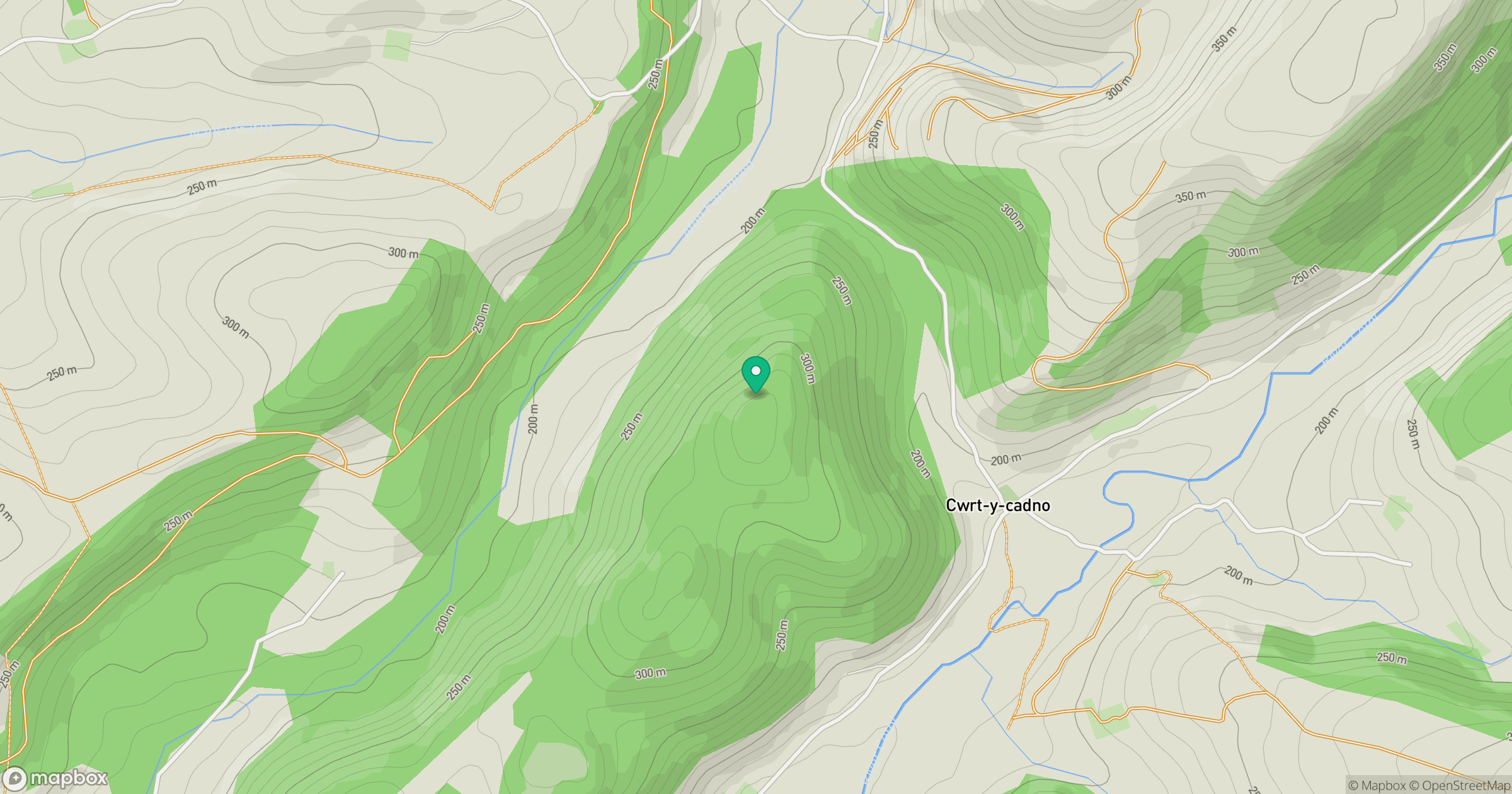
Grid reference: SN686444
View on OpenStreetMapOpens a map in a new tab, centred on the hill.
Hills within 30 km
Straight-line distance, not a walking route or confirmation of access.
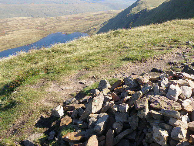
Fan Brycheiniog - Twr y Fan Foel
802m
Mynydd Mallaen
461m
Banc y Garreg
332m
Mynydd Llansadwrn
345m
Allt Ddu
244m
No comments yet. Be the first.