
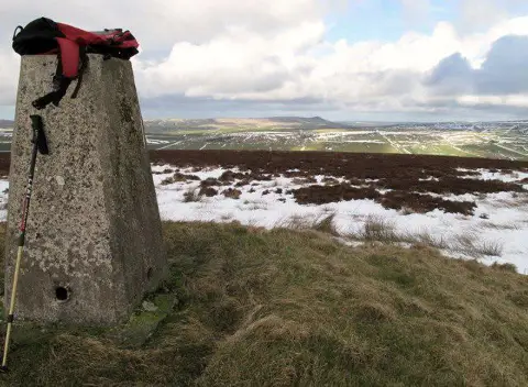
Mynydd Castlebythe
Good walks are even better shared.
Overview
Introduction
Mynydd Castlebythe, standing at an elevation of 303 meters, isn’t the highest fell in the South Wales area, but it certainly has its charm. Perfect for a wee adventure or an easy-going family hike, it is particularly known for its stunning panoramic views and friendly slopes.
Geology
The ground beneath your feet is predominantly Old Red Sandstone, which is fascinating as it has seen many geological transformations over millions of years. This merger of rock types not only creates beautiful vistas but also supports diverse ecosystems.
Routes
As mentioned, there are a couple of popular routes to tackle the hill. The 'Castlebythe Loop' is perfect for families, offering an enchanting path with lovely scenery and accessible inclines.
For the more ambitious souls, the 'Mynydd Castlebythe Ascent' challenges you to take the direct path to the summit. The thrill of reaching the top, especially after an uphill sweat, is one to be relished!
Summit Features
Once you've huffed and puffed your way to the summit, you'll be greeted by a trig point that stands proud as a beacon to all who come after you. The rocky outcrops serve as great spots to catch your breath and enjoy the views—or to hide from any pesky midges during summer!
Terrain Type
Expect a bit of everything: grassy stretches, rocky patches, and the occasional bog. Best advice? Wear your boots—unless you're particularly fond of squelching sounds!
Views
The vistas from Mynydd Castlebythe are nothing short of splendid. On particularly bright days, you could see the Brecon Beacons stretching out endlessly before you, along with the misty peaks of Snowdonia. Autumn is especially breathtaking—nature truly shows off her crayons during that season!
Hazards
As with most hikes, cautiousness is key. Keep an eye on your footing, especially on rocky surfaces which can be rather slippery. And be prepared for possible weather changes—typical Welsh! Bring layers and perhaps a spare pair of socks just in case!
Nearby Summits
Don’t just stop at Castlebythe! Other nearby summits like Mynydd y Gwrhyd and Mynydd Llangatwg await your feet, promising further adventures and explorations.
Access
For access, there is a modest parking space near the start of the Castlebythe Loop. Public transport options exist; however, you'll need a good plan in place to ensure you don't end up on a wild goose chase! Glynneath is your closest town, where you can refuel with tasty Welsh food after your outing.
Facilities
While in Glynneath, be sure to check out the local cafés—they are often filled with warm welcomes and even warmer cups of tea. Just what you need after a day of hiking.
Conclusion
Mynydd Castlebythe may not be the king of mountains, but it’s a beloved local gem worth visiting. With captivating views, friendly trails, and its rich history, it’s bound to leave a lasting impression on any hiker. So, slap on those boots and enjoy your time out in the Welsh countryside. Adventure awaits!
Explore routes near Mynydd Castlebythe
Public walks starting within 80 km of this hill. Nearby does not mean a route reaches the summit; check its map and access before setting out.
Pembrokeshire Coast Path: Newport Parrog to Fishguard via Dinas Head
View route
Neyland to Johnston: Brunel and Westfield Railway Trail
View route
Stackpole Estate: Bosherston Lily Ponds and Lodge Park Woodland Circuit
View route
Abergwili to Nantgaredig: Tywi Valley Path out and back
View route
Route planning notes
These notes describe possible approaches, not verified navigable routes or permission to cross land. Check current paths, local access rules and conditions before setting out.
Castlebythe Loop
A scenic loop that takes you around the foothills of Mynydd Castlebythe, perfect for those who prefer a gentler incline.
Mynydd Castlebythe Ascent
A direct route leading to the summit, offering panoramic views and a slightly steeper challenge for the eager hiker.
Make a day of it, together
Find someone to share the walk with, or organise a day out along a route you like.
Photo Gallery
View all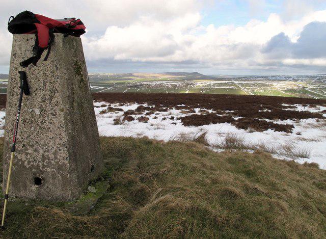 Photo could not load
SN0229 : Mynydd Castlebythe
Rude Health
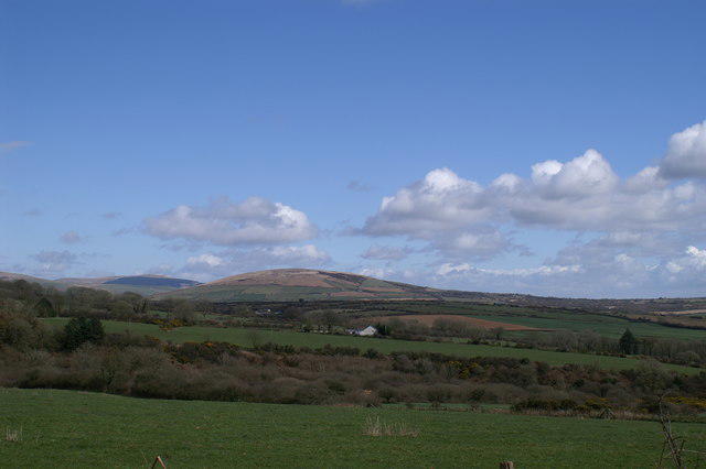 Photo could not load
SN0229 : Mynydd Castlebythe
Jeff Horne
Hill facts and local notes
Classifications
Elevation
347m
1,138 ft
Prominence
116m
Coordinates
51.9304, -4.8687
SN028296
OS Map
145 157 158
Explorer: OL35E
At the Summit
The summit boasts a prominent trig point and scattered rock outcrops, providing excellent spots for photos—or a well-deserved sit down if you've had enough of the steep bits!
Terrain & Geology
The mountain is primarily composed of sedimentary rocks, predominantly Old Red Sandstone. This results in interesting rock formations and colourful landscapes, especially during the autumn months.
Views & Scenery
On a clear day, you’ll glimpse the Brecon Beacons and the rolling hills of South Wales, along with the distant silhouettes of Snowdonia.
History & Heritage
Name Origin
The name Castlebythe likely derives from the Welsh elements meaning 'fort' and 'bythe', referring to the nearby historical sites which were once significant in local lore.
Historical Significance
Historically, the area has links to ancient hillforts and the rich mining heritage of South Wales, adding depth to the outdoor experience beyond just splendid views.
Getting There & Facilities
Check current local access restrictions, parking rules and transport timetables before travelling. These notes do not confirm public access to the summit.
Parking
There is a small parking area at the start of the Castlebythe Loop on the minor road at SN022293.
Public Transport
Buses run from nearby towns like Neath and Swansea, though the service may be infrequent. Check local timetables!
Nearby Facilities
There are a few quaint cafes and pubs in Glynneath for a warm meal or a comforting cup of tea post-hike.
Safety Information
Known Hazards
- Slippery rocks, particularly after rain; muddy paths in wet seasons; and potential for sudden weather changes in higher elevations.
General Safety Tips
- Check weather conditions before setting out
- Carry appropriate clothing and equipment
- Let someone know your planned route
- Take a map, compass, and GPS device
- Carry emergency supplies: food, water, first aid kit, torch
Hills
Some common questions about the hills answered
Are there group walks up Mynydd Castlebythe?
Many walkers use Walkmates to join or organise walks with others. You can check for group walks around Mynydd Castlebythe through the maps
Are there other walkers around Mynydd Castlebythe?
Activity varies by location and time, but Walkmates lets you see whether others have shared walks or shown interest in this area. Find other people through the walking friends search walking friends for Mynydd Castlebythe search or of course create your own walk for Mynydd Castlebythe
Can I organise a walk to Mynydd Castlebythe?
Yes. If there aren’t any walks listed already, you can create a walk and make it available for others to join.
If you're signed up to Walkmates, you can create a walk to Mynydd Castlebythe.
How do I find a walk up this hill?
There are often multiple ways to walk this hill, depending on experience and route preference. Walkmates helps you explore walks and routes that others have shared.
Can I suggest a new route up Mynydd Castlebythe?
Yes. You can suggest or create routes to share with others. Walkmates focuses on the social side of walking, so routes are used to help people organise walks and explore areas together, rather than as detailed navigation tools or route libraries.
Other uses really appreciate knowledgeable walkers sharing their routes. Share your favourite route to Mynydd Castlebythe here
The is an error or something incorrect about this hill. How do I let you know?
We always strive to keep the information on Walkmates as accurate as possible. If you find an error, please let us know through the contact form and we'll aim to correct it as quickly as possible
Community Discussion
Comments
Location
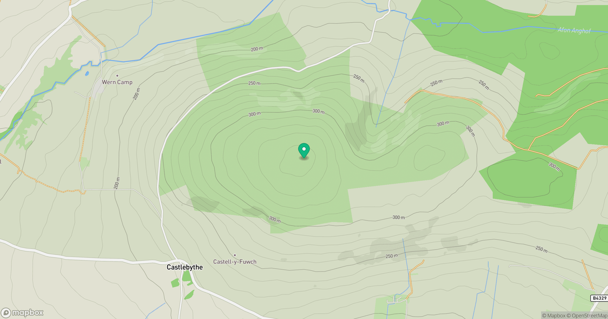
Grid reference: SN028296
View on OpenStreetMapOpens a map in a new tab, centred on the hill.
Hills within 30 km
Straight-line distance, not a walking route or confirmation of access.
No comments yet. Be the first.