

Mynydd Carningli
Good walks are even better shared.
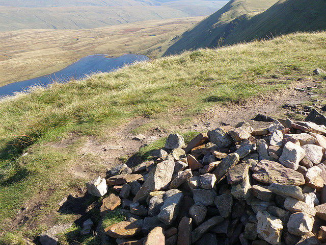
SN0637 : Approaching Carn Ingli from the west
Bill Boaden Photo source
Overview
Mynydd Carningli is a 346.9 m rocky hill above Newport/Trefdraeth in Pembrokeshire. Its natural summit tors and extensive prehistoric hillfort overlook Newport Bay and the Preseli countryside. Approaches from Newport and Parrog involve steep, uneven ground and require careful route-finding.
Mynydd Carningli
Mynydd Carningli rises above Newport/Trefdraeth in Pembrokeshire, its rocky summit overlooking Newport Bay and the surrounding Preseli countryside. The hill reaches 346.9 m and is crowned by extensive prehistoric remains. Its short approaches still involve steep, rough ground and careful route-finding among several moorland paths.
Summit and views
The recorded high point is a natural rock tor at SN 06243 37230. A tor 55 m south-southwest is of similar height; another 25 m south-southwest is 0.3 m lower. The remains of the hillfort occupy the summit area, but walls and cairns should not be treated as the natural high point. Take care on the irregular rocks and avoid disturbing old stonework. In clear weather, the coast around Newport Bay and the hills inland form a wide panorama.
From Newport
The National Park's Newport/Carningli walk begins in the town, with its start reference at SN056392. Follow the official map south through town past the church and castle, then along lanes and paths towards Carn Llwyd and the northern approach to the summit crags. After the summit-area loop, return north to the common-path junction and take the western branch across the common. The mapped lane and field-edge path lead north to the western end of Newport; turn east along the A487 to the town crossroads, then north to Long Street car park. The published base circuit is 5.6 km, with an estimated two hours of walking. Visiting the exact high tor may require a short deviation from that mapped loop; allow additional time for the rocks and archaeological remains. No separate distance or time is established here for a summit-extended version.
A longer return walk starts at the Parrog Road car park, SN052396. Walking Britain's guide follows Newport's streets and lanes to a field-edge path, then climbs the northern slope to the hillfort and high ground. Descend northeast to rejoin the approach and retrace it all the way to the same car park. The guide gives 7.3 km and about three hours ten minutes for the complete return walk.
The National Park also promotes 2.4 km and 1.6 km lower-slope circuits from the eastern car park at SN068376. These bypass the summit. Adding the rocky top changes their length and walking time.
Terrain and access
Expect uneven moorland paths, steep sections and rocky ground near the top. Wet rocks can be slippery, and cloud can make the network of paths confusing. Carry a map and compass and know how to use them. Check the forecast, wear suitable footwear and carry warm waterproof layers, food and water. Strong winds or poor visibility are good reasons to leave the summit rocks for another day.
The common is grazed by sheep, cattle and ponies. Keep dogs on a lead near livestock and follow access-land seasonal and local restrictions. Use public paths through enclosed land, leave gates as found and follow signs. Check current Natural Resources Wales access restrictions before setting out.
Geology and archaeology
British Geological Survey identifies a microtonalite intrusion at Carningli and describes frost-shattered blocks on the hill. Its precise geological origin is uncertain; the rocky outline should not be taken as proof of a surviving volcanic cone.
Stone ramparts, enclosures, huts and old field boundaries survive around the summit. Coflein's archaeological account stresses that the sequence of occupation is not fully understood. The familiar association with St Brynach, who is said to have communed with angels here, belongs to local legend. Leave archaeological stones where they are, avoid climbing on old walls and do not light fires.
Getting there
Newport is the usual base. Choose the town car park for the official circuit or the Parrog Road start for the longer return walk, and check signs and current parking arrangements. TrawsCymru's T5 serves Newport; check the current timetable and service updates for the day of travel and plan the return journey as well as the outward bus.
Other hills in the area
Cnwc yr Hydd (339.1 m), Foel Eryr (468 m) and Mynydd Dinas (307.8 m) are separate hills in this part of Pembrokeshire. Each needs its own access and route planning.
Explore routes near Mynydd Carningli
Walks starting near this hill. Open a route to check its map, distance and full itinerary.
Neyland to Johnston: Brunel and Westfield Railway Trail
View route
Abergwili to Nantgaredig: Tywi Valley Path out and back
View route
Stackpole Estate: Bosherston Lily Ponds and Lodge Park Woodland Circuit
View route
Llanerchaeron: Lanlas, Aberaeron and Aeron Valley circular
View route
Route planning notes
These notes describe possible approaches. Check a route's map and access information when planning your walk.
Newport circuit with Carningli summit visit
Start and finish at the Newport town car park, official start reference SN056392. Follow the National Park map south through town past the church and castle, then use the lanes and paths towards Carn Llwyd and the steep northern approach to Carningli. Identify the natural high tor at SN 06243 37230 without disturbing the hillfort, then rejoin the mapped summit-area loop. Return north to the common-path junction and take the western branch across the common. Follow the mapped lane and field-edge path north to the western end of Newport, turn east along the A487 to the town crossroads, then head north back to Long Street car park. The publisher gives 5.6 km and 2 hours for its base loop around the crags; an exact high-tor visit may require a short deviation, so those figures do not measure the summit-extended walk. Allow extra time for the rocks and archaeological remains. Carry the official map and check current restrictions.
Parrog Road to Carningli summit and return
Start and finish at Parrog Road car park in Newport, SN052396. Follow the published Walking Britain approach through Newport streets and lanes, then the field-edge path and steep northern slope to the hillfort and natural summit tor. Descend northeast to rejoin the outward path, then retrace the whole approach through Newport to the same car park. Walking Britain gives 7.3 km and about 3 hours 10 minutes for the complete return walk. Navigate carefully among the moorland paths, take care on wet rocks and keep clear of grazing animals.
Make a day of it, together
Find someone to share the walk with, or organise a day out along a route you like.
Photo Gallery
View all Photo could not load
SN0637 : Approaching Carn Ingli from the west
Bill Boaden
 Photo could not load
SN0637 : View south from Carn Ingli
Gareth James
 Photo could not load
SN0637 : View SE from Carn Ingli
Gareth James
 Photo could not load
SN0637 : Rocky outcrop on Carn Ingli
Gareth James
 Photo could not load
SN0637 : Mynydd Carningli
Ian Medcalf
 Photo could not load
SN0637 : Carningli
Ian Medcalf
 Photo could not load
SN0637 : Carningli from Eglwyswrw: Sunset
Dylan Moore
 Photo could not load
SN0637 : View SW from Carn Ingli
Gareth James
 Photo could not load
SN0637 : Towards Carn Ingli
Gareth James

SN0637 : Carningli fort from Carningli common looking east
Natasha Ceridwen de Chroustchoff
Hill facts and local notes
Classifications
Elevation
347m
1,138 ft
Prominence
232m
Coordinates
51.9996, -4.8240
SN062372
OS Map
145
Explorer: OL35E
At the Summit
A natural rock tor at SN 06243 37230, amid prehistoric hillfort remains. The DoBIH row notes a similar-height tor 55 m SSW at SN 06216 37183 and a tor 25 m SSW at SN 06237 37206 that is 0.3 m lower. Identify the natural high ground without disturbing archaeological stonework.
Terrain & Geology
British Geological Survey identifies a microtonalite intrusion at Mynydd Carningli and illustrates frost-shattered microtonalite blocks. The intrusion cuts the Fishguard Volcanic Group and underlying rocks; its origin is uncertain. The hill should not be described simply as a surviving dolerite volcanic cone.
Views & Scenery
In clear conditions the summit overlooks Newport Bay, the nearby coast and the Preseli countryside inland.
History & Heritage
Name Origin
Carningli is commonly rendered as the Mountain of Angels and is associated in local legend with St Brynach.
Historical Significance
Prehistoric stone ramparts, enclosures, huts and field boundaries survive on and around Carningli. Coflein describes an uncertain sequence of occupation rather than a securely dated single-phase fort. St Brynach communing with angels on the hill is local legend. Leave archaeological stones in place and do not light fires.
Getting There & Facilities
Parking
For the Newport circuit use the town car park near the official start at SN056392. The longer return route starts at Parrog Road car park, SN052396. The eastern car park at SN068376 serves the separate lower-slope circuits. Check local signs and keep entrances clear.
Public Transport
TrawsCymru T5 serves Newport on the route between Fishguard and Cardigan. Check the current timetable, service updates and return journey at https://traws.cymru/en/services/RBRO/T5 before travel.
Nearby Facilities
Plan refreshment stops in Newport and carry the food and drinking water needed for the hill. Check current parking signs and facilities before setting out.
Safety Information
Known Hazards
- Steep, uneven paths and rocky summit ground
- Slippery rock and mud after rain
- Confusing junctions among moorland paths, especially in cloud
- Exposed high ground in strong wind
- Free-roaming sheep, cattle and ponies
Seasonal Hazards
Rain makes rocks and paths slippery. Strong winds and low cloud increase difficulty on the exposed summit. On access land, keep dogs on a short lead from 1 March to 31 July and around livestock; follow any additional local restrictions.
General Safety Tips
- Check weather conditions before setting out
- Carry appropriate clothing and equipment
- Let someone know your planned route
- Take a map, compass, and GPS device
- Carry emergency supplies: food, water, first aid kit, torch
Hills
Some common questions about the hills answered
Are there group walks up Mynydd Carningli?
Many walkers use Walkmates to join or organise walks with others. You can check for group walks around Mynydd Carningli through the maps
Are there other walkers around Mynydd Carningli?
Activity varies by location and time, but Walkmates lets you see whether others have shared walks or shown interest in this area. Find other people through the walking friends search walking friends for Mynydd Carningli search or of course create your own walk for Mynydd Carningli
Can I organise a walk to Mynydd Carningli?
Yes. If there aren’t any walks listed already, you can create a walk and make it available for others to join.
If you're signed up to Walkmates, you can create a walk to Mynydd Carningli.
How do I find a walk up this hill?
There are often multiple ways to walk this hill, depending on experience and route preference. Walkmates helps you explore walks and routes that others have shared.
Can I suggest a new route up Mynydd Carningli?
Yes. You can suggest or create routes to share with others. Walkmates focuses on the social side of walking, so routes are used to help people organise walks and explore areas together, rather than as detailed navigation tools or route libraries.
Other uses really appreciate knowledgeable walkers sharing their routes. Share your favourite route to Mynydd Carningli here
The is an error or something incorrect about this hill. How do I let you know?
We always strive to keep the information on Walkmates as accurate as possible. If you find an error, please let us know through the contact form and we'll aim to correct it as quickly as possible
Community Discussion
Comments
Location
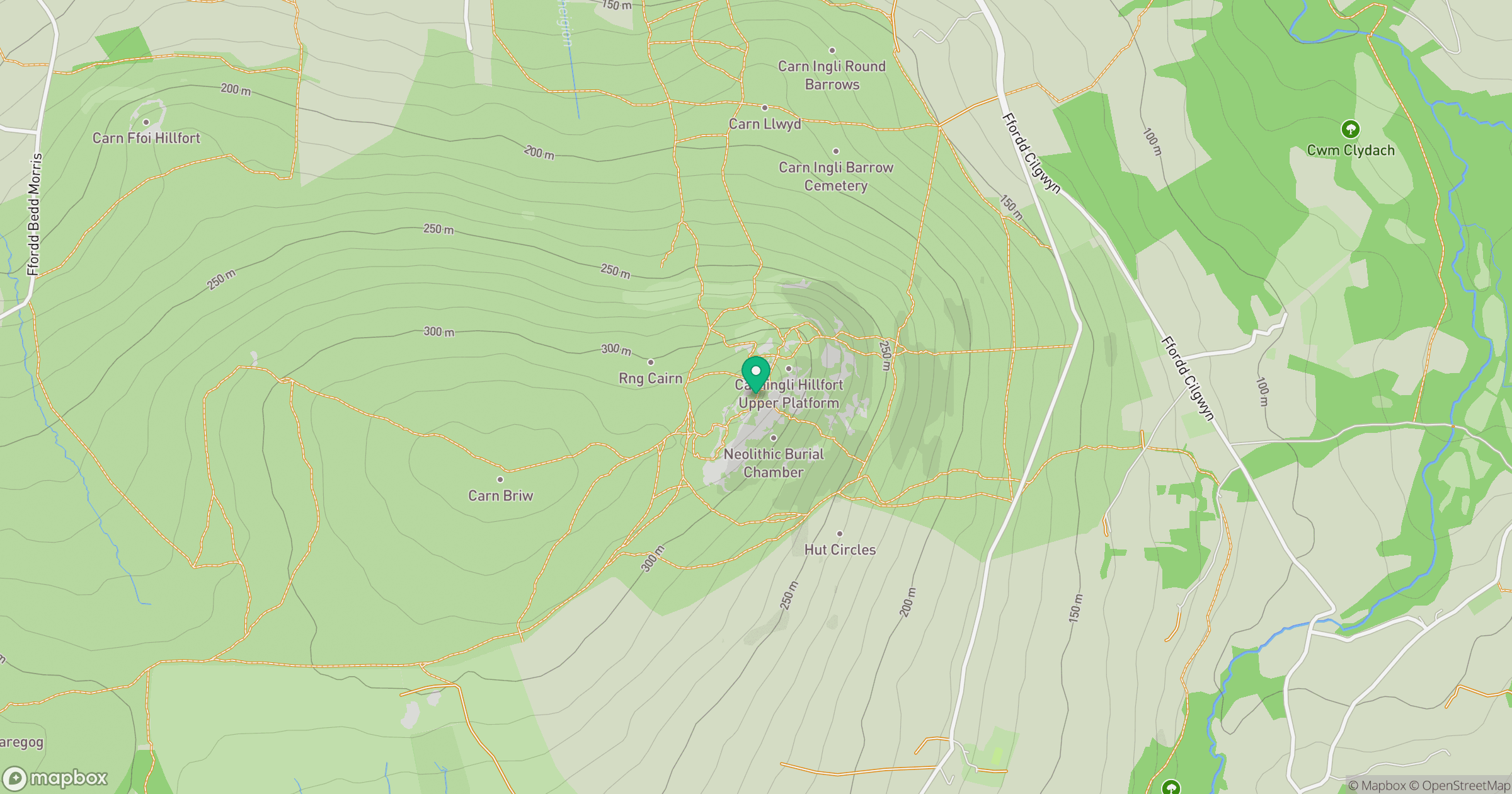
Grid reference: SN062372
View on OpenStreetMapOpens a map in a new tab, centred on the hill.
No comments yet. Be the first.