

Millfore
Good walks are even better shared.
NX4775 : ATV track near Millfore summit
wrobison Photo source
Overview
Hiking Millfore: A Scottish Adventure
Millfore, standing at 702 meters, is an alluring peak nestled in the Southern Uplands of Scotland. This majestic hill offers not just a workout for the legs, but also a feast for the eyes!
Geology
Millfore’s granite and gneiss are testaments to the geological history of this beautiful area. As you explore, notice the unique formations that tell stories of natural forces shaping the landscape over millions of years.
Access
Head to the forest car park at NX476749. It's free and just delightful. If you’re considering public transport, remember to check in with local services from Newton Stewart. Nothing worse than planning a hiking day that turns into a waiting game!
Route
The Millfore Circular is your ticket to an enjoyable day out. At 10 km and taking approximately 3.5 hours, it presents a moderate challenge suitable for most fitness levels. Giddy up those legs as you traverse through beautiful scenery.
Summit Features
Upon reaching the summit, you’re greeted by a large cairn and a beacon standing proudly. This makes for a fantastic photo opportunity! You may just spot some other adventurous souls playing king of the hill.
Terrain and Views
Expect a pleasant combination of grassy knolls and rugged rocky areas. The views from the top are nothing short of spectacular, especially if you crank up the time of day during spring or autumn. Galloway Forest Park and the Solway Firth will make your heart skip a beat. Binoculars are highly recommended!
Hazards
Millfore is friendly, but do keep an eye on the weather and tread carefully on uneven grounds—sudden rain and slippery rocks do love to play games!
Facilities
Newton Stewart is not too far off and houses a charming café where you can refuel after your hike. Treat yourself; you’ve earned it!
History
With a name that translates to 'mill on the hill', Millfore is steeped in history. Ancient remnants nearby speak of the region's rich cultural tapestry, inviting history buffs to take a stroll down memory lane.
So lace up your hiking boots, grab your walking stick, and hit the trails of Millfore. Adventure awaits with every step you take!
Explore routes near Millfore
Walks starting near this hill. Open a route to check its map, distance and full itinerary.
Loch Trool: Full Loch and Oak Woodland Circuit
View route
Knockman Wood Cairn and Woodland Trail
View route
Wood of Cree Waterfalls and Scrubland Circuit
View route
Kirroughtree Little Bruntis Lochs and Woodland Trail
View route
Route planning notes
These notes describe possible approaches. Check a route's map and access information when planning your walk.
Millfore Circular
A scenic loop starting from the forest car park, taking you through lush woodlands and up the gentle slopes to the summit.
Make a day of it, together
Find someone to share the walk with, or organise a day out along a route you like.
Photo Gallery
View all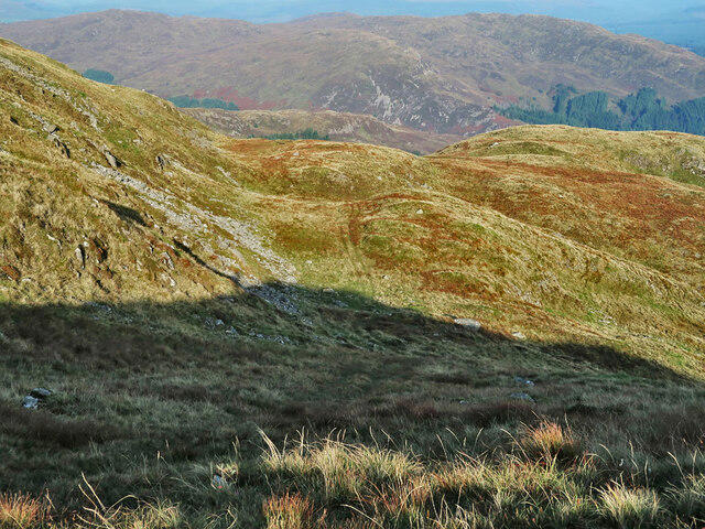 Photo could not load
NX4775 : ATV track near Millfore summit
wrobison
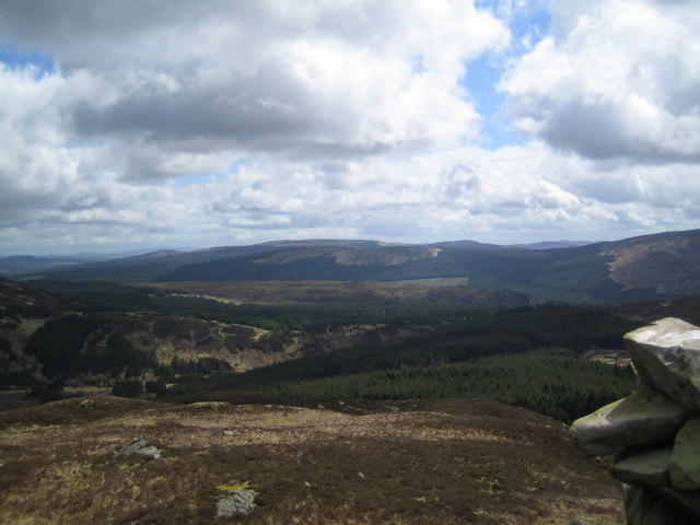 Photo could not load
NX4775 : View on Millfore looking towards Craignell and Darnaw Hills
Judy Catterall
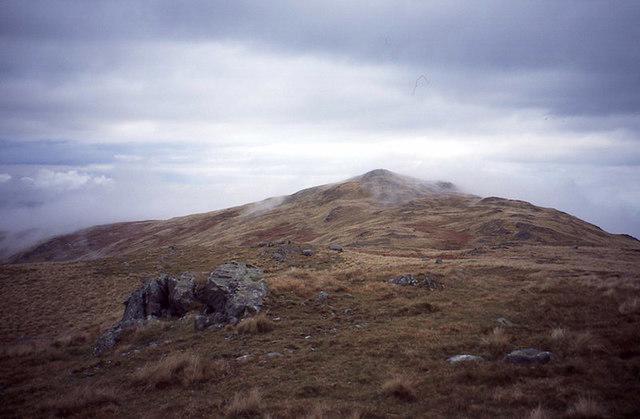 Photo could not load
NX4775 : Millfore
Richard Webb
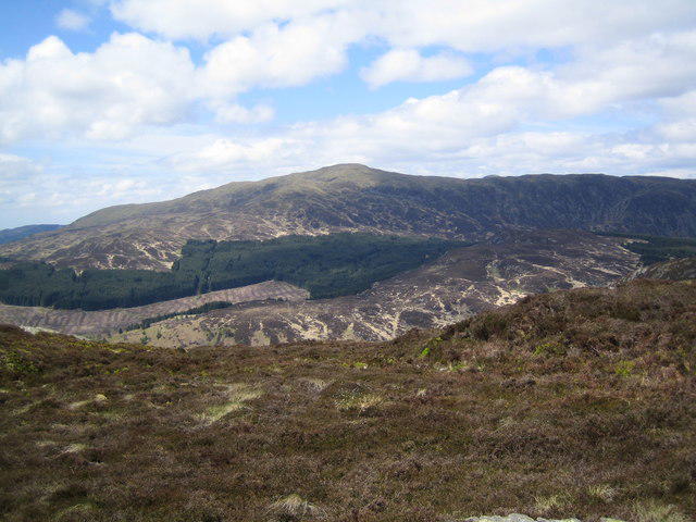 Photo could not load
NX4775 : View of Millfore from Craignell
Judy Catterall
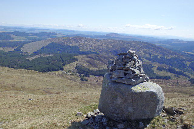 Photo could not load
NX4775 : Cairn on Millfore
Michael Graham
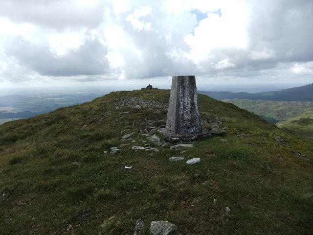 Photo could not load
NX4775 : Summit of Millfore
David Brown
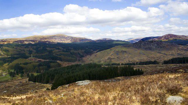 Photo could not load
NX4775 : Millfore From Craignelder
Duncan McNaught
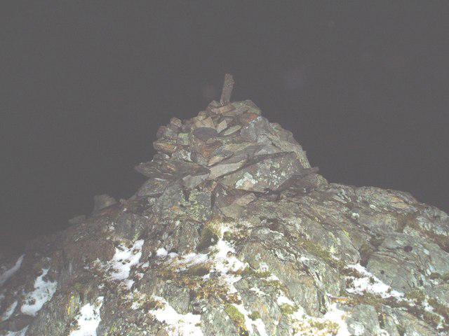 Photo could not load
NX4775 : Millfore Cairn on a winter's night.
Bob Peace
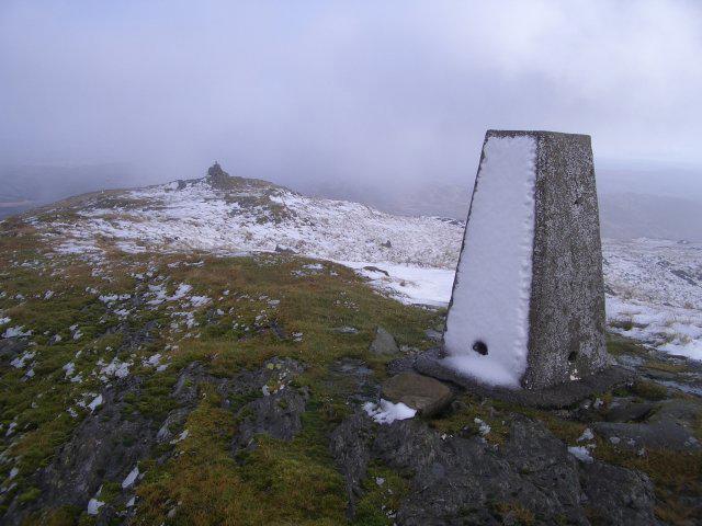 Photo could not load
NX4775 : Trig point and cairn
Callum Black
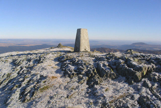
NX4775 : The trig point at 656m on Millfore in The Galloway Hills
Walter Baxter
Hill facts and local notes
Classifications
Elevation
657m
2,156 ft
Prominence
250m
Coordinates
55.0502, -4.3838
NX478754
OS Map
77
Explorer: 319
At the Summit
The summit features a large cairn and a beacon, perfect for a photo op! If you squint just right, you might even think it looks like a tiny lighthouse.
Terrain & Geology
Millfore is primarily composed of granite and gneiss, which provide a sturdy footing for aspiring climbers and excellent views of the surrounding area. You’ll notice the striking patterns etched into the rock that tell tales of eons gone by — geologists’ delight!
Views & Scenery
On a clear day, enjoy panoramic views of the surrounding hills, including the Galloway Forest Park and the distant Solway Firth. Don’t forget your binoculars; you’ll want to catch the sights of passing ships!
History & Heritage
Name Origin
The name 'Millfore' translates to 'mill on the hill' referring to historical milling activity in the region. Apparently, peaks were pretty good at grinding out a recipe or two.
Historical Significance
The surrounding area has a rich heritage, with remnants of ancient forts and evidence of Neolithic presence. A true historic treat for those interested in Scotland's past!
Getting There & Facilities
Parking
The nearest parking is at the forest car park located at NX476749. It has space for several vehicles, and it’s free! Handy for those of us who have slightly less cash in hand.
Public Transport
Limited public transport is available; your best bet is to get a taxi from Newton Stewart. Make sure to double-check the departure times to avoid a long wait at the bus stop!
Nearby Facilities
Facilities are minimal on the mountain itself. However, Newton Stewart has a lovely café where you can grab a cuppa and scone — reward yourself after a good hike!
Safety Information
Known Hazards
- Watch for sudden changes in weather; the forecast may be sunny one minute and turn on you like a bear with a sore head the next. Also, be cautious of uneven terrain, particularly in boggy areas.
General Safety Tips
- Check weather conditions before setting out
- Carry appropriate clothing and equipment
- Let someone know your planned route
- Take a map, compass, and GPS device
- Carry emergency supplies: food, water, first aid kit, torch
Hills
Some common questions about the hills answered
Are there group walks up Millfore?
Many walkers use Walkmates to join or organise walks with others. You can check for group walks around Millfore through the maps
Are there other walkers around Millfore?
Activity varies by location and time, but Walkmates lets you see whether others have shared walks or shown interest in this area. Find other people through the walking friends search walking friends for Millfore search or of course create your own walk for Millfore
Can I organise a walk to Millfore?
Yes. If there aren’t any walks listed already, you can create a walk and make it available for others to join.
If you're signed up to Walkmates, you can create a walk to Millfore.
How do I find a walk up this hill?
There are often multiple ways to walk this hill, depending on experience and route preference. Walkmates helps you explore walks and routes that others have shared.
Can I suggest a new route up Millfore?
Yes. You can suggest or create routes to share with others. Walkmates focuses on the social side of walking, so routes are used to help people organise walks and explore areas together, rather than as detailed navigation tools or route libraries.
Other uses really appreciate knowledgeable walkers sharing their routes. Share your favourite route to Millfore here
The is an error or something incorrect about this hill. How do I let you know?
We always strive to keep the information on Walkmates as accurate as possible. If you find an error, please let us know through the contact form and we'll aim to correct it as quickly as possible
Community Discussion
Comments
Location
View the hill's mapped position and surrounding paths.
Grid reference: NX478754
View on OpenStreetMapOpens a map in a new tab, centred on the hill.

No comments yet. Be the first.